


Nature reserve Urique, Chihuahua Municipality of Urique Copper Canyon
Mexico's great canyon system in the Sierra Tarahumara: Rarámuri country, rim-top viewpoints and the Chepe train along the edge.
From Cuauhtémoc: 3 h 20 min by car (204 km by road) How to get there ↓
Near here
See everything nearby ↓


Plan your visit to Barrancas del Cobre
Where to stay near Barrancas del Cobre
Compare hotels, posadas and guest houses in Barrancas del Cobre.
Tours to Barrancas del Cobre
Day trips and guided outings from Creel often include Barrancas del Cobre; with a local guide you can get there without a car.
 Tour to Barrancas del Cobre
★ 4.7 (10) · From US$64
How to get to Barrancas del Cobre
- From Cuauhtémoc: about 3 h 20 min by road (~204 km)
- Nearest airport: Chihuahua (CUU), 3 h 59 min by car to Creel
Links open a partner site. We may earn a commission if you book, at no cost to you.
Popular tours to Barrancas del Cobre
Tours, prices and ratings from Viator, checked weekly. We may earn a commission if you book.
About Barrancas del Cobre
The Barrancas del Cobre, known in English as the Copper Canyon, are not one canyon but a whole network of them cut into the Sierra Madre Occidental in southwestern Chihuahua. Six rivers draining the western side of the Sierra Tarahumara carved the main gorges, and all of them end up feeding the Río Fuerte, which runs out to the Gulf of California. Together the system covers somewhere between 60,000 and 65,000 square kilometers, depending on the source, and it is often compared with the Grand Canyon in Arizona: larger in extent and, in places, deeper. The name comes from a ravine known for its copper mines and from the copper and green tones of the canyon walls.
The usual list of major canyons includes Urique, the deepest in Mexico at about 1,879 meters; La Sinforosa, with the Rosalinda and San Ignacio waterfalls on its slopes; Batopilas, where an old silver town sits on the canyon floor; Candameña, home to the Basaseachi and Piedra Volada falls and the 885-meter rock wall called El Gigante; Huapoca, with archaeological sites of the Paquimé culture; and Chínipas, one of the least visited, with the oldest mission in the sierra at its bottom. The Tararecua canyon, visible from Divisadero, is part of the same landscape. Geologists date the origin of this network to tectonic activity more than 20 million years ago.
The canyons are the home of the Rarámuri, or Tarahumara, a people estimated at around 70,000 who traditionally move between the cool highlands in summer and the warm canyon bottoms in winter, and who are famous for long-distance running, including the rarajípari ball race along canyon trails. Because the elevation range is so large, the climate changes completely on the way down: Douglas-fir and pine forests above about 2,400 meters, oak woodland in the middle, and figs and palms at the subtropical bottoms, where summer can top 40 °C.
Most visitors see the canyons from the Ferrocarril Chihuahua al Pacífico, known as El Chepe. The line, finished in 1961 after decades of delays, runs 652 kilometers between Chihuahua and Los Mochis with 86 tunnels and dozens of bridges. Today it runs as two services: the tourist Chepe Express between Los Mochis and Creel, stopping at El Fuerte, Bahuichivo and Divisadero, and the Chepe Regional, which covers the whole line from Chihuahua city to Los Mochis and also stops at smaller stations. Divisadero, on the rim, is the classic viewpoint and the site of the Parque de Aventura Barrancas del Cobre with its cable car and zip lines.
How to get to Barrancas del Cobre
Drive from Cuauhtémoc: 3 h 20 min, 204 km
The gateway town is Creel, about 260 km southwest of Chihuahua city, roughly three and a half hours by road; Chihuahua's international airport is the nearest big one. From Creel the road continues about 50 km to Divisadero on the rim. By train, the Chepe Express runs between Los Mochis (Sinaloa) and Creel three times a week in each direction, stopping at El Fuerte, Bahuichivo and Divisadero, while the Chepe Regional leaves Chihuahua city on Tuesdays and Saturdays and Los Mochis on Wednesdays and Sundays. From the rim towns, rough roads lead down into the individual canyons.
Directions to Barrancas del Cobre on Google Maps
Distances are in a straight line; the road is usually longer.
Links open a partner site. We may earn a commission if you book, at no cost to you.
From the nearest cities to Barrancas del Cobre
- Cuauhtémoc · 204 km by road, 3 h 20 min
- Ciudad Obregón · about 280 km by road, ~4 h 5 min
- Hidalgo del Parral · about 285 km by road, ~4 h 10 min
Drive times by road from OpenStreetMap, without traffic or stops. Times marked ~ are estimated from the straight-line distance.
Before you go to Barrancas del Cobre: hours, prices and tips
- Best time of day
- October–November and March–April bring mild weather on the rim; April–June is the dry season and the summer rains start in July. The canyon bottoms are warm all year and very hot in summer. Wikipedia: Copper Canyon · checked Oct 2026
Hours and prices change, especially around holidays. Each fact links to where we checked it.
Visiting Barrancas del Cobre: what to see and do
Ride El Chepe through the tunnels and bridges between Creel and El Fuerte.
Stand at the Divisadero rim and look into the Urique, Cobre and Tararecua canyons.
Cross the canyon by cable car or zip line at the Parque de Aventura Barrancas del Cobre.
Drive or hike down to a canyon-bottom town such as Urique or Batopilas to feel the change in climate.
Visit the Basaseachi falls in the Candameña canyon.
Buy baskets and crafts directly from Rarámuri artisans at the stations and viewpoints.
Plan your trip
Places to stay in Barrancas del Cobre
Compare hotels, posadas, and rentals in and around Barrancas del Cobre.
Tours & activities
Day trips and guided outings from Creel often include Barrancas del Cobre; with a local guide you can get there without a car.
Rental cars
Pick up a car at CUU (Chihuahua): about 3 h 59 min by road to Creel, then 29 km more to Barrancas del Cobre, on your own schedule.
Flights
The nearest airport with scheduled flights is Chihuahua (CUU), about 3 h 59 min by road from Creel, the base for Barrancas del Cobre.
Travel insurance
If you plan on hiking at Barrancas del Cobre, check that your policy covers it: some plans leave adventure activities out.
Mobile data
Signal can drop away from Creel: download a map of the way to Barrancas del Cobre before you set out, or carry an eSIM with data.
Links open a partner site. We may earn a commission if you book, at no cost to you.
Photos
When to go to Barrancas del Cobre cool
Barrancas del Cobre shares the climate of Creel, 29 km away. The best months to visit are April, May, September, and October.
See the month-by-month climate of Creel
Weather in Barrancas del Cobre now and the next 7 days
Live forecast from Open-Meteo. Chance of rain is the day's highest.
The closest Pueblo Mágico: Creel

Creel is the Pueblo Mágico closest to Barrancas del Cobre, with places to stay, food, and more to see.
Also close to
- Batopilas · Chihuahua · 54 km away
Closest to Barrancas del Cobre
-
Divisadero · Village · 6 km away
-
Aguas Termales de Recowata · Hot springs · 19 km away
-
Cascada de Cusárare · Waterfall · 22 km away
-
Lago de Arareko · Lake · 28 km away
-
San Ignacio de Arareko · Town · 28 km away
-
Valle de los Monjes · Nature reserve · 32 km away
-
Urique · Town · 37 km away
-
Cerro Colorado · Town · 46 km away

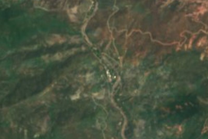
Location from OpenStreetMap. Written by Puebloteca.