Mountain Texcoco, Estado de México Municipality of Texcoco Valley of Mexico
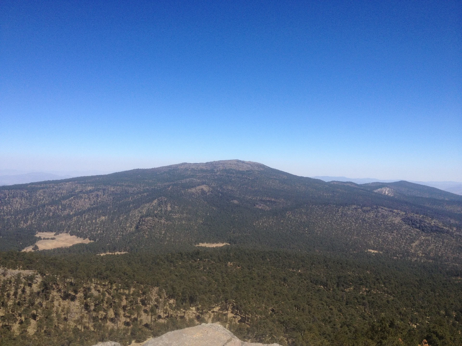
A 4,120 m volcano between Texcoco and Ixtapaluca with a shrine to the rain god on top, climbed on foot from Río Frío.
Reached on foot from Río Frío de Juárez: 4 h each way. How to get there ↓
Near here
See everything nearby ↓


Plan your visit to Monte Tláloc
Where to stay near Monte Tláloc
Compare hotels, posadas and guest houses in Monte Tláloc.
Tours to Monte Tláloc
Day trips and guided outings from Otumba often include Monte Tláloc; with a local guide you can get there without a car.
 Tours from Zacatlan
Zacatlán Guided Tour walking through the Center
★ 5.0 (2) · From US$8
How to get to Monte Tláloc
- Reached on foot from Río Frío de Juárez: 4 h each way.
- From San Martín Texmelucan: about 30 min by road (~29 km)
- Nearest airport: Mexico City (Felipe Ángeles) (NLU), 43 min by car to Otumba
Links open a partner site. We may earn a commission if you book, at no cost to you.
Tours from Zacatlan, near Monte Tláloc
Tours, prices and ratings from Viator, checked weekly. We may earn a commission if you book.
About Monte Tláloc
Tláloc, or Tlalocatepetl, is an extinct, eroded volcano rising to 4,120 m on the border of Texcoco and Ixtapaluca municipalities, the ninth-highest summit in Mexico. With Telapón (4,060 m) and a few lower hills it makes up the Sierra de Río Frío, the northern end of the Sierra Nevada chain that runs south to Iztaccíhuatl and Popocatépetl. Its slopes belong to the Zoquiapan section of the Izta-Popo national park, forested with pine, oak, fir and alder up to about 4,000 m, with bunchgrass above. Expect cold: the yearly average is under 8 °C, and most rain falls from May to October.
The mountain was one of the holiest places of the Aztec Triple Alliance, believed to be a home of the rain god. On the summit is a walled stone enclosure reached by a causeway about 150 m long, counted as the highest archaeological site in Mesoamerica, with remains going back to around AD 350. Rulers from Tenochtitlan, Texcoco and Tlacopan climbed up in April, just before the rains, with offerings and sacrifices. Around 1539 the temple was pulled down on the orders of Bishop Juan de Zumárraga; INAH archaeologist Víctor Arribalzaga, whose team has recorded 176 sites on the slopes, has since rebuilt the causeway.
There is no ticket office or opening hours. The ejidos that own the land watch over it, and signs along the path ask hikers to stay on the trail and leave the stones alone. Around 12 February the sun rises between Pico de Orizaba and La Malinche, the so-called ghost mountain, and thousands come up for it; about 3,000 people did in 2017.
How to get to Monte Tláloc
Drive from San Martín Texmelucan to Río Frío de Juárez: 30 min, 29 km
The usual climb starts in Río Frío de Juárez (Ixtapaluca), the old mountain pass on the Mexico City-Puebla toll road (150D), which has its own exits; from Mexico City it is about an hour and a half. By bus, go to the TAPO terminal (Metro San Lázaro, lines 1 and B) and take a bus that uses the México-Puebla highway, such as Estrella Roja, asking for Río Frío; it makes several stops, so watch for yours. From the village the route is waymarked: about 9.6 km one way, from roughly 3,160 m to 4,120 m. Most of it is easy, but 2-3 km below the summit there is a steep, rocky stretch where you use your hands, slippery in rain. Routes also go up from the Texcoco side, from San Pablo Ixayoc, San Jerónimo Amanalco or San Miguel Coatlinchán; the ejido at San Pablo Ixayoc runs a checkpoint. The town of Otumba is about 32 km away in a straight line.
Reached on foot from Río Frío de Juárez: 4 h each way.
Directions to Monte Tláloc on Google Maps
Distances are in a straight line; the road is usually longer.
Links open a partner site. We may earn a commission if you book, at no cost to you.
From the nearest cities to Monte Tláloc
- San Martín Texmelucan · 29 km by road, 30 min to Río Frío de Juárez, then 4 h on foot
- Chiautempan · 61 km by road, 55 min to Río Frío de Juárez, then 4 h on foot
- Mexico City · 64 km by road, 55 min to Río Frío de Juárez, then 4 h on foot
Drive times by road from OpenStreetMap, without traffic or stops. Times marked ~ are estimated from the straight-line distance.
Before you go to Monte Tláloc: hours, prices and tips
- Time needed
- The waymarked route from Río Frío is about 9.6 km one way, with roughly 960 m of climbing. Hiking Project · checked Oct 2026
- Best time of day
- Around 12 February the sun rises between Pico de Orizaba and La Malinche (the ghost mountain); expect crowds, about 3,000 people in 2017. El Universal · checked Oct 2026
- Best season
- Cold mountain climate, averaging under 8 °C a year; the rainy season runs from May to October. Wikipedia · checked Oct 2026
- What to bring
- Water, sunscreen and sunglasses even on cloudy days, proper shoes, layers and a charged phone. Chilango · checked Oct 2026
- Rules
- No ticket office or hours; the ejidos patrol the mountain. Don't climb on the walls or move stones, and stay on the path; the ejido at San Pablo Ixayoc has a checkpoint. El Universal · checked Oct 2026
Hours and prices change, especially around holidays. Each fact links to where we checked it.
Visiting Monte Tláloc: what to see and do
Walk the roughly 150 m causeway that leads into the summit enclosure.
See the ruined walls of the rain god's shrine, above 4,100 m.
Take in views of Iztaccíhuatl and Popocatépetl most of the way up.
Look for the boulder petroglyphs shaped like frogs, snakes and turtles on the slopes.
Come for the ghost mountain sunrise between Pico de Orizaba and La Malinche around 12 February.
In August the forest fills with wild mushrooms.
Plan your trip
Places to stay in Monte Tláloc
Compare hotels, posadas, and rentals in and around Monte Tláloc.
Tours & activities
Day trips and guided outings from Otumba often include Monte Tláloc; with a local guide you can get there without a car.
Rental cars
Pick up a car at NLU (Mexico City (Felipe Ángeles)): about 43 min by road to Otumba, then 32 km more to Monte Tláloc, on your own schedule.
Flights
The nearest airport with scheduled flights is Mexico City (Felipe Ángeles) (NLU), about 43 min by road from Otumba, the base for Monte Tláloc.
Travel insurance
If you plan on hiking at altitude at Monte Tláloc, check that your policy covers it: some plans leave adventure activities out.
Mobile data
Signal can drop away from Otumba: download a map of the way to Monte Tláloc before you set out, or carry an eSIM with data.
Links open a partner site. We may earn a commission if you book, at no cost to you.
When to go to Monte Tláloc cool
Monte Tláloc shares the climate of Otumba, 32 km away. The best months to visit are January, February, November, and December.
For the clearest views from Monte Tláloc, go in the driest months (January, February, November, and December); in the rains, clouds tend to build up by midday.
See the month-by-month climate of Otumba
Weather in Monte Tláloc now and the next 7 days
Live forecast from Open-Meteo. Chance of rain is the day's highest.
The closest Pueblo Mágico: Otumba

Otumba is the Pueblo Mágico closest to Monte Tláloc, with places to stay, food, and more to see.
Also close to
- Teotihuacán · Estado de México · 34 km away
- Huejotzingo · Puebla · 43 km away
- Zempoala · Hidalgo · 56 km away
- Cholula · Puebla · 58 km away
- Tlayacapan · Morelos · 58 km away
Closest to Monte Tláloc
-
Papayo · Mountain · 12 km away
-
Baños de Nezahualcóyotl · Archaeological site · 15 km away
-
Santa Rita Tlahuapan · Town · 16 km away
-
La Purificación Tepetitla · Village · 17 km away
-
Parque Nacional Molino de Flores · Nature reserve · 17 km away
-
San Felipe Hidalgo · Village · 17 km away
-
San Francisco Acuautla · Village · 17 km away
-
San Miguel Coatlinchán · Town · 17 km away


Lists with Monte Tláloc
Mountains in Estado de México · 8 Mountains near San Martín Texmelucan · 16 Mountains near Otumba · 12 Mountains near Teotihuacán · 12 Mountains near Huejotzingo · 12 Mountains near Mexico City · 14 Mountains near Chiautempan · 13 Mountains near Zempoala · 3Location from OpenStreetMap. Written by Puebloteca.