

Village Othón P. Blanco, Quintana Roo Municipality of Othón P. Blanco Chetumal and the south
Fishing village on Chetumal Bay just north of the city, known for seafood restaurants, bay swimming spots and boats to Isla Tamalcab.
From Chetumal: 10 min by car (8 km by road) How to get there ↓
Near here
See everything nearby ↓




Plan your visit to Calderitas
Where to stay near Calderitas
Compare hotels, posadas and guest houses in Calderitas.
Tours to Calderitas
Day trips and guided outings from Bacalar often include Calderitas; with a local guide you can get there without a car.
 Tours from Bacalar
Sailing Tour through the Laguna de los Siete Colores
★ 5.0 (1,672) · From US$41
How to get to Calderitas
- From Chetumal: about 10 min by road (~8 km)
- Nearest airport: Chetumal (CTM), 31 min by car to Bacalar
Links open a partner site. We may earn a commission if you book, at no cost to you.
Tours from Bacalar, near Calderitas


Tours, prices and ratings from Viator, checked weekly. We may earn a commission if you book.
About Calderitas
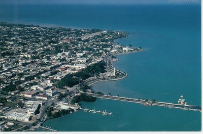
Calderitas is a small bayside village a few kilometres north-east of Chetumal, along the shore road that continues from the end of the city's malecón. With 5,551 residents in the 2020 census it is the second-largest community in Othón P. Blanco municipality after the capital, and for most chetumaleños it is the weekend place to eat fish and swim.
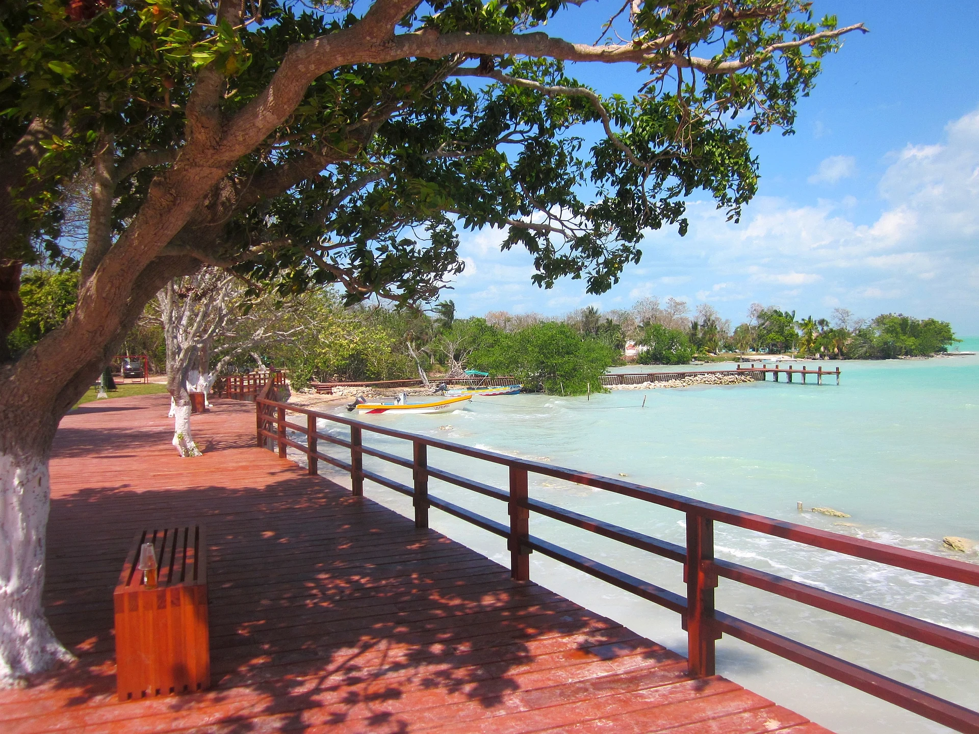
The village faces the calm, shallow water of Chetumal Bay rather than the open Caribbean, so there is no surf and the shore is a mix of short sandy stretches, rocks, mangrove roots and wooden piers. A waterfront promenade with a red-boarded walkway runs past palapa restaurants, small balnearios where families wade in the clear green water, a boat ramp and the jetty where fishermen and boat operators tie up. A few wooden Caribbean-style houses with red tin roofs survive among the newer concrete homes. Across the water sits the long wooded line of Isla Tamalcab.
Like Chetumal, Calderitas was hit by the Category 5 hurricanes Janet in 1955 and Dean in 2007. Today it lives from fishing, small-scale tourism and day visitors from the capital. Boats leave the village pier for Isla Tamalcab, and the Maya ruins of Oxtankah are about 8 km further north along the bay road, making the village a natural first stop on a half-day trip out of the city.
How to get to Calderitas
Drive from Chetumal: 10 min, 8 km
From central Chetumal follow the Boulevard Bahía north-east past the end of the malecón; the road continues straight to Calderitas, about 15 minutes by taxi or car. Cheap shared colectivos to Calderitas leave from next to the Museo de la Cultura Maya on Avenida de los Héroes. For Oxtankah, carry on north past Calderitas for about 4.5 km on the paved road along the bay.
Directions to Calderitas on Google Maps
Distances are in a straight line; the road is usually longer.
Links open a partner site. We may earn a commission if you book, at no cost to you.
From the nearest cities to Calderitas
- Chetumal · 8 km by road, 10 min
- Playa del Carmen · 325 km by road, 4 h 20 min
- Valladolid · 311 km by road, 4 h 30 min
Drive times by road from OpenStreetMap, without traffic or stops. Times marked ~ are estimated from the straight-line distance.
Visiting Calderitas: what to see and do
Seafood at the palapa restaurants along the bay
The waterfront promenade, piers and small balnearios for a swim in the calm bay
Boat trips from the pier to Isla Tamalcab, with a chance of dolphins and manatees on the way
The Oxtankah Maya ruins, about 8 km north along the bay road
Sunsets over Chetumal Bay
Plan your trip
Places to stay in Calderitas
Compare hotels, posadas, and rentals in and around Calderitas.
Tours & activities
Day trips and guided outings from Bacalar often include Calderitas; with a local guide you can get there without a car.
Rental cars
Pick up a car at CTM (Chetumal): about 31 min by road to Bacalar, then 20 km more to Calderitas, on your own schedule.
Flights
The nearest airport with scheduled flights is Chetumal (CTM), about 31 min by road from Bacalar, the base for Calderitas.
Mobile data
Signal can drop away from Bacalar: download a map of the way to Calderitas before you set out, or carry an eSIM with data.
Links open a partner site. We may earn a commission if you book, at no cost to you.
Photos
When to go to Calderitas warm
Calderitas shares the climate of Bacalar, 20 km away. The best months to visit are January, February, March, and December.
See the month-by-month climate of Bacalar
Weather in Calderitas now and the next 7 days
Live forecast from Open-Meteo. Chance of rain is the day's highest.
The closest Pueblo Mágico: Bacalar

Bacalar is the Pueblo Mágico closest to Calderitas, with places to stay, food, and more to see.
Closest to Calderitas
-
Oxtankah · Archaeological site · 6 km away
-
Museo de la Cultura Maya · Landmark · 7 km away
-
Centro Histórico de Chetumal · Landmark · 8 km away
-
Chetumal · City · 8 km away
-
Isla Tamalcab · Island · 8 km away
-
Canal de los Piratas · Lagoon · 18 km away
-
Isla de los Pájaros · Island · 18 km away
-
Laguna Milagros · Lake · 19 km away


Near Calderitas


Drive times by road from OpenStreetMap, without traffic. Times marked ~ are estimated from the straight-line distance.
Location from OpenStreetMap. Written by Puebloteca.