

Lagoon Bacalar, Quintana Roo Municipality of Bacalar Bacalar Lagoon
The 'lagoon of seven colours': a long, narrow freshwater lake of blues over white limestone, with stromatolites, cenotes and quiet sailing.
From Chetumal: 50 min by car (52 km by road) How to get there ↓
Near here
See everything nearby ↓


Plan your visit to Laguna de Bacalar
Where to stay near Laguna de Bacalar
Compare hotels, posadas and guest houses in Laguna de Bacalar.
Tours to Laguna de Bacalar
Day trips and guided outings from Bacalar often include Laguna de Bacalar; with a local guide you can get there without a car.
 laguna de bacalar y cenote exploration
★ 3.0 (2) · From US$120
How to get to Laguna de Bacalar
- From Chetumal: about 50 min by road (~52 km)
- Nearest airport: Chetumal (CTM), 31 min by car to Bacalar
Links open a partner site. We may earn a commission if you book, at no cost to you.
Popular tours to Laguna de Bacalar

Tours, prices and ratings from Viator, checked weekly. We may earn a commission if you book.
About Laguna de Bacalar
Laguna de Bacalar is a long, narrow body of fresh water in the south of Quintana Roo, running roughly north to south for some 55 to 60 kilometres and never much more than two kilometres wide. The town of Bacalar sits on its western shore about 40 kilometres north of Chetumal, and the lagoon is shared between the municipalities of Bacalar and Othón P. Blanco. On a peninsula where rain usually disappears straight into the limestone, it is one of the very few permanent surface lakes, fed mostly from below by underground rivers and cenotes and draining south through the Estero de Chac toward the Río Hondo and Chetumal Bay.
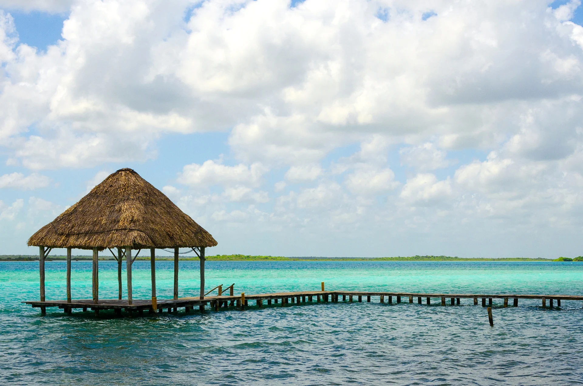
Its nickname, the lagoon of seven colours, comes from the way the water shifts from milky turquoise over the shallow white sand near shore to cobalt and almost black where the bottom drops into cenotes. Three of these open inside the lagoon itself: Cocalitos, Cenote Esmeralda and Cenote Negro, the last more than 90 metres deep. The shallows hold what is described as the largest freshwater stromatolite system in the world, rocky mounds built over thousands of years by microbial mats and among the oldest forms of life on Earth. The name Bacalar is usually traced to the Maya Bakhalal, 'surrounded by reeds', and in colonial times English pirates reached the town through the channels to the south, which is why the Spanish built the Fuerte de San Felipe above the shore.
The lagoon is also fragile. In June 2020 the rains of Tropical Storm Cristóbal washed soil, organic matter and farm runoff into it and much of the water turned brown; the colours returned only gradually and patchily, and heavy rains in 2022 clouded it again. Researchers point to deforestation, lost mangrove, sewage and the growth in tourism. Proposals to make it a federal protected area have not gone ahead, but navigation rules announced in 2025 divide the water into speed zones and treat Los Rápidos and the Canal de los Piratas as sensitive areas, and stepping on stromatolites is forbidden.
Most visitors see it from a boat: pontoon tours of two to three hours leave from the docks in town and stop at the cenotes, Isla de los Pájaros and the Canal de los Piratas, and sailing, kayak and paddleboard trips are popular for the calm early mornings. Swimming is easy from the town balneario, the many lakeside docks and spots like Cocalitos and Los Rápidos.
How to get to Laguna de Bacalar
Drive from Chetumal: 50 min, 52 km
The lagoon is reached from the town of Bacalar on Highway 307, about 40 km north of Chetumal and roughly 2½ hours' drive south of Tulum (about 5 hours from Cancún). ADO, Mayab and Autobuses Unidos buses stop at Bacalar's bus station on the highway, about 1 km from the centre, and the Tren Maya has a Bacalar station. Boat, kayak and sailing tours leave from the docks along the town waterfront.
Directions to Laguna de Bacalar on Google Maps
Distances are in a straight line; the road is usually longer.
Links open a partner site. We may earn a commission if you book, at no cost to you.
From the nearest cities to Laguna de Bacalar
- Chetumal · 52 km by road, 50 min
- Playa del Carmen · 271 km by road, 3 h 35 min
- Valladolid · 257 km by road, 3 h 45 min
Drive times by road from OpenStreetMap, without traffic or stops. Times marked ~ are estimated from the straight-line distance.
Before you go to Laguna de Bacalar: hours, prices and tips
- Entry
- Shared boat tours from the town waterfront ran about M$250 for a two-hour, five-stop trip (2022); kayaks rented for about M$150 single or M$250 double per hour. Wikivoyage (2022) · checked Oct 2026
- Time needed
- A boat trip around the main stops takes about 2½ to 3 hours; sailboat trips take longer. Por Esto (2023) · checked Oct 2026
- Best season
- Heavy rains can cloud the water: after Tropical Storm Cristóbal in June 2020 much of the lagoon turned brown, and early rains in June 2022 did it again. The clearest colours come outside the rainy season. El Financiero (2022) · checked Oct 2026
- What to bring
- Go into the water without sunscreen, insect repellent or body lotion, to protect the stromatolites. Cestee (2026) · checked Oct 2026
- Rules
- Do not step on, sit on or touch the stromatolites; it is prohibited and signposted. Boats must keep to 7.4 km/h within 50 m of the shore, and buoyed sensitive areas are closed to boats and swimmers. Por Esto; Riviera Maya News (2025) · checked Oct 2026
Hours and prices change, especially around holidays. Each fact links to where we checked it.
Visiting Laguna de Bacalar: what to see and do
A pontoon or sailboat tour to Cenote Negro, Cenote Esmeralda, Cocalitos, Isla de los Pájaros and the Canal de los Piratas
The stromatolites in the shallows, seen from the water without touching them
Kayaking or paddleboarding at sunrise, when the lagoon is at its calmest
The view over the water from the Fuerte de San Felipe in Bacalar town
A swim from one of the lakeside docks, or a float down the current at Los Rápidos
Plan your trip
Places to stay in Laguna de Bacalar
Compare hotels, posadas, and rentals in and around Laguna de Bacalar.
Tours & activities
Day trips and guided outings from Bacalar often include Laguna de Bacalar; with a local guide you can get there without a car.
Rental cars
Pick up a car at CTM (Chetumal): about 31 min by road to Bacalar, then 12 km more to Laguna de Bacalar, on your own schedule.
Flights
The nearest airport with scheduled flights is Chetumal (CTM), about 31 min by road from Bacalar, the base for Laguna de Bacalar.
Mobile data
Signal can drop away from Bacalar: download a map of the way to Laguna de Bacalar before you set out, or carry an eSIM with data.
Links open a partner site. We may earn a commission if you book, at no cost to you.
Photos
When to go to Laguna de Bacalar warm
Laguna de Bacalar shares the climate of Bacalar, 12 km away. The best months to visit are January, February, March, and December.
See the month-by-month climate of Bacalar
Weather in Laguna de Bacalar now and the next 7 days
Live forecast from Open-Meteo. Chance of rain is the day's highest.
The closest Pueblo Mágico: Bacalar

Bacalar is the Pueblo Mágico closest to Laguna de Bacalar, with places to stay, food, and more to see.
Closest to Laguna de Bacalar
-
Canal de los Piratas · Lagoon · 11 km away
-
Isla de los Pájaros · Island · 13 km away
-
Cenote Azul · Cenote · 15 km away
-
Cocalitos · Cenote · 15 km away
-
Oxtankah · Archaeological site · 18 km away
-
Isla Tamalcab · Island · 20 km away
-
Los Rápidos · Lake · 22 km away
-
Calderitas · Village · 23 km away


Near Laguna de Bacalar




Drive times by road from OpenStreetMap, without traffic. Times marked ~ are estimated from the straight-line distance.
Lists with Laguna de Bacalar
Lakes and Lagoons in Quintana Roo · 6 Lakes and Lagoons near Chetumal · 4Location from OpenStreetMap. Written by Puebloteca.