

Lagoon Benito Juárez, Quintana Roo Municipality of Benito Juárez Cancún
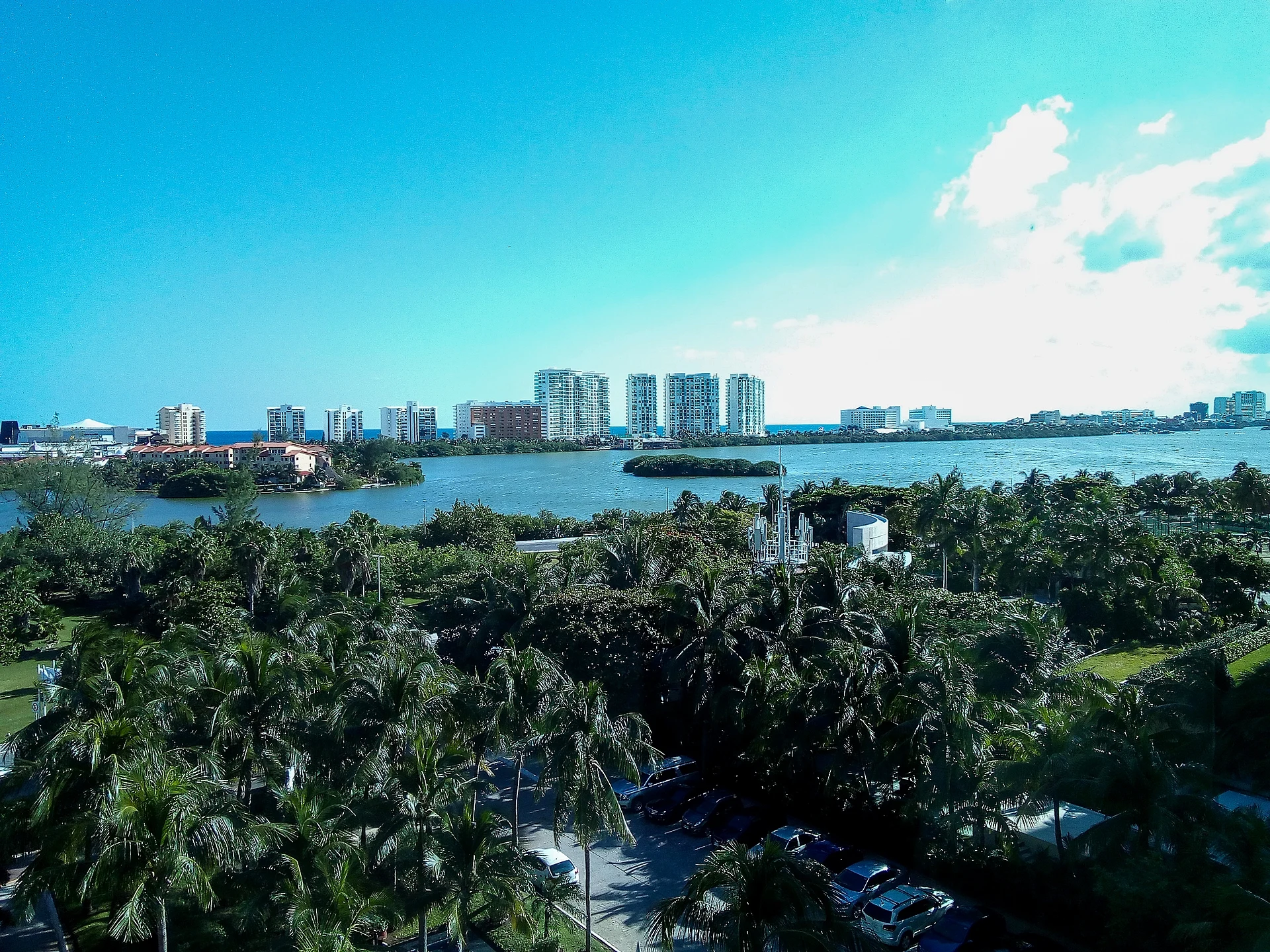
The mangrove-lined lagoon system cupped by Cancún's Hotel Zone, a Ramsar wetland of crocodiles and herons best seen by kayak or boat.
From Cancún: 20 min by car (14 km by road) How to get there ↓
Near here
See everything nearby ↓


Plan your visit to Laguna Nichupté
Where to stay near Laguna Nichupté
Compare hotels, posadas and guest houses in Laguna Nichupté.
Tours to Laguna Nichupté
Day trips and guided outings from Isla Mujeres often include Laguna Nichupté; with a local guide you can get there without a car.
 Kayak adventure through Laguna Nichupté in Cancun
★ 4.9 (205) · From US$49
How to get to Laguna Nichupté
- From Cancún: about 20 min by road (~14 km)
Links open a partner site. We may earn a commission if you book, at no cost to you.
Popular tours to Laguna Nichupté


Tours, prices and ratings from Viator, checked weekly. We may earn a commission if you book.
About Laguna Nichupté
Laguna Nichupté is the body of water enclosed by the 7-shaped Hotel Zone of Cancún, between the resort strip and the mainland city. It is not one lagoon but a system of seven connected basins, among them Laguna Bojórquez, the northern, central and southern basins, Río Inglés and Laguna del Amor, covering more than 3,000 hectares. Its brackish water reaches the Caribbean through two channels, Sigfrido and Nizuc, and its shores are lined with red, black and white mangrove and buttonwood.
The mangroves and the lagoon around them were declared the Manglares de Nichupté flora and fauna protection area in 2008 and listed as a Ramsar wetland of international importance the same year, with about 4,257 hectares. The protected area shelters Morelet's and American crocodiles, black spiny-tailed iguanas, green turtles and about 160 recorded bird species. The decree has been controversial: an adjoining strip of mangrove known as Tajamar was left outside it and later cleared for development. Hurricane Wilma badly damaged the mangroves in 2005, and since 2008 a local conservation group working with CONANP and Cinvestav has replanted tens of hectares.
For visitors the lagoon is mostly something seen from the Hotel Zone road and the restaurants and docks along it, especially at sunset, when the light falls across the water toward the city. Marinas on the lagoon side run speedboat "jungle tours" through the mangrove channels out to the reef, along with kayaking, paddleboarding and dinner cruises. In May 2026 the 11.2-km Puente Vehicular Nichupté opened, carrying traffic 8.8 km across the water between Boulevard Colosio and the Hotel Zone. Swimming in the lagoon is a bad idea: crocodiles live here, warning signs mark the shoreline, and there have been serious attacks on people who ignored them.
How to get to Laguna Nichupté
Drive from Cancún: 20 min, 14 km
The lagoon borders the whole Hotel Zone: Boulevard Kukulcán runs along its eastern shore from Km 0 to Km 25, and city bus R-1 from downtown Cancún (M$12, 2025) stops at the marinas and lagoon-side restaurants. The Puente Nichupté, open since May 2026, crosses it from Boulevard Colosio. Tours leave from marinas on the lagoon side of the boulevard.
Directions to Laguna Nichupté on Google Maps
Distances are in a straight line; the road is usually longer.
Links open a partner site. We may earn a commission if you book, at no cost to you.
From the nearest cities to Laguna Nichupté
- Cancún · 14 km by road, 20 min
- Playa del Carmen · 66 km by road, 55 min
- Valladolid · 174 km by road, 2 h 10 min
Drive times by road from OpenStreetMap, without traffic or stops. Times marked ~ are estimated from the straight-line distance.
Before you go to Laguna Nichupté: hours, prices and tips
- Guide or tour
- Most visitors see the lagoon on a tour from a Hotel Zone marina (speedboat jungle tours, kayak trips), but you can also simply walk the shoreline docks and restaurants. Tours: Viator GetYourGuide Wikivoyage, Cancún (2025) · checked Oct 2026
- Rules
- Do not swim in the lagoon: crocodiles live here, warning signs mark restricted areas, and authorities call entering the water a mortal risk. Do not feed the crocodiles. Riviera Maya News (2025) · checked Oct 2026
Hours and prices change, especially around holidays. Each fact links to where we checked it.
Visiting Laguna Nichupté: what to see and do
Sunset over the lagoon from the docks and restaurants along Boulevard Kukulcán
A kayak or paddleboard trip into the mangrove channels
A speedboat jungle tour from a Hotel Zone marina through the mangroves to the reef
Birdwatching for herons, egrets and other waterbirds in the protected area
The view from the new Puente Nichupté across the lagoon
Plan your trip
Places to stay in Laguna Nichupté
Compare hotels, posadas, and rentals in and around Laguna Nichupté.
Tours & activities
Day trips and guided outings from Isla Mujeres often include Laguna Nichupté; with a local guide you can get there without a car.
Rental cars
Pick up a car at CUN (Cancún), 26 km from Isla Mujeres as the crow flies; Laguna Nichupté is 16 km beyond the pueblo.
Flights
The nearest airport with scheduled flights is Cancún (CUN), 26 km from Isla Mujeres, the base for Laguna Nichupté.
Mobile data
Signal can drop away from Isla Mujeres: download a map of the way to Laguna Nichupté before you set out, or carry an eSIM with data.
Links open a partner site. We may earn a commission if you book, at no cost to you.
Photos
When to go to Laguna Nichupté warm
Laguna Nichupté shares the climate of Isla Mujeres, 16 km away. The best months to visit are February, March, April, and July.
See the month-by-month climate of Isla Mujeres
Weather in Laguna Nichupté now and the next 7 days
Live forecast from Open-Meteo. Chance of rain is the day's highest.
The closest Pueblo Mágico: Isla Mujeres

Isla Mujeres is the Pueblo Mágico closest to Laguna Nichupté, with places to stay, food, and more to see.
Also close to
- Cozumel · Quintana Roo · 69 km away
Closest to Laguna Nichupté
-
Zona Hotelera de Cancún · Town · 2 km away
-
Punta Nizuc · Nature reserve · 7 km away
-
Cancún · City · 8 km away
-
Puerto Juárez · Town · 10 km away
-
El Meco · Archaeological site · 13 km away
-
Museo Subacuático de Arte (MUSA) · Landmark · 13 km away
-
Punta Sur · Viewpoint · 14 km away
-
Punta Sam · Village · 15 km away


Near Laguna Nichupté


Drive times by road from OpenStreetMap, without traffic. Times marked ~ are estimated from the straight-line distance.
Lists with Laguna Nichupté
Lakes and Lagoons in Quintana Roo · 6Location from OpenStreetMap. Written by Puebloteca.