City Navojoa, Sonora
The Pearl of the Mayo: a southern Sonora farm city, Álvaro Obregón's birthplace, with a museum in the old station and the road to Álamos.
From Ciudad Obregón: 55 min by car (68 km by road) How to get there ↓
Near here
See everything nearby ↓


Plan your visit to Navojoa
Where to stay near Navojoa
Compare hotels, posadas and guest houses in Navojoa.
Tours to Navojoa
Day trips and guided outings from Álamos often include Navojoa; with a local guide you can get there without a car.
How to get to Navojoa
- From Ciudad Obregón: about 55 min by road (~68 km)
- Nearest airport: Ciudad Obregón (CEN), 1 h 39 min by car to Álamos
Links open a partner site. We may earn a commission if you book, at no cost to you.
About Navojoa
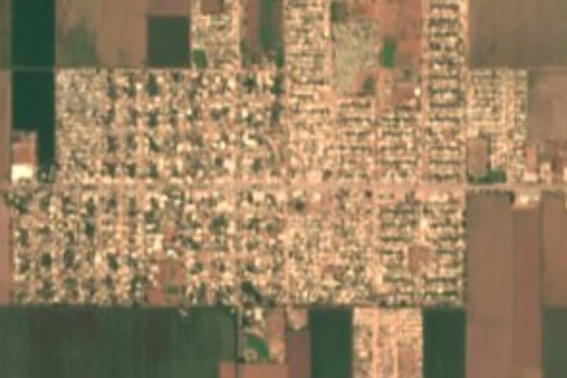
Navojoa, seat of the municipality of the same name, is one of Sonora's larger cities, with 120,926 people in the 2020 census. It lies in the valley of the Mayo River, roughly 40 to 50 meters above sea level, between the Sierra Madre foothills and the Gulf of California, and goes by the nickname La Perla del Mayo. The name is Mayo (Yoreme) for cactus house: navo means prickly pear and jova means house. Yoreme families have farmed this valley since before the Spanish arrived, and crosses of mesquite or ironwood still stand in front of many homes around the city.
There are really two Navojoas. Jesuit Pedro Méndez founded the mission of Santa María de Navojoa beside the river in 1614. Then, after a flood in 1907, residents asked for higher ground near the new railway, and on May 7 of that year, the day the first train pulled in, the neighborhood of Pueblo Nuevo de Navojoa was born; the old settlement, now called Pueblo Viejo, was left behind. Francisco I. Madero stepped off at this station on his 1910 campaign. Álvaro Obregón, born at the nearby Hacienda de Siquisiva, became president of Mexico in 1920, and Pueblo Nuevo took the name Navojoa in 1918.
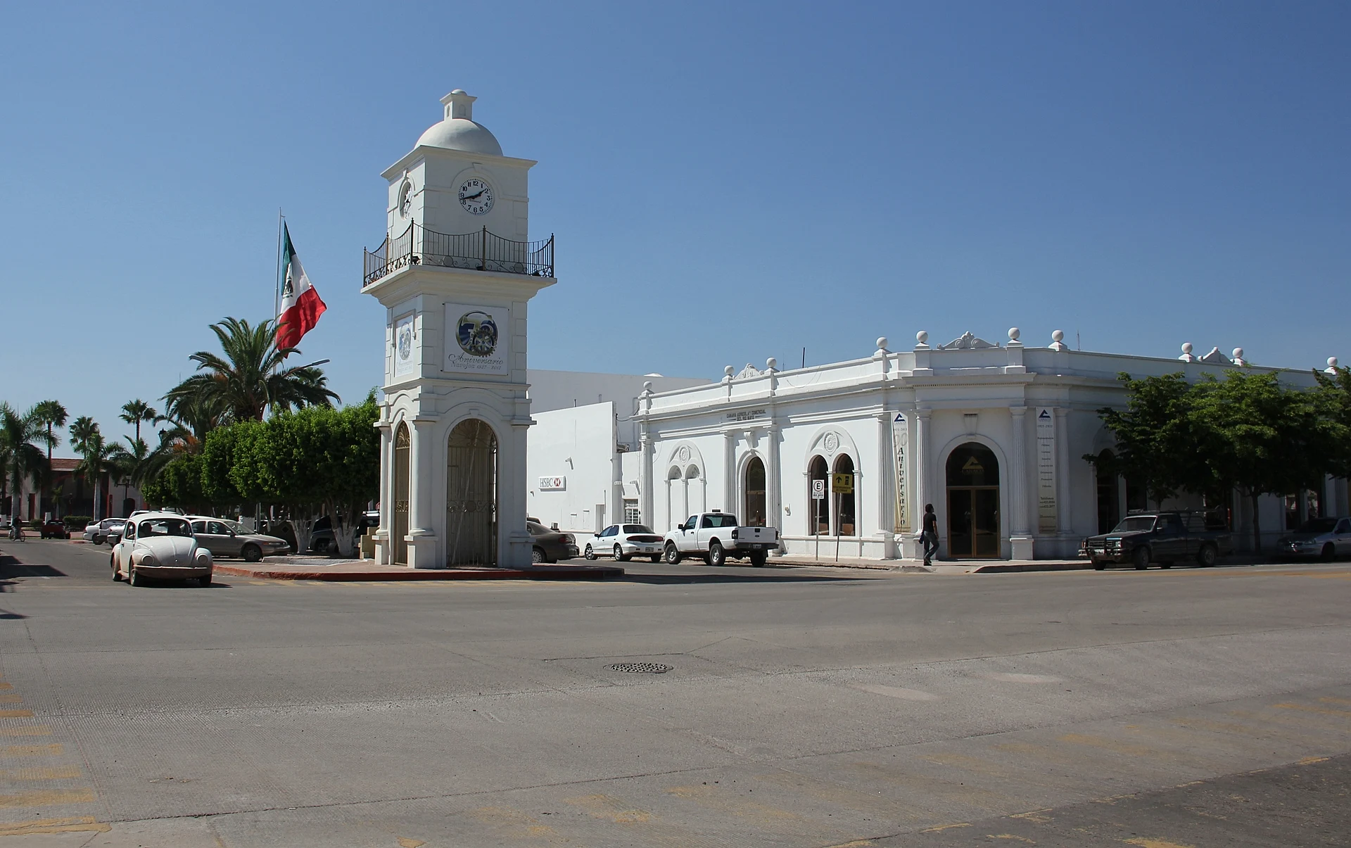
Downtown centers on Plaza 5 de Mayo, with an obelisk to Obregón and a replica of the Winged Victory added in 2007. The Templo del Sagrado Corazón de Jesús was remodeled between 1952 and 1957, trading its neo-Gothic look for a twin-towered neo-Baroque front in pink stone. The clock tower and the city hall are close by. The old railroad station, opposite Santa Fe Springs Square, holds the Museo Regional del Mayo, five rooms of pre-Hispanic and colonial objects, Yoreme ethnography, crafts and local history. Sculptures welded from scrap iron dot the avenues and parks, part of a city project chasing a world record for their number.
About 18 km away on the Mayo River, the Tehuelibampo eco-museum protects 89 petroglyphs. Professor Lombardo Ríos Ramírez, whose name the regional museum carries, brought the site to light in 1984, and the museum building is made of local stone. El Rebote, an ecological park on the riverbank, opened in 2018. Adolfo Ruiz Cortines Dam, locally called Mocúzarit, draws anglers, kayakers and water-skiers. At Easter many local families camp for a week at Las Bocas beach, and Huatabampito is about an hour away.
Expect dry heat: the yearly mean is around 25 °C, highs of 48 °C have been recorded in May and June, and most rain falls from July to September. The economy rests on Mayo Valley agriculture, two big hog producers that export to the US, Germany and Japan, a FEMSA brewery and a growing shrimp-farming sector. Travelers mostly use Navojoa as the base for Álamos, the colonial Pueblo Mágico in the hills about 48 km inland.
How to get to Navojoa
Drive from Ciudad Obregón: 55 min, 68 km
From Ciudad Obregón it is 64 km south on Federal Highway 15, a four-lane road with a toll section; about an hour. The nearest commercial airport is Ciudad Obregón's, 48 km north. From Hermosillo, ACN buses run down the coast to Navojoa in about 3.5 hours. Álamos, the nearest Pueblo Mágico, is about 48 km east: Albatros buses take around an hour and leave about three times a day from the small terminal on José María Morelos street downtown.
Directions to Navojoa on Google Maps
Distances are in a straight line; the road is usually longer.
Links open a partner site. We may earn a commission if you book, at no cost to you.
From the nearest cities to Navojoa
- Ciudad Obregón · 68 km by road, 55 min
- Los Mochis · 163 km by road, 1 h 55 min
- Guaymas · 196 km by road, 2 h 30 min
Drive times by road from OpenStreetMap, without traffic or stops. Times marked ~ are estimated from the straight-line distance.
Before you go to Navojoa: hours, prices and tips
- Best time of day
- November to March, when the heat eases and it is dry; May and June have reached 48 °C, and the rains come from July to September. Wikipedia (es) · checked Oct 2026
- Best season
- Pueblo Nuevo's founding anniversary on May 7; San Juan on June 24 and Holy Week, both with Mayo traditions. Wikipedia (es) · checked Oct 2026
Hours and prices change, especially around holidays. Each fact links to where we checked it.
Visiting Navojoa: what to see and do
Walk Plaza 5 de Mayo, with its obelisk to Álvaro Obregón and the Winged Victory replica.
Look up at the twin pink-stone towers of the Templo del Sagrado Corazón de Jesús.
Visit the Museo Regional del Mayo in the old railroad station.
Spot the scrap-iron sculptures scattered along avenues and parks.
See the 89 petroglyphs at the Tehuelibampo eco-museum on the Mayo River.
Walk the riverbank at El Rebote ecological park.
Fish or paddle at Mocúzarit (Adolfo Ruiz Cortines) Dam.
Drive up to Álamos, the Pueblo Mágico, about 48 km away.
Plan your trip
Places to stay in Navojoa
Compare hotels, posadas, and rentals in and around Navojoa.
Tours & activities
Day trips and guided outings from Álamos often include Navojoa; with a local guide you can get there without a car.
Rental cars
Pick up a car at CEN (Ciudad Obregón): about 1 h 39 min by road to Álamos, then 50 km more to Navojoa, on your own schedule.
Flights
The nearest airport with scheduled flights is Ciudad Obregón (CEN), about 1 h 39 min by road from Álamos, the base for Navojoa.
Mobile data
Signal can drop away from Álamos: download a map of the way to Navojoa before you set out, or carry an eSIM with data.
Links open a partner site. We may earn a commission if you book, at no cost to you.
When to go to Navojoa warm
Navojoa shares the climate of Álamos, 50 km away. The best months to visit are January, February, March, and November.
See the month-by-month climate of Álamos
Weather in Navojoa now and the next 7 days
Live forecast from Open-Meteo. Chance of rain is the day's highest.
The closest Pueblo Mágico: Álamos

Álamos is the Pueblo Mágico closest to Navojoa, with places to stay, food, and more to see.
Closest to Navojoa
-
Huatabampo · Town · 34 km away
-
La Aduana · Town · 43 km away
-
Minas Nuevas · Town · 43 km away
-
Parque La Colorada · Nature reserve · 49 km away
Near Navojoa


Drive times by road from OpenStreetMap, without traffic. Times marked ~ are estimated from the straight-line distance.
Location from OpenStreetMap. Written by Puebloteca.