Town Nacajuca, Tabasco
Chontal Maya seat 30 minutes from Villahermosa, with San Antonio church, a riverwalk, crafts plaza and a pejelagarto restaurant strip.
From Villahermosa: about 25 min by road (~30 km) How to get there ↓
Near here
See everything nearby ↓


Plan your visit to Nacajuca
Where to stay near Nacajuca
Compare hotels, posadas and guest houses in Nacajuca.
Tours to Nacajuca
Day trips around Frontera sometimes stop in Nacajuca; a tour is the easy way to see it without a car.
 Tours from Villahermosa
Palenque Archaeological site from Villahermosa City or airport
★ 5.0 (9) · From US$184
How to get to Nacajuca
- From Villahermosa: about 25 min by road (~30 km)
- Nearest airport: Villahermosa (VSA), 1 h 6 min by car to Frontera
Links open a partner site. We may earn a commission if you book, at no cost to you.
Tours from Villahermosa, near Nacajuca


Tours, prices and ratings from Viator, checked weekly. We may earn a commission if you book.
About Nacajuca
Nacajuca is the seat of the municipality of the same name, on low plain north of Villahermosa, and one of the main centers of Tabasco's Chontal Maya people. It had 10,956 residents in 2020. In Yokot'an, the Chontals' Mayan language, the town is called Yäxtup; the people call themselves yoko yinikob (men) and yoko ixikob (women), "the true ones", while "Chontal" is a Nahuatl word meaning "foreigner". The land is flat and floods easily, and the 2007 and 2011 floods hit it hard.
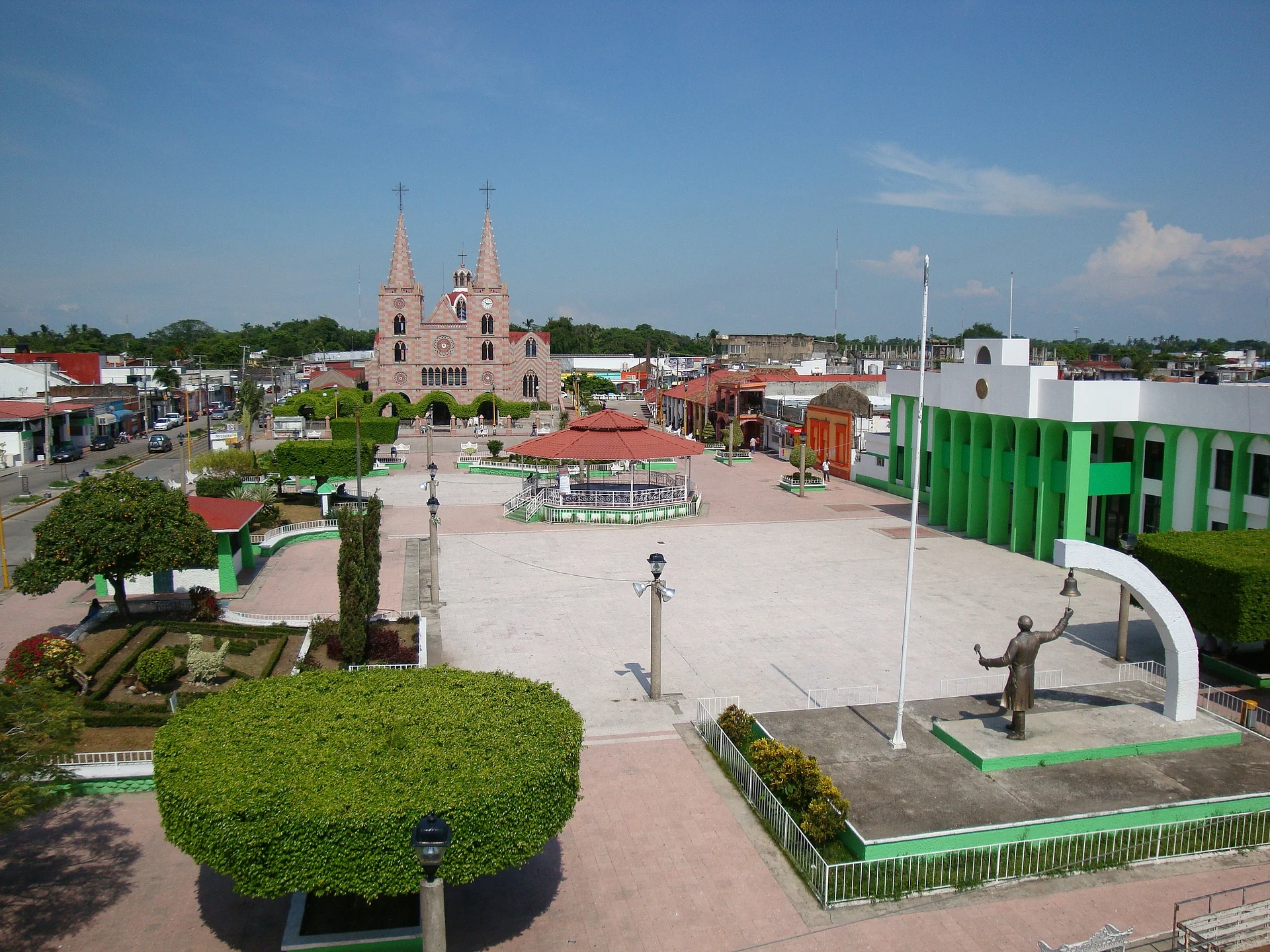
Hernán Cortés passed through in 1524-1525 and praised the region's cacao. The first church, of straw, wattle and clay, went up in 1614 along with the royal house; the town became a villa in 1863 and a city in 1971. In 1906 a railway linked it with Cunduacán and Comalcalco. Today the church of San Antonio de Padua, built in 1965 and mostly Gothic in style, faces the Parque Miguel Hidalgo, the hub of civic life. There is a riverside walk on the Nacajuca River and a crafts plaza where artisans from across the municipality sell bags, hats and mats woven of palm or water hyacinth, joloche figures, gourds, and the embroidered ribbons of the Arroyo community.
Food is part of the visit: roasted pejelagarto, river and lagoon fish, pozol, chorote and hot chocolate. Along the Villahermosa–Nacajuca road runs a strip of restaurants called Bijhi Yoko'tan. Nearby are Olcuatitán (Candlemas, 1 and 2 February), Tucta, Tapotzingo and Mazateupa, with colorful churches and workshops. The feast of San Antonio is 11 to 13 June.
How to get to Nacajuca
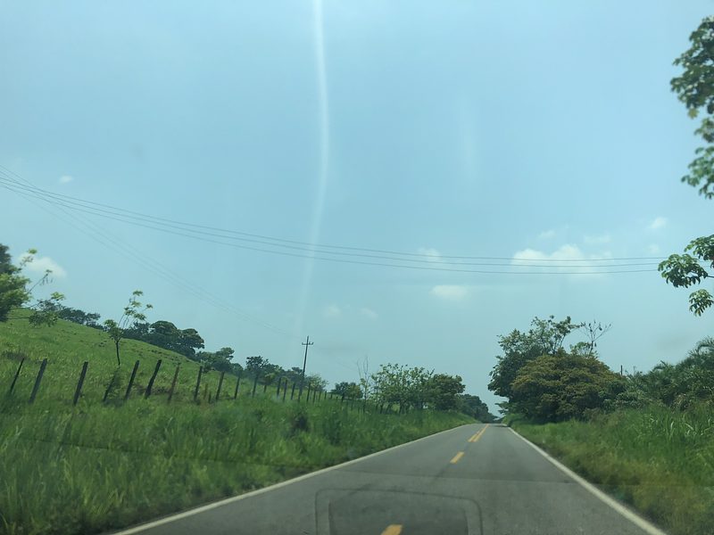
Nacajuca is 27 km and about 30 minutes by road from Villahermosa, and 85 km and roughly 1 h 15 min from Frontera. From Villahermosa take the state road Villahermosa–Nacajuca–Comalcalco north; it is the same road that runs past the restaurant strip. Another way in is the Cunduacán–Jalpa de Méndez–Nacajuca road, and Jalpa is only 5 km to the north. The town has passenger buses and taxis, but I found no timetables or exact departure point in Villahermosa, so ask at the capital's regional terminals. For the nearby Chontal villages a car or taxi is the practical choice.
Directions to Nacajuca on Google Maps
Distances are in a straight line; the road is usually longer.
Links open a partner site. We may earn a commission if you book, at no cost to you.
From the nearest cities to Nacajuca
- Villahermosa · about 30 km by road, ~25 min
- Cárdenas · about 55 km by road, ~50 min
- Palenque · about 170 km by road, ~2 h 30 min
Drive times by road from OpenStreetMap, without traffic or stops. Times marked ~ are estimated from the straight-line distance.
Before you go to Nacajuca: hours, prices and tips
- Best season
- San Antonio patron-saint fiesta 11-13 June in town; Candelaria in Olcuatitán on 1-2 February. Wikipedia (es), municipio de Nacajuca · checked Oct 2026
Hours and prices change, especially around holidays. Each fact links to where we checked it.
Visiting Nacajuca: what to see and do
Church of San Antonio de Padua, facing Parque Miguel Hidalgo.
Riverside walk on the Nacajuca River.
Crafts plaza, with palm, water-hyacinth, joloche and embroidery work.
Colonial buildings in the center and the Palacio Municipal.
Bijhi Yoko'tan restaurant strip, for roasted pejelagarto.
Route through the Chontal villages: Olcuatitán, Tucta, Tapotzingo and Mazateupa.
Plan your trip
Places to stay in Nacajuca
Compare hotels, posadas, and rentals in and around Nacajuca.
Tours & activities
Day trips around Frontera sometimes stop in Nacajuca; a tour is the easy way to see it without a car.
Rental cars
Pick up a car at VSA (Villahermosa): about 1 h 6 min by road to Frontera, then 56 km more to Nacajuca, on your own schedule.
Flights
The nearest airport with scheduled flights is Villahermosa (VSA), about 1 h 6 min by road from Frontera, the base for Nacajuca.
Mobile data
Signal can drop away from Frontera: download a map of the way to Nacajuca before you set out, or carry an eSIM with data.
Links open a partner site. We may earn a commission if you book, at no cost to you.
When to go to Nacajuca warm
Nacajuca shares the climate of Frontera, 56 km away. The best months to visit are January, February, November, and December.
See the month-by-month climate of Frontera
Weather in Nacajuca now and the next 7 days
Live forecast from Open-Meteo. Chance of rain is the day's highest.
The closest Pueblo Mágico: Frontera

Frontera is the Pueblo Mágico closest to Nacajuca, with places to stay, food, and more to see.
Also close to
- Teapa · Tabasco · 69 km away
Closest to Nacajuca
-
Cunduacán · Town · 20 km away
-
Parque-Museo La Venta · Landmark · 21 km away
-
Comalcalco · Archaeological site · 23 km away
-
Villahermosa · City · 23 km away
-
Zona Luz · Landmark · 23 km away
-
Comalcalco · Town · 24 km away
-
Pantanos de Centla · Nature reserve · 47 km away

Near Nacajuca



Drive times by road from OpenStreetMap, without traffic. Times marked ~ are estimated from the straight-line distance.
Location from OpenStreetMap. Written by Puebloteca.