Town Comalcalco, Tabasco Cacao Route
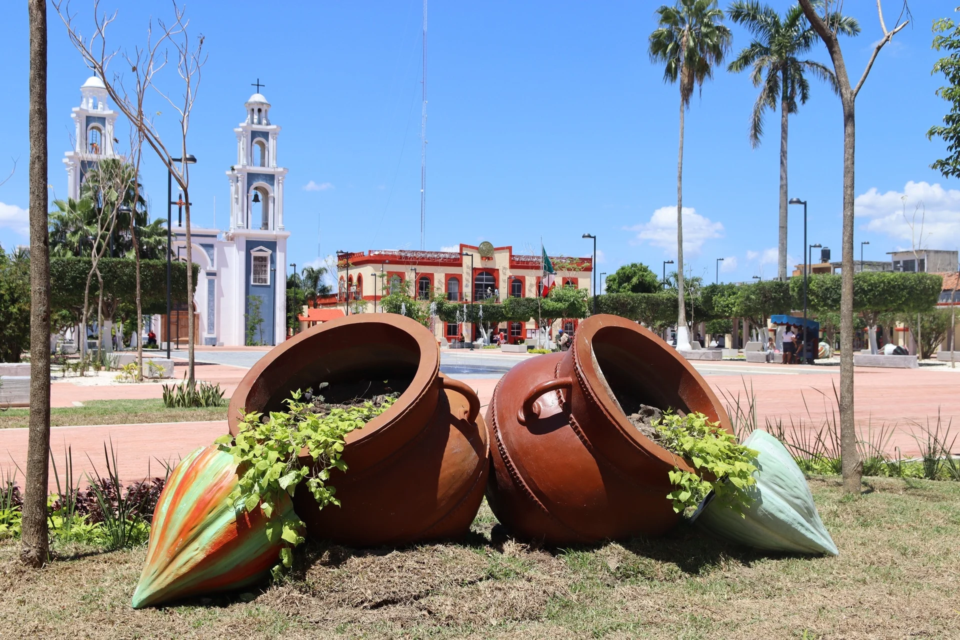
The cacao capital of Tabasco's Chontalpa, with chocolate haciendas on its edges, brick Maya ruins to the north and a colorful church in nearby Cupilco.
From Cárdenas: 45 min by car (40 km by road) How to get there ↓
Near here
See everything nearby ↓


Plan your visit to Comalcalco
Where to stay near Comalcalco
Compare hotels, posadas and guest houses in Comalcalco.
Tours to Comalcalco
Day trips around Frontera sometimes stop in Comalcalco; a tour is the easy way to see it without a car.
 Tours from Villahermosa
Palenque Archaeological site from Villahermosa City or airport
★ 5.0 (9) · From US$184
How to get to Comalcalco
- From Cárdenas: about 45 min by road (~40 km)
- Nearest airport: Villahermosa (VSA), 1 h 6 min by car to Frontera
Links open a partner site. We may earn a commission if you book, at no cost to you.
Tours from Villahermosa, near Comalcalco


Tours, prices and ratings from Viator, checked weekly. We may earn a commission if you book.
About Comalcalco
Comalcalco is a working city of about 43,000 people (2020) in the Chontalpa, the flat, wet lowland of western Tabasco, and the seat of a municipality of more than 200,000. It is the third city of the state after Villahermosa and Cárdenas, and locals call it the Perla de la Chontalpa. Its name is Nahuatl for "house of the comals", the flat griddles used for tortillas. The Maya city whose brick ruins stand just north of town flourished more than a thousand years earlier, but the present town was founded on 27 October 1827 as San Isidro de Comalcalco, on islands left in a dried-up bed of the Mezcalapa River.
Comalcalco became a municipality in 1834. On 8 October 1863 Colonel Gregorio Méndez rose here against the French intervention, the start of the uprising that eventually drove the imperial forces out of Tabasco, and in 1897 the state congress raised the town to a city. Today its economy rests on two things: oil, with large Pemex offices that run nearby fields, and cacao. The municipality is one of Mexico's main cacao producers, and family factories in and around town make drinking chocolate, bars and the cacao-and-corn drink pozol.
For visitors Comalcalco is the heart of the Ruta del Cacao. Cacao haciendas such as Hacienda La Luz, in town, and Hacienda Jesús María, to the south, offer tours of the groves and of how beans become chocolate, and the Comalcalco archaeological zone is a few minutes north. The center is small and walkable, with an arcaded main square, the municipal palace and the Mercado 27 de Octubre. A short taxi ride away, the village of Cupilco has the brightly painted church of the Asunción, and the Río Playa reserve, protected by its ejido, is good for birdwatching. Comalcalco is about an hour from Villahermosa, so it works as a day trip or an overnight stop.
How to get to Comalcalco
Drive from Cárdenas: 45 min, 40 km
Comalcalco is about 60 km northwest of Villahermosa, roughly an hour's drive: take Federal 180 west for about 25 km, then head north through Cunduacán. Comalli Plus buses leave Villahermosa about every 20 minutes from early morning to early evening; AU and other lines also run, some via Cárdenas, which takes longer. Villahermosa airport is the nearest, about an hour away. In town, taxis gather near the main square.
Directions to Comalcalco on Google Maps
Distances are in a straight line; the road is usually longer.
Links open a partner site. We may earn a commission if you book, at no cost to you.
From the nearest cities to Comalcalco
- Cárdenas · 40 km by road, 45 min
- Villahermosa · 58 km by road, 1 h
- Coatzacoalcos · 157 km by road, 2 h 5 min
Drive times by road from OpenStreetMap, without traffic or stops. Times marked ~ are estimated from the straight-line distance.
Before you go to Comalcalco: hours, prices and tips
- Hours
- The Mercado 27 de Octubre is open daily, about 6 am–6 pm. Wikivoyage · checked Oct 2026
- Best season
- Hot and wet; September is the rainiest month and May the hottest. The main cacao harvest runs from November to January, with a second harvest from May to July. Wikipedia (es) / México Desconocido · checked Oct 2026
Hours and prices change, especially around holidays. Each fact links to where we checked it.
Visiting Comalcalco: what to see and do
Tour a cacao hacienda such as Hacienda La Luz or Hacienda Jesús María and make your own chocolate.
Visit the brick-built Maya city at the Comalcalco archaeological zone, just north of town.
Walk the arcaded main square and eat local dishes at the Mercado 27 de Octubre.
Take a taxi to Cupilco to see the brightly painted church of the Asunción.
Look for birds in the Río Playa ecological reserve.
Plan your trip
Places to stay in Comalcalco
Compare hotels, posadas, and rentals in and around Comalcalco.
Tours & activities
Day trips around Frontera sometimes stop in Comalcalco; a tour is the easy way to see it without a car.
Rental cars
Pick up a car at VSA (Villahermosa): about 1 h 6 min by road to Frontera, then 67 km more to Comalcalco, on your own schedule.
Flights
The nearest airport with scheduled flights is Villahermosa (VSA), about 1 h 6 min by road from Frontera, the base for Comalcalco.
Mobile data
Signal can drop away from Frontera: download a map of the way to Comalcalco before you set out, or carry an eSIM with data.
Links open a partner site. We may earn a commission if you book, at no cost to you.
When to go to Comalcalco warm
Comalcalco shares the climate of Frontera, 67 km away. The best months to visit are January, February, November, and December.
See the month-by-month climate of Frontera
Weather in Comalcalco now and the next 7 days
Live forecast from Open-Meteo. Chance of rain is the day's highest.
The closest Pueblo Mágico: Frontera

Frontera is the Pueblo Mágico closest to Comalcalco, with places to stay, food, and more to see.
Closest to Comalcalco
-
Comalcalco · Archaeological site · 3 km away
-
Parque-Museo La Venta · Landmark · 42 km away
-
Villahermosa · City · 44 km away
-
Zona Luz · Landmark · 44 km away
Near Comalcalco




Drive times by road from OpenStreetMap, without traffic. Times marked ~ are estimated from the straight-line distance.
Location from OpenStreetMap. Written by Puebloteca.