Town General Francisco R. Murguía, Zacatecas
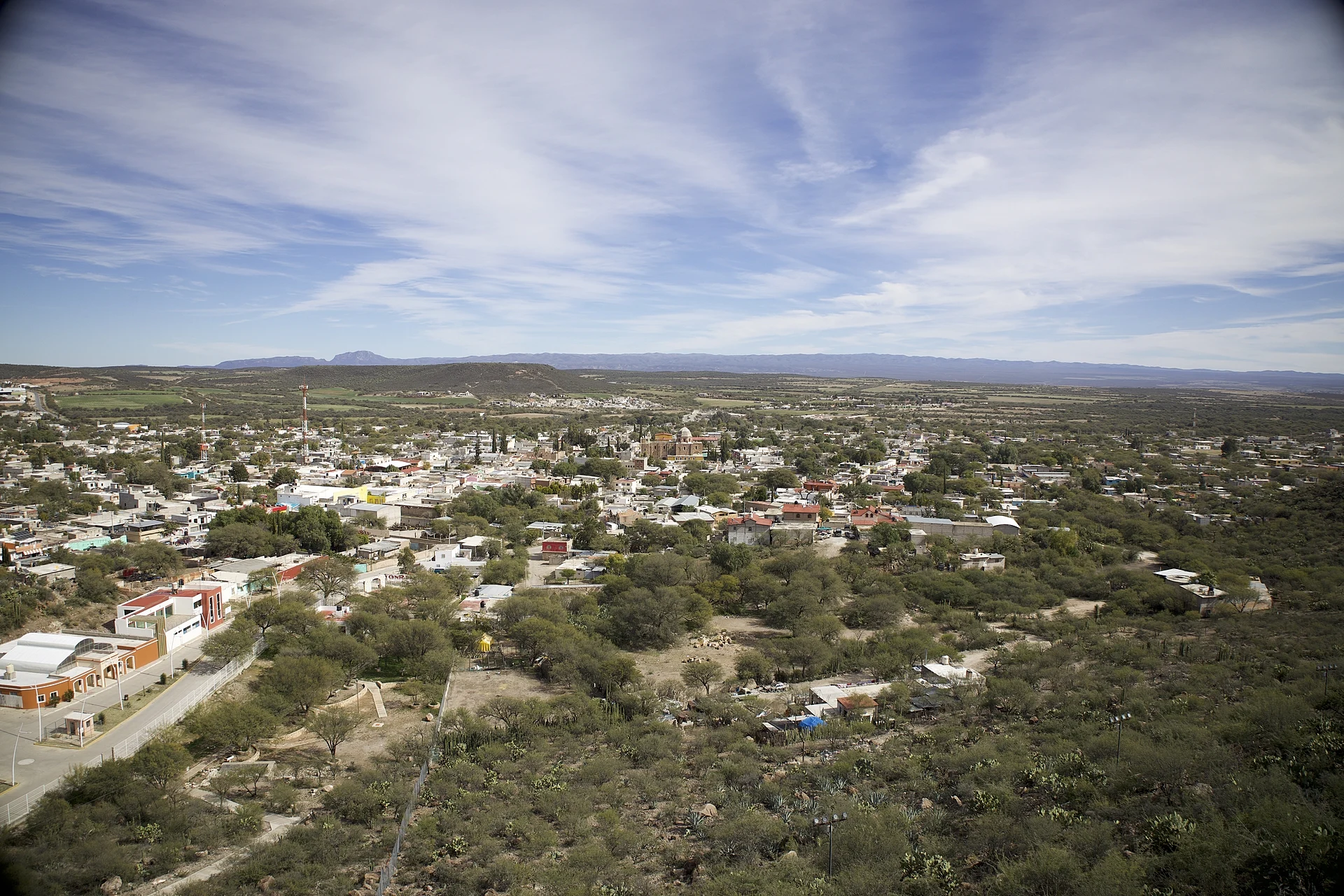
Seat of General Francisco R. Murguía on the Aguanaval River, with its church of Santa María de las Nieves and a fair on August 1-6.
From Fresnillo: about 1 h 45 min by road (~120 km) How to get there ↓
Plan your visit to Nieves
Where to stay near Nieves
Compare hotels, posadas and guest houses in Nieves.
Tours to Nieves
Day trips around Sombrerete sometimes stop in Nieves; a tour is the easy way to see it without a car.
How to get to Nieves
- From Fresnillo: about 1 h 45 min by road (~120 km)
- Nearest airport: Durango (DGO), 1 h 53 min by car to Sombrerete
Links open a partner site. We may earn a commission if you book, at no cost to you.
About Nieves
Nieves is a town of nearly 5,900 people in the semi-desert of northern Zacatecas, 1,914 metres up, and the seat of General Francisco R. Murguía municipality. The Aguanaval River, known locally as the río de Nieves, runs past it northward toward Durango through mesquite and prickly-pear scrub.
Francisco de Ibarra's expedition reached the spot on August 5, 1558, camping beside a spring west of today's streets. It was the feast of Our Lady of the Snows, so the friars travelling with him named the place Santa María de las Nieves; the caiman on the municipal coat of arms comes from the name they gave the spring, Ojo de Agua el Caimán. Silver mining earned it the name Real de Minas in the early 1700s, later shortened to Nieves. After independence it headed one of the districts (partidos) set up by Zacatecas's first state constitution in 1825. The municipality took its present name in 1964, after a revolutionary general born in Mazapil.
On February 4, 1911, Luis Moya, a Maderista who had adopted Nieves as his home, captured the town in one of the first actions of the Revolution in Zacatecas. He was killed that May taking Sombrerete and buried in the San Lorenzo cemetery here. His monument stands on the Plaza Constitución.
Farming and trade keep the town going now, and the time to come is the regional fair of August 1-6 for Our Lady of the Snows: pilgrimages start on July 27 with feather dancers and matachines, and feast days bring reliquia, beef in red chile served with pasta soups.
How to get to Nieves
From Fresnillo head north on federal highway 45 and after a few kilometres take federal highway 49 toward Río Grande, about 60 km across the plain. Near Río Grande a local road runs through Alfonso Medina and enters Nieves on the Nieves-Santa Rita state road. It is 1 h 30 min from Fresnillo, 100 km by road. From Sombrerete, the nearest Pueblo Mágico, take the González Ortega-Río Grande road, then highway 49 and the Francisco R. Murguía turn-off: 1 h 50 min, 118 km.
Without a car: we found no published bus timetable to Nieves. Fresnillo's Central de Autobuses (Calle Durango 402) is the regional hub; ask there, or in Río Grande, about buses on to Nieves.
Directions to Nieves on Google Maps
Distances are in a straight line; the road is usually longer.
Links open a partner site. We may earn a commission if you book, at no cost to you.
From the nearest cities to Nieves
- Fresnillo · about 120 km by road, ~1 h 45 min
- Zacatecas · about 185 km by road, ~2 h 45 min
- Durango · about 215 km by road, ~3 h 10 min
Drive times by road from OpenStreetMap, without traffic or stops. Times marked ~ are estimated from the straight-line distance.
Before you go to Nieves: hours, prices and tips
- Best season
- Regional fair August 1-6 for Our Lady of the Snows; pilgrimages begin on July 27. Enciclopedia de los Municipios de México (INAFED), General Francisco R. Murguía · checked Oct 2026
- Rules
- The US State Department advises against all travel to Zacatecas over crime. US State Department, Mexico travel advisory · checked Oct 2026
Hours and prices change, especially around holidays. Each fact links to where we checked it.
Visiting Nieves: what to see and do
The church of Santa María de las Nieves, a single-nave baroque church on a cross plan with a central dome
The clock on the church's west side, installed in 1892
The monument to Luis Moya on the Plaza Constitución
The San Lorenzo cemetery, where Luis Moya lay buried from 1911 to 1960
The Aguanaval River, which runs through town
The regional fair of August 1-6, with feather dancers and matachines
Plan your trip
Places to stay in Nieves
Compare hotels, posadas, and rentals in and around Nieves.
Tours & activities
Day trips around Sombrerete sometimes stop in Nieves; a tour is the easy way to see it without a car.
Rental cars
Pick up a car at DGO (Durango): about 1 h 53 min by road to Sombrerete, then 74 km more to Nieves, on your own schedule.
Flights
The nearest airport with scheduled flights is Durango (DGO), about 1 h 53 min by road from Sombrerete, the base for Nieves.
Mobile data
Signal can drop away from Sombrerete: download a map of the way to Nieves before you set out, or carry an eSIM with data.
Links open a partner site. We may earn a commission if you book, at no cost to you.
When to go to Nieves cool
Nieves shares the climate of Sombrerete, 74 km away. The best months to visit are February, March, April, and December.
See the month-by-month climate of Sombrerete
Weather in Nieves now and the next 7 days
Live forecast from Open-Meteo. Chance of rain is the day's highest.
The closest Pueblo Mágico: Sombrerete

Sombrerete is the Pueblo Mágico closest to Nieves, with places to stay, food, and more to see.
Closest to Nieves
-
Río Grande · Town · 19 km away
-
Juan Aldama · Town · 50 km away


Near Nieves





Drive times by road from OpenStreetMap, without traffic. Times marked ~ are estimated from the straight-line distance.
Location from OpenStreetMap. Written by Puebloteca.