

Beach La Paz, Baja California Sur Municipality of La Paz La Paz Bay
A long, gently sloping sand beach with palapa restaurants and kayak rentals, and the usual launch point for boats to Isla Espíritu Santo.
From La Paz: 25 min by car (25 km by road) How to get there ↓
Near here
See everything nearby ↓


Plan your visit to Playa El Tecolote
Where to stay near Playa El Tecolote
Compare hotels, posadas and guest houses in Playa El Tecolote.
Tours to Playa El Tecolote
Day trips and guided outings from Todos Santos often include Playa El Tecolote; with a local guide you can get there without a car.
 Tours from La Paz
Adventure to Espiritu Santo Island: Snorkel with Sea Lions and Beach
★ 5.0 (846) · From US$126
How to get to Playa El Tecolote
- From La Paz: about 25 min by road (~25 km)
- Nearest airport: Los Cabos (SJD), 1 h 17 min by car to Todos Santos
Links open a partner site. We may earn a commission if you book, at no cost to you.
Tours from La Paz, near Playa El Tecolote


Tours, prices and ratings from Viator, checked weekly. We may earn a commission if you book.
About Playa El Tecolote
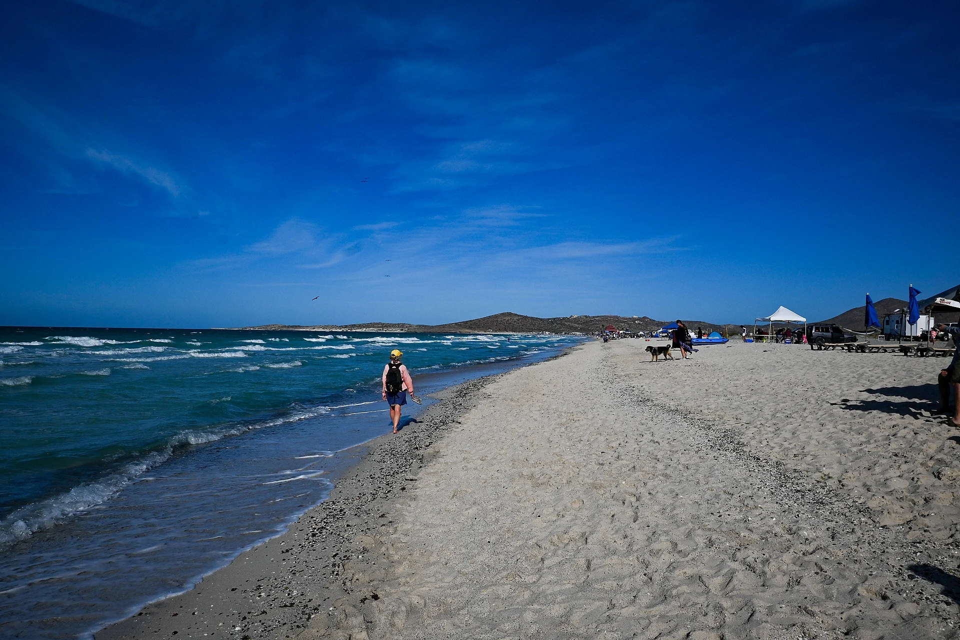
Playa El Tecolote is a long sand beach at the end of the coast road north of La Paz, in the La Paz municipality of Baja California Sur, about 30 km from the city and just beyond Playa Balandra. It faces the Gulf of California, and Isla Espíritu Santo lies across the water, so on clear days the island's cliffs and ridges are the backdrop to the beach. A few kilometers of pale sand, a gentle slope into the water and a view of the island give it the feel of a weekend beach for people from La Paz as well as visitors.
It is more developed than Balandra. Two palapa restaurants, El Tecolote and Palapa Azul, serve grilled fish, ceviche and chocolate clams, and rent beach chairs, umbrellas, kayaks and fishing gear; free municipal palapas and barbecue grills are spread along the sand on either side, and there is plenty of parking. The water is calm enough for swimming and wading, with a sandy bottom, though it is not as clear as at Balandra. Snorkeling is better at the rocky ends of the beach, particularly the western end. Kayaks and stand-up paddleboards are rented on the sand, and some operators also offer jet skis.
The beach is the departure point for independent boat operators who run to Isla Espíritu Santo, Ensenada Grande and the sea lion colony at Los Islotes; crossing from here is shorter than from La Paz itself. You can book on the sand or arrange a tour from La Paz that picks up here. Mornings and weekdays are quietest; the wind tends to pick up in the afternoon and weekends can be crowded.
The beach is open to the public, with no entry quota, unlike Balandra a few minutes down the road, which now limits visitors. Bring sun protection, because shade is limited away from the palapas. The hot months are summer; from October through March the weather is easier.
How to get to Playa El Tecolote
Drive from La Paz: 25 min, 25 km
El Tecolote is at the end of the paved coast road north of La Paz, about 30 km from the city, roughly a 30-minute drive past Pichilingue and Playa Balandra; Balandra is only about 2 km before it. Taxis and tour operators go from La Paz, and the municipal bus serves the road toward Balandra. There is ample parking at the beach.
Directions to Playa El Tecolote on Google Maps
Distances are in a straight line; the road is usually longer.
Links open a partner site. We may earn a commission if you book, at no cost to you.
From the nearest cities to Playa El Tecolote
- La Paz · 25 km by road, 25 min
- Cabo San Lucas · 184 km by road, 2 h 40 min
- San José del Cabo · 212 km by road, 3 h
Drive times by road from OpenStreetMap, without traffic or stops. Times marked ~ are estimated from the straight-line distance.
Before you go to Playa El Tecolote: hours, prices and tips
- Best time of day
- Mornings and weekdays are quieter; the wind tends to rise in the afternoon and weekends can be crowded. Backpack and Snorkel · checked Oct 2026
- What to bring
- There are two palapa restaurants and free municipal palapas with grills and trash barrels; bring sun protection for the stretches without shade. Backpack and Snorkel · checked Oct 2026
Hours and prices change, especially around holidays. Each fact links to where we checked it.
Visiting Playa El Tecolote: what to see and do
Swim and wade from the gently sloping sand.
Eat grilled fish, ceviche or chocolate clams at the palapa restaurants.
Rent a kayak or paddleboard on the beach.
Snorkel around the rocks at the west end of the beach.
Take a boat to Isla Espíritu Santo, Ensenada Grande or Los Islotes.
Watch the sunset over the water.
Plan your trip
Places to stay in Playa El Tecolote
Compare hotels, posadas, and rentals in and around Playa El Tecolote.
Tours & activities
Day trips and guided outings from Todos Santos often include Playa El Tecolote; with a local guide you can get there without a car.
Rental cars
Pick up a car at SJD (Los Cabos): about 1 h 17 min by road to Todos Santos, then 98 km more to Playa El Tecolote, on your own schedule.
Flights
The nearest airport with scheduled flights is Los Cabos (SJD), about 1 h 17 min by road from Todos Santos, the base for Playa El Tecolote.
Travel insurance
If you plan on swimming or surfing at Playa El Tecolote, check that your policy covers it: some plans leave adventure activities out.
Mobile data
Signal can drop away from Todos Santos: download a map of the way to Playa El Tecolote before you set out, or carry an eSIM with data.
Links open a partner site. We may earn a commission if you book, at no cost to you.
Photos
When to go to Playa El Tecolote mild
Playa El Tecolote shares the climate of Todos Santos, 98 km away. The best months to visit are March, April, May, and December.
Playa El Tecolote is best for swimming and time on the water in the warmest months (July, August, and September); in the rainiest ones (August, September, and October) expect storms in the afternoon.
See the month-by-month climate of Todos Santos
Weather in Playa El Tecolote now and the next 7 days
Live forecast from Open-Meteo. Chance of rain is the day's highest.
The closest Pueblo Mágico: Todos Santos

Todos Santos is the Pueblo Mágico closest to Playa El Tecolote, with places to stay, food, and more to see.
Closest to Playa El Tecolote
-
Playa Balandra · Beach · 2 km away
-
Isla Espíritu Santo · Island · 15 km away
-
La Paz · City · 19 km away
-
Los Islotes · Island · 31 km away
Near Playa El Tecolote

Drive times by road from OpenStreetMap, without traffic. Times marked ~ are estimated from the straight-line distance.
Lists with Playa El Tecolote
Beaches in Baja California Sur · 12Location from OpenStreetMap. Written by Puebloteca.