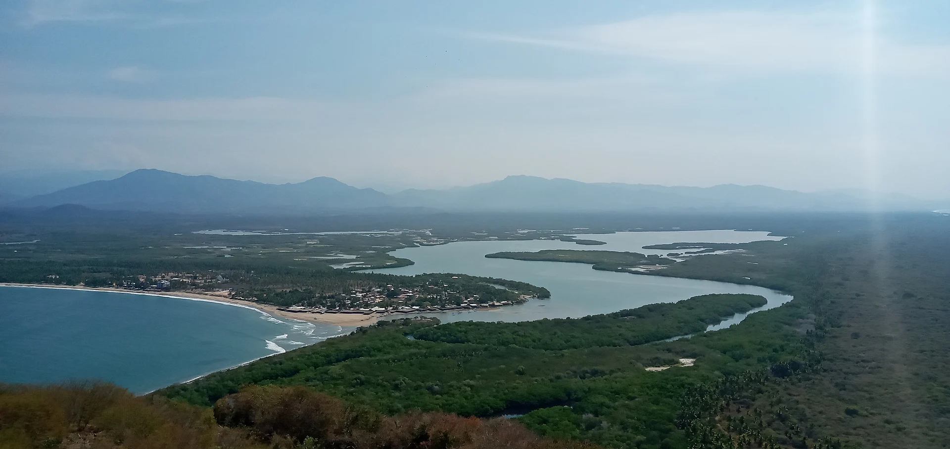
Lagoon Petatlán, Guerrero Municipality of Petatlán Costa Grande of Guerrero
A coastal lagoon with 454 hectares of mangrove and 212 recorded bird species, beside the fishing village of Barra de Potosí.
From Zihuatanejo: about 20 min by road (~20 km) How to get there ↓
Near here
See everything nearby ↓



Plan your visit to Laguna de Potosí
Where to stay near Laguna de Potosí
Compare hotels, posadas and guest houses in Laguna de Potosí.
Tours to Laguna de Potosí
Day trips and guided outings from Zihuatanejo often include Laguna de Potosí; with a local guide you can get there without a car.
 Tours from Zihuatanejo
Private Ixtapa and Zihuatanejo City Tour
★ 5.0 (153) · From US$56
How to get to Laguna de Potosí
- From Zihuatanejo: about 20 min by road (~20 km)
- Nearest airport: Zihuatanejo (ZIH), 12 min by car to Zihuatanejo
Links open a partner site. We may earn a commission if you book, at no cost to you.
Tours from Zihuatanejo, near Laguna de Potosí


Tours, prices and ratings from Viator, checked weekly. We may earn a commission if you book.
About Laguna de Potosí
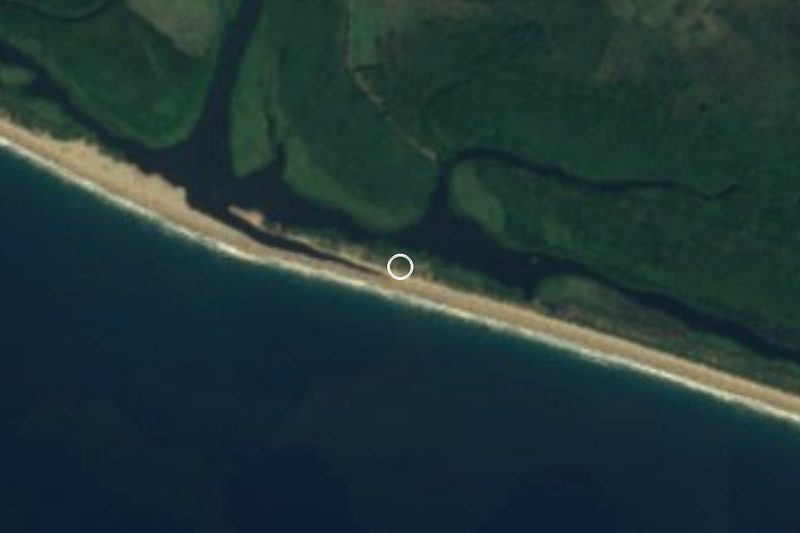
Laguna de Potosí is a coastal lagoon south of Zihuatanejo, in the municipality of Petatlán, held back from the Pacific by a sandbar. On its shore sits Barra de Potosí, a fishing village of fewer than 400 people with three main streets. The lagoon and its surroundings cover about 800 hectares, 454 of them mangrove of three kinds: red, black and buttonwood. In the rainy season the water rises, breaks through the bar and the lagoon joins the sea.
The birds are the big draw. A study by the Universidad Autónoma Metropolitana in Xochimilco recorded 212 species here: 82 water or sea birds, 23 endemics and 19 on Mexico's list of protected species at risk. The same research counted 188 butterfly species, 68 fish, 18 reptiles and 488 plants, and crocodiles live in the mangroves.
The way to see it is by boat or kayak, in the permitted areas only, with the village boatmen and operators, who also run fishing trips. Between the lagoon and the beach are enramadas, open palapa restaurants that fill up at weekends with families from Zihuatanejo and nearby inland towns. The food is fresh fish: pescado a la talla, Zihuatanejo-style fish tiritas, shrimp and seafood pozole, with shrimp, octopus, squid and fish in a dried-chile broth. A rocky headland rises off the lagoon mouth, and in winter boats go out to watch humpback whales.
On the open-sea beach the current can be strong and it is no place for beginner swimmers; in places the sand forms a channel towards the lagoon mouth.
How to get to Laguna de Potosí
The lagoon is 25 minutes from Zihuatanejo, 27 km by road. Take federal highway 200 south towards Petatlán and Acapulco as far as the village of Los Achotes, where the side road to Barra de Potosí, on the lagoon shore, turns off. From Mexico City, buses to Zihuatanejo leave the Terminal del Sur (Taxqueña), including Estrella de Oro and Costa Line, taking about 10 to 11 hours. From central Zihuatanejo, urvans run to Los Achotes (about 28 pesos), and any Petatlán bus will drop you there if you ask. Colectivos leave Los Achotes for Barra de Potosí: pickup trucks with benches in the back that wait until they fill up, sometimes nearly half an hour; the last one back leaves around 6 pm in low season. A taxi from central Zihuatanejo costs around 480 pesos and from Ixtapa about 660; there is no official fare, so agree on the price before you get in. The US State Department advises against all travel to Guerrero; travel by day and ask about local conditions before you go.
Directions to Laguna de Potosí on Google Maps
Distances are in a straight line; the road is usually longer.
Links open a partner site. We may earn a commission if you book, at no cost to you.
From the nearest cities to Laguna de Potosí
- Zihuatanejo · about 20 km by road, ~20 min
- Lázaro Cárdenas · about 120 km by road, ~1 h 45 min
- Acapulco · about 235 km by road, ~3 h 30 min
Drive times by road from OpenStreetMap, without traffic or stops. Times marked ~ are estimated from the straight-line distance.
Before you go to Laguna de Potosí: hours, prices and tips
- Best season
- Humpback whale watching runs in winter; in the rainy season the lagoon opens to the sea. Wikipedia · checked Oct 2026
- Rules
- Boat and kayak trips are only allowed in the lagoon's authorised areas. Food and Pleasure · checked Oct 2026
Hours and prices change, especially around holidays. Each fact links to where we checked it.
Visiting Laguna de Potosí: what to see and do
A boat ride through the mangrove channels.
Kayaking in the lagoon's permitted areas.
Birdwatching: 212 species recorded here.
The lagoon mouth, which opens to the sea in the rainy season.
Seafood pozole or pescado a la talla at an enramada.
Humpback whale watching in winter.
The fishing village of Barra de Potosí.
Plan your trip
Places to stay in Laguna de Potosí
Compare hotels, posadas, and rentals in and around Laguna de Potosí.
Tours & activities
Day trips and guided outings from Zihuatanejo often include Laguna de Potosí; with a local guide you can get there without a car.
Rental cars
Pick up a car at ZIH (Zihuatanejo): about 12 min by road to Zihuatanejo, then 16 km more to Laguna de Potosí, on your own schedule.
Flights
The nearest airport with scheduled flights is Zihuatanejo (ZIH), about 12 min by road from Zihuatanejo, the base for Laguna de Potosí.
Mobile data
Signal can drop away from Zihuatanejo: download a map of the way to Laguna de Potosí before you set out, or carry an eSIM with data.
Links open a partner site. We may earn a commission if you book, at no cost to you.
When to go to Laguna de Potosí warm
Laguna de Potosí shares the climate of Zihuatanejo, 16 km away. The best months to visit are January, February, March, and April.
See the month-by-month climate of Zihuatanejo
Weather in Laguna de Potosí now and the next 7 days
Live forecast from Open-Meteo. Chance of rain is the day's highest.
The closest Pueblo Mágico: Zihuatanejo

Zihuatanejo is the Pueblo Mágico closest to Laguna de Potosí, with places to stay, food, and more to see.
Closest to Laguna de Potosí
-
Barra de Potosí · Town · 2 km away
-
Playa Blanca · Beach · 6 km away
-
Playa Larga · Beach · 11 km away
-
Soledad de Maciel (La Chole) · Archaeological site · 13 km away
-
Playa Valentín · Beach · 14 km away
-
Playa La Ropa · Beach · 15 km away
-
Playa Las Gatas · Beach · 15 km away
-
Xihuacan · Archaeological site · 15 km away


Near Laguna de Potosí


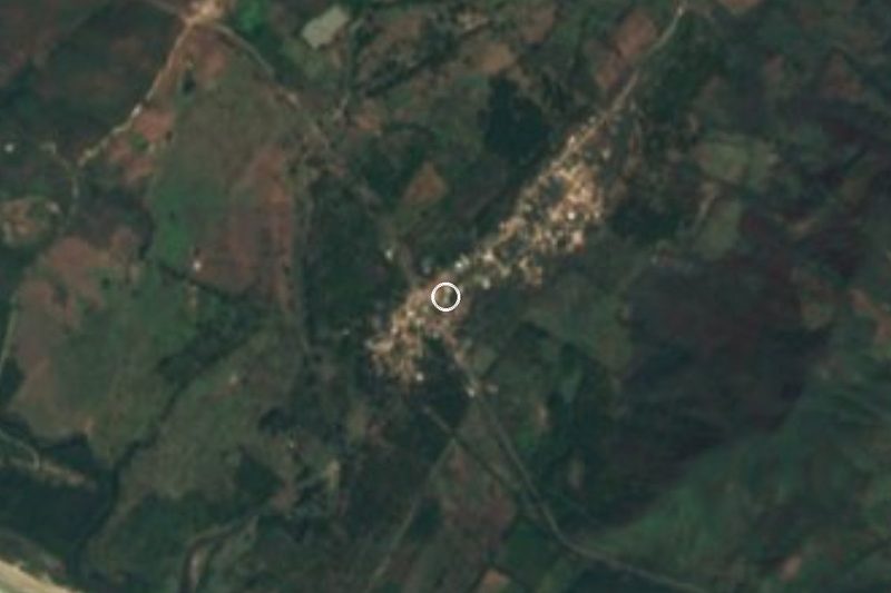


Drive times by road from OpenStreetMap, without traffic. Times marked ~ are estimated from the straight-line distance.
Lists with Laguna de Potosí
Lakes and Lagoons in Guerrero · 4Location from OpenStreetMap. Written by Puebloteca.