
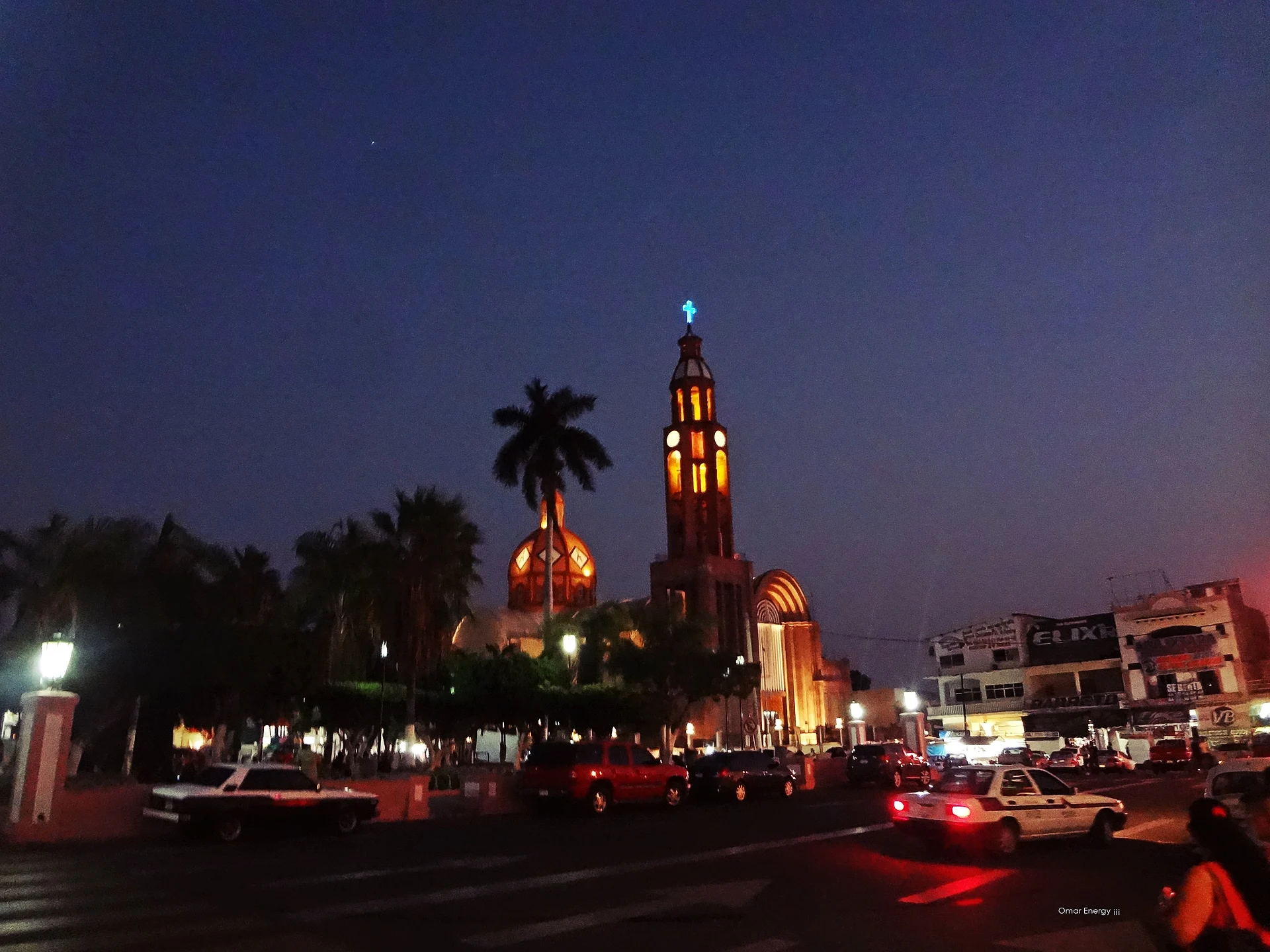


City Apatzingán, Michoacán Tierra Caliente
The hot lime-growing capital of Michoacán's Tierra Caliente, where Morelos's insurgent congress signed Mexico's first constitution on 22 October 1814.
From Uruapan: 1 h 25 min by car (105 km by road) How to get there ↓
Near here
See everything nearby ↓


Plan your visit to Apatzingán
Where to stay near Apatzingán
Compare hotels, posadas and guest houses in Apatzingán.
Tours to Apatzingán
Day trips and guided outings from Paracho often include Apatzingán; with a local guide you can get there without a car.
How to get to Apatzingán
- From Uruapan: about 1 h 25 min by road (~105 km)
- Nearest airport: Uruapan (UPN), 42 min by car to Paracho
Links open a partner site. We may earn a commission if you book, at no cost to you.
About Apatzingán
Apatzingán de la Constitución lies at only 324 m in the broad, hot valley of Michoacán's Tierra Caliente, with the Sierra Madre del Sur to the west. With about 102,000 people (2020 census) it is the largest city of the region and the fourth-largest in the state. Franciscan and Augustinian friars founded the town in 1617, and it was officially made a city in 1883. Its name is a Purépecha place name usually explained as the place of the temple of the god Apahtzï, a weasel linked with death, though other authors read it as 'place of weasels' or 'place of little reeds'. The climate is semi-arid and very warm, and the irrigated valley grows limes, papayas, grapefruit and starfruit, much of it for export.
The city's place in history was fixed on 22 October 1814, when the insurgent congress gathered by José María Morelos signed here the Decreto Constitucional para la Libertad de la América Mexicana, known as the Constitution of Apatzingán, Mexico's first constitution. The house where it was signed, at Avenida Morelos 2 in the centre, is now the Casa de la Constitución museum, with paintings, engravings, flags and historical documents, including works by Roberto Cueva del Río. Every October the city celebrates the anniversary with a long fair of livestock, farm and crafts shows, jaripeos, bands, fireworks and a big civic parade on the 22nd.
The centre runs along Avenida Constitución, with the Plaza de los Constituyentes, the municipal palace and the modernist cathedral built in 1953. The region's culture is cowboy and ranching culture: the Cuerudos de Apatzingán, horsemen in deerskin suits descended from the rural defence corps, appear at civic events, and the conjuntos de arpa grande play the valonas and sones of Tierra Caliente. Local food includes chavindecas, carne seca cooked as aporreadillo with chilli and egg, cecina enchiladas and iguana broth, and craftsmen make parota-wood furniture and equipales. Less than 20 minutes up into the pine hills, the village of Acahuato has a lookout over the valley and draws thousands of pilgrims to its Virgen de la Candelaria on 2 February.
How to get to Apatzingán
Drive from Uruapan: 1 h 25 min, 105 km
Apatzingán is about 107 km by road southwest of Uruapan, down from the highlands into the Tierra Caliente. Buses from Uruapan take about 1 hour 50 minutes, with departures through the day. The US State Department rates Michoacán "Do not travel" because of crime, and Apatzingán and the Tierra Caliente are not among the exceptions open to its employees; check the current advisory and local news before planning any road trip here.
Directions to Apatzingán on Google Maps
Distances are in a straight line; the road is usually longer.
Links open a partner site. We may earn a commission if you book, at no cost to you.
From the nearest cities to Apatzingán
- Uruapan · 105 km by road, 1 h 25 min
- Pátzcuaro · 137 km by road, 1 h 50 min
- Sahuayo · about 150 km by road, ~2 h 10 min
Drive times by road from OpenStreetMap, without traffic or stops. Times marked ~ are estimated from the straight-line distance.
Before you go to Apatzingán: hours, prices and tips
- Hours
- Casa de la Constitución museum: Monday to Friday 9am to 6pm, Saturday and Sunday 10am to 4pm; free entry. Zona Turística · checked Oct 2026
- Best time of day
- 2 February, when thousands of pilgrims climb to Acahuato for the feast of the Virgen de la Candelaria. Wikipedia (es) · checked Oct 2026
- Best season
- The constitution fair runs from 4 to 28 October, with livestock and crafts shows, jaripeos, bullfights, fireworks and the big civic parade on 22 October. Wikipedia (es) · checked Oct 2026
Hours and prices change, especially around holidays. Each fact links to where we checked it.
Visiting Apatzingán: what to see and do
Visit the Casa de la Constitución, where Mexico's first constitution was signed in 1814.
Walk Avenida Constitución, the Plaza de los Constituyentes and the 1953 modernist cathedral.
Come for the October fair and the civic parade on 22 October.
Listen to arpa grande music and see the deerskin-clad Cuerudos at civic events.
Try chavindecas, aporreadillo and cecina enchiladas.
Drive up to Acahuato for the lookout over the valley.
Plan your trip
Places to stay in Apatzingán
Compare hotels, posadas, and rentals in and around Apatzingán.
Tours & activities
Day trips and guided outings from Paracho often include Apatzingán; with a local guide you can get there without a car.
Rental cars
Pick up a car at UPN (Uruapan): about 42 min by road to Paracho, then 70 km more to Apatzingán, on your own schedule.
Flights
The nearest airport with scheduled flights is Uruapan (UPN), about 42 min by road from Paracho, the base for Apatzingán.
Mobile data
Signal can drop away from Paracho: download a map of the way to Apatzingán before you set out, or carry an eSIM with data.
Links open a partner site. We may earn a commission if you book, at no cost to you.
Photos
When to go to Apatzingán cool
Apatzingán shares the climate of Paracho, 70 km away. The best months to visit are January, March, April, and November.
See the month-by-month climate of Paracho
Weather in Apatzingán now and the next 7 days
Live forecast from Open-Meteo. Chance of rain is the day's highest.
The closest Pueblo Mágico: Paracho

Paracho is the Pueblo Mágico closest to Apatzingán, with places to stay, food, and more to see.
Closest to Apatzingán
-
La Tzaráracua · Waterfall · 41 km away
-
Volcán Paricutín · Mountain · 46 km away
-
Barrio de San Pedro · Landmark · 47 km away
-
Parque Nacional Barranca del Cupatitzio · Nature reserve · 47 km away
-
La Huatápera (Museo de los Cuatro Pueblos Indios) · Landmark · 48 km away
-
Uruapan · City · 48 km away
-
Templo de San Juan Parangaricutiro · Landmark · 50 km away

Near Apatzingán

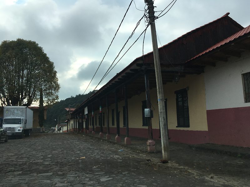


Drive times by road from OpenStreetMap, without traffic. Times marked ~ are estimated from the straight-line distance.
Location from OpenStreetMap. Written by Puebloteca.