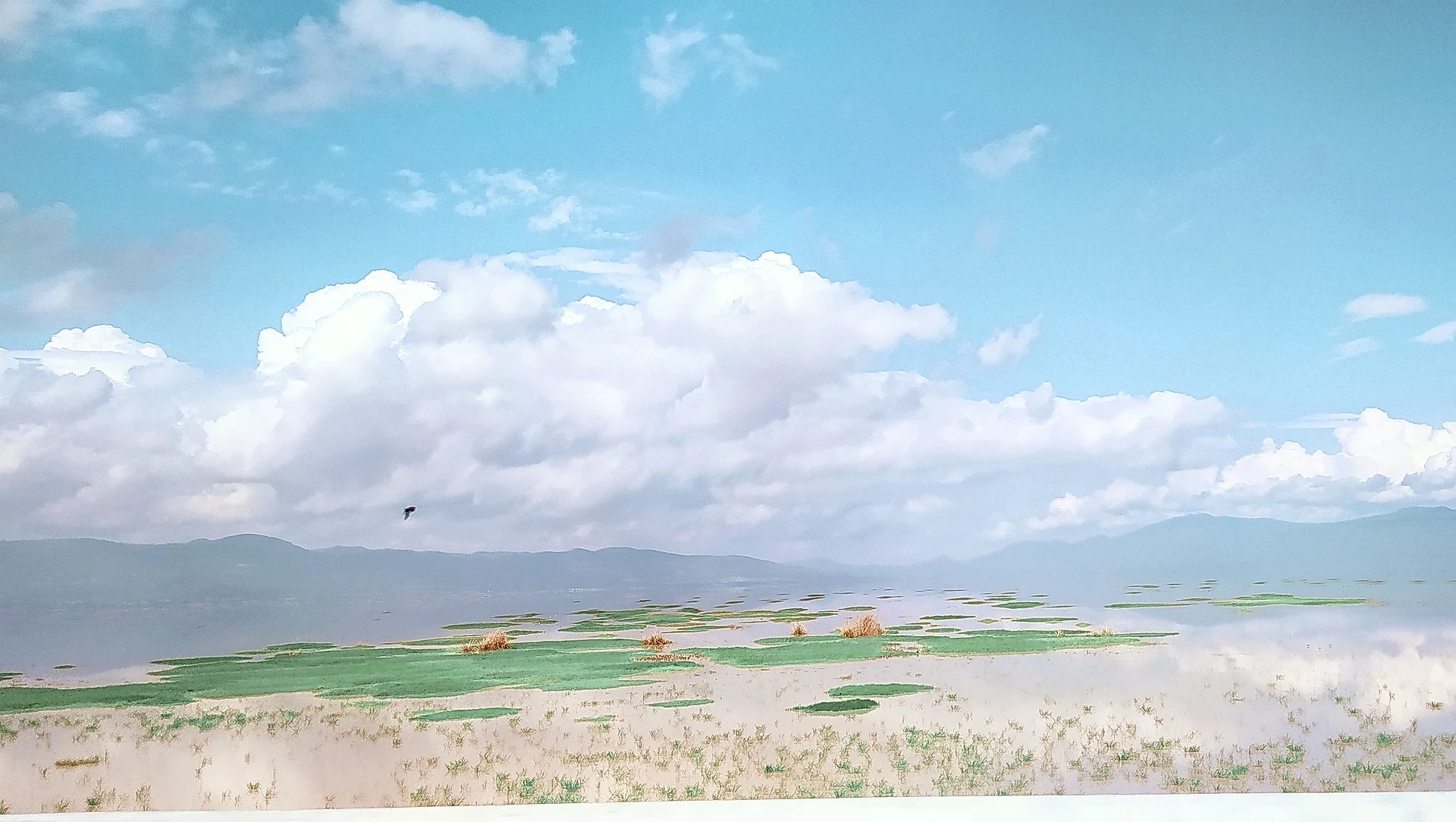


Lake Cuitzeo, Michoacán Municipality of Cuitzeo Lake Cuitzeo
Mexico's second-largest freshwater lake, a shallow, shifting sheet of water north of Morelia crossed by highway causeways and visited by winter birds.
From Uriangato: 30 min by car (31 km by road) How to get there ↓
Near here
See everything nearby ↓



Plan your visit to Lago de Cuitzeo
Where to stay near Lago de Cuitzeo
Compare hotels, posadas and guest houses in Lago de Cuitzeo.
Tours to Lago de Cuitzeo
Day trips and guided outings from Cuitzeo often include Lago de Cuitzeo; with a local guide you can get there without a car.
 Tours from Morelia
Morelia City Tour
★ 4.9 (115) · From US$33
How to get to Lago de Cuitzeo
- From Uriangato: about 30 min by road (~31 km)
- Nearest airport: Morelia (MLM), 26 min by car to Cuitzeo
Links open a partner site. We may earn a commission if you book, at no cost to you.
Tours from Morelia, near Lago de Cuitzeo


Tours, prices and ratings from Viator, checked weekly. We may earn a commission if you book.
About Lago de Cuitzeo
Lago de Cuitzeo spreads across a valley of the Trans-Mexican Volcanic Belt north of Morelia, mostly in Michoacán with a small part in Guanajuato. It takes its name from the town of Cuitzeo del Porvenir on its north shore. It is Mexico's second-largest freshwater lake after Chapala, covering somewhere between 300 and 400 square kilometres, but it is never more than about 10 m deep and its size changes constantly with the rains: scientists call it astatic. It lies in a closed basin of some 4,000 square kilometres that does not drain to the sea; its main feeders are the Grande de Morelia, the Viejo de Morelia and the Queréndaro rivers, which enter through the marshy centre of the lake, and a canal cut to the north lets high water drain toward Lake Yuriria and the Lerma river.
The lake is irregular, with northern, western and eastern arms joined by that central marsh, and two highways run straight across its western part on causeways: the free Federal Highway 43 and the 43D toll road between Morelia and the Bajío, while the 15D motorway skirts the south shore. The western section is saltier and supports unusual fisheries of clam shrimp, and the basin is the only home of a subspecies of the Mexican garter snake. Local people fish for charal, carp, mojarra and tilapia, catch frogs and weave the lake's tule reeds into mats, baskets and animal figures in San Agustín del Pulque, sold on weekends in Cuitzeo's main square.
In winter many migratory birds stop on the lake, and flocks of hundreds of pelicans and white egrets can be seen; Cuitzeo is part of the Western Hemisphere Shorebird Reserve Network as a site of regional importance. The lake is under heavy pressure: water extraction for farming, pollution, deforestation and evaporation from its broad, shallow bed have shrunk it, and in early 2024 Mexico News Daily reported that it had lost about 70 percent of its water over 25 years, after three dry years in a row, hurting the fishermen who depend on it. Around the shore are hot-spring pools, the most numerous at Huandacareo, and the small Tres Cerritos archaeological site near Cuitzeo.
How to get to Lago de Cuitzeo
Drive from Uriangato: 30 min, 31 km
From Morelia, Federal Highway 43 runs north to Cuitzeo del Porvenir and crosses the western part of the lake on a causeway toward Guanajuato; the 43D toll road runs parallel. For kayaking, the village of San Bernardo lies 13 km from the entrance to Morelia's international airport on the free road toward Zinapécuaro, and a dirt track drivable by car goes down from there to a fishermen's landing on the shore, with no tourist services.
Directions to Lago de Cuitzeo on Google Maps
Distances are in a straight line; the road is usually longer.
Links open a partner site. We may earn a commission if you book, at no cost to you.
From the nearest cities to Lago de Cuitzeo
- Uriangato · 31 km by road, 30 min
- Morelia · 41 km by road, 40 min
- Valle de Santiago · 64 km by road, 50 min
Drive times by road from OpenStreetMap, without traffic or stops. Times marked ~ are estimated from the straight-line distance.
Before you go to Lago de Cuitzeo: hours, prices and tips
- Best time of day
- Winter, when many migratory species spend the season on the lake and flocks of hundreds of pelicans and white egrets gather. Wikipedia (es) · checked Oct 2026
- Best season
- Water levels swing widely with the rains; after three dry years up to 2023 much of the lake had shrunk, so ask locally before planning a boat or kayak trip. Mexico News Daily · checked Oct 2026
- What to bring
- Your own kayak and supplies if you launch from San Bernardo: the shore access there has no tourist services. Wikipedia (es) · checked Oct 2026
Hours and prices change, especially around holidays. Each fact links to where we checked it.
Visiting Lago de Cuitzeo: what to see and do
Drive the causeway across the lake on Highway 43 between Morelia and Cuitzeo.
Watch pelicans, egrets and other migratory birds in winter.
Kayak from the fishermen's landing below San Bernardo, near Morelia airport.
Buy tule baskets and figures from San Agustín del Pulque in Cuitzeo's square at weekends.
Eat local dishes in the lakeside restaurants of Cuitzeo del Porvenir.
Soak in the hot-spring pools at Huandacareo, or visit the Tres Cerritos ruins.
Plan your trip
Places to stay in Lago de Cuitzeo
Compare hotels, posadas, and rentals in and around Lago de Cuitzeo.
Tours & activities
Day trips and guided outings from Cuitzeo often include Lago de Cuitzeo; with a local guide you can get there without a car.
Rental cars
Pick up a car at MLM (Morelia): about 26 min by road to Cuitzeo, then 10 km more to Lago de Cuitzeo, on your own schedule.
Flights
The nearest airport with scheduled flights is Morelia (MLM), about 26 min by road from Cuitzeo, the base for Lago de Cuitzeo.
Travel insurance
If you plan on swimming or kayaking at Lago de Cuitzeo, check that your policy covers it: some plans leave adventure activities out.
Mobile data
Signal can drop away from Cuitzeo: download a map of the way to Lago de Cuitzeo before you set out, or carry an eSIM with data.
Links open a partner site. We may earn a commission if you book, at no cost to you.
Photos
When to go to Lago de Cuitzeo mild
Lago de Cuitzeo shares the climate of Cuitzeo, 10 km away. The best months to visit are January, March, April, and November.
Lago de Cuitzeo is best for swimming and time on the water in the warmest months (April, May, and June); in the rainiest ones (July, August, and September) expect storms in the afternoon.
See the month-by-month climate of Cuitzeo
Weather in Lago de Cuitzeo now and the next 7 days
Live forecast from Open-Meteo. Chance of rain is the day's highest.
The closest Pueblo Mágico: Cuitzeo

Cuitzeo is the Pueblo Mágico closest to Lago de Cuitzeo, with places to stay, food, and more to see.
Also close to
- Yuriria · Guanajuato · 33 km away
- Salvatierra · Guanajuato · 48 km away
- Tzintzuntzan · Michoacán · 50 km away
- Pátzcuaro · Michoacán · 61 km away
- Santa Clara del Cobre · Michoacán · 73 km away
Closest to Lago de Cuitzeo
-
Copándaro de Galeana · Town · 5 km away
-
Huandacareo · Hot springs · 8 km away
-
Huandacareo La Nopalera · Archaeological site · 9 km away
-
Tres Cerritos · Archaeological site · 13 km away
-
San Agustín del Pulque · Town · 18 km away
-
Moroleón · Town · 22 km away
-
Uriangato · Town · 23 km away
-
Cerano · Town · 25 km away


Near Lago de Cuitzeo


Drive times by road from OpenStreetMap, without traffic. Times marked ~ are estimated from the straight-line distance.
Lists with Lago de Cuitzeo
Lakes and Lagoons in Michoacán · 5 Lakes and Lagoons near Tzintzuntzan · 4 Lakes and Lagoons near Valle de Santiago · 3 Lakes and Lagoons near Zacapu · 3Location from OpenStreetMap. Written by Puebloteca.