Town Yuriria, Guanajuato Municipality of Yuriria
Second-largest settlement in Yuriria municipality: a 17th-century hacienda town with seven fiestas a year and a market that serves the whole district.
From Uriangato: 50 min by car (29 km by road) How to get there ↓
Near here
See everything nearby ↓


Plan your visit to Cerano
Where to stay near Cerano
Compare hotels, posadas and guest houses in Cerano.
Tours to Cerano
Day trips around Yuriria sometimes stop in Cerano; a tour is the easy way to see it without a car.
 Tours from Morelia
Morelia City Tour
★ 4.9 (115) · From US$33
How to get to Cerano
- From Uriangato: about 50 min by road (~29 km)
- Nearest airport: Morelia (MLM), 49 min by car to Yuriria
Links open a partner site. We may earn a commission if you book, at no cost to you.
Tours from Morelia, near Cerano


Tours, prices and ratings from Viator, checked weekly. We may earn a commission if you book.
About Cerano
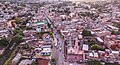
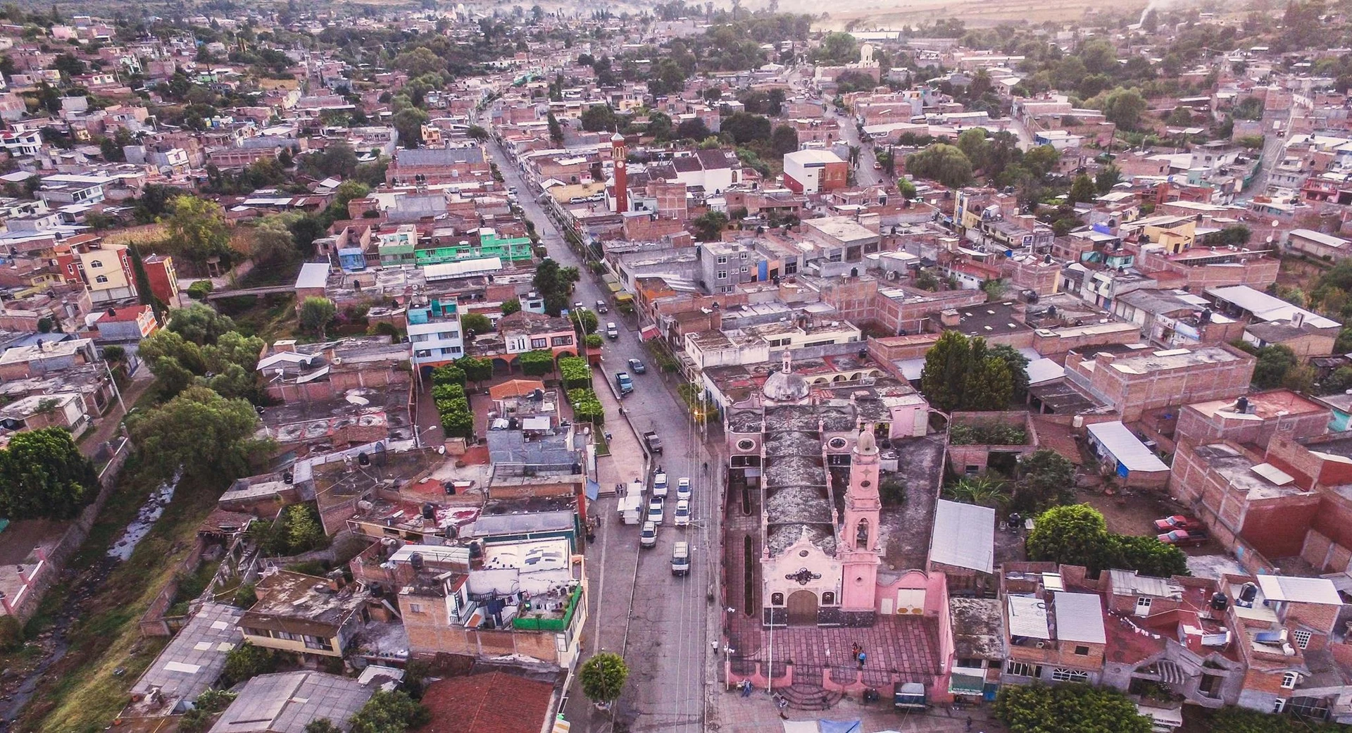
Cerano sits at 1,886 metres on the far western edge of Yuriria municipality, closer to Michoacán than to most sizeable towns in Guanajuato: Puruándiro lies to the southwest and Moroleón to the east. With about 5,400 residents in 2020 it is the municipality's second-largest settlement after the seat, and the street life shows it. The shopping district runs between Jesús Montaño and Lázaro Cárdenas, and people from the ranches round about come in for clothes, shoes, furniture and building supplies.
Its origin comes in two layers. Local tradition has a Purépecha group arriving from the Lake Chapala shore in the early 1600s and calling the spot Cherapite, roughly "place of red waters". Then came the hacienda, which passed to an Italian named Juan Bautista after the Jesuits were expelled in 1767; as the village tells it, he gave it the name of his birthplace, Cerano, with St John the Baptist as patron. During the War of Independence the hacienda was attacked repeatedly in 1812, and in the Revolution it sheltered raiding bands such as that of José Inés Chávez García.
What remains of the hacienda compound is the expiatory temple of the Señor de la Sacristía, the oldest building in town, remodelled and reopened in 1999. The parish church of San Juan Bautista is far newer: eight years in the building under the priest J. Jesús Montaño, inaugurated in 1945. Beside it stands the Santuario de la Virgen de Guadalupe, on the site of the old cemetery, paid for with the bazaars, dances and rodeos of the pilgrims who walk to the Basilica of Guadalupe in Mexico City.
The calendar is crowded: seven fiestas a year, among them 12 February (coronation of the Virgin and village fair), 3 May, 24 June (San Juan Bautista), 28 October (San Judas Tadeo) and 12 December. The singer Junior H was born here. The surrounding fields grow maize, beans, wheat, sorghum and chickpeas, and pigs and cattle are the main livestock.
How to get to Cerano
Drive from Uriangato: 50 min, 29 km
Cerano is roughly 29 km in a straight line from Yuriria (about 35 minutes by road) and about 49 km from Morelia (about 55 minutes), so it is nearly as easy to reach from the Michoacán side as from the Bajío. The main road is the Cerano-Puruándiro road, inaugurated in 1971, which links it with Michoacán; eastward you leave toward Moroleón and Yuriria.
By bus, what could be confirmed runs only as far as Yuriria: Flecha Amarilla goes from Yuriria to Irapuato (about 2 hours, hourly) and to Celaya (about 1 h 40, hourly; Coordinados also runs this). No published bus or combi timetable straight to Cerano turned up, so ask at the Yuriria bus station about local transport, or go by car or taxi. From Mexico City the usual route is a bus to Morelia (Central de Autobuses) and then the road toward Puruándiro. The town has ATMs and places to eat, shop and sleep.
Directions to Cerano on Google Maps
Distances are in a straight line; the road is usually longer.
Links open a partner site. We may earn a commission if you book, at no cost to you.
From the nearest cities to Cerano
- Uriangato · 29 km by road, 50 min
- Valle de Santiago · 51 km by road, 1 h 10 min
- Salamanca · 75 km by road, 1 h 30 min
Drive times by road from OpenStreetMap, without traffic or stops. Times marked ~ are estimated from the straight-line distance.
Before you go to Cerano: hours, prices and tips
- Best season
- Seven fiestas a year: 12 February (crowning of the Virgin and village fair), Señor de la Misericordia, 3 May (Santa Cruz), 24 June (San Juan Bautista, the patron saint), 28 October (San Judas Tadeo), 22 November (Santa Cecilia) and 12 December (Virgen de Guadalupe). Wikipedia (es) · checked Oct 2026
Hours and prices change, especially around holidays. Each fact links to where we checked it.
Visiting Cerano: what to see and do
Templo expiatorio del Señor de la Sacristía, the old hacienda chapel, reopened in 1999
Parish church of San Juan Bautista, inaugurated in 1945
Santuario de la Virgen de Guadalupe, built over the former cemetery
Shopping streets between Jesús Montaño and Lázaro Cárdenas
Cerro de Huariaco, the viewpoint over the whole town
Plan your trip
Places to stay in Cerano
Compare hotels, posadas, and rentals in and around Cerano.
Tours & activities
Day trips around Yuriria sometimes stop in Cerano; a tour is the easy way to see it without a car.
Rental cars
Pick up a car at MLM (Morelia): about 49 min by road to Yuriria, then 29 km more to Cerano, on your own schedule.
Flights
The nearest airport with scheduled flights is Morelia (MLM), about 49 min by road from Yuriria, the base for Cerano.
Mobile data
Signal can drop away from Yuriria: download a map of the way to Cerano before you set out, or carry an eSIM with data.
Links open a partner site. We may earn a commission if you book, at no cost to you.
When to go to Cerano mild
Cerano shares the climate of Yuriria, 29 km away. The best months to visit are January, March, April, and December.
See the month-by-month climate of Yuriria
Weather in Cerano now and the next 7 days
Live forecast from Open-Meteo. Chance of rain is the day's highest.
The closest Pueblo Mágico: Yuriria

Yuriria is the Pueblo Mágico closest to Cerano, with places to stay, food, and more to see.
Also close to
- Cuitzeo · Michoacán · 30 km away
- Salvatierra · Guanajuato · 54 km away
- Tzintzuntzan · Michoacán · 57 km away
- Pátzcuaro · Michoacán · 70 km away
Closest to Cerano
-
Huandacareo La Nopalera · Archaeological site · 16 km away
-
Huandacareo · Hot springs · 18 km away
-
Moroleón · Town · 20 km away
-
Uriangato · Town · 22 km away
-
Lago de Cuitzeo · Lake · 25 km away
-
Lago-Cráter La Joya · Nature reserve · 29 km away
-
Copándaro de Galeana · Town · 30 km away
-
Huanímaro · Town · 31 km away

Near Cerano




Drive times by road from OpenStreetMap, without traffic. Times marked ~ are estimated from the straight-line distance.
Location from OpenStreetMap. Written by Puebloteca.