Nature reserve Oaxaca de Juárez, Oaxaca Municipality of Oaxaca de Juárez Central Valleys of Oaxaca
A national park of pine-oak forest on the hills just north of Oaxaca city, with marked trails, birdwatching, zip lines and views over the valley.
From Oaxaca: 10 min by car (8 km by road) How to get there ↓
Near here
See everything nearby ↓


Plan your visit to Parque Nacional Benito Juárez
Where to stay near Parque Nacional Benito Juárez
Compare hotels, posadas and guest houses in Parque Nacional Benito Juárez.
Tours to Parque Nacional Benito Juárez
Day trips and guided outings from Capulálpam de Méndez often include Parque Nacional Benito Juárez; with a local guide you can get there without a car.
 Tours from Oaxaca City
Hierve el Agua 2.5 hours, Mitla, Tule, Rugs and Mezcal for a Day
★ 4.9 (1,558) · From US$70
How to get to Parque Nacional Benito Juárez
- From Oaxaca: about 10 min by road (~8 km)
- Nearest airport: Oaxaca (OAX), 1 h 27 min by car to Capulálpam de Méndez
Links open a partner site. We may earn a commission if you book, at no cost to you.
Tours from Oaxaca City, near Parque Nacional Benito Juárez


Tours, prices and ratings from Viator, checked weekly. We may earn a commission if you book.
About Parque Nacional Benito Juárez
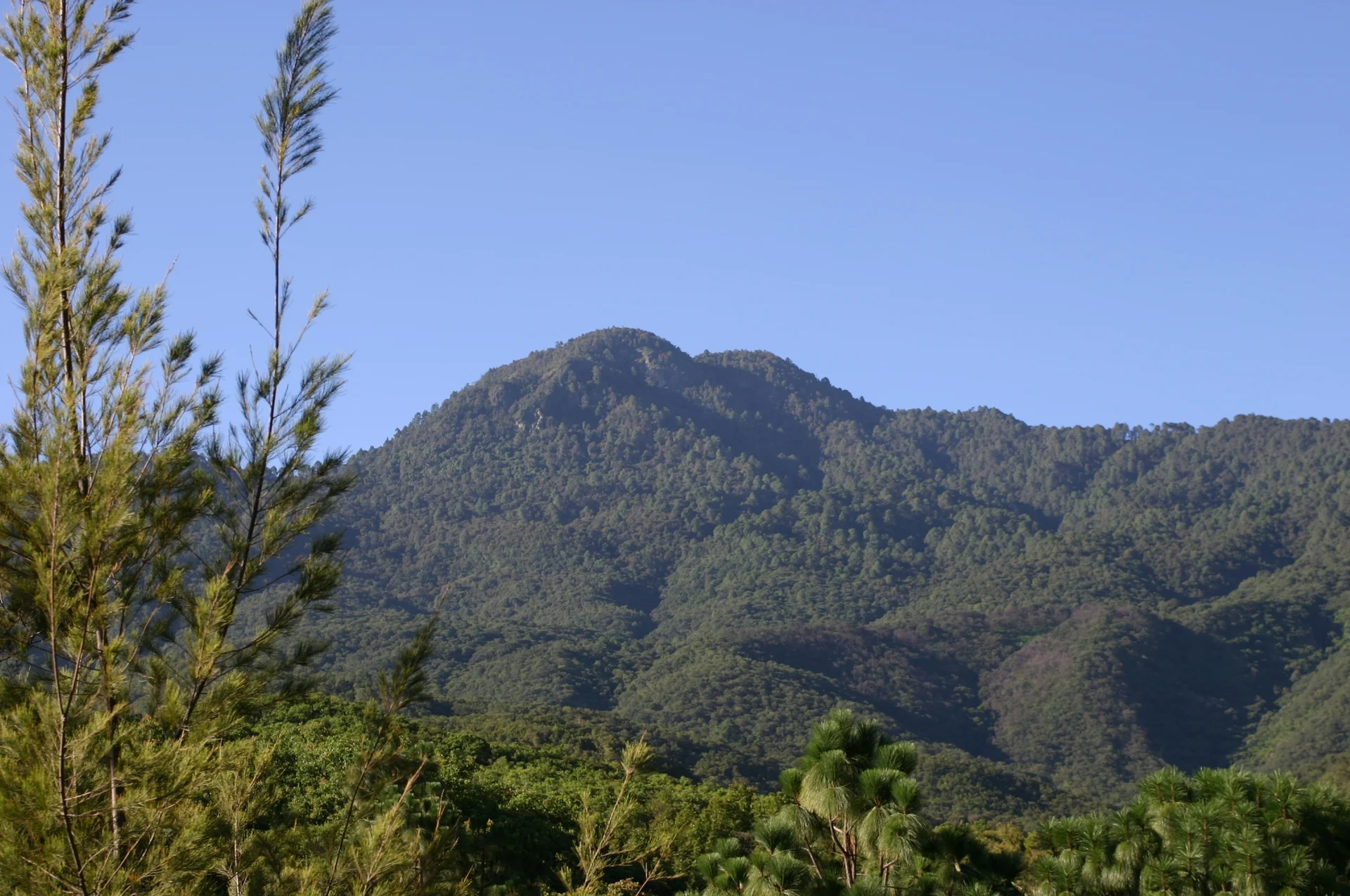
Parque Nacional Benito Juárez covers the slopes of the Sierra de San Felipe, part of the Sierra Madre de Oaxaca, immediately north of Oaxaca city. Its lower edge lies only about 5 km from the city centre, and the land climbs from around 1,650 m to Cerro San Felipe, the highest point, at over 3,000 m (sources give figures between 3,100 m and 3,500 m). The park takes in land of San Felipe del Agua, Donají, San Luis Beltrán and San Andrés Huayápam. It was decreed on 30 December 1937 under President Lázaro Cárdenas and named after Benito Juárez, who grew up in Oaxaca. Semarnat puts its area at about 2,590 hectares.
The park matters to the city mainly as a water source: the San Felipe and Huayápam streams rise on its slopes, and most of their water is piped down to Oaxaca. Vegetation changes with height. Near the villages the lower slopes are cornfields, orchards and patches of the original dry deciduous forest with copal and guaje trees; above about 2,000 m comes pine and oak forest, with bromeliads, mosses and many orchids, including Malaxis pollardii, found only on this mountain. The summit is often wrapped in fog. Semarnat has recorded some 230 bird species, 67 mammals, 39 reptiles and 18 amphibians, and the park was set aside largely to protect bird habitat. Illegal logging, fires and the collection of wild orchids and dahlias are the main threats.
Most visitors use the recreation area of the Donají ejido on the park's southern edge, a few minutes by taxi from downtown. There are marked loops of about 3 km and 5 km, including the easy Sendero La Coronilla, a lookout over the city, a children's playground, zip lines on weekends and steep trails used for downhill mountain biking. Birdwatching is popular, and the walks give wide views over the Valley of Oaxaca.
How to get to Parque Nacional Benito Juárez
Drive from Oaxaca: 10 min, 8 km
The park begins on the northern edge of Oaxaca city. The ejido Donají recreation area, the usual entry point, is about 8 minutes by taxi from downtown, and there is ample parking.
Directions to Parque Nacional Benito Juárez on Google Maps
Distances are in a straight line; the road is usually longer.
Links open a partner site. We may earn a commission if you book, at no cost to you.
From the nearest cities to Parque Nacional Benito Juárez
- Oaxaca · 8 km by road, 10 min
- Tuxtepec · about 165 km by road, ~2 h 25 min
- Huajuapan de León · 177 km by road, 2 h 30 min
Drive times by road from OpenStreetMap, without traffic or stops. Times marked ~ are estimated from the straight-line distance.
Before you go to Parque Nacional Benito Juárez: hours, prices and tips
- Entry
- 20 pesos entry; zip lines from 50 pesos (weekends only); toilets 5 pesos. Wikivoyage · checked Oct 2026
- Best season
- Rains fall mainly from May to November; the rest of the year is dry. Wikipedia (es) · checked Oct 2026
- What to bring
- Hiking boots (there are snakes), a hat, sunscreen and water. Wikivoyage · checked Oct 2026
- Rules
- Dogs are not allowed in the park. Wikivoyage · checked Oct 2026
Hours and prices change, especially around holidays. Each fact links to where we checked it.
Visiting Parque Nacional Benito Juárez: what to see and do
Walk the marked 3 km or 5 km loops through pine and oak forest.
Take the easy Sendero La Coronilla.
Look out over Oaxaca city and the valley from the observation deck.
Look for some of the park's 230 bird species.
Ride the zip lines on a weekend.
Bring a mountain bike for the downhill trails.
Plan your trip
Places to stay in Parque Nacional Benito Juárez
Compare hotels, posadas, and rentals in and around Parque Nacional Benito Juárez.
Tours & activities
Day trips and guided outings from Capulálpam de Méndez often include Parque Nacional Benito Juárez; with a local guide you can get there without a car.
Rental cars
Pick up a car at OAX (Oaxaca): about 1 h 27 min by road to Capulálpam de Méndez, then 34 km more to Parque Nacional Benito Juárez, on your own schedule.
Flights
The nearest airport with scheduled flights is Oaxaca (OAX), about 1 h 27 min by road from Capulálpam de Méndez, the base for Parque Nacional Benito Juárez.
Travel insurance
If you plan on hiking at Parque Nacional Benito Juárez, check that your policy covers it: some plans leave adventure activities out.
Mobile data
Signal can drop away from Capulálpam de Méndez: download a map of the way to Parque Nacional Benito Juárez before you set out, or carry an eSIM with data.
Links open a partner site. We may earn a commission if you book, at no cost to you.
When to go to Parque Nacional Benito Juárez cool
Parque Nacional Benito Juárez shares the climate of Capulálpam de Méndez, 34 km away. The best months to visit are January, February, March, and December.
See the month-by-month climate of Capulálpam de Méndez
Weather in Parque Nacional Benito Juárez now and the next 7 days
Live forecast from Open-Meteo. Chance of rain is the day's highest.
The closest Pueblo Mágico: Capulálpam de Méndez

Capulálpam de Méndez is the Pueblo Mágico closest to Parque Nacional Benito Juárez, with places to stay, food, and more to see.
Also close to
- Mitla · Oaxaca · 41 km away
Closest to Parque Nacional Benito Juárez
-
San Andrés Huayápam · Town · 3 km away
-
Acueducto de San Felipe del Agua · Landmark · 5 km away
-
Barrio de Jalatlaco · Landmark · 5 km away
-
Barrio de Xochimilco · Landmark · 5 km away
-
San Francisco Tutla · Town · 5 km away
-
Santa Lucía del Camino · Town · 5 km away
-
Andador Macedonio Alcalá · Landmark · 6 km away
-
Basílica de Nuestra Señora de la Soledad · Landmark · 6 km away


Near Parque Nacional Benito Juárez


Drive times by road from OpenStreetMap, without traffic. Times marked ~ are estimated from the straight-line distance.
Lists with Parque Nacional Benito Juárez
Nature Parks in Oaxaca · 8 Nature Parks near Oaxaca · 3Location from OpenStreetMap. Written by Puebloteca.