Town Municipio de Tenosique, Tabasco
Usumacinta river town in Tabasco's far southeast, known for its Carnival and the Pochó dance; 1 h 25 min from Palenque.
From Palenque: about 1 h 10 min by road (~80 km) How to get there ↓
Plan your visit to Tenosique de Pino Suárez
Where to stay near Tenosique de Pino Suárez
Compare hotels, posadas and guest houses in Tenosique de Pino Suárez.
Tours to Tenosique de Pino Suárez
Day trips around Palenque sometimes stop in Tenosique de Pino Suárez; a tour is the easy way to see it without a car.
 Tours from Palenque
Yaxchilan & Bonampak: Hidden Maya Ruins from Palenque
★ 4.4 (41) · From US$133
How to get to Tenosique de Pino Suárez
- From Palenque: about 1 h 10 min by road (~80 km)
- Nearest airport: Villahermosa (VSA), 1 h 47 min by car to Palenque
Links open a partner site. We may earn a commission if you book, at no cost to you.
Tours from Palenque, near Tenosique de Pino Suárez


Tours, prices and ratings from Viator, checked weekly. We may earn a commission if you book.
About Tenosique de Pino Suárez
Tenosique de Pino Suárez is the seat of Tenosique municipality in Tabasco's far southeast, on the right bank of the Usumacinta River at about 20 metres above sea level. It had 34,946 residents in the 2020 census, making it the state's fourth-largest city, and it is the commercial hub of the Los Ríos subregion; the El Ceibo border crossing into Guatemala feeds much of that trade. The name comes from the Maya Taanaj-Tsíik, usually read as house of the spinner, joined to the surname of José María Pino Suárez, who was born here, became Mexico's last vice president and was killed alongside Madero in 1913. The city has carried his name since 1915.
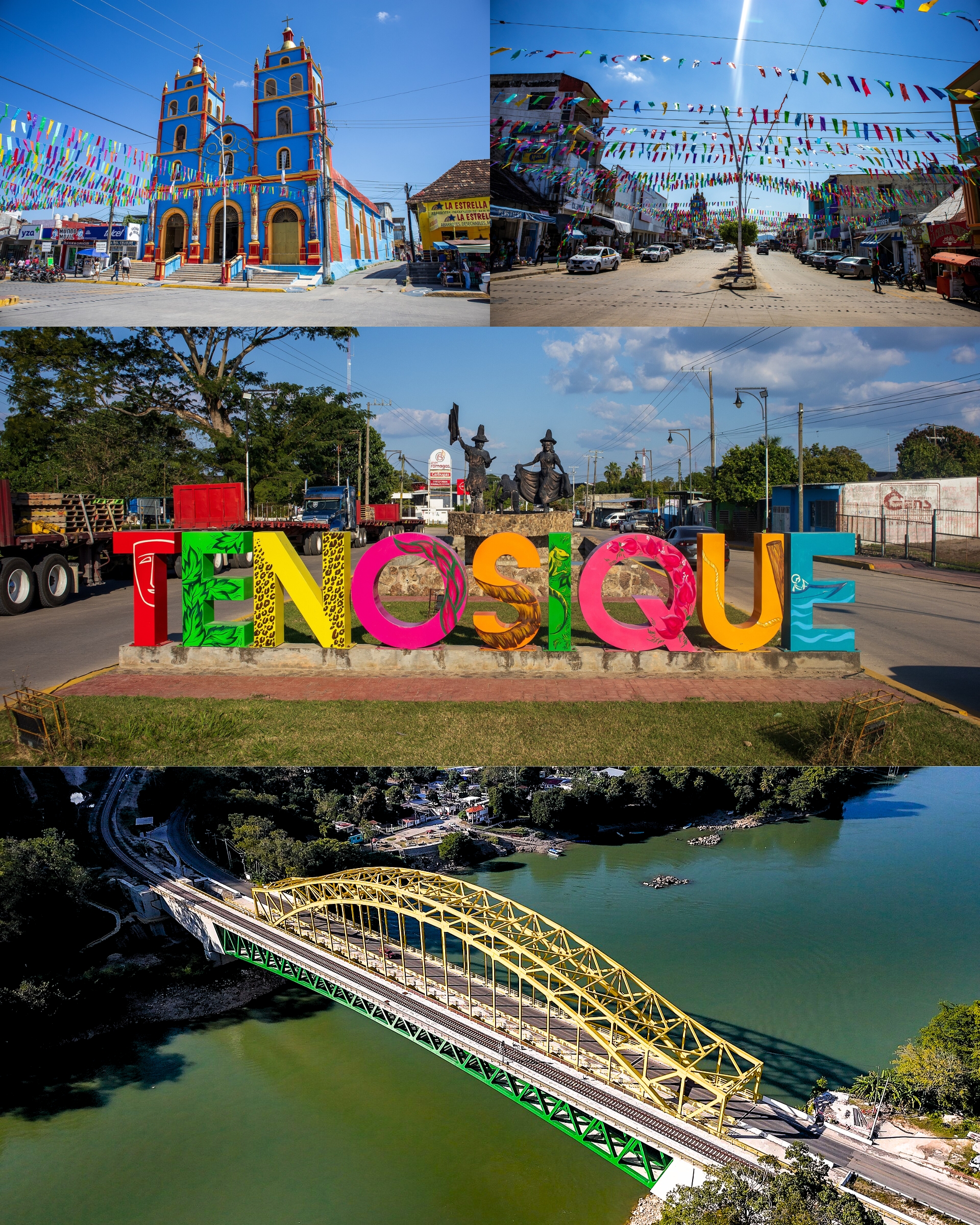
The centre is compact and easy to cover on foot: the main square, the riverside malecón with its mural and the colourful TENOSIQUE letters, and Pino Suárez's house. What draws the crowds is Carnival, which opens in late January with a flour fight and runs to Shrove Tuesday (in 2026 it ran from 19 January to 17 February). Its centrepiece is the Danza del Pochó, with cojoes, pochoveras and jaguars, which parades through the streets on four consecutive Sundays; it is recognised as Tabasco cultural heritage and hotels book up far ahead.
Outside town lies the Usumacinta Canyon, a protected area of rainforest with jaguars and white-tailed deer, where rafting trips run the San José and Desempeño rapids. Nearby are the Maya sites of Pomoná, where climbing the pyramids is still allowed, and San Claudio on the road to El Ceibo, plus the Boca del Cerro bridge about 10 km out, used for bridge jumping.
How to get to Tenosique de Pino Suárez
From Palenque, the nearest Pueblo Mágico, it is about 80 km and 1 h 25 min by road. The city links to the rest of Tabasco by Federal Highway 203, which meets Highway 186 toward Villahermosa at Emiliano Zapata (about 215 km from Villahermosa: Highway 186 to the km 147 junction, then 75 km on 203). Without a car, combis to Tenosique leave from Transportes Palenque in the centre of Palenque: about 2 h 30 min and 90 pesos, hourly until the afternoon (2023 data; check times). The Tren Maya runs Palenque to Tenosique in about 44 minutes; in 2025 there were three departures a day (7:35, 9:00 and 14:20) and the tourist fare was around 129 pesos. Tenosique station opened on 7 July 2025 and is not a full-service stop. From Villahermosa, ADO runs hourly (about 3 h 30 min, from around 200 pesos) to the terminal on Prolongación Calle 20. Colectivos to El Ceibo leave hourly (1 h, about 60 pesos in 2023). Around town, taxis and moto-taxis.
Directions to Tenosique de Pino Suárez on Google Maps
Distances are in a straight line; the road is usually longer.
Links open a partner site. We may earn a commission if you book, at no cost to you.
From the nearest cities to Tenosique de Pino Suárez
- Palenque · about 80 km by road, ~1 h 10 min
- Ciudad del Carmen · about 180 km by road, ~2 h 40 min
- San Cristóbal de las Casas · about 200 km by road, ~2 h 55 min
Drive times by road from OpenStreetMap, without traffic or stops. Times marked ~ are estimated from the straight-line distance.
Before you go to Tenosique de Pino Suárez: hours, prices and tips
- Best season
- Tenosique Carnival runs from late January to Shrove Tuesday; the Danza del Pochó parades on four consecutive Sundays (in 2026, 25 January to 15 February). Hotels book up months ahead. La Verdad: Tenosique listo para celebrar el Carnaval · checked Oct 2026
Hours and prices change, especially around holidays. Each fact links to where we checked it.
Visiting Tenosique de Pino Suárez: what to see and do
The Usumacinta malecón, with its mural and colourful letters.
The main square and the house of José María Pino Suárez.
Carnival and the Danza del Pochó (late January to February).
The Pomoná archaeological zone.
The San Claudio archaeological zone, on the road to El Ceibo.
The Boca del Cerro bridge and the Usumacinta Canyon.
The Mercado Nuevo, on Calle 45.
Plan your trip
Places to stay in Tenosique de Pino Suárez
Compare hotels, posadas, and rentals in and around Tenosique de Pino Suárez.
Tours & activities
Day trips around Palenque sometimes stop in Tenosique de Pino Suárez; a tour is the easy way to see it without a car.
Rental cars
Pick up a car at VSA (Villahermosa): about 1 h 47 min by road to Palenque, then 59 km more to Tenosique de Pino Suárez, on your own schedule.
Flights
The nearest airport with scheduled flights is Villahermosa (VSA), about 1 h 47 min by road from Palenque, the base for Tenosique de Pino Suárez.
Mobile data
Signal can drop away from Palenque: download a map of the way to Tenosique de Pino Suárez before you set out, or carry an eSIM with data.
Links open a partner site. We may earn a commission if you book, at no cost to you.
When to go to Tenosique de Pino Suárez warm
Tenosique de Pino Suárez shares the climate of Palenque, 59 km away. The best months to visit are January, February, March, and December.
See the month-by-month climate of Palenque
Weather in Tenosique de Pino Suárez now and the next 7 days
Live forecast from Open-Meteo. Chance of rain is the day's highest.
The closest Pueblo Mágico: Palenque

Palenque is the Pueblo Mágico closest to Tenosique de Pino Suárez, with places to stay, food, and more to see.
Closest to Tenosique de Pino Suárez
-
Zona Arqueológica de Pomoná · Archaeological site · 16 km away
-
Cascada Welib-Já · Waterfall · 41 km away

Near Tenosique de Pino Suárez



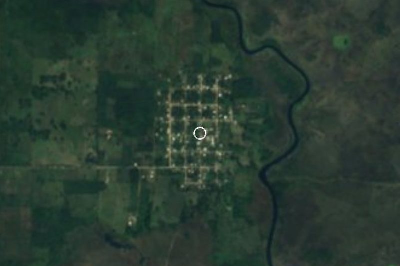


Drive times by road from OpenStreetMap, without traffic. Times marked ~ are estimated from the straight-line distance.
Location from OpenStreetMap. Written by Puebloteca.