

Archaeological site Ensenada, Baja California Municipality of Ensenada
Adobe walls of a 1787 Dominican mission in La Misión, beside the free road to Ensenada; an INAH site with free entry.
From Ensenada: about 40 min by road (~45 km) How to get there ↓
Near here
See everything nearby ↓


Plan your visit to Misión San Miguel Arcángel de la Frontera
Where to stay near Misión San Miguel Arcángel de la Frontera
Compare hotels, posadas and guest houses in Misión San Miguel Arcángel de la Frontera.
Tours to Misión San Miguel Arcángel de la Frontera
A guide brings Misión San Miguel Arcángel de la Frontera to life: look for tours from Tecate that include the site and the ride there.
 Tours from Ensenada
Las Cañadas Zipline Tour (with Luxury Roundtrip Transportation)
★ 4.9 (407) · From US$77
How to get to Misión San Miguel Arcángel de la Frontera
- From Ensenada: about 40 min by road (~45 km)
- Nearest airport: Tijuana (TIJ), 40 min by car to Tecate
Links open a partner site. We may earn a commission if you book, at no cost to you.
Tours from Ensenada, near Misión San Miguel Arcángel de la Frontera


Tours, prices and ratings from Viator, checked weekly. We may earn a commission if you book.
About Misión San Miguel Arcángel de la Frontera
Mission San Miguel Arcángel de la Frontera was founded by the Dominican friar Luis Sales on 28 March 1787, halfway between San Vicente Ferrer and San Diego, to convert the Kumeyaay. The first site, El Encino, lost its spring, so in 1788 the mission moved about 11 km west to a spot a little over 2 km from the sea that Fray Juan Crespí had named San Juan Bautista. That is today's La Misión valley, and the ruins are there.
Near here in 1773, Fray Francisco Palóu had a large cross raised to mark the line between the Franciscan missions to the north and the Dominican ones to the south; in 1804 the same line split Alta from Baja California. By the end of 1787 the mission counted 137 converts, it peaked at some 350 to 400 in 1824, and by 1830 only 78 were left. At its height it ran over 3,000 cattle, goats and sheep and 400 horses and mules and grew wheat, maize, beans, lentils, barley and grapes, the start of the vaquero ranching culture of the northern peninsula. Around 1810, after floods washed out its fields, Fray Tomás de Ahumada moved part of the work north to El Descanso. No mission activity is recorded after 1834, and in 1862 the Crosthwaite family bought the land for their ranch, La Misión Vieja de San Miguel.
The compound was a rectangle with the church and living quarters on the east and south sides, an open patio, a single gate at the southeast corner guarded by a barracks, four granaries and an irrigation ditch. Walls were adobe, 0.9 to 1.1 m thick, on round-stone footings. Three fragments of wall survive. Under its Camino Real Misionero de las Californias program, INAH coats them in a sacrificial layer of clay, sand, nopal and manure, and has consolidated the foundations and braced one wall.
How to get to Misión San Miguel Arcángel de la Frontera
The ruins are in the village of La Misión at km 65.5 of the free Federal Highway 1 (Tijuana–Ensenada), on the north side of the road behind the school. From Ensenada, the nearest city, it is 45 minutes and 44 km north. From Rosarito, drive south on toll road 1D and leave it for the free road at the Alisitos exit near km 59.5; La Misión is about a mile and a half on. Tecate, the nearest Pueblo Mágico, is 1 h 15 min and 88 km away. The free road is paved but two-lane, with no shoulder and some winding stretches. We found no bus route that stops at La Misión; come by car or by taxi from Rosarito or Ensenada.
Directions to Misión San Miguel Arcángel de la Frontera on Google Maps
Distances are in a straight line; the road is usually longer.
Links open a partner site. We may earn a commission if you book, at no cost to you.
From the nearest cities to Misión San Miguel Arcángel de la Frontera
- Ensenada · about 45 km by road, ~40 min
- Tijuana · about 70 km by road, ~1 h
- Tecate · about 75 km by road, ~1 h 5 min
Drive times by road from OpenStreetMap, without traffic or stops. Times marked ~ are estimated from the straight-line distance.
Before you go to Misión San Miguel Arcángel de la Frontera: hours, prices and tips
- Hours
- Over Easter 2026, INAH opened the site Wednesday to Sunday, 8:00-16:00; check the hours before you go. El Imparcial · checked Oct 2026
- Entry
- Free entry. El Imparcial · checked Oct 2026
- Rules
- The free road is two-lane, with no shoulder and some steep, winding stretches; drive it in daylight. Discover Baja · checked Oct 2026
Hours and prices change, especially around holidays. Each fact links to where we checked it.
Visiting Misión San Miguel Arcángel de la Frontera: what to see and do
The three surviving adobe walls under their protective clay coat
The round-stone footings of the mission quadrangle
The San Miguel creek valley and the hill the mission was built against
The estuary where the Guadalupe creek meets the sea, just over 2 km away
El Descanso, the site the mission moved to around 1810, further north
Plan your trip
Places to stay in Misión San Miguel Arcángel de la Frontera
Compare hotels, posadas, and rentals in and around Misión San Miguel Arcángel de la Frontera.
Tours & activities
A guide brings Misión San Miguel Arcángel de la Frontera to life: look for tours from Tecate that include the site and the ride there.
Rental cars
Pick up a car at TIJ (Tijuana): about 40 min by road to Tecate, then 56 km more to Misión San Miguel Arcángel de la Frontera, on your own schedule.
Flights
The nearest airport with scheduled flights is Tijuana (TIJ), about 40 min by road from Tecate, the base for Misión San Miguel Arcángel de la Frontera.
Mobile data
Signal can drop away from Tecate: download a map of the way to Misión San Miguel Arcángel de la Frontera before you set out, or carry an eSIM with data.
Links open a partner site. We may earn a commission if you book, at no cost to you.
When to go to Misión San Miguel Arcángel de la Frontera mild
Misión San Miguel Arcángel de la Frontera shares the climate of Tecate, 56 km away. The best months to visit are May, June, September, and October.
See the month-by-month climate of Tecate
Weather in Misión San Miguel Arcángel de la Frontera now and the next 7 days
Live forecast from Open-Meteo. Chance of rain is the day's highest.
The closest Pueblo Mágico: Tecate

Tecate is the Pueblo Mágico closest to Misión San Miguel Arcángel de la Frontera, with places to stay, food, and more to see.
Closest to Misión San Miguel Arcángel de la Frontera
-
La Misión · Village · 0 km away
-
Misión El Descanso · Village · 14 km away
-
Puerto Nuevo · Village · 18 km away
-
San Antonio de las Minas · Village · 24 km away
-
Valle de Guadalupe · Nature reserve · 25 km away
-
Francisco Zarco · Village · 27 km away
-
Ensenada · City · 35 km away
-
La Bufadora · Landmark · 43 km away


Near Misión San Miguel Arcángel de la Frontera

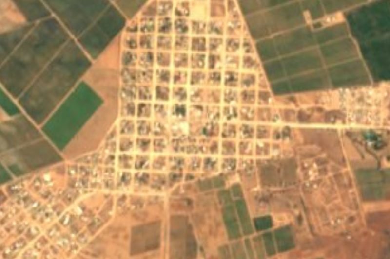


Drive times by road from OpenStreetMap, without traffic. Times marked ~ are estimated from the straight-line distance.
Location from OpenStreetMap. Written by Puebloteca.