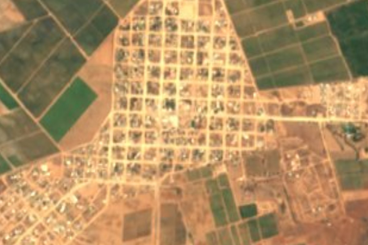
Town Ensenada, Baja California Municipality of Ensenada
Ranching valley on Highway 3, 40 min from Ensenada: Ramonetti cheese aged in a stone cave, high vineyards and the ruins of an 1870s gold town.
From Ensenada: about 35 min by road (~40 km) How to get there ↓
Near here
See everything nearby ↓


Plan your visit to Ojos Negros
Where to stay near Ojos Negros
Compare hotels, posadas and guest houses in Ojos Negros.
Tours to Ojos Negros
Day trips around Tecate sometimes stop in Ojos Negros; a tour is the easy way to see it without a car.
 Ojos Negros Valley Wine and Cheese Route Tour in Baja California
★ 5.0 (30) · From US$150
How to get to Ojos Negros
- From Ensenada: about 35 min by road (~40 km)
- Nearest airport: Tijuana (TIJ), 40 min by car to Tecate
Links open a partner site. We may earn a commission if you book, at no cost to you.
Popular tours to Ojos Negros

Tours, prices and ratings from Viator, checked weekly. We may earn a commission if you book.
About Ojos Negros
Ojos Negros is the town of the valley of the same name, about 705 meters up, just north of Federal Highway 3 between Ensenada and San Felipe. It had 2,707 people at the 2020 census and is the seat of a delegación of Ensenada municipality. The valley used to be called San Rafael, after the creek that runs through it; the present name, in use since 1864, comes from two marshes that looked like a pair of dark eyes from a distance.
This was Kumiai and Paipai land. Agustín Mancillas received the first land grant in 1843, and in 1870 the prospector Ambrosio Castillo struck gold. Some 1,500 people rushed in, Real del Castillo was formally founded on October 2, 1870, and from 1872 to 1882 the camp was capital of the northern district of Baja California, until the seat moved to Ensenada. Once the gold ran out the place emptied, a flood in 1890 wrecked most of what was left, and by 1930 only about 37 people remained. The ruins of Real del Castillo Viejo still stand in the valley.
Ranching, farming, cheese and, more recently, wine keep the valley going. At Rancho La Campana, north of the highway, the Ramonetti family has made cheese since 1911, and in 2008 Marcelo Castro, the fourth generation, built a stone cave that holds up to 10,000 wheels, each turned by hand every day. Visitors can watch the evening milking, taste fresh and aged cheeses from six months to two years, and eat at picnic tables under the trees; the milk is not pasteurized. Vines arrived around 2000 with Bodegas San Rafael, followed by Vinícola Infinito, Dominio de las Abejas and others. With vineyards above 800 meters, this is the highest and farthest-inland wine valley in Baja California, cooler and wetter than Valle de Guadalupe, and it shares a wine-and-cheese route with Santo Tomás and Guadalupe.
How to get to Ojos Negros
From Ensenada it is 40 min and 41 km by road: head east on Federal Highway 3 toward San Felipe and the town appears around km 40, on the north side. For the cheese cave, turn left at km 43.5 at the Rancho La Campana sign and drive about 7 km. Tecate, the nearest Pueblo Mágico, is 2 h 10 min and 145 km away, on Federal 3 through Valle de Guadalupe. We found no published bus timetable to Ojos Negros; a car or taxi from Ensenada is the sure way. Ojos Negros is also where the dirt road to Constitución de 1857 National Park begins.
Directions to Ojos Negros on Google Maps
Distances are in a straight line; the road is usually longer.
Links open a partner site. We may earn a commission if you book, at no cost to you.
From the nearest cities to Ojos Negros
- Ensenada · about 40 km by road, ~35 min
- Tecate · about 105 km by road, ~1 h 35 min
- Tijuana · about 130 km by road, ~1 h 55 min
Drive times by road from OpenStreetMap, without traffic or stops. Times marked ~ are estimated from the straight-line distance.
Before you go to Ojos Negros: hours, prices and tips
- Hours
- La Cava de Marcelo is open Thursday to Sunday, 1 to 6 pm. Discover Baja · checked Oct 2026
Hours and prices change, especially around holidays. Each fact links to where we checked it.
Visiting Ojos Negros: what to see and do
La Cava de Marcelo, a stone cave holding up to 10,000 wheels of Ramonetti cheese, at Rancho La Campana
The evening milking and a fresh and aged cheese tasting at the ranch
The ruins of Real del Castillo Viejo, the 1870 gold-rush town
The valley's wineries, among them Vinícola Infinito and Dominio de las Abejas
The valley itself, chaparral below and pines toward the sierra
The dirt road up to Constitución de 1857 National Park
Plan your trip
Places to stay in Ojos Negros
Compare hotels, posadas, and rentals in and around Ojos Negros.
Tours & activities
Day trips around Tecate sometimes stop in Ojos Negros; a tour is the easy way to see it without a car.
Rental cars
Pick up a car at TIJ (Tijuana): about 40 min by road to Tecate, then 81 km more to Ojos Negros, on your own schedule.
Flights
The nearest airport with scheduled flights is Tijuana (TIJ), about 40 min by road from Tecate, the base for Ojos Negros.
Mobile data
Signal can drop away from Tecate: download a map of the way to Ojos Negros before you set out, or carry an eSIM with data.
Links open a partner site. We may earn a commission if you book, at no cost to you.
When to go to Ojos Negros mild
Ojos Negros shares the climate of Tecate, 81 km away. The best months to visit are May, June, September, and October.
See the month-by-month climate of Tecate
Weather in Ojos Negros now and the next 7 days
Live forecast from Open-Meteo. Chance of rain is the day's highest.
The closest Pueblo Mágico: Tecate

Tecate is the Pueblo Mágico closest to Ojos Negros, with places to stay, food, and more to see.
Closest to Ojos Negros
-
Ensenada · City · 32 km away
-
Francisco Zarco · Village · 35 km away
-
San Antonio de las Minas · Village · 36 km away
-
Valle de Guadalupe · Nature reserve · 36 km away
-
Parque Nacional Constitución de 1857 · Nature reserve · 41 km away
-
La Bufadora · Landmark · 47 km away
Near Ojos Negros
-
Misión San Miguel Arcángel de la Frontera · Archaeological site · Baja California
~1 h 10 min drive · 59 km


Drive times by road from OpenStreetMap, without traffic. Times marked ~ are estimated from the straight-line distance.
Location from OpenStreetMap. Written by Puebloteca.