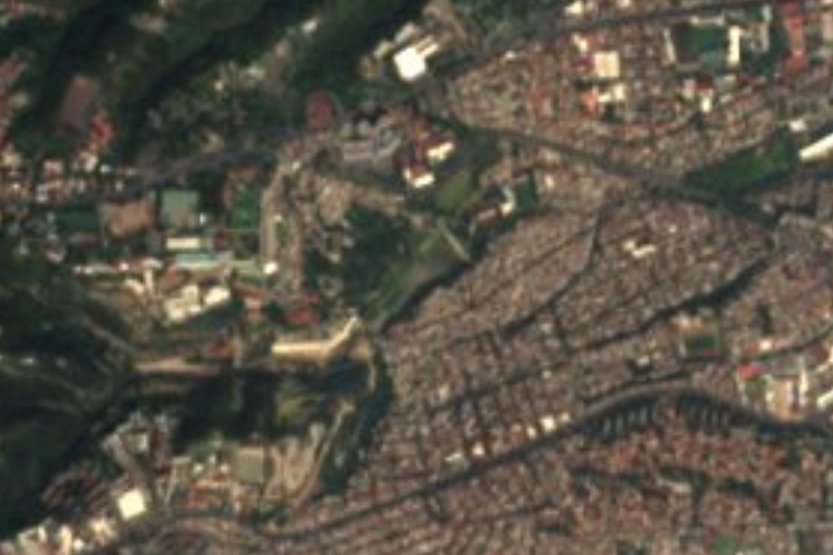
Landmark Álvaro Obregón, Ciudad de México Municipality of Álvaro Obregón Valley of Mexico
Flood-control dam from 1936 on the Tacubaya river, ringed by neighbourhoods; the El Insurgente train viaduct crosses its basin.
From Mexico City: 20 min by car (15 km by road) How to get there ↓
Near here
See everything nearby ↓


Plan your visit to Presa Tacubaya
Where to stay near Presa Tacubaya
Compare hotels, posadas and guest houses in Presa Tacubaya.
Tours to Presa Tacubaya
Look for tours of the area around Tepotzotlán that stop at Presa Tacubaya.
 Tours from Mexico City
Teotihuacan pyramids morning or afternoon without tourist traps
★ 4.9 (10,269) · From US$59
How to get to Presa Tacubaya
- From Mexico City: about 20 min by road (~15 km)
- Nearest airport: Mexico City (Felipe Ángeles) (NLU), 48 min by car to Tepotzotlán
Links open a partner site. We may earn a commission if you book, at no cost to you.
Tours from Mexico City, near Presa Tacubaya


Tours, prices and ratings from Viator, checked weekly. We may earn a commission if you book.
About Presa Tacubaya
Presa Tacubaya is part of the city's water infrastructure rather than a place for a stroll: a regulating basin in the west of the city, on the Tacubaya river, on Calle Leandro Valle in the Liberales de 1857 district of Álvaro Obregón. It was built in 1936 to hold back the surges of water that come down the ravines in the rainy season, with an original capacity of 700,000 m³. It borders El Capulín, Liberales de 1987, Pólvora and Molino de Santo Domingo, and is one of the borough's 13 containment dams, alongside others on the same river such as Ruiz Cortines and Totolapan.
The basin collects rubbish and homes have crept up its edges. Floods hit the surrounding neighbourhoods every so often, and in 2023 water entered about 50 houses in El Capulín after the Tacubaya, Becerra and Ruiz Cortines dams overflowed; the authorities blamed rain and rubbish clogging the drains, while some residents say a gate was opened to protect the railway works.
Today the dam is best known for that railway. The final stretch of El Insurgente, the Mexico City to Toluca commuter train, crosses the basin on an elevated viaduct; the route was shifted here in 2015 because a protected area blocked the original line, and residents of Liberales de 1857 and Belén de las Flores have since demanded risk studies, since the columns stand very close to their homes. On 17 April 2024 an 800-tonne segment launcher collapsed inside the basin; no one was hurt. So rather than a sight, the dam is a way to see how water and the city share space in the west.
How to get to Presa Tacubaya
Drive from Mexico City: 20 min, 15 km
Public transport reaches Observatorio, a little over 1 km (approx.) from the dam. The stop serves Metro lines 1 and 12, the Observatorio bus yard, the Terminal Poniente long-distance bus station and, since 2 February 2026, the Observatorio station of El Insurgente, the western terminus of the Mexico City to Toluca train (which has stopped at Santa Fe since 31 August 2024). From Observatorio, the practical choice is to walk or take a taxi toward Calle Leandro Valle in Liberales de 1857. By car, access is through the neighbourhood streets, with no parking or visitor entrance; it is easier to leave the car around Observatorio. From the Zócalo it is roughly 10 km via Constituyentes or Circuito Interior; time depends on traffic.
Directions to Presa Tacubaya on Google Maps
Distances are in a straight line; the road is usually longer.
Links open a partner site. We may earn a commission if you book, at no cost to you.
From the nearest cities to Presa Tacubaya
- Mexico City · 15 km by road, 20 min
- Toluca · 56 km by road, 55 min
- Cuernavaca · 79 km by road, 1 h 25 min
Drive times by road from OpenStreetMap, without traffic or stops. Times marked ~ are estimated from the straight-line distance.
Visiting Presa Tacubaya: what to see and do
Look at the basin and its wall from the street, with care: this is a lived-in area.
See the elevated El Insurgente viaduct that crosses the basin.
Walk the neighbouring districts (Liberales de 1857, El Capulín, Belén de las Flores) to see how homes reach the edge.
Combine it with a look at the Observatorio train and Metro station, a little over 1 km away.
Plan your trip
Places to stay in Presa Tacubaya
Compare hotels, posadas, and rentals in and around Presa Tacubaya.
Tours & activities
Look for tours of the area around Tepotzotlán that stop at Presa Tacubaya.
Rental cars
Pick up a car at NLU (Mexico City (Felipe Ángeles)): about 48 min by road to Tepotzotlán, then 36 km more to Presa Tacubaya, on your own schedule.
Flights
The nearest airport with scheduled flights is Mexico City (Felipe Ángeles) (NLU), about 48 min by road from Tepotzotlán, the base for Presa Tacubaya.
Mobile data
Signal can drop away from Tepotzotlán: download a map of the way to Presa Tacubaya before you set out, or carry an eSIM with data.
Links open a partner site. We may earn a commission if you book, at no cost to you.
When to go to Presa Tacubaya cool
Presa Tacubaya shares the climate of Tepotzotlán, 36 km away. The best months to visit are January, February, March, and December.
See the month-by-month climate of Tepotzotlán
Weather in Presa Tacubaya now and the next 7 days
Live forecast from Open-Meteo. Chance of rain is the day's highest.
The closest Pueblo Mágico: Tepotzotlán

Tepotzotlán is the Pueblo Mágico closest to Presa Tacubaya, with places to stay, food, and more to see.
Also close to
- Metepec · Estado de México · 43 km away
- Villa del Carbón · Estado de México · 45 km away
- Tepoztlán · Morelos · 47 km away
- Teotihuacán · Estado de México · 51 km away
- Tlayacapan · Morelos · 55 km away
Closest to Presa Tacubaya
-
Bosque de Chapultepec · Nature reserve · 3 km away
-
Mixcoac · Town · 3 km away
-
Tacubaya · Village · 3 km away
-
Baños de Moctezuma · Archaeological site · 4 km away
-
Casa del Lago Juan José Arreola · Landmark · 4 km away
-
Casa Estudio Diego Rivera y Frida Kahlo · Landmark · 5 km away
-
Castillo de Chapultepec · Landmark · 5 km away
-
Condesa · Landmark · 5 km away


Near Presa Tacubaya


Drive times by road from OpenStreetMap, without traffic. Times marked ~ are estimated from the straight-line distance.
Location from OpenStreetMap. Written by Puebloteca.