Village Barrio Mágico Museums Churches and shrines Miguel Hidalgo, Ciudad de México Municipality of Miguel Hidalgo Valley of Mexico
West Mexico City neighbourhood with Parque Lira, Casa de la Bola, Barragán's house and a hub of Metro, Metrobús and city buses.
From Mexico City: 10 min by car (10 km by road) How to get there ↓
Near here
See everything nearby ↓


Plan your visit to Tacubaya
Where to stay near Tacubaya
Compare hotels, posadas and guest houses in Tacubaya.
Tours to Tacubaya
Day trips and guided outings from Tepotzotlán often include Tacubaya; with a local guide you can get there without a car.
 Tours from Mexico City
Teotihuacan pyramids morning or afternoon without tourist traps
★ 4.9 (10,269) · From US$59
How to get to Tacubaya
- From Mexico City: about 10 min by road (~10 km)
- Nearest airport: Mexico City (Felipe Ángeles) (NLU), 48 min by car to Tepotzotlán
Links open a partner site. We may earn a commission if you book, at no cost to you.
Tours from Mexico City, near Tacubaya


Tours, prices and ratings from Viator, checked weekly. We may earn a commission if you book.
About Tacubaya
Tacubaya is a neighbourhood in western Mexico City and the seat of the Miguel Hidalgo borough. The name comes from Nahuatl Atlacuihuayan, "where water is gathered". Standing on high ground, it stayed dry when the colonial city flooded, which is why wealthy families built country houses here; it was a municipality of its own from 1903 until 1928, when the Federal District swallowed it.
Mexican history has run through its streets. In the old archbishop's palace, now home of the national weather service, the Provisional Governing Junta held its first session in September 1821, and in December 1857 the Plan of Tacubaya was proclaimed, setting off the Reform War. On 11 April 1859 around two hundred captured republicans were shot nearby, the Mártires de Tacubaya, remembered by a street name and an obelisk in the Alameda de Tacubaya on Avenida Revolución.
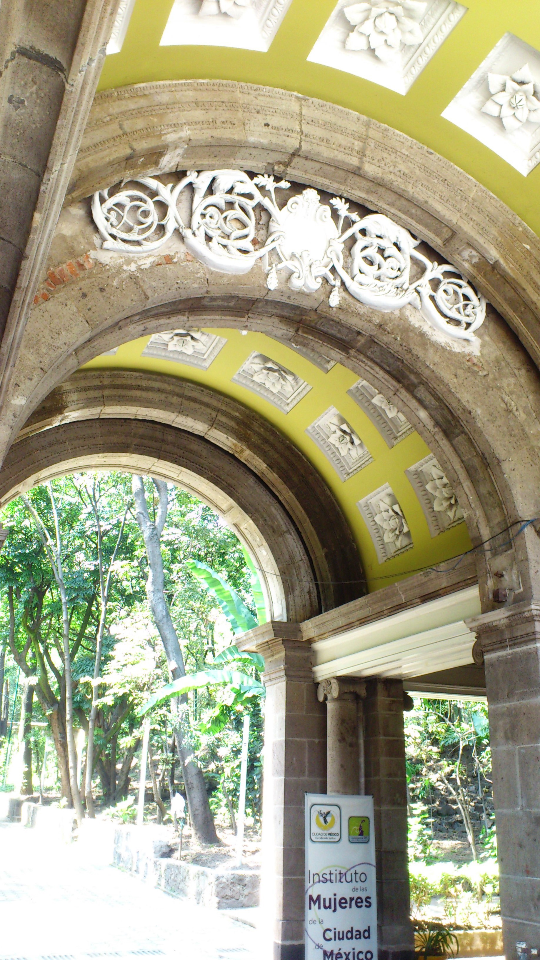
Today it is a busy, working-class district, more a place people pass through than stroll in, but with corners worth the detour. Parque Lira is entered through a neoclassical arch and has a library and green lawns; beside it stands the Casa Amarilla, dating from 1618, now the borough offices. A short walk away is the Casa de la Bola, a colonial house turned museum, and on Calle General Francisco Ramírez the house and studio of architect Luis Barragán, open only on pre-booked guided visits.
Architecture fans can also look for the Ermita building, an Art Deco block from 1931 still standing by the big road junction. The parish of La Candelaria occupies the former Dominican convent of Santo Domingo, and the Virgen de la Candelaria is the neighbourhood's patron.
How to get to Tacubaya
Drive from Mexico City: 10 min, 10 km
Tacubaya is one of the biggest transport interchanges in western Mexico City. Tacubaya Metro station joins Line 1 (Observatorio–Pantitlán), Line 7 (El Rosario–Barranca del Muerto) and Line 9 (Tacubaya–Pantitlán, which starts here). The next station on Line 1, Observatorio, is where the Terminal Poniente for intercity buses stands. On Metrobús, Line 2 (Tacubaya–Tepalcates) has its western terminus here, and its Parque Lira and Antonio Maceo stops are a few blocks from the museums. Beside the Metro station there is a bus yard (CETRAM) on Avenida Jalisco, served by microbuses from about twelve routes, and RTP routes 110, 110-B, 110-C, 112, 113-B, 115, 118, 119 and 200 stop at the station. By car, arrive on the Viaducto Miguel Alemán or Circuito Interior, or on Periférico and Avenida Constituyentes; traffic is heavy and street parking scarce, so leave the car behind and take the Metro. From the historic centre the simplest way is Line 1 straight from Pino Suárez or Salto del Agua to Tacubaya.
Directions to Tacubaya on Google Maps
Distances are in a straight line; the road is usually longer.
Links open a partner site. We may earn a commission if you book, at no cost to you.
From the nearest cities to Tacubaya
- Mexico City · 10 km by road, 10 min
- Toluca · 57 km by road, 55 min
- Cuernavaca · 76 km by road, 1 h 15 min
Drive times by road from OpenStreetMap, without traffic or stops. Times marked ~ are estimated from the straight-line distance.
Before you go to Tacubaya: hours, prices and tips
- Hours
- Casa de la Bola opens only for pre-booked guided visits, in groups of up to 8 people, booked at least a week ahead (tel. 55 2614 0164). At Barragán's house tickets are bought online in advance and entry without a booking is not guaranteed. Chilango; Casa Luis Barragán · checked Oct 2026
- Guide or tour
- Both house museums are visited with a guide built into the tour; tips are customary at Casa de la Bola. Tours: Viator GetYourGuide Chilango · checked Oct 2026
- Rules
- Barragán's house does not admit anyone under 12, with no exceptions. Casa Luis Barragán · checked Oct 2026
Hours and prices change, especially around holidays. Each fact links to where we checked it.
Visiting Tacubaya: what to see and do
Parque Lira and its entrance arch, on Avenida Parque Lira.
Casa Amarilla (1618), next to the park, now the Miguel Hidalgo borough offices.
Museo Casa de la Bola, a colonial house with salons, libraries and an art collection; guided, pre-booked visits only.
Luis Barragán's house and studio on General Francisco Ramírez; tickets must be booked on its website.
Parroquia de la Candelaria, the former Santo Domingo convent.
Alameda de Tacubaya, with the obelisk to the Mártires de Tacubaya, and the 1931 Ermita building.
The former archbishop's palace on Avenida Observatorio, now the national weather service.
Plan your trip
Places to stay in Tacubaya
Compare hotels, posadas, and rentals in and around Tacubaya.
Tours & activities
Day trips and guided outings from Tepotzotlán often include Tacubaya; with a local guide you can get there without a car.
Rental cars
Pick up a car at NLU (Mexico City (Felipe Ángeles)): about 48 min by road to Tepotzotlán, then 35 km more to Tacubaya, on your own schedule.
Flights
The nearest airport with scheduled flights is Mexico City (Felipe Ángeles) (NLU), about 48 min by road from Tepotzotlán, the base for Tacubaya.
Mobile data
Signal can drop away from Tepotzotlán: download a map of the way to Tacubaya before you set out, or carry an eSIM with data.
Links open a partner site. We may earn a commission if you book, at no cost to you.
When to go to Tacubaya cool
Tacubaya shares the climate of Tepotzotlán, 35 km away. The best months to visit are January, February, March, and December.
See the month-by-month climate of Tepotzotlán
Weather in Tacubaya now and the next 7 days
Live forecast from Open-Meteo. Chance of rain is the day's highest.
The closest Pueblo Mágico: Tepotzotlán

Tepotzotlán is the Pueblo Mágico closest to Tacubaya, with places to stay, food, and more to see.
Also close to
- Metepec · Estado de México · 46 km away
- Villa del Carbón · Estado de México · 46 km away
- Tepoztlán · Morelos · 47 km away
- Teotihuacán · Estado de México · 48 km away
- Tlayacapan · Morelos · 54 km away
Closest to Tacubaya
-
Baños de Moctezuma · Archaeological site · 2 km away
-
Bosque de Chapultepec · Nature reserve · 2 km away
-
Casa del Lago Juan José Arreola · Landmark · 2 km away
-
Castillo de Chapultepec · Landmark · 2 km away
-
Condesa · Landmark · 2 km away
-
Mixcoac · Town · 3 km away
-
Museo Nacional de Antropología · Landmark · 3 km away
-
Presa Tacubaya · Landmark · 3 km away

Near Tacubaya


Drive times by road from OpenStreetMap, without traffic. Times marked ~ are estimated from the straight-line distance.
Location from OpenStreetMap. Written by Puebloteca.