Village La Huerta, Jalisco Municipality of La Huerta
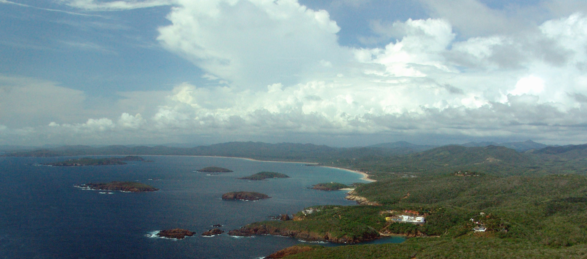
Town at the southern end of Chamela Bay on Highway 200, facing a chain of islands protected since 2001.
From Manzanillo: 1 h 40 min by car (130 km by road) How to get there ↓
Near here
See everything nearby ↓


Plan your visit to Chamela
Where to stay near Chamela
Compare hotels, posadas and guest houses in Chamela.
Tours to Chamela
Day trips and guided outings from Talpa de Allende often include Chamela; with a local guide you can get there without a car.
How to get to Chamela
- From Manzanillo: about 1 h 40 min by road (~130 km)
- Nearest airport: Puerto Vallarta (PVR), 2 h 23 min by car to Talpa de Allende
Links open a partner site. We may earn a commission if you book, at no cost to you.
About Chamela
Chamela is a small town on Jalisco's south coast, in the municipality of La Huerta. It sits at the southern end of Chamela Bay, also called Island Bay, on federal Highway 200, about 8 miles (roughly 13 km) north of Careyes. The other two settlements on the bay are San Mateo and Punta Pérula. The area is still little developed for tourism and the area has hotels and rustic cabins.
The bay has about 13 km of beach, framed by cliffs and rock stacks, and nine islands that run from north to south: Pasavera (the Pajarera), Novilla, Colorada, Cocina, Esfinge, San Pedro, San Agustín, San Andrés and La Negrita. Pasavera fills with nests in February and March, and the federal government declared Chamela's islands a natural sanctuary on 9 April 2001. Though they look close, currents are strong, so ask local fishermen before crossing by boat. In colonial times Chamela was a port that galleons visited, and ruins of a fortification attributed to Pedro de Alvarado remain. Hurricane Patricia largely destroyed the town in 2015.
In the tropical dry forest stands UNAM's Chamela Biology Station, the best-known facility in the area. It belongs to the Chamela-Cuixmala Biosphere Reserve, decreed in 1993 and covering 13,142 hectares, split into two sections by Highway 200. Only research, protection and conservation activities are allowed there. Main traveller services are in Barra de Navidad and Manzanillo.
How to get to Chamela
Drive from Manzanillo: 1 h 40 min, 130 km
Chamela is on federal Highway 200, on the Costa Sur stretch between Puerto Vallarta and Manzanillo. From Guadalajara, take Highway 80 to Autlán de Navarro and then Highway 200 to the coast, a drive of 5 to 6 hours; you can also take the Puerto Vallarta road and head south on 200. From Manzanillo it is about 120 km north on Highway 200 (roughly 2 hours). Buses run to La Huerta or Careyes, with local transport on to Chamela; there are no published schedules. From Careyes it is about 8 miles north.
Directions to Chamela on Google Maps
Distances are in a straight line; the road is usually longer.
Links open a partner site. We may earn a commission if you book, at no cost to you.
From the nearest cities to Chamela
- Manzanillo · 130 km by road, 1 h 40 min
- Puerto Vallarta · 155 km by road, 2 h 10 min
- Tecomán · 181 km by road, 2 h 10 min
Drive times by road from OpenStreetMap, without traffic or stops. Times marked ~ are estimated from the straight-line distance.
Before you go to Chamela: hours, prices and tips
- Best time of day
- November to April, drier and cooler with no tropical cyclones; July to October is the rainy season, when the forest turns green. Azteca Jalisco · checked Oct 2026
Hours and prices change, especially around holidays. Each fact links to where we checked it.
Visiting Chamela: what to see and do
Chamela Bay and its 13 km of beach
The nine islands, a natural sanctuary since 2001; Pasavera with nests in February and March
The ruins of the colonial fortification attributed to Pedro de Alvarado
The Chamela-Cuixmala Biosphere Reserve and its tropical dry forest
UNAM's Chamela Biology Station
Plan your trip
Places to stay in Chamela
Compare hotels, posadas, and rentals in and around Chamela.
Tours & activities
Day trips and guided outings from Talpa de Allende often include Chamela; with a local guide you can get there without a car.
Rental cars
Pick up a car at PVR (Puerto Vallarta): about 2 h 23 min by road to Talpa de Allende, then 98 km more to Chamela, on your own schedule.
Flights
The nearest airport with scheduled flights is Puerto Vallarta (PVR), about 2 h 23 min by road from Talpa de Allende, the base for Chamela.
Mobile data
Signal can drop away from Talpa de Allende: download a map of the way to Chamela before you set out, or carry an eSIM with data.
Links open a partner site. We may earn a commission if you book, at no cost to you.
When to go to Chamela mild
Chamela shares the climate of Talpa de Allende, 98 km away. The best months to visit are January, March, November, and December.
See the month-by-month climate of Talpa de Allende
Weather in Chamela now and the next 7 days
Live forecast from Open-Meteo. Chance of rain is the day's highest.
The closest Pueblo Mágico: Talpa de Allende

Talpa de Allende is the Pueblo Mágico closest to Chamela, with places to stay, food, and more to see.
Closest to Chamela
-
Reserva de la Biosfera Chamela-Cuixmala · Nature reserve · 10 km away
-
Emiliano Zapata · Village · 20 km away
-
La Manzanilla · Village · 41 km away
Near Chamela


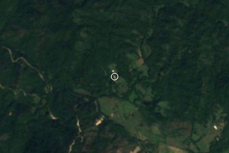


Drive times by road from OpenStreetMap, without traffic. Times marked ~ are estimated from the straight-line distance.
Location from OpenStreetMap. Written by Puebloteca.