Nature reserve La Huerta, Jalisco Municipality of La Huerta
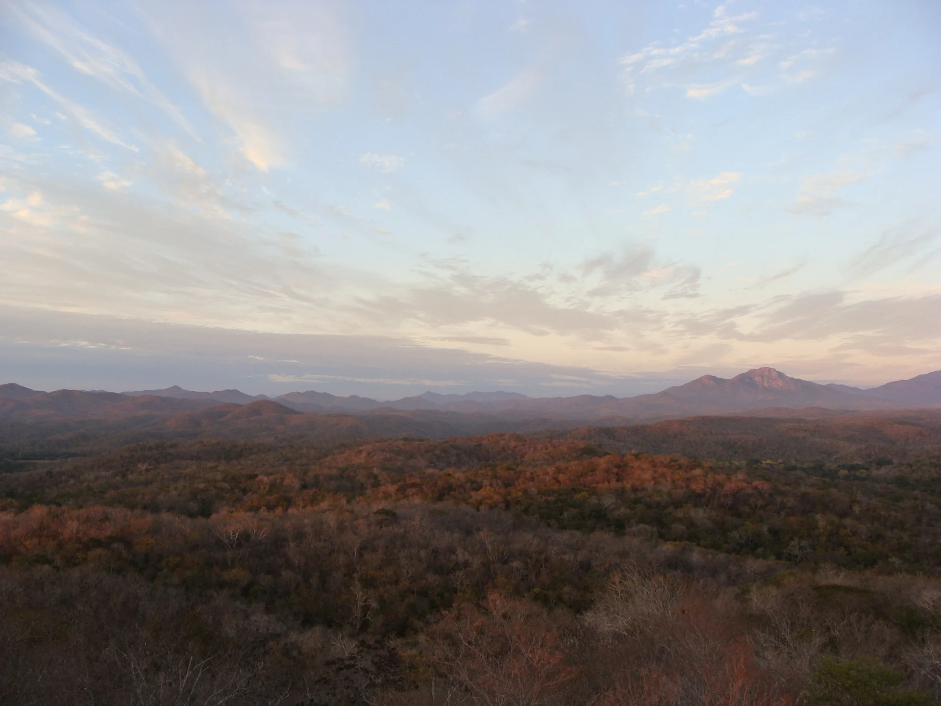
13,142 hectares of tropical dry forest on the Jalisco coast between the Chamela creek and the Cuitzmala River, home to jaguars, crocodiles and 270 bird species.
From Manzanillo: 1 h 35 min by car (123 km by road) How to get there ↓
Near here
See everything nearby ↓


Plan your visit to Reserva de la Biosfera Chamela-Cuixmala
Where to stay near Reserva de la Biosfera Chamela-Cuixmala
Compare hotels, posadas and guest houses in Reserva de la Biosfera Chamela-Cuixmala.
Tours to Reserva de la Biosfera Chamela-Cuixmala
Day trips and guided outings from Jalisco often include Reserva de la Biosfera Chamela-Cuixmala; with a local guide you can get there without a car.
 Tours from Manzanillo
Private Chichen Itza & Yaxunah Ruins with Cenote
★ 4.8 (111) · From US$518
How to get to Reserva de la Biosfera Chamela-Cuixmala
- From Manzanillo: about 1 h 35 min by road (~123 km)
Links open a partner site. We may earn a commission if you book, at no cost to you.
Tours from Manzanillo, near Reserva de la Biosfera Chamela-Cuixmala


Tours, prices and ratings from Viator, checked weekly. We may earn a commission if you book.
About Reserva de la Biosfera Chamela-Cuixmala
The Chamela-Cuixmala Biosphere Reserve protects 13,142 hectares of tropical dry forest on Jalisco's southern coast, in La Huerta municipality, about 120 km north of Manzanillo. Its natural boundaries are the Chamela creek and Chamela Bay on one side and the Cuitzmala River, one of the main rivers of the Jalisco coast, on the other. Federal Highway 200, from Melaque to Puerto Vallarta, cuts it in two. The land is rolling hills and alluvial plains, and besides the dry forest there are patches of semi-evergreen forest, mangroves, riverside woodland, reed beds and scrub.
The dry forest changes completely with the seasons: most rain falls from July to October, 750 to 780 mm a year, and from November to June the deciduous forest, as its name says, sheds its leaves. The average temperature is around 25 °C. More than 1,800 species of plants and animals have been recorded here: about 1,200 plants, 270 birds, around 70 mammals, over 60 reptiles, some twenty amphibians and more than 2,200 insects. A third of the mammals and half of the reptiles and amphibians are endemic to Mexico. Jaguar, puma, ocelot, jaguarundi, white-tailed deer, peccary, coati, American crocodile and the military macaw live here, four species of sea turtle nest on its beaches, and many migratory birds arrive in winter.
The reserve began in 1971, when UNAM's Institute of Biology opened the Chamela Biological Station on a donated 1,600-hectare tract. From the late 1970s the British financier James Goldsmith bought about 9,700 hectares to conserve, and in 1988 he set up the Cuixmala Ecological Foundation. The reserve was decreed on 30 December 1993, joined UNESCO's network of biosphere reserves in 2006 and is also a Ramsar wetland. More than 70% of the land is private; the rest belongs to UNAM, the University of Guadalajara, small owners and the Rincón de Ixtán ejido, and nobody lives inside. Illegal logging, poaching and tourism developments along its edges are the main threats, and Hurricanes Jova in 2011 and Patricia in 2015 damaged parts of the forest.
How to get to Reserva de la Biosfera Chamela-Cuixmala
Drive from Manzanillo: 1 h 35 min, 123 km
The reserve straddles Federal Highway 200, the Pacific coast road; its entrance is roughly halfway between Chamela and Costa Careyes. From Puerto Vallarta it is about 160 km south, roughly a 3-hour drive, and from Manzanillo about 120 km north. Primera Plus runs two first-class buses a day from Puerto Vallarta to Manzanillo along this highway, and Autocamiones del Pacífico runs second-class buses along the coast; a rental car is the easiest option, as everything here is far apart. Puerto Vallarta has the airport with the most flights; Manzanillo's is closer but has fewer.
Directions to Reserva de la Biosfera Chamela-Cuixmala on Google Maps
Distances are in a straight line; the road is usually longer.
Links open a partner site. We may earn a commission if you book, at no cost to you.
From the nearest cities to Reserva de la Biosfera Chamela-Cuixmala
- Manzanillo · 123 km by road, 1 h 35 min
- Tecomán · 174 km by road, 2 h 5 min
- Puerto Vallarta · 162 km by road, 2 h 15 min
Drive times by road from OpenStreetMap, without traffic or stops. Times marked ~ are estimated from the straight-line distance.
Before you go to Reserva de la Biosfera Chamela-Cuixmala: hours, prices and tips
- Best time of day
- Rain falls from July to October, when the forest is green; November to June is the dry season, when most trees lose their leaves. Migratory birds arrive in winter. Wikipedia · checked Oct 2026
Hours and prices change, especially around holidays. Each fact links to where we checked it.
Visiting Reserva de la Biosfera Chamela-Cuixmala: what to see and do
Drive the stretch of Highway 200 that crosses the reserve through hills of dry forest.
Look for birds: 270 species have been recorded, including the military macaw and orange-fronted parakeet, plus many winter migrants.
See the mangroves and the riverside woodland of the Cuitzmala River, home to American crocodiles.
Ride through the reserve on the horseback tours Casa Cuixmala arranges for its guests.
Pair it with Chamela Bay and its islands; boats to Isla Cocinas leave from Playa Perula.
Plan your trip
Places to stay in Reserva de la Biosfera Chamela-Cuixmala
Compare hotels, posadas, and rentals in and around Reserva de la Biosfera Chamela-Cuixmala.
Tours & activities
Day trips and guided outings from Jalisco often include Reserva de la Biosfera Chamela-Cuixmala; with a local guide you can get there without a car.
Travel insurance
If you plan on hiking at Reserva de la Biosfera Chamela-Cuixmala, check that your policy covers it: some plans leave adventure activities out.
Mobile data
Signal can drop away from Jalisco: download a map of the way to Reserva de la Biosfera Chamela-Cuixmala before you set out, or carry an eSIM with data.
Links open a partner site. We may earn a commission if you book, at no cost to you.
Closest to Reserva de la Biosfera Chamela-Cuixmala
-
Chamela · Village · 10 km away
-
Emiliano Zapata · Village · 11 km away
-
La Manzanilla · Village · 31 km away
-
San Patricio · Town · 42 km away
-
Barra de Navidad · Village · 45 km away
Near Reserva de la Biosfera Chamela-Cuixmala


Drive times by road from OpenStreetMap, without traffic. Times marked ~ are estimated from the straight-line distance.
Lists with Reserva de la Biosfera Chamela-Cuixmala
Nature Parks in Jalisco · 17Location from OpenStreetMap. Written by Puebloteca.