
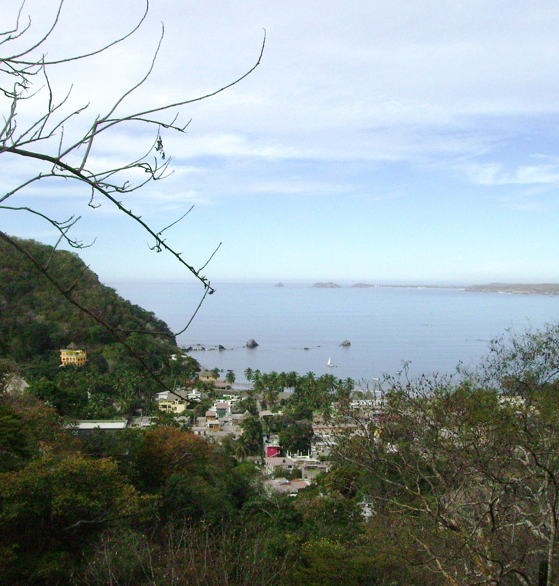
Village La Huerta, Jalisco Municipality of La Huerta
Beach village on Tenacatita Bay with a protected mangrove estuary where hundreds of American crocodiles can be seen from a boardwalk.
From Manzanillo: 1 h 5 min by car (82 km by road) How to get there ↓
Near here
See everything nearby ↓


Plan your visit to La Manzanilla
Where to stay near La Manzanilla
Compare hotels, posadas and guest houses in La Manzanilla.
Tours to La Manzanilla
Day trips and guided outings from Jalisco often include La Manzanilla; with a local guide you can get there without a car.
 Tours from Manzanillo
Private Chichen Itza & Yaxunah Ruins with Cenote
★ 4.8 (111) · From US$518
How to get to La Manzanilla
- From Manzanillo: about 1 h 5 min by road (~82 km)
Links open a partner site. We may earn a commission if you book, at no cost to you.
Tours from Manzanillo, near La Manzanilla


Tours, prices and ratings from Viator, checked weekly. We may earn a commission if you book.
About La Manzanilla
La Manzanilla is a coastal village in La Huerta municipality on Tenacatita Bay, at kilometre 14 of Federal Highway 200 on the stretch from Melaque to Puerto Vallarta. It lies about 56 km northwest of the port of Manzanillo, which it should not be confused with, and roughly half an hour from Barra de Navidad and Melaque. It had 1,592 people at the 2020 census. It is a quiet, walkable place with modest hotels, and its high season runs from mid-November to March, when yoga, cooking and art classes are offered and there is an art gallery.
Its main draw is the estuary, some 264 hectares of mangrove and river mouth that hold the largest population of American crocodiles (Crocodylus acutus) on the Jalisco coast, between 400 and 500 animals. Residents fought developers for years as they filled in the mangroves to sell as building land, formed a group called Cipactli, after the Nahuatl word for crocodile, and won government recognition of the area as an environmental management unit (UMA). In 2008 the Estero La Manzanilla was listed as a Ramsar wetland. The ejido's crocodile sanctuary has a 650-metre circular boardwalk over open water and through the mangroves, with a lookout tower halfway round and a nursery for young crocodiles at the end. One of the best-known residents, Pancho, is about 4 metres long and weighs around 380 kilos. Sixty-three resident and sixteen migratory bird species have been counted in the estuary, iguanas, herons, anhingas and white ibises are easy to spot, and baby sea turtles are released here in July, August and September.
In the sea you can swim, snorkel, kayak or paddleboard, or swim out to the rocks where a statue of María Asunción stands. Local fishermen take visitors out for dorado, sailfish and tuna, and spotted dolphins, whales, pelicans, cormorants, boobies and frigatebirds are commonly seen. Inland, a hike up a riverbed leads to waterfalls. Just north of the village is Boca de Iguanas, with beach campsites and hotels.
How to get to La Manzanilla
Drive from Manzanillo: 1 h 5 min, 82 km
La Manzanilla is just off Federal Highway 200, at kilometre 14 of the Melaque–Puerto Vallarta stretch; you drive into the village on Avenida Lázaro Cárdenas, and the crocodile sanctuary is on the right just before the street ends at the beach. It is about 30 minutes northwest of Barra de Navidad or Melaque, 56 km from Manzanillo and about 45 minutes from Manzanillo airport; from Puerto Vallarta it is around 3 hours on Highway 200, and from Guadalajara 4 to 4.5 hours on the toll road via Colima and Manzanillo. By bus, Primera Plus and Autocamiones del Pacífico run along the coast road between Puerto Vallarta, Manzanillo and Melaque, and several buses a day go in and out of the village. There is no direct bus from Manzanillo airport; a taxi costs about US$50 each way.
Directions to La Manzanilla on Google Maps
Distances are in a straight line; the road is usually longer.
Links open a partner site. We may earn a commission if you book, at no cost to you.
From the nearest cities to La Manzanilla
- Manzanillo · 82 km by road, 1 h 5 min
- Tecomán · 133 km by road, 1 h 35 min
- Colima · 171 km by road, 2 h 15 min
Drive times by road from OpenStreetMap, without traffic or stops. Times marked ~ are estimated from the straight-line distance.
Before you go to La Manzanilla: hours, prices and tips
- Hours
- The crocodile sanctuary is open daily from 9:00 to 18:30 (as of 2017). Guadalajara Reporter · checked Oct 2026
- Entry
- Entry to the crocodile sanctuary cost 25 pesos in 2017. Guadalajara Reporter · checked Oct 2026
- Best season
- High season runs from mid-November to March; baby turtles are released in July, August and September. Wikivoyage · checked Oct 2026
- Rules
- Keep dogs away from the estuary: the crocodiles attack them, and signs warn about it. Mexico News Daily · checked Oct 2026
Hours and prices change, especially around holidays. Each fact links to where we checked it.
Visiting La Manzanilla: what to see and do
Walk the sanctuary's 650-metre boardwalk through the mangroves, with its lookout tower and crocodile nursery.
Take a 90-minute dusk boat tour through the estuary to see birds.
Swim or paddle out to the rocks with the statue of María Asunción.
Go out for dorado or sailfish with a local fisherman.
Hike up the riverbed to the waterfalls.
Camp or spend the day on the beach at Boca de Iguanas, just north of the village.
Plan your trip
Places to stay in La Manzanilla
Compare hotels, posadas, and rentals in and around La Manzanilla.
Tours & activities
Day trips and guided outings from Jalisco often include La Manzanilla; with a local guide you can get there without a car.
Mobile data
Signal can drop away from Jalisco: download a map of the way to La Manzanilla before you set out, or carry an eSIM with data.
Links open a partner site. We may earn a commission if you book, at no cost to you.
Closest to La Manzanilla
-
San Patricio · Town · 11 km away
-
Barra de Navidad · Village · 14 km away
-
Emiliano Zapata · Village · 22 km away
-
Cihuatlán · Town · 24 km away
-
La Huerta · Town · 27 km away
-
Careyes · Town · 31 km away
-
Reserva de la Biosfera Chamela-Cuixmala · Nature reserve · 31 km away
-
Chamela · Village · 41 km away


Near La Manzanilla


Drive times by road from OpenStreetMap, without traffic. Times marked ~ are estimated from the straight-line distance.
Location from OpenStreetMap. Written by Puebloteca.