

Town San Francisco Telixtlahuaca, Oaxaca Central Valleys of Oaxaca
Hill village at nearly 2,000 m where a railway once ended; the track lies under earth and the last 3 km are a dirt road.
From Oaxaca: 40 min by car (46 km by road) How to get there ↓
Near here
See everything nearby ↓


Plan your visit to San Sebastián Sedas
Where to stay near San Sebastián Sedas
Compare hotels, posadas and guest houses in San Sebastián Sedas.
Tours to San Sebastián Sedas
Day trips around Capulálpam de Méndez sometimes stop in San Sebastián Sedas; a tour is the easy way to see it without a car.
How to get to San Sebastián Sedas
- From Oaxaca: about 40 min by road (~46 km)
- Nearest airport: Oaxaca (OAX), 1 h 27 min by car to Capulálpam de Méndez
Links open a partner site. We may earn a commission if you book, at no cost to you.
About San Sebastián Sedas
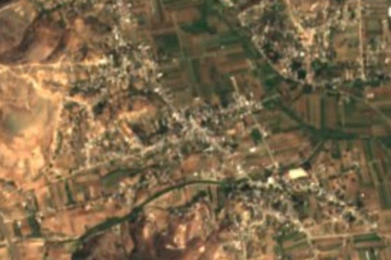
San Sebastián Sedas sits on the edge between the Central Valleys and the Sierra de Flores Magón, at roughly 1,900 to 1,950 m, among eroded yellow slopes and gullies. It belongs to the municipality of San Francisco Telixtlahuaca and is the second-largest of its 18 localities: 404 people in 2005, 496 in 2010 and 455 in 2020, in about 128 occupied homes.
The village grew around a station of the Ferrocarril Mexicano del Sur, opened in 1892; Sedas was the fifth stop out of Oaxaca city. In 1860, during the Reform War, a battle was fought here and won by liberal troops under Félix Díaz Mori, and in 1912 a local club asked the Madero government for a post office. When trains stopped running the village was left with few jobs and poor connections. Only stretches of track remain, covered by earth, and one of the best-known photos of the place shows that line running out to the gullies.
Small hamlets lie around it: Cañada las Sedas 2 km east, El Mogote del Sol, Santa Cruz el Salto, San Isidro Ojo de Agua and, farther north, Santiago Tenango. Cerro Mesón (2,142 m) is about 2 km to the northeast and Cerro La Cumbre (2,327 m) about 5 km east. The climate is semi-dry, averaging about 19 °C with roughly 770 mm of rain a year. There is no river in the village; the Parián stream runs a few kilometres away. Almost everyone is Catholic and Spanish-speaking.
How to get to San Sebastián Sedas
Drive from Oaxaca: 40 min, 46 km
From Oaxaca city take the highway toward Cuicatlán, which passes through San Francisco Telixtlahuaca, the municipal seat, about 40 km from Oaxaca (allow 45 to 60 minutes, approx.). Sedas lies some 7 km northwest of Telixtlahuaca as the crow flies. Leave the highway and follow a dirt road of about 3 km; after rain a vehicle with good clearance helps.
We found no scheduled public transport to Sedas. The practical way is a bus or colectivo from Oaxaca to Telixtlahuaca, then asking there for local transport or a taxi to the turn-off. Operators and terminals are not confirmed for this stretch. Most homes have mobile signal.
Directions to San Sebastián Sedas on Google Maps
Distances are in a straight line; the road is usually longer.
Links open a partner site. We may earn a commission if you book, at no cost to you.
From the nearest cities to San Sebastián Sedas
- Oaxaca · 46 km by road, 40 min
- Huajuapan de León · 137 km by road, 2 h 5 min
- Tehuacán · 179 km by road, 2 h 15 min
Drive times by road from OpenStreetMap, without traffic or stops. Times marked ~ are estimated from the straight-line distance.
Visiting San Sebastián Sedas: what to see and do
Follow the line of the old railway, now covered by earth.
Look out over the yellow-earth gullies from the edge of the village.
Walk to Cañada las Sedas, about 2 km east.
Hike toward Cerro Mesón (2,142 m) with a local guide.
Ask about the Parián stream, a few kilometres away.
Plan your trip
Places to stay in San Sebastián Sedas
Compare hotels, posadas, and rentals in and around San Sebastián Sedas.
Tours & activities
Day trips around Capulálpam de Méndez sometimes stop in San Sebastián Sedas; a tour is the easy way to see it without a car.
Rental cars
Pick up a car at OAX (Oaxaca): about 1 h 27 min by road to Capulálpam de Méndez, then 53 km more to San Sebastián Sedas, on your own schedule.
Flights
The nearest airport with scheduled flights is Oaxaca (OAX), about 1 h 27 min by road from Capulálpam de Méndez, the base for San Sebastián Sedas.
Mobile data
Signal can drop away from Capulálpam de Méndez: download a map of the way to San Sebastián Sedas before you set out, or carry an eSIM with data.
Links open a partner site. We may earn a commission if you book, at no cost to you.
When to go to San Sebastián Sedas cool
San Sebastián Sedas shares the climate of Capulálpam de Méndez, 53 km away. The best months to visit are January, February, March, and December.
See the month-by-month climate of Capulálpam de Méndez
Weather in San Sebastián Sedas now and the next 7 days
Live forecast from Open-Meteo. Chance of rain is the day's highest.
The closest Pueblo Mágico: Capulálpam de Méndez

Capulálpam de Méndez is the Pueblo Mágico closest to San Sebastián Sedas, with places to stay, food, and more to see.
Also close to
- Teposcolula · Oaxaca · 61 km away
- Mitla · Oaxaca · 77 km away
Closest to San Sebastián Sedas
-
San Pablo Huitzo · Town · 10 km away
-
Santiago Suchilquitongo · Town · 13 km away
-
San Andrés Zautla · Town · 19 km away
-
Reyes Etla · Town · 21 km away
-
Villa de Etla · Town · 22 km away
-
Soledad Etla · Town · 23 km away
-
San José Mogote · Archaeological site · 25 km away
-
San Agustín Etla · Town · 26 km away


Near San Sebastián Sedas




Drive times by road from OpenStreetMap, without traffic. Times marked ~ are estimated from the straight-line distance.
Location from OpenStreetMap. Written by Puebloteca.