


Town Panabá, Yucatán Yucatán's east coast
Cattle town between Tizimín and Río Lagartos, known for its June fiesta of San Pedro with vaquerías and the pig's-head dance.
From Tizimín: 25 min by car (24 km by road) How to get there ↓
Near here
See everything nearby ↓



Plan your visit to Panabá
Where to stay near Panabá
Compare hotels, posadas and guest houses in Panabá.
Tours to Panabá
Day trips around Espita sometimes stop in Panabá; a tour is the easy way to see it without a car.
 Tours from Rio Lagartos
Eco Safari through the Ria Lagartos Natural Park
★ 5.0 (41) · From US$58
How to get to Panabá
- From Tizimín: about 25 min by road (~24 km)
- Nearest airport: Tulum (TQO), 2 h 28 min by car to Espita
Links open a partner site. We may earn a commission if you book, at no cost to you.
Tours from Rio Lagartos, near Panabá


Tours, prices and ratings from Viator, checked weekly. We may earn a commission if you book.
About Panabá
Panabá is a cattle town of about 5,300 people (5,318 in the 2020 census) in the far northeast of Yucatán, the seat of the municipality of the same name. It stands 17 metres above sea level on the flat ranch country between Tizimín and the coast, 23 km from Tizimín, 17 km from Sucilá, 33 km from Espita, 32 km from San Felipe, 41 km from Río Lagartos, 60 km from Ek Balam, 75 km from Valladolid and 166 km from Mérida. The name comes from the Maya páanab ha', "water found by digging", a reference to a dug well.
Before the conquest the site belonged to the Maya province of the Cupules, and Maya remains have been found where the town now stands. Local accounts offer three candidates for the original settlement: X-Lacah, the "old town" about 12 km away, now a ranch, with a 6-metre well of cut stone and the ruins of an early colonial open chapel built on top of a pre-Columbian mound; Acab Dzib, an ejido 5 km away with a spring and carved glyphs that have never been deciphered; and Acancún, also 5 km away, with ruined Maya buildings and cenotes. By around 1700 Panabá was an encomienda, governed from Valladolid through Tizimín, and it stayed in the Partido de Tizimín until it became the seat of its own municipality in 1918. The town grew from 407 people in 1910 to about 5,000 by 1990.
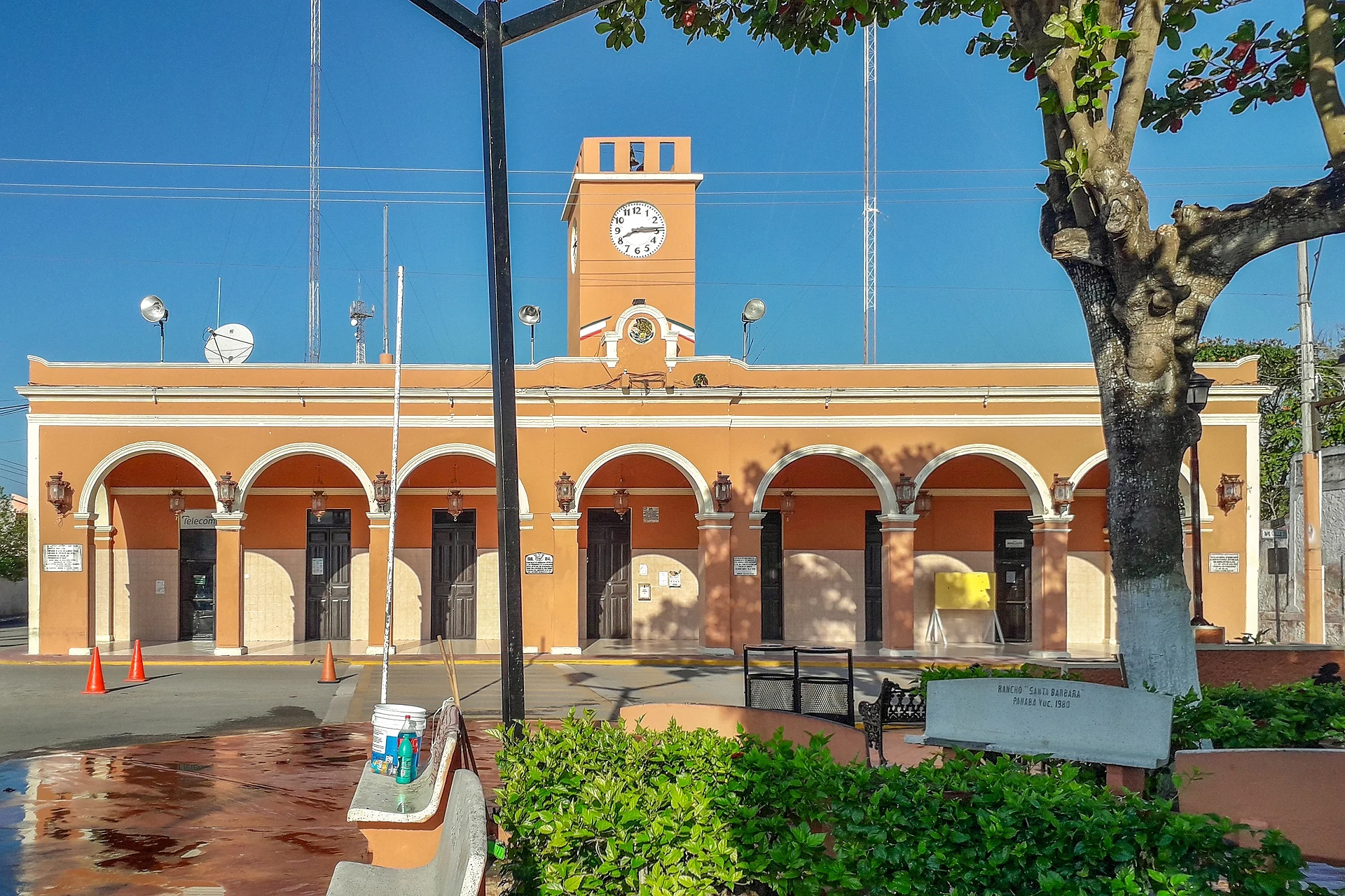
This part of the state is cattle country, and ranching shapes the town: a bull statue on the roundabout at the exit to Sucilá serves as a monument to livestock farming, and there is a charro ring, the Lienzo Charro Ernesto López Aranda, and a fairground. The centre has a large main park with a bandstand, an arcaded municipal palace with a clock tower, and the church of San Pedro, whose building date is unknown. The town's Casa de la Cultura, founded in 1999, runs workshops in guitar, painting and folk dance. Cenotes in the area include Acancún, Azul, Balam-Chaktán, Chen Chac and Chunchechén.
Panabá is liveliest at fiesta time. The fair of San Pedro runs from 26 to 30 June with vaquerías and jarana dancing, and two traditional dances: the Cabeza de Cochino (pig's head) and Los Ramilletes. In May, from the 11th to the 16th, the image of San Isidro Labrador is brought down from its niche to preside over a week of bullfights, jaranas and fireworks.
How to get to Panabá
Drive from Tizimín: 25 min, 24 km
Panabá is about 166 km from Mérida and 75 km from Valladolid. The usual approach is via Tizimín, 23 km away; Sucilá is 17 km away and Río Lagartos 41 km, so Panabá fits easily into a trip to the east coast of the state. From Cancún the distance is about 205 km.
Directions to Panabá on Google Maps
Distances are in a straight line; the road is usually longer.
Links open a partner site. We may earn a commission if you book, at no cost to you.
From the nearest cities to Panabá
- Tizimín · 24 km by road, 25 min
- Valladolid · 76 km by road, 1 h 15 min
- Mérida · 165 km by road, 2 h 30 min
Drive times by road from OpenStreetMap, without traffic or stops. Times marked ~ are estimated from the straight-line distance.
Before you go to Panabá: hours, prices and tips
- Best season
- Fiesta of San Pedro 26–30 June, with vaquerías and traditional dances; fiesta of San Isidro Labrador 11–16 May, with bullfights and fireworks. Wikipedia: Panabá · checked Oct 2026
Hours and prices change, especially around holidays. Each fact links to where we checked it.
Visiting Panabá: what to see and do
The church of San Pedro and the large main park with its bandstand.
The arcaded municipal palace with its clock tower.
The bull monument to cattle ranching on the roundabout at the exit to Sucilá.
The fiesta of San Pedro, 26–30 June, with vaquerías and the Cabeza de Cochino dance.
The Casa de la Cultura, with workshops in guitar, painting and folk dance.
Plan your trip
Places to stay in Panabá
Compare hotels, posadas, and rentals in and around Panabá.
Tours & activities
Day trips around Espita sometimes stop in Panabá; a tour is the easy way to see it without a car.
Rental cars
Pick up a car at TQO (Tulum): about 2 h 28 min by road to Espita, then 32 km more to Panabá, on your own schedule.
Flights
The nearest airport with scheduled flights is Tulum (TQO), about 2 h 28 min by road from Espita, the base for Panabá.
Mobile data
Signal can drop away from Espita: download a map of the way to Panabá before you set out, or carry an eSIM with data.
Links open a partner site. We may earn a commission if you book, at no cost to you.
Photos
When to go to Panabá warm
Panabá shares the climate of Espita, 32 km away. The best months to visit are January, February, November, and December.
See the month-by-month climate of Espita
Weather in Panabá now and the next 7 days
Live forecast from Open-Meteo. Chance of rain is the day's highest.
The closest Pueblo Mágico: Espita

Espita is the Pueblo Mágico closest to Panabá, with places to stay, food, and more to see.
Also close to
- Valladolid · Yucatán · 68 km away
Closest to Panabá
-
Cenote Kikil · Cenote · 16 km away
-
Sucilá · Town · 16 km away
-
Tizimín · Town · 21 km away
-
Sucopó · Village · 28 km away
-
Isla Cerritos · Island · 30 km away
-
San Felipe · Town · 30 km away
-
Calotmul · Town · 32 km away
-
Punta Bachul · Nature reserve · 32 km away

Near Panabá


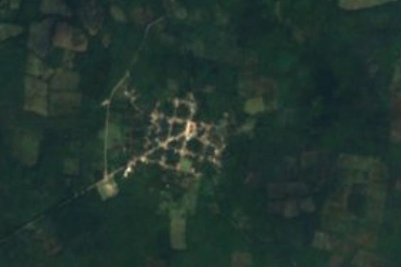


Drive times by road from OpenStreetMap, without traffic. Times marked ~ are estimated from the straight-line distance.
Location from OpenStreetMap. Written by Puebloteca.