

Town Ixtapan del Oro, Estado de México Monarch Butterfly country Valle de Bravo and Avándaro
Hill-country municipal seat in the far west of the state, with a wooden-kiosk plaza, San Miguel church, a waterfall and warm-water pools.
From Zitácuaro: 55 min by car (31 km by road) How to get there ↓
Near here
See everything nearby ↓


Plan your visit to Ixtapan del Oro
Where to stay near Ixtapan del Oro
Compare hotels, posadas and guest houses in Ixtapan del Oro.
Tours to Ixtapan del Oro
Day trips around Valle de Bravo sometimes stop in Ixtapan del Oro; a tour is the easy way to see it without a car.
How to get to Ixtapan del Oro
- From Zitácuaro: about 55 min by road (~31 km)
- Nearest airport: Toluca (TLC), 1 h 10 min by car to Valle de Bravo
Links open a partner site. We may earn a commission if you book, at no cost to you.
About Ixtapan del Oro
Ixtapan del Oro is the seat of the municipality of the same name, in the far west of the State of Mexico beside Michoacán, at about 1,700 m (sources range from 1,640 to 1,800). In 2020 the town had 944 residents and the whole municipality 6,495. Ixtapan is Nahuatl and refers to salt; some of the local waters are salty, and the municipal spa is still known as Las Salinas. "Del Oro" was added in 1894 when gold veins were found. The settlement split from Otzoloapan in 1870 to become its own municipality, got electricity in 1949 and inaugurated its municipal palace on 29 March 1969.
The centre is a garden plaza with a small octagonal wooden kiosk on stone bases under a red-tile roof. Nearby stands the parish of San Miguel Arcángel: a whitewashed church with an open atrium, an arched gate and a five-stage clock tower, which México Desconocido dates to the 16th century. The main feast is 29 September: the image is carried in procession from San Miguel Ixtapan to the parish, followed by mass, a fair, a torito and fireworks castle.
Most of what visitors come for lies around town. About 2 km north-west, half an hour on foot, the El Salto ecological park has a waterfall of roughly 60 m that it shares with Donato Guerra; the El Salitre spa offers pools, one at about 20 °C and another warmer, plus cabins and a camping area. In San Martín Ocoxochitepec there is a park of ahuehuete trees that legend says the Franciscans planted, and a 17th-century Franciscan church; near El Chilar lies the Huerta de Pagaza, a late-19th-century country house frequented by the bishop and poet Joaquín Arcadio Pagaza. The climate is mild, 16 to 22 °C, with summer rain.
How to get to Ixtapan del Oro
Drive from Zitácuaro: 55 min, 31 km
By road from Toluca, México Desconocido describes this route: take federal highway 15 to San Nicolás Tolentino, passing Colorines, then turn right onto state highway 2 and continue about 24 km to Ixtapan del Oro (an older article: check a map and the signs). Route aggregators estimate about 92 km and 1 h 20 from Toluca, and about 46 km and 57 minutes from Valle de Bravo (approx.). Without a car: Autobuses Zinacantepec (Zina) runs hourly from Toluca to Valle de Bravo, about 2 hours, then continue by taxi (approx. 1 hour); there is also one daily departure from Toluca to El Arco, 50 minutes, then a taxi. From Mexico City you have to go through Toluca. There is no published direct bus to the town.
Directions to Ixtapan del Oro on Google Maps
Distances are in a straight line; the road is usually longer.
Links open a partner site. We may earn a commission if you book, at no cost to you.
From the nearest cities to Ixtapan del Oro
- Zitácuaro · 31 km by road, 55 min
- Toluca · 91 km by road, 1 h 35 min
- Ciudad Hidalgo · 79 km by road, 1 h 40 min
Drive times by road from OpenStreetMap, without traffic or stops. Times marked ~ are estimated from the straight-line distance.
Before you go to Ixtapan del Oro: hours, prices and tips
- Time needed
- El Salto is about 2 km from town, roughly a 30-minute walk. México Desconocido · checked Oct 2026
- Best season
- The main feast is 29 September (San Miguel Arcángel); also 2 February in Tutuapan, 11 November in San Martín Ocoxochitepec, 12 December in most communities, and the Holy Week Way of the Cross. Wikipedia · checked Oct 2026
Hours and prices change, especially around holidays. Each fact links to where we checked it.
Visiting Ixtapan del Oro: what to see and do
Sit in the plaza by the octagonal wooden kiosk and step into the parish of San Miguel Arcángel with its clock tower.
Walk to the El Salto ecological park, about 2 km (half an hour on foot), for the waterfall of roughly 60 m.
Soak in the El Salitre spa (Las Salinas), with water around 20 °C and a warmer pool.
Go to San Martín Ocoxochitepec for its ahuehuete trees and 17th-century Franciscan church.
See the Huerta de Pagaza near El Chilar, planted with coffee, orange, banana and peach trees.
Look for the pre-Hispanic sculpture found near the little-explored El Pedregal archaeological site.
Visit the Casa de Cultura Joaquín Arcadio Pagaza, with folk dance and rondalla groups.
Plan your trip
Places to stay in Ixtapan del Oro
Compare hotels, posadas, and rentals in and around Ixtapan del Oro.
Tours & activities
Day trips around Valle de Bravo sometimes stop in Ixtapan del Oro; a tour is the easy way to see it without a car.
Rental cars
Pick up a car at TLC (Toluca): about 1 h 10 min by road to Valle de Bravo, then 16 km more to Ixtapan del Oro, on your own schedule.
Flights
The nearest airport with scheduled flights is Toluca (TLC), about 1 h 10 min by road from Valle de Bravo, the base for Ixtapan del Oro.
Mobile data
Signal can drop away from Valle de Bravo: download a map of the way to Ixtapan del Oro before you set out, or carry an eSIM with data.
Links open a partner site. We may earn a commission if you book, at no cost to you.
When to go to Ixtapan del Oro mild
Ixtapan del Oro shares the climate of Valle de Bravo, 16 km away. The best months to visit are January, March, April, and December.
See the month-by-month climate of Valle de Bravo
Weather in Ixtapan del Oro now and the next 7 days
Live forecast from Open-Meteo. Chance of rain is the day's highest.
The closest Pueblo Mágico: Valle de Bravo

Valle de Bravo is the Pueblo Mágico closest to Ixtapan del Oro, with places to stay, food, and more to see.
Also close to
- Angangueo · Michoacán · 40 km away
- El Oro · Estado de México · 61 km away
- Tlalpujahua · Michoacán · 61 km away
- Metepec · Estado de México · 70 km away
- Ixtapan de la Sal · Estado de México · 77 km away
Closest to Ixtapan del Oro
-
Salto de Chihuahua · Waterfall · 2 km away
-
Santo Tomás de los Plátanos · Town · 9 km away
-
Santuario Cerro Pelón · Nature reserve · 14 km away
-
Santuario El Capulín · Nature reserve · 14 km away
-
Cascada Velo de Novia · Waterfall · 17 km away
-
Avándaro · Town · 18 km away
-
San Martín Obispo · Village · 21 km away
-
Zacazonapan · Town · 21 km away

Near Ixtapan del Oro


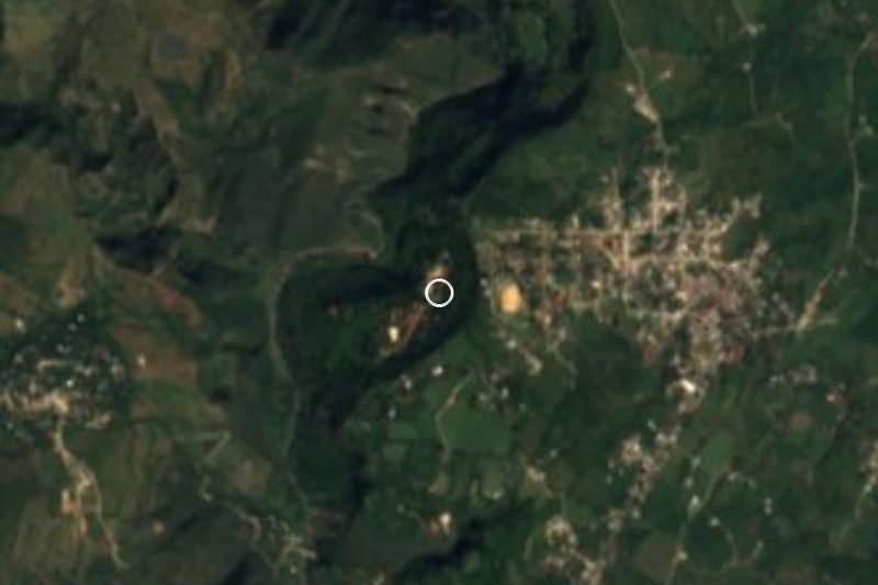


Drive times by road from OpenStreetMap, without traffic. Times marked ~ are estimated from the straight-line distance.
Location from OpenStreetMap. Written by Puebloteca.