Village Cortazar, Guanajuato Municipality of Cortazar The Bajío
Village founded in 1612 between El Culiacán and La Gavia hills, where Blessed Elías del Socorro Nieves was killed.
From Celaya: 35 min by car (33 km by road) How to get there ↓
Near here
See everything nearby ↓


Plan your visit to Cañada de Caracheo
Where to stay near Cañada de Caracheo
Compare hotels, posadas and guest houses in Cañada de Caracheo.
Tours to Cañada de Caracheo
Day trips and guided outings from Salvatierra often include Cañada de Caracheo; with a local guide you can get there without a car.
 Tours from San Miguel de Allende
Immersive Cañada de La Virgen Pyramid Tour
★ 4.8 (803) · From US$84
How to get to Cañada de Caracheo
- From Celaya: about 35 min by road (~33 km)
- Nearest airport: Morelia (MLM), 1 h 9 min by car to Salvatierra
Links open a partner site. We may earn a commission if you book, at no cost to you.
Tours from San Miguel de Allende, near Cañada de Caracheo


Tours, prices and ratings from Viator, checked weekly. We may earn a commission if you book.
About Cañada de Caracheo
Cañada de Caracheo, often just called La Cañada, is in the municipality of Cortazar at 1,720 metres, in the fold between the hills of El Culiacán and La Gavia. It had 2,436 residents in 2020. Caracheo comes from Purépecha carachi, "dry water", so the full name reads as "the ravine of the dry water". The village is dated to 1612, and the local account is that it began when the owner of the neighbouring Caracheo hacienda, short of land, had another one set up beyond it, in the ravine.
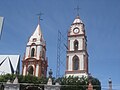
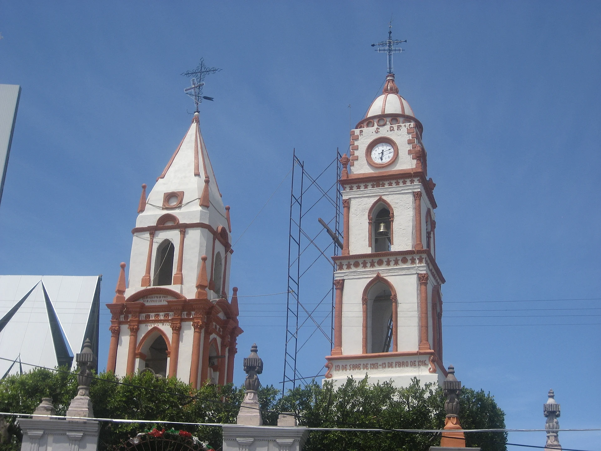
The building that organises village life is the parish of Nuestra Señora de los Dolores, and the biggest fiestas hang on it: the Virgen de los Dolores, which starts a week before Easter Sunday, and the feast of Padre Nieves on 10 March. That date is not arbitrary. Elías del Socorro Nieves, an Augustinian priest born in Yuriria, was shot in La Cañada on 10 March 1928 during the Cristero War, and John Paul II beatified him in 1997.
Above the village rises Cerro de Culiacán, a regular cone visible from much of southern Guanajuato. It is regarded as a sacred mountain, with archaeological remains on the slopes and summit that suggest ritual use; most of the land is ejido-owned and there is no tourist infrastructure, so climb respectfully and ideally let people in the community know. Each April the Santa Cruz de Culiacán festival of Cortazar ends with a pilgrimage of dancers to the church on the summit.
How to get to Cañada de Caracheo
Drive from Celaya: 35 min, 33 km
La Cañada is roughly 25 minutes by car from Celaya and roughly 20 minutes from Salvatierra. Cortazar, the municipal seat, lies on the Celaya-Irapuato highway; from there the link toward the area is the Carretera Cortázar-Salvatierra, which runs very close to the village, and the last stretch is a local road. There is no published bus or combi timetable to Cañada de Caracheo; the usual approach in the region is an intercity bus to Cortazar or Salvatierra and then local transport or a taxi. If you plan to climb Cerro de Culiacán, start early and confirm the route with people in the community.
Directions to Cañada de Caracheo on Google Maps
Distances are in a straight line; the road is usually longer.
Links open a partner site. We may earn a commission if you book, at no cost to you.
From the nearest cities to Cañada de Caracheo
- Celaya · 33 km by road, 35 min
- Salamanca · 44 km by road, 45 min
- Valle de Santiago · 36 km by road, 50 min
Drive times by road from OpenStreetMap, without traffic or stops. Times marked ~ are estimated from the straight-line distance.
Before you go to Cañada de Caracheo: hours, prices and tips
- Best season
- Fiesta de la Virgen de los Dolores starts a week before Easter Sunday (Thursday noon to Monday morning); Padre Nieves on 10 March; Santa Cruz de Culiacán in April, main parade on the 29th. English Wikipedia (fiestas); Guanajuato Turismo (Santa Cruz de Culiacán) · checked Oct 2026
- Rules
- Cerro de Culiacán is mostly ejido land with no tourist infrastructure; visit with respect for the communities that care for it. Guanajuato Turismo · checked Oct 2026
Hours and prices change, especially around holidays. Each fact links to where we checked it.
Visiting Cañada de Caracheo: what to see and do
Parish of Nuestra Señora de los Dolores
Cerro de Culiacán, a sacred mountain with archaeological remains
Feast of Padre Nieves, every 10 March
Fiesta of the Virgen de los Dolores, from a week before Easter Sunday
Santa Cruz de Culiacán festival in April (main parade on the 29th)
Plan your trip
Places to stay in Cañada de Caracheo
Compare hotels, posadas, and rentals in and around Cañada de Caracheo.
Tours & activities
Day trips and guided outings from Salvatierra often include Cañada de Caracheo; with a local guide you can get there without a car.
Rental cars
Pick up a car at MLM (Morelia): about 1 h 9 min by road to Salvatierra, then 19 km more to Cañada de Caracheo, on your own schedule.
Flights
The nearest airport with scheduled flights is Morelia (MLM), about 1 h 9 min by road from Salvatierra, the base for Cañada de Caracheo.
Mobile data
Signal can drop away from Salvatierra: download a map of the way to Cañada de Caracheo before you set out, or carry an eSIM with data.
Links open a partner site. We may earn a commission if you book, at no cost to you.
When to go to Cañada de Caracheo mild
Cañada de Caracheo shares the climate of Salvatierra, 19 km away. The best months to visit are January, February, March, and April.
See the month-by-month climate of Salvatierra
Weather in Cañada de Caracheo now and the next 7 days
Live forecast from Open-Meteo. Chance of rain is the day's highest.
The closest Pueblo Mágico: Salvatierra

Salvatierra is the Pueblo Mágico closest to Cañada de Caracheo, with places to stay, food, and more to see.
Also close to
Closest to Cañada de Caracheo
-
Cerro del Culiacán · Mountain · 5 km away
-
Cortazar · Town · 12 km away
-
Jaral del Progreso · Town · 12 km away
-
Villagrán · Town · 16 km away
-
La Moncada · Village · 18 km away
-
Rincón de Tamayo · Town · 21 km away
-
Celaya · City · 22 km away
-
San Pablo Casacuarán · Village · 22 km away


Near Cañada de Caracheo




Drive times by road from OpenStreetMap, without traffic. Times marked ~ are estimated from the straight-line distance.
Location from OpenStreetMap. Written by Puebloteca.