
Village Nicolás Flores, Hidalgo
Seat of its own municipality, at 1,518 m in the Sierra Gorda; once called Santa María Tepexi, in Mezquital Otomí country.
From Querétaro: about 2 h 30 min by road (~170 km) How to get there ↓
Near here
See everything nearby ↓


Plan your visit to Nicolás Flores
Where to stay near Nicolás Flores
Compare hotels, posadas and guest houses in Nicolás Flores.
Tours to Nicolás Flores
Day trips and guided outings from Zimapán often include Nicolás Flores; with a local guide you can get there without a car.
 Tours from Xilitla
Surrealist Garden of Edward James, Castle of Health and Xilitla Nativity
★ 4.3 (10) · From US$100
How to get to Nicolás Flores
- From Querétaro: about 2 h 30 min by road (~170 km)
- Nearest airport: Querétaro (QRO), 2 h 23 min by car to Zimapán
Links open a partner site. We may earn a commission if you book, at no cost to you.
Tours from Xilitla, near Nicolás Flores


Tours, prices and ratings from Viator, checked weekly. We may earn a commission if you book.
About Nicolás Flores
Until 1914 the village was called Santa María Tepexi; that year a decree changed it to Santa María Tepeji, and decree 439 of 1 January 1938 gave it its present name, in honour of General Nicolás Flores Rubio. Today it is the seat of the municipality of Nicolás Flores and has 404 residents (2020 census), at 1,518 metres.
Geographically it belongs to the Sierra Gorda, though in its people and customs it is counted with the Valle del Mezquital: more than half the municipality speaks Otomí. The climate is temperate and sub-humid, averaging 16 °C a year with about 470 mm of rain falling from March to September. The ground is mostly limestone, and the slopes carry oak, ocote pine, juniper, huizache and maguey.
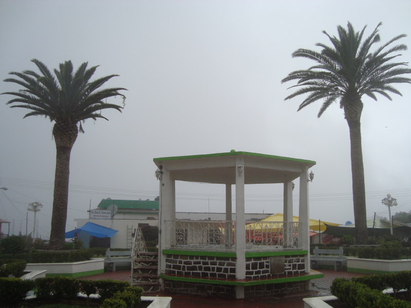
The municipality was created on 3 March 1870 and has 46 localities, the largest being Bocua. Part of its land lies inside Los Mármoles National Park, decreed on 8 September 1936 with 23,150 hectares and shared with Jacala, Pacula and Zimapán. The village is small and quiet; the plaza with its bandstand, is the first thing you see on arrival.
How to get to Nicolás Flores
Nicolás Flores lies in northern Hidalgo, between Zimapán and Cardonal. A local listing puts Zimapán, the nearest Pueblo Mágico, about 37 km and 40 minutes away by car; in a straight line it is about 24 km. Pachuca is about 84 km as the crow flies, so allow an hour and a half or more by road.
The municipality borders Zimapán, Jacala de Ledezma, Tlahuiltepa, Cardonal and Ixmiquilpan, and administratively falls under the Ixmiquilpan operating region, which makes Ixmiquilpan, in the Valle del Mezquital, the other sensible gateway. Before going, check in Zimapán or Ixmiquilpan which colectivos climb to the village and when they come back.
Directions to Nicolás Flores on Google Maps
Distances are in a straight line; the road is usually longer.
Links open a partner site. We may earn a commission if you book, at no cost to you.
From the nearest cities to Nicolás Flores
- Querétaro · about 170 km by road, ~2 h 30 min
- Huauchinango · about 170 km by road, ~2 h 30 min
- Pachuca · 133 km by road, 2 h 35 min
Drive times by road from OpenStreetMap, without traffic or stops. Times marked ~ are estimated from the straight-line distance.
Before you go to Nicolás Flores: hours, prices and tips
- Best season
- Rain falls mostly from March to September; the mean annual temperature is 16 °C with about 470 mm of rain a year. Wikipedia: Nicolás Flores (Hidalgo) · checked Oct 2026
Hours and prices change, especially around holidays. Each fact links to where we checked it.
Visiting Nicolás Flores: what to see and do
The central plaza and bandstand
The municipal palace
Los Mármoles National Park, which reaches into the municipality
Arroyo Las Adjuntas, the municipality's permanent stream
Bocua, the municipality's largest locality
Plan your trip
Places to stay in Nicolás Flores
Compare hotels, posadas, and rentals in and around Nicolás Flores.
Tours & activities
Day trips and guided outings from Zimapán often include Nicolás Flores; with a local guide you can get there without a car.
Rental cars
Pick up a car at QRO (Querétaro): about 2 h 23 min by road to Zimapán, then 24 km more to Nicolás Flores, on your own schedule.
Flights
The nearest airport with scheduled flights is Querétaro (QRO), about 2 h 23 min by road from Zimapán, the base for Nicolás Flores.
Mobile data
Signal can drop away from Zimapán: download a map of the way to Nicolás Flores before you set out, or carry an eSIM with data.
Links open a partner site. We may earn a commission if you book, at no cost to you.
When to go to Nicolás Flores mild
Nicolás Flores shares the climate of Zimapán, 24 km away. The best months to visit are January, February, March, and December.
See the month-by-month climate of Zimapán
Weather in Nicolás Flores now and the next 7 days
Live forecast from Open-Meteo. Chance of rain is the day's highest.
The closest Pueblo Mágico: Zimapán

Zimapán is the Pueblo Mágico closest to Nicolás Flores, with places to stay, food, and more to see.
Also close to
- Metztitlán · Hidalgo · 45 km away
- San Joaquín · Querétaro · 46 km away
- Tecozautla · Hidalgo · 56 km away
- Jalpan · Querétaro · 60 km away
- Pinal de Amoles · Querétaro · 64 km away
Closest to Nicolás Flores
-
La Ciénega · Village · 4 km away
-
La Encarnación · Town · 13 km away
-
Cerritos · Village · 14 km away
-
Parque Nacional Los Mármoles · Nature reserve · 15 km away
-
San Miguel Jigui · Village · 15 km away
-
Cardonal · Town · 18 km away
-
Grutas de Tolantongo · Hot springs · 21 km away
-
Los Remedios · Village · 26 km away


Near Nicolás Flores





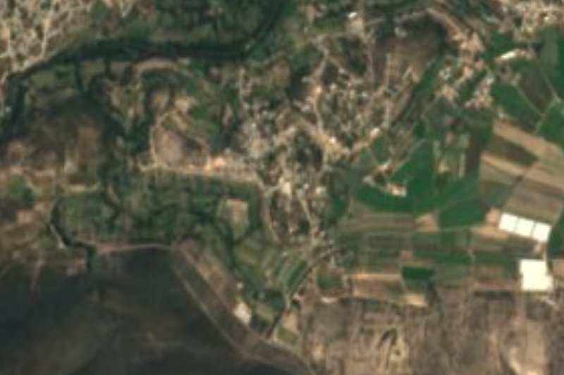

Drive times by road from OpenStreetMap, without traffic. Times marked ~ are estimated from the straight-line distance.
Location from OpenStreetMap. Written by Puebloteca.