
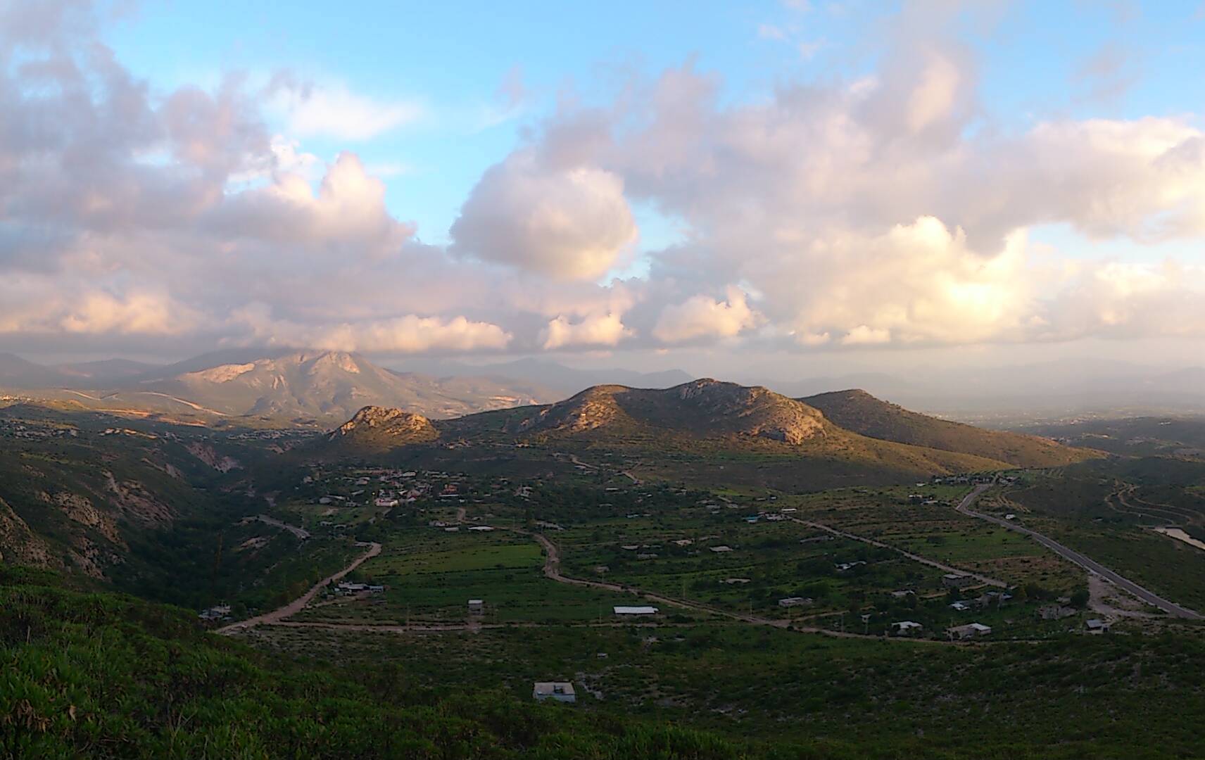
Village Cardonal, Hidalgo Municipality of Cardonal Mezquital Valley
An Otomí community at 2,148 m between Cardonal and Ixmiquilpan, named for the jilitla trees along its stream.
From Pachuca: 1 h 45 min by car (97 km by road) How to get there ↓
Near here
See everything nearby ↓


Plan your visit to San Miguel Jigui
Where to stay near San Miguel Jigui
Compare hotels, posadas and guest houses in San Miguel Jigui.
Tours to San Miguel Jigui
Day trips and guided outings from Zimapán often include San Miguel Jigui; with a local guide you can get there without a car.
 Tours from Xilitla
Surrealist Garden of Edward James, Castle of Health and Xilitla Nativity
★ 4.3 (10) · From US$100
How to get to San Miguel Jigui
- From Pachuca: about 1 h 45 min by road (~97 km)
- Nearest airport: Querétaro (QRO), 2 h 23 min by car to Zimapán
Links open a partner site. We may earn a commission if you book, at no cost to you.
Tours from Xilitla, near San Miguel Jigui


Tours, prices and ratings from Viator, checked weekly. We may earn a commission if you book.
About San Miguel Jigui
The name pairs the patron saint, San Miguel Arcángel, with an Otomí word, h'ugui, that refers to the abundance of jilitla trees along the community's stream. Jigui sits at 2,148 metres, about 10 km northwest of Cardonal, right on the boundary between the municipalities of Cardonal and Ixmiquilpan; its neighbours are San Clemente, Santuario Mapethé, El Deca, Cerro Blanco, El Olivo and El Buena.
In 2020 it had 478 residents in 123 homes. People speak Spanish and also Mezquital Valley Otomí; the census notes a Catholic majority and a Pentecostal minority. The climate is temperate and sub-humid, averaging 16 to 18 °C with 400 to 430 mm of rain a year, and the vegetation mixes mesquite, huizache and pirul with cacti such as garambullo, organ pipe, biznaga and pitaya, plus walnut, ash and orchard fruit like avocado and apple. A small reservoir tucked into one corner of the community holds mojarra and catfish.
The local economy rests on rain-fed maize and beans, some sheep grazing, backyard poultry, two clothing and footwear workshops and, above all, money sent home by relatives who emigrated to the United States. There is a kindergarten, a primary school, a telesecundaria and a health centre. It is a community in which to meet the Otomí Mezquital with respect, with no tourist infrastructure.
How to get to San Miguel Jigui
Drive from Pachuca: 1 h 45 min, 97 km
San Miguel Jigui is about 10.5 km northwest of Cardonal, the municipal seat, on the boundary with Ixmiquilpan. A shared collective service connects the community with Ixmiquilpan (San Miguel Jigui–Ixmiquilpan and back), so the easiest way is to reach Ixmiquilpan and take the colectivo from there; check times at the stop before you go.
In a straight line Pachuca is about 72 km away (about 85 minutes) and Zimapán, the nearest Pueblo Mágico, about 26 km (about 30 minutes).
Directions to San Miguel Jigui on Google Maps
Distances are in a straight line; the road is usually longer.
Links open a partner site. We may earn a commission if you book, at no cost to you.
From the nearest cities to San Miguel Jigui
- Pachuca · 97 km by road, 1 h 45 min
- San Juan del Río · 122 km by road, 2 h 10 min
- Huauchinango · about 165 km by road, ~2 h 25 min
Drive times by road from OpenStreetMap, without traffic or stops. Times marked ~ are estimated from the straight-line distance.
Visiting San Miguel Jigui: what to see and do
The sierra and hill country of the Mezquital, with garambullo, biznaga and mesquite
The community's reservoir, stocked with mojarra and catfish
Sunset panoramas over the sierra, like the one that illustrates the village on Wikimedia Commons
The Otomí language of the Valle del Mezquital, still spoken in the community
Plan your trip
Places to stay in San Miguel Jigui
Compare hotels, posadas, and rentals in and around San Miguel Jigui.
Tours & activities
Day trips and guided outings from Zimapán often include San Miguel Jigui; with a local guide you can get there without a car.
Rental cars
Pick up a car at QRO (Querétaro): about 2 h 23 min by road to Zimapán, then 26 km more to San Miguel Jigui, on your own schedule.
Flights
The nearest airport with scheduled flights is Querétaro (QRO), about 2 h 23 min by road from Zimapán, the base for San Miguel Jigui.
Mobile data
Signal can drop away from Zimapán: download a map of the way to San Miguel Jigui before you set out, or carry an eSIM with data.
Links open a partner site. We may earn a commission if you book, at no cost to you.
When to go to San Miguel Jigui mild
San Miguel Jigui shares the climate of Zimapán, 26 km away. The best months to visit are January, February, March, and December.
See the month-by-month climate of Zimapán
Weather in San Miguel Jigui now and the next 7 days
Live forecast from Open-Meteo. Chance of rain is the day's highest.
The closest Pueblo Mágico: Zimapán

Zimapán is the Pueblo Mágico closest to San Miguel Jigui, with places to stay, food, and more to see.
Also close to
- Metztitlán · Hidalgo · 41 km away
- Tecozautla · Hidalgo · 51 km away
- San Joaquín · Querétaro · 53 km away
- Huichapan · Hidalgo · 59 km away
- Mineral del Chico · Hidalgo · 64 km away
Closest to San Miguel Jigui
-
Cerritos · Village · 2 km away
-
Cardonal · Town · 5 km away
-
Los Remedios · Village · 12 km away
-
Nicolás Flores · Village · 15 km away
-
El Nith · Village · 17 km away
-
Grutas de Tolantongo · Hot springs · 17 km away
-
Ixmiquilpan · Town · 18 km away
-
La Ciénega · Village · 19 km away


Near San Miguel Jigui




Drive times by road from OpenStreetMap, without traffic. Times marked ~ are estimated from the straight-line distance.
Location from OpenStreetMap. Written by Puebloteca.