
Village San Cristóbal de la Barranca, Jalisco
Municipal seat in the Santiago River canyon at 844 m, with fiestas for San Cristóbal on 24-30 January.
From Guadalajara: 1 h by car (58 km by road) How to get there ↓
Near here
See everything nearby ↓


Plan your visit to San Cristóbal de la Barranca
Where to stay near San Cristóbal de la Barranca
Compare hotels, posadas and guest houses in San Cristóbal de la Barranca.
Tours to San Cristóbal de la Barranca
Day trips and guided outings from Tequila often include San Cristóbal de la Barranca; with a local guide you can get there without a car.
 Tours from Guadalajara
Full Day Tour to Tequila and Amatitán with Fun and Culture
★ 4.9 (751) · From US$44
How to get to San Cristóbal de la Barranca
- From Guadalajara: about 1 h by road (~58 km)
- Nearest airport: Guadalajara (GDL), 1 h 16 min by car to Tequila
Links open a partner site. We may earn a commission if you book, at no cost to you.
Tours from Guadalajara, near San Cristóbal de la Barranca


Tours, prices and ratings from Viator, checked weekly. We may earn a commission if you book.
About San Cristóbal de la Barranca
San Cristóbal de la Barranca is the seat of the municipality of the same name in north-central Jalisco, right against the Zacatecas border. The town lies at about 844 metres above sea level inside the canyon (barranca) of the Santiago River, which gives it its name; at the 2020 census it had 843 inhabitants. Because it is at the bottom of the canyon the climate is very hot: summer temperatures commonly pass 40 degrees, and the vegetation is dry tropical forest with prickly pear and cactus.
Before the conquest the area answered to the chief of Xochitepec. Cristóbal de Oñate, of Nuño de Guzmán's army, arrived in 1530; the inhabitants rose up in 1538 and in 1540 took part in the Mixtón War. Through the colonial period it was a corregimiento. The present town dates from 1875, when a strong earthquake attributed to the Ceboruco volcano left the earlier settlement in ruins on the night of 11 February and the town was founded again on the same spot.
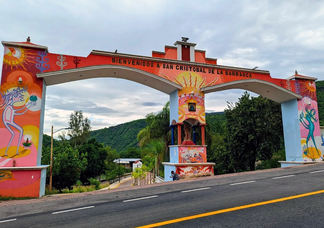
At the centre are the church of San Cristóbal, the municipal palace and the plaza with its bandstand. At the entrance to town a hand-painted arch welcomes visitors. From 24 to 30 January the patron saint is celebrated with a novena, bell-ringing, fireworks, pilgrimages, dances and the burning of castillos, and from 14 to 17 September the independence festivities. The municipality has hot springs and geysers, among them those of the Parque Ecológico Los Hervores on the Patitos River, between San Cristóbal and Teúl.
How to get to San Cristóbal de la Barranca
Drive from Guadalajara: 1 h, 58 km
San Cristóbal de la Barranca is about 54 minutes by car from Guadalajara, around 60 km (approx.); the sources consulted do not name the highway, so follow a map north toward Ixtlahuacán del Río and the canyon. By bus, Rojo de los Altos leaves the Nueva Central Camionera in Guadalajara (module 7) with about 3 departures a day and a trip of 1 to 3 hours depending on the run; confirm schedules at the ticket counter. The town is about 46 km and 55 minutes from Tequila (approx.). In summer, with temperatures over 40 degrees at the bottom of the canyon, bring water and start early.
Directions to San Cristóbal de la Barranca on Google Maps
Distances are in a straight line; the road is usually longer.
Links open a partner site. We may earn a commission if you book, at no cost to you.
From the nearest cities to San Cristóbal de la Barranca
- Guadalajara · 58 km by road, 1 h
- Tepatitlán · 133 km by road, 1 h 55 min
- Ocotlán · 141 km by road, 2 h
Drive times by road from OpenStreetMap, without traffic or stops. Times marked ~ are estimated from the straight-line distance.
Before you go to San Cristóbal de la Barranca: hours, prices and tips
- Best season
- 24-30 January, fiestas for San Cristóbal; 14-16 September, independence festivities (running on to the 17th). INAFED, Enciclopedia de los Municipios · checked Oct 2026
Hours and prices change, especially around holidays. Each fact links to where we checked it.
Visiting San Cristóbal de la Barranca: what to see and do
The main plaza with its bandstand and the municipal palace.
The church of San Cristóbal, the town's patron saint.
The hand-painted welcome arch at the entrance.
The fiestas of 24-30 January, with novena, pilgrimages, dances and castillos.
The hot springs and geysers of Parque Ecológico Los Hervores, on the Patitos River, toward Teúl.
Plan your trip
Places to stay in San Cristóbal de la Barranca
Compare hotels, posadas, and rentals in and around San Cristóbal de la Barranca.
Tours & activities
Day trips and guided outings from Tequila often include San Cristóbal de la Barranca; with a local guide you can get there without a car.
Rental cars
Pick up a car at GDL (Guadalajara): about 1 h 16 min by road to Tequila, then 46 km more to San Cristóbal de la Barranca, on your own schedule.
Flights
The nearest airport with scheduled flights is Guadalajara (GDL), about 1 h 16 min by road from Tequila, the base for San Cristóbal de la Barranca.
Mobile data
Signal can drop away from Tequila: download a map of the way to San Cristóbal de la Barranca before you set out, or carry an eSIM with data.
Links open a partner site. We may earn a commission if you book, at no cost to you.
When to go to San Cristóbal de la Barranca mild
San Cristóbal de la Barranca shares the climate of Tequila, 46 km away. The best months to visit are January, February, November, and December.
See the month-by-month climate of Tequila
Weather in San Cristóbal de la Barranca now and the next 7 days
Live forecast from Open-Meteo. Chance of rain is the day's highest.
The closest Pueblo Mágico: Tequila

Tequila is the Pueblo Mágico closest to San Cristóbal de la Barranca, with places to stay, food, and more to see.
Also close to
- Teúl de González Ortega · Zacatecas · 47 km away
- Tlaquepaque · Jalisco · 47 km away
- Nochistlán · Zacatecas · 70 km away
- Temacapulín · Jalisco · 77 km away
Closest to San Cristóbal de la Barranca
-
San Francisco de Ixcatán · Village · 22 km away
-
Valle de los Molinos · Town · 22 km away
-
Tesistán · Town · 28 km away
-
Nextipac · Village · 32 km away
-
Barranca de Huentitán · Nature reserve · 36 km away
-
Parque Mirador Independencia · Viewpoint · 36 km away
-
Amatitán · Town · 39 km away
-
Parque Alcalde · Nature reserve · 40 km away


Near San Cristóbal de la Barranca


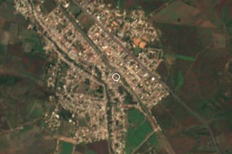


Drive times by road from OpenStreetMap, without traffic. Times marked ~ are estimated from the straight-line distance.
Location from OpenStreetMap. Written by Puebloteca.