Town Peribán, Michoacán Meseta Purépecha
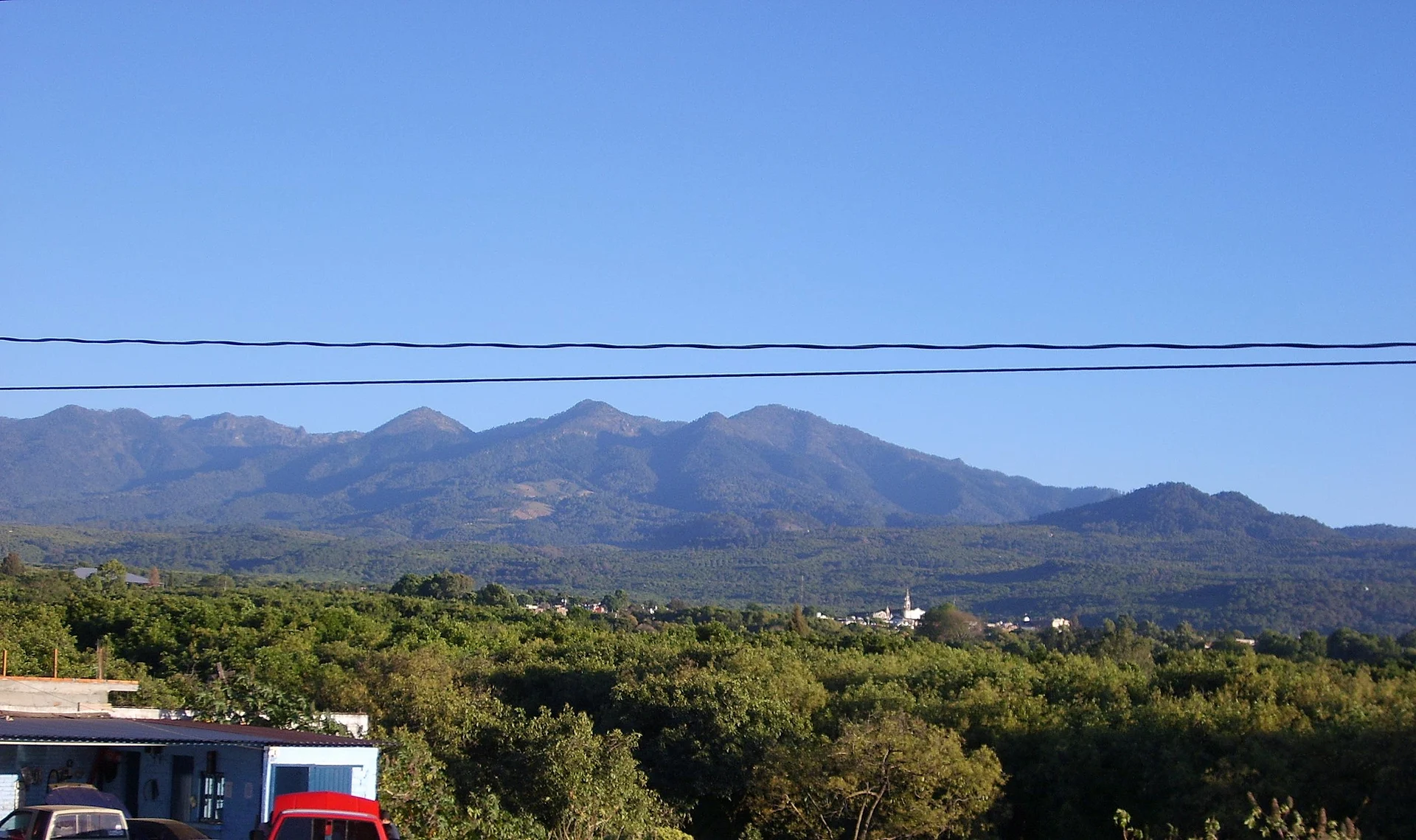
An avocado town at 1,640 m below the Tancítaro range, known for lacquered trays and its Palm Sunday fair. 9 km from Los Reyes.
From Uruapan: about 50 min by road (~55 km) How to get there ↓
Near here
See everything nearby ↓


Plan your visit to Peribán de Ramos
Where to stay near Peribán de Ramos
Compare hotels, posadas and guest houses in Peribán de Ramos.
Tours to Peribán de Ramos
Day trips around Cotija sometimes stop in Peribán de Ramos; a tour is the easy way to see it without a car.
How to get to Peribán de Ramos
- From Uruapan: about 50 min by road (~55 km)
- Nearest airport: Uruapan (UPN), 2 h 5 min by car to Cotija
Links open a partner site. We may earn a commission if you book, at no cost to you.
About Peribán de Ramos
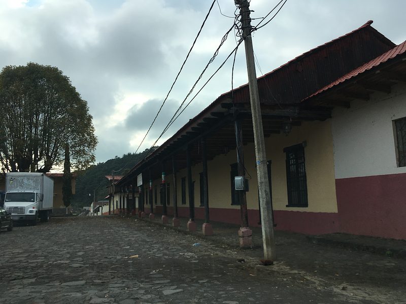
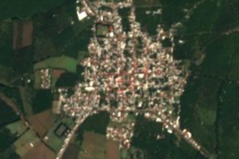
Peribán de Ramos is the seat of Peribán municipality in western Michoacán, on the Jalisco line and 9 kilometres from Los Reyes. It sits at about 1,640 metres on the western slope of the Tancítaro range, and had 17,291 people in 2020. The name comes from Cuitlatec and means "place where they spin thread"; "de Ramos" was added on January 18, 1862, when it was made a villa, because its main feast is Palm Sunday.
Fray Jacobo Daciano, a Franciscan who reached western Michoacán in 1541, brought Christianity here. In 1765 the parish of Peribán counted 145 Spanish and mestizo families and 71 Indigenous ones, and took in the town of Los Reyes plus a dozen haciendas and sugar mills. It was a subdivision of Los Reyes until April 10, 1868, when it became a municipality. Marcos Méndez, a Maderista revolutionary who died in 1912, was born here.
Peribán gave its name to a craft: peribanas, large lacquered wooden trays and gourd bowls finished in gold, made by incising a design and filling it with coloured lacquer, a technique now held in collections such as LACMA's. Today the town lives on avocados, with several packing plants that export; on November 20, 2022, at its avocado fair, more than 300 people made a 4,972 kg guacamole that set a Guinness record. Local cooking runs to guacamole, avocado salsa and avocado ice cream.
How to get to Peribán de Ramos
Peribán lies in western Michoacán, 9 km south of Los Reyes de Salgado. The nearest Pueblo Mágico by road is Cotija, 1 h 5 min away (56 km by road). From Apatzingán it is 1 h 20 min and 78 km by road, skirting the Tancítaro range. Morelia is about 180 km away. The US State Department rates Michoacán "Do not travel", and the UK government advises against all but essential travel to the state except Morelia, Pátzcuaro and highway 15D; Peribán is outside those exceptions, so travel by day and ask locally before you go.
Directions to Peribán de Ramos on Google Maps
Distances are in a straight line; the road is usually longer.
Links open a partner site. We may earn a commission if you book, at no cost to you.
From the nearest cities to Peribán de Ramos
- Uruapan · about 55 km by road, ~50 min
- Apatzingán · about 60 km by road, ~55 min
- Zamora · about 75 km by road, ~1 h 5 min
Drive times by road from OpenStreetMap, without traffic or stops. Times marked ~ are estimated from the straight-line distance.
Before you go to Peribán de Ramos: hours, prices and tips
- Best season
- Palm Sunday Fair (movable date, start of Holy Week); San Francisco Peribán fiesta on October 4. Enciclopedia de los Municipios (INAFED) · checked Oct 2026
Hours and prices change, especially around holidays. Each fact links to where we checked it.
Visiting Peribán de Ramos: what to see and do
The Palm Sunday Fair, the town's big feast, each year at the start of Holy Week.
The patron-saint fiesta of San Francisco Peribán on October 4, 6 km from town.
Look for peribanas, lacquered wooden trays with gold finishes.
Try avocado ice cream and avocado salsa.
Take in the Tancítaro range and its peak from the orchards around town.
The municipality's springs, such as Puentecillas, Carichi, Chinácuaro and Cutio.
Plan your trip
Places to stay in Peribán de Ramos
Compare hotels, posadas, and rentals in and around Peribán de Ramos.
Tours & activities
Day trips around Cotija sometimes stop in Peribán de Ramos; a tour is the easy way to see it without a car.
Rental cars
Pick up a car at UPN (Uruapan): about 2 h 5 min by road to Cotija, then 44 km more to Peribán de Ramos, on your own schedule.
Flights
The nearest airport with scheduled flights is Uruapan (UPN), about 2 h 5 min by road from Cotija, the base for Peribán de Ramos.
Mobile data
Signal can drop away from Cotija: download a map of the way to Peribán de Ramos before you set out, or carry an eSIM with data.
Links open a partner site. We may earn a commission if you book, at no cost to you.
When to go to Peribán de Ramos mild
Peribán de Ramos shares the climate of Cotija, 44 km away. The best months to visit are January, March, April, and November.
See the month-by-month climate of Cotija
Weather in Peribán de Ramos now and the next 7 days
Live forecast from Open-Meteo. Chance of rain is the day's highest.
The closest Pueblo Mágico: Cotija

Cotija is the Pueblo Mágico closest to Peribán de Ramos, with places to stay, food, and more to see.
Also close to
Closest to Peribán de Ramos
-
Chorros del Varal · Waterfall · 12 km away
-
Zacán · Town · 19 km away
-
Tancítaro · Town · 20 km away
-
Volcán Paricutín · Mountain · 21 km away
-
Templo de San Juan Parangaricutiro · Landmark · 22 km away
-
Tocumbo · Town · 24 km away
-
Angahuan · Town · 25 km away
-
Buenavista Tomatlán · Village · 34 km away


Near Peribán de Ramos


Drive times by road from OpenStreetMap, without traffic. Times marked ~ are estimated from the straight-line distance.
Location from OpenStreetMap. Written by Puebloteca.