

Nature reserve Santa María Huatulco, Oaxaca Municipality of Santa María Huatulco Oaxaca Coast
The main river of the Huatulco coast, running from the Sierra Sur to La Bocana, with rafting from family floats to class IV rapids.
From Salina Cruz: 1 h 35 min by car (129 km by road) How to get there ↓
Near here
See everything nearby ↓


Plan your visit to Río Copalita
Where to stay near Río Copalita
Compare hotels, posadas and guest houses in Río Copalita.
Tours to Río Copalita
Day trips and guided outings from Mazunte often include Río Copalita; with a local guide you can get there without a car.
 Tours from Huatulco
Tour to Copalitilla Magical Waterfalls from Huatulco with admission included
★ 4.9 (414) · From US$55
How to get to Río Copalita
- From Salina Cruz: about 1 h 35 min by road (~129 km)
- Nearest airport: Huatulco (HUX), 44 min by car to Mazunte
Links open a partner site. We may earn a commission if you book, at no cost to you.
Tours from Huatulco, near Río Copalita


Tours, prices and ratings from Viator, checked weekly. We may earn a commission if you book.
About Río Copalita
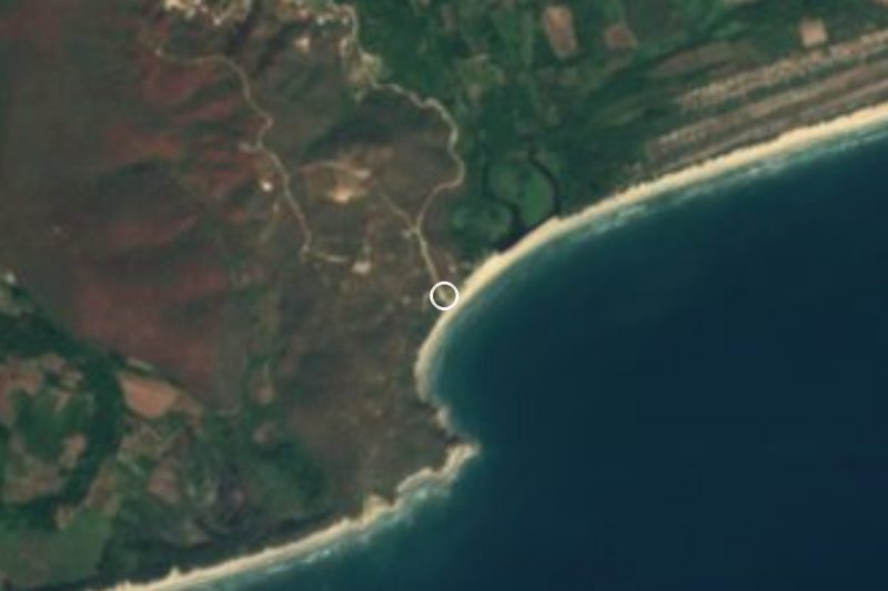
The Copalita is the main river of the Huatulco coast. Its basin begins high in the Sierra Madre del Sur, at about 3,350 m, and the wider Copalita–Huatulco watershed covers some 2,366 km² across 19 municipalities. Along the way it passes below the coffee country of Pluma Hidalgo, whose cloud-forest farms are fed by its streams, and picks up side rivers such as the Copalitilla, home of the Cascadas Mágicas. It reaches the Pacific at La Bocana, just east of Huatulco's Tangolunda bay, beside the Copalita archaeological park.
In its lower course the river marks the line between Santa María Huatulco and San Miguel del Puerto. Federal Highway 200 crosses it at the village of Copalita, and just downstream lies Barra de Copalita, where families come down to the banks on weekends for a swim, a meal of seafood at the riverside restaurants, a horse ride or a bit of fishing. Access to the water there is free.
The Copalita is best known for rafting. Huatulco outfitters run several stretches: the gentle lower river ending at La Bocana is used for family floats with bird watching; the Zimatán and Las Hamacas sections offer class II and III rapids; and La Alemania, on the upper river, packs some 60 class III–IV rapids and is run when water is high, roughly from autumn into winter. A typical half-day trip covers 8 to 11 km in about three hours, needs no experience, and includes transport and a light meal. Two-day expeditions with a riverside camp are also offered.
How to get to Río Copalita
Drive from Salina Cruz: 1 h 35 min, 129 km
The river is about 20 minutes east of La Crucecita. For the banks at Barra de Copalita, take Boulevard Benito Juárez toward Barra de Copalita by car, or a colectivo taxi from La Crucecita (about 20 minutes). Federal Highway 200 crosses the river at Copalita, and La Bocana, at the mouth, is reached along the coastal boulevard from Tangolunda. Rafting outfitters pick up at Huatulco hotels and drive to the put-in for each section; the upper sections are about an hour inland.
Directions to Río Copalita on Google Maps
Distances are in a straight line; the road is usually longer.
Links open a partner site. We may earn a commission if you book, at no cost to you.
From the nearest cities to Río Copalita
- Salina Cruz · 129 km by road, 1 h 35 min
- Juchitán · 171 km by road, 2 h 10 min
- Oaxaca · 289 km by road, 4 h 5 min
Drive times by road from OpenStreetMap, without traffic or stops. Times marked ~ are estimated from the straight-line distance.
Before you go to Río Copalita: hours, prices and tips
- Entry
- Going down to the river at Barra de Copalita is free; rafting is paid separately to the outfitter. BahiasdeHuatulco.org · checked Oct 2026
- Time needed
- A standard rafting trip covers 8–11 km in about three hours, class I–III, with no experience needed; pickup, gear, guide and a light meal are included. Viva Huatulco · checked Oct 2026
- Guide or tour
- Rafting is done only with an outfitter's certified guides. Tours: Viator GetYourGuide Viva Huatulco · checked Oct 2026
- What to bring
- Swimsuit, river shoes or sandals that strap on, and biodegradable sunscreen. Rafting is not advised during pregnancy or with recent injuries. Viva Huatulco · checked Oct 2026
Hours and prices change, especially around holidays. Each fact links to where we checked it.
Visiting Río Copalita: what to see and do
Raft the lower river on a family float that ends at La Bocana.
Take on the class II–III rapids of the Las Hamacas section.
Run the 60 rapids of La Alemania when the river is high.
Swim and eat seafood on the banks at Barra de Copalita.
Watch the river meet the sea at La Bocana beach.
Pair it with the Copalita archaeological park at the river mouth.
Plan your trip
Places to stay in Río Copalita
Compare hotels, posadas, and rentals in and around Río Copalita.
Tours & activities
Day trips and guided outings from Mazunte often include Río Copalita; with a local guide you can get there without a car.
Rental cars
Pick up a car at HUX (Huatulco): about 44 min by road to Mazunte, then 55 km more to Río Copalita, on your own schedule.
Flights
The nearest airport with scheduled flights is Huatulco (HUX), about 44 min by road from Mazunte, the base for Río Copalita.
Travel insurance
If you plan on hiking at Río Copalita, check that your policy covers it: some plans leave adventure activities out.
Mobile data
Signal can drop away from Mazunte: download a map of the way to Río Copalita before you set out, or carry an eSIM with data.
Links open a partner site. We may earn a commission if you book, at no cost to you.
When to go to Río Copalita warm
Río Copalita shares the climate of Mazunte, 55 km away. The best months to visit are January, February, November, and December.
See the month-by-month climate of Mazunte
Weather in Río Copalita now and the next 7 days
Live forecast from Open-Meteo. Chance of rain is the day's highest.
The closest Pueblo Mágico: Mazunte

Mazunte is the Pueblo Mágico closest to Río Copalita, with places to stay, food, and more to see.
Closest to Río Copalita
-
Parque Eco-Arqueológico Copalita · Archaeological site · 3 km away
-
Bahía de Tangolunda · Beach · 6 km away
-
Bahía de Chahué · Beach · 9 km away
-
Bahía de Santa Cruz · Beach · 10 km away
-
La Crucecita · Town · 10 km away
-
Barra de la Cruz · Beach · 11 km away
-
Playa La Entrega · Beach · 11 km away
-
Bahía El Órgano · Beach · 12 km away


Near Río Copalita






Drive times by road from OpenStreetMap, without traffic. Times marked ~ are estimated from the straight-line distance.
Lists with Río Copalita
Nature Parks in Oaxaca · 8 Nature Parks near Mazunte · 4Location from OpenStreetMap. Written by Puebloteca.