

Town Santa María Tonameca, Oaxaca Municipality of Santa María Tonameca Oaxaca Coast
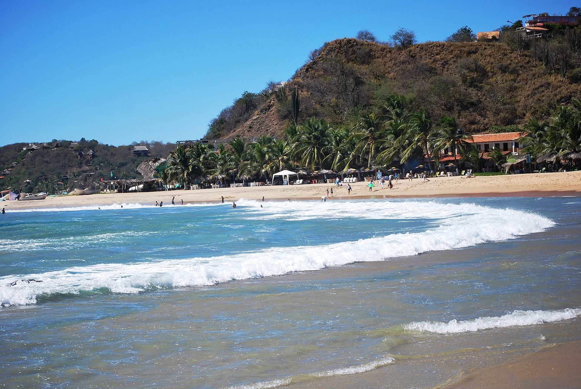
Mazunte's next-door village: a short strip of beach with gentle waves for bodyboarding and relaxed seafood restaurants.
From Salina Cruz: 2 h 35 min by car (199 km by road) How to get there ↓
Near here



Plan your visit to San Agustinillo
Tours to San Agustinillo
Day trips around Mazunte sometimes stop in San Agustinillo; a tour is the easy way to see it without a car.
 Tours from Huatulco
Tour to Copalitilla Magical Waterfalls from Huatulco with admission included
★ 4.9 (414) · From US$55
How to get to San Agustinillo
- From Salina Cruz: about 2 h 35 min by road (~199 km)
- 1 km east of Mazunte
- Nearest airport: Huatulco (HUX), 44 min by car to Mazunte
Links open a partner site. We may earn a commission if you book, at no cost to you.
Tours from Huatulco, near San Agustinillo


Tours, prices and ratings from Viator, checked weekly. We may earn a commission if you book.
About San Agustinillo
San Agustinillo is the small village on the next bay east of Mazunte, so close that you can walk between them in about twenty minutes. Like Mazunte, it lived from sea turtles until Mexico banned the trade in 1990; turtle hunting on this coast is said to have started here, and the area's turtle slaughterhouse stood nearby. Today the village gets by on small-scale fishing, farming and a gentle kind of tourism.
Its beach is about 1.3 kilometers of golden sand facing the open Pacific, divided into three sections by rocky points. The western end, Playa Rinconcito, is the most sheltered and the usual choice for a swim; the eastern section, Playa Aragón, has bigger waves and a strong undertow. On calmer days the waves in the middle are popular for bodyboarding and learning to surf.
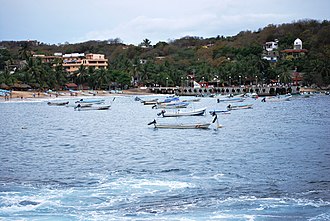
The village is a single strip of small hotels, cabins and seafood restaurants along the road and the sand, quieter than Mazunte and much quieter than Zipolite. From December to April, boats from this coast go out to look for whales, dolphins and turtles.
How to get to San Agustinillo
Drive from Salina Cruz: 2 h 35 min, 199 km
San Agustinillo is about 5 minutes east of Mazunte by car or taxi on the coastal road toward Zipolite and Puerto Ángel, or a 20-minute walk. Colectivos running between Mazunte and Pochutla pass through all day.
1 km east of Mazunte
Directions from Mazunte on Google Maps
Distances are in a straight line; the road is usually longer.
Links open a partner site. We may earn a commission if you book, at no cost to you.
From the nearest cities to San Agustinillo
- Salina Cruz · 199 km by road, 2 h 35 min
- Juchitán · 242 km by road, 3 h 10 min
- Oaxaca · 233 km by road, 3 h 20 min
Drive times by road from OpenStreetMap, without traffic or stops. Times marked ~ are estimated from the straight-line distance.
What to see in San Agustinillo 4
Sights with their own page, closest to the centre first.
Beaches
-
Playa Mermejita · Beach · 2 km from the centre
A long, undeveloped beach just west of Mazunte between Punta Cometa and Punta Ventanilla, known for sunsets and dangerous currents. -
Zipolite · Beach · 3 km from the centre
A long, wild surf beach with a 1970s backpacker spirit, Mexico's best-known clothing-optional beach and big sunsets.
Nature reserves
-
La Ventanilla · Nature reserve · 3 km from the centre
A community-run mangrove lagoon where local guides row you past crocodiles, iguanas and herons.
Viewpoints
-
Punta Cometa · Viewpoint · 2 km from the centre
The rocky headland west of Mazunte, Oaxaca's southernmost point, where a short trail leads to a famous sunset viewpoint.
Map of San Agustinillo
Day trips and tours from San Agustinillo
The closest Pueblos Mágicos and places to visit, with the drive from San Agustinillo and tours that leave from it.



Times marked ~ are estimated from the distance. Links open a partner site. We may earn a commission if you book, at no cost to you.
Before you go: getting to and around San Agustinillo
- The nearest airport is Huatulco (HUX).
- The best months to go are January, February, November, and December.
- Everything on this page is in or close to the centre: walk, or take a short taxi ride.
- For day trips a rental car gives the most freedom; the tours above leave from San Agustinillo.
Before you go to San Agustinillo: hours, prices and tips
- Guide or tour
- Not needed. Ocean Surf School gives surf lessons and rents paddleboards, and local operators such as Pacífico Mágico and Yetlanezy Tours sell boat trips right on the beach with no booking ahead. Tours: Viator GetYourGuide Along Dusty Roads (updated Oct 2025) · checked Oct 2026
- What to bring
- A flashlight or charged phone if you walk back over the hill from Mazunte at night. Restaurants close early, with little open after 9 pm. Along Dusty Roads (updated Oct 2025) · checked Oct 2026
- Rules
- Signs ban nudism on Playa Elefante and the built-up part of San Agustinillo beach, and that usually covers going topless too. Along Dusty Roads (updated Oct 2025) · checked Oct 2026
Hours and prices change, especially around holidays. Each fact links to where we checked it.
Visiting San Agustinillo: what to see and do
Swim at Playa Rinconcito, the sheltered western end of the beach.
Try bodyboarding or a surf lesson in the middle section on a calm day.
Walk the coastal road or the sand to Mazunte for sunset at Punta Cometa.
Go out with a local boat between December and April to look for whales and dolphins.
Plan your trip
Places to stay in San Agustinillo
Buda Tortuga Hotel · ★★★ · 120 m from the center Find on Expedia Un Sueño Cabañas del Pacífico Hotel · ★★★ · 160 m from the center Find on Expedia Punta Placer Hotel · 80 m from the center Find on Expedia Hotel Paraiso del Pescador Hotel · 80 m from the center Find on Expedia Cabañas Juquilita Hotel · 100 m from the center Find on Expedia Bambú Hotel · 200 m from the center Find on ExpediaTours & activities
Day trips around Mazunte sometimes stop in San Agustinillo; a tour is the easy way to see it without a car.
Rental cars
Pick up a car at HUX (Huatulco): about 44 min by road to Mazunte, then 1 km more to San Agustinillo, on your own schedule.
Flights
The nearest airport with scheduled flights is Huatulco (HUX), about 44 min by road from Mazunte, the base for San Agustinillo.
Mobile data
Signal can drop away from Mazunte: download a map of the way to San Agustinillo before you set out, or carry an eSIM with data.
Links open a partner site. We may earn a commission if you book, at no cost to you. Hotel names from OpenStreetMap.
Photos
When to go to San Agustinillo warm
San Agustinillo shares the climate of Mazunte, 1 km away. The best months to visit are January, February, November, and December.
See the month-by-month climate of Mazunte
Weather in San Agustinillo now and the next 7 days
Live forecast from Open-Meteo. Chance of rain is the day's highest.
Make Mazunte your base

San Agustinillo is an easy trip from Mazunte, a Pueblo Mágico with places to stay, food, and more to see.
Near San Agustinillo




Drive times by road from OpenStreetMap, without traffic. Times marked ~ are estimated from the straight-line distance.
Something wrong or missing on this page? Suggest a fix or addition
Location from OpenStreetMap. Written by Puebloteca.