

Town Santa María Colotepec, Oaxaca Municipality of Santa María Colotepec Oaxaca Coast
Communal town at 48 m, seat of a coastal municipality reaching Zicatela; its 1880 church is under restoration and its 11 boundary stones date from 1715.
From Oaxaca: 2 h 25 min by car (169 km by road) How to get there ↓
Near here
See everything nearby ↓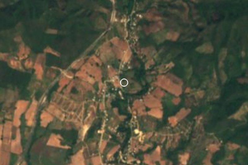


Plan your visit to Santa María Colotepec
Where to stay near Santa María Colotepec
Compare hotels, posadas and guest houses in Santa María Colotepec.
Tours to Santa María Colotepec
Day trips around Mazunte sometimes stop in Santa María Colotepec; a tour is the easy way to see it without a car.
 Tours from Puerto Escondido
Dolphin & Whale Watching in Puerto Escondido
★ 4.8 (362) · From US$61
How to get to Santa María Colotepec
- From Oaxaca: about 2 h 25 min by road (~169 km)
- Nearest airport: Huatulco (HUX), 44 min by car to Mazunte
Links open a partner site. We may earn a commission if you book, at no cost to you.
Tours from Puerto Escondido, near Santa María Colotepec


Tours, prices and ratings from Viator, checked weekly. We may earn a commission if you book.
About Santa María Colotepec
Colotepec is the inland town that gives its name to the municipality where Zicatela, Puerto Escondido's famous surf beach, lies. The seat is small (1,539 people in 2020, at 48 m above sea level), while the coast holds the crowds: Brisas de Zicatela has 10,632 and the whole municipality adds up to more than 27,000 people in 68 localities, across about 416 km² between the Pacific and the sierra.
Its documented history starts with a land title of 1714, which the community counts as its founding; before that the Zapotec speakers of the area were subject to the Mixtecs of Tututepec. The boundaries were fixed in 1715 with eleven boundary stones, and every 5 May the comuneros, about 2,000 of them, walk and clear the line. One stone stands in the old cemetery by the Puerto Escondido lighthouse, on the western edge. The old church went up in 1880 and is being restored. Saint's-day fiestas usually run three or four days, with fireworks, a castillo, a jaripeo rodeo and cockfights.
The landscape is low forest (more than half the territory), farming on a third, some mangrove and dunes, and rivers crossing the municipality: Colotepec, Valdeflores, Aguacate, Corozal and more. It is hot all year (24 to 28 °C) with 800 to 2,000 mm of rain, mostly in summer, and floods in the rainy season. The town council is chosen by customary law and changes every three years.
How to get to Santa María Colotepec
Drive from Oaxaca: 2 h 25 min, 169 km
Colotepec is on Oaxaca's coast beside Puerto Escondido, along federal highway 200, which runs the length of the Pacific. From Puerto Escondido, the seat and the Zicatela area are about 10 minutes by car (approx.). From the city of Oaxaca the route is the Oaxaca to Puerto Escondido road, about 131 km as the crow flies and considerably more by mountain road; a motorway under construction is expected to cut the trip to about 2.5 hours.
We could not find published colectivo or bus schedules to the town itself. The usual way is to reach Puerto Escondido (by bus or plane) and take a taxi or a route pickup to the seat.
Directions to Santa María Colotepec on Google Maps
Distances are in a straight line; the road is usually longer.
Links open a partner site. We may earn a commission if you book, at no cost to you.
From the nearest cities to Santa María Colotepec
- Oaxaca · 169 km by road, 2 h 25 min
- Salina Cruz · 254 km by road, 3 h 20 min
- Juchitán · 296 km by road, 4 h
Drive times by road from OpenStreetMap, without traffic or stops. Times marked ~ are estimated from the straight-line distance.
Before you go to Santa María Colotepec: hours, prices and tips
- Best season
- Every 5 May the comuneros of Colotepec clear the municipality's boundary line. Viva Puerto: Santa María Colotepec · checked Oct 2026
Hours and prices change, especially around holidays. Each fact links to where we checked it.
Visiting Santa María Colotepec: what to see and do
See the white church of 1880, now under restoration.
Stroll the plaza and centre of the seat, away from the bustle of Zicatela.
Look for the boundary stone in the old cemetery by the Puerto Escondido lighthouse.
Come on a saint's-day fiesta: fireworks, castillo, jaripeo and cockfights.
Ride a bike across the Colotepec river and the farmland around.
Go on to Zicatela, a few minutes away, to watch the surf.
Plan your trip
Places to stay in Santa María Colotepec
Compare hotels, posadas, and rentals in and around Santa María Colotepec.
Tours & activities
Day trips around Mazunte sometimes stop in Santa María Colotepec; a tour is the easy way to see it without a car.
Rental cars
Pick up a car at HUX (Huatulco): about 44 min by road to Mazunte, then 48 km more to Santa María Colotepec, on your own schedule.
Flights
The nearest airport with scheduled flights is Huatulco (HUX), about 44 min by road from Mazunte, the base for Santa María Colotepec.
Mobile data
Signal can drop away from Mazunte: download a map of the way to Santa María Colotepec before you set out, or carry an eSIM with data.
Links open a partner site. We may earn a commission if you book, at no cost to you.
When to go to Santa María Colotepec warm
Santa María Colotepec shares the climate of Mazunte, 48 km away. The best months to visit are January, February, November, and December.
See the month-by-month climate of Mazunte
Weather in Santa María Colotepec now and the next 7 days
Live forecast from Open-Meteo. Chance of rain is the day's highest.
The closest Pueblo Mágico: Mazunte

Mazunte is the Pueblo Mágico closest to Santa María Colotepec, with places to stay, food, and more to see.
Also close to
- Juquila · Oaxaca · 53 km away
Closest to Santa María Colotepec
-
Ventanilla · Village · 9 km away
-
Cascada de la Reforma · Waterfall · 11 km away
-
La Punta (Playa Zicatela) · Beach · 14 km away
-
Playa Zicatela · Beach · 14 km away
-
Playa Puerto Angelito · Beach · 15 km away
-
Puerto Escondido · Town · 15 km away
-
Playa Carrizalillo · Beach · 16 km away
-
Playa Bacocho · Beach · 17 km away


Near Santa María Colotepec


Drive times by road from OpenStreetMap, without traffic. Times marked ~ are estimated from the straight-line distance.
Location from OpenStreetMap. Written by Puebloteca.