

Beach Santa María Huatulco, Oaxaca Municipality of Santa María Huatulco Oaxaca Coast
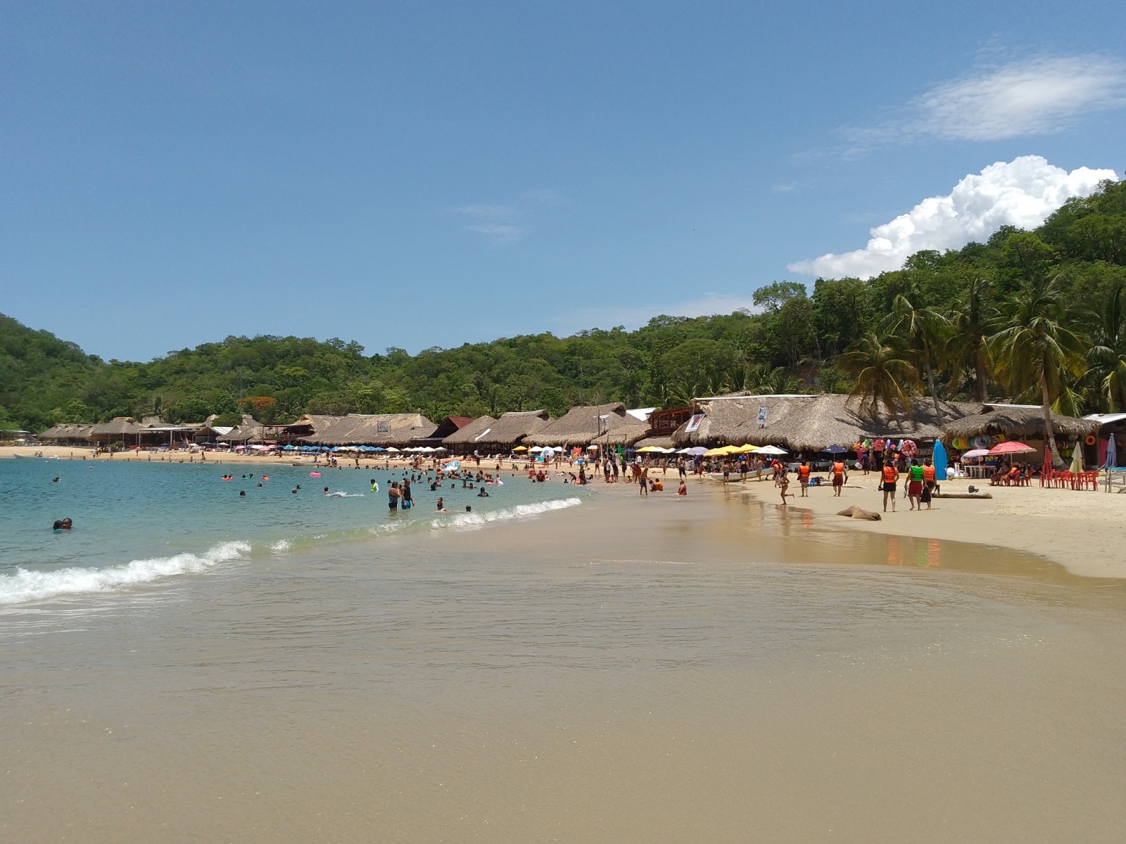
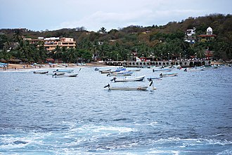
A calm, sheltered bay in Huatulco National Park with a row of palapa seafood restaurants and snorkelling off the rocks.
From Salina Cruz: 1 h 55 min by car (151 km by road) How to get there ↓
Near here
See everything nearby ↓


Plan your visit to Bahía El Maguey
Where to stay near Bahía El Maguey
Compare hotels, posadas and guest houses in Bahía El Maguey.
Tours to Bahía El Maguey
Day trips and guided outings from Mazunte often include Bahía El Maguey; with a local guide you can get there without a car.
 Tours from Huatulco
Tour to Copalitilla Magical Waterfalls from Huatulco with admission included
★ 4.9 (414) · From US$55
How to get to Bahía El Maguey
- From Salina Cruz: about 1 h 55 min by road (~151 km)
- Nearest airport: Huatulco (HUX), 44 min by car to Mazunte
Links open a partner site. We may earn a commission if you book, at no cost to you.
Tours from Huatulco, near Bahía El Maguey


Tours, prices and ratings from Viator, checked weekly. We may earn a commission if you book.
About Bahía El Maguey
El Maguey is a small, sheltered bay about 3 km west of Santa Cruz, inside Huatulco National Park, in the municipality of Santa María Huatulco. The beach is roughly 500 m long and 25 to 50 m wide, with fine pale sand and clear green-blue water. Its calm sea makes it one of the busiest bays in Huatulco and the easiest of the park's beaches to reach, since a paved road runs right down to it.
The national park, decreed on 24 July 1998, protects about 6,375 hectares of dry lowland forest and 5,516 hectares of sea, and includes the bays of Maguey, Órgano, Cacaluta, Chachacual and San Agustín. Maguey is the only one of these with a full row of services: a dozen or more family-run palapas line the sand serving fresh fish and seafood, and boat tours of the bays often stop here for lunch.
The best snorkelling is around the rocks on the east side of the bay, and gear can be rented on the beach. Much of Huatulco's coral died in the 2023 marine heatwave, but there are still plenty of fish. A trail starting from the road above the bay leads to the undeveloped beach of El Órgano next door, and the turn-off for the walk to Cacaluta is just before Maguey.
How to get to Bahía El Maguey
Drive from Salina Cruz: 1 h 55 min, 151 km
Maguey is about 3 km west of Santa Cruz by a paved road, and there is a sidewalk along it if you want to walk. There is no regular bus, but taxis wait at the car park at the bottom and you may find a colectivo taxi back to town at some hours. Shared and private boat tours from the Santa Cruz pier also stop here.
Directions to Bahía El Maguey on Google Maps
Distances are in a straight line; the road is usually longer.
Links open a partner site. We may earn a commission if you book, at no cost to you.
From the nearest cities to Bahía El Maguey
- Salina Cruz · 151 km by road, 1 h 55 min
- Juchitán · 193 km by road, 2 h 35 min
- Oaxaca · 285 km by road, 4 h 10 min
Drive times by road from OpenStreetMap, without traffic or stops. Times marked ~ are estimated from the straight-line distance.
Before you go to Bahía El Maguey: hours, prices and tips
- What to bring
- Snorkel gear can be rented on the beach; the best spot is the rocks on the east side. Lonely Planet · checked Oct 2026
Hours and prices change, especially around holidays. Each fact links to where we checked it.
Visiting Bahía El Maguey: what to see and do
Swim in the calm water of the bay.
Snorkel around the rocks on the east side.
Eat fresh fish or seafood at one of the beach palapas.
Walk the forest trail to El Órgano, the next bay east.
Combine it with a boat tour of the national park bays.
Plan your trip
Places to stay in Bahía El Maguey
Compare hotels, posadas, and rentals in and around Bahía El Maguey.
Tours & activities
Day trips and guided outings from Mazunte often include Bahía El Maguey; with a local guide you can get there without a car.
Rental cars
Pick up a car at HUX (Huatulco): about 44 min by road to Mazunte, then 44 km more to Bahía El Maguey, on your own schedule.
Flights
The nearest airport with scheduled flights is Huatulco (HUX), about 44 min by road from Mazunte, the base for Bahía El Maguey.
Travel insurance
If you plan on swimming or surfing at Bahía El Maguey, check that your policy covers it: some plans leave adventure activities out.
Mobile data
Signal can drop away from Mazunte: download a map of the way to Bahía El Maguey before you set out, or carry an eSIM with data.
Links open a partner site. We may earn a commission if you book, at no cost to you.
Photos
When to go to Bahía El Maguey warm
Bahía El Maguey shares the climate of Mazunte, 44 km away. The best months to visit are January, February, November, and December.
Bahía El Maguey is best for swimming and time on the water in the warmest months (March, April, and May); in the rainiest ones (June, August, and September) expect storms in the afternoon.
See the month-by-month climate of Mazunte
Weather in Bahía El Maguey now and the next 7 days
Live forecast from Open-Meteo. Chance of rain is the day's highest.
The closest Pueblo Mágico: Mazunte

Mazunte is the Pueblo Mágico closest to Bahía El Maguey, with places to stay, food, and more to see.
Closest to Bahía El Maguey
-
Bahía El Órgano · Beach · 1 km away
-
Bahía de Cacaluta · Beach · 1 km away
-
Bahía de Santa Cruz · Beach · 3 km away
-
Parque Nacional Huatulco · Nature reserve · 3 km away
-
Playa La Entrega · Beach · 3 km away
-
Bahía de Chahué · Beach · 4 km away
-
La Crucecita · Town · 4 km away
-
Bahías de Huatulco · Nature reserve · 5 km away


Near Bahía El Maguey





Drive times by road from OpenStreetMap, without traffic. Times marked ~ are estimated from the straight-line distance.
Lists with Bahía El Maguey
Beaches in Oaxaca · 19 Beaches near Mazunte · 16Location from OpenStreetMap. Written by Puebloteca.