

Town San Bartolo Coyotepec, Oaxaca Central Valleys of Oaxaca
The Zapotec town of barro negro, Oaxaca's shiny black pottery, 11 km south of the city, with Doña Rosa's workshop and the state folk art museum.
From Oaxaca: 15 min by car (12 km by road) How to get there ↓
Near here
See everything nearby ↓


Plan your visit to San Bartolo Coyotepec
Where to stay near San Bartolo Coyotepec
Compare hotels, posadas and guest houses in San Bartolo Coyotepec.
Tours to San Bartolo Coyotepec
Day trips around Mitla sometimes stop in San Bartolo Coyotepec; a tour is the easy way to see it without a car.
 Black Mud Workshop in San Bartolo Coyotepec
★ 5.0 (2) · From US$270
How to get to San Bartolo Coyotepec
- From Oaxaca: about 15 min by road (~12 km)
- Nearest airport: Oaxaca (OAX), 47 min by car to Mitla
Links open a partner site. We may earn a commission if you book, at no cost to you.
Popular tours to San Bartolo Coyotepec


Tours, prices and ratings from Viator, checked weekly. We may earn a commission if you book.
About San Bartolo Coyotepec
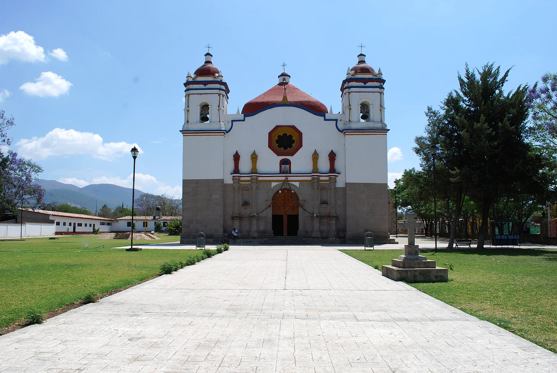
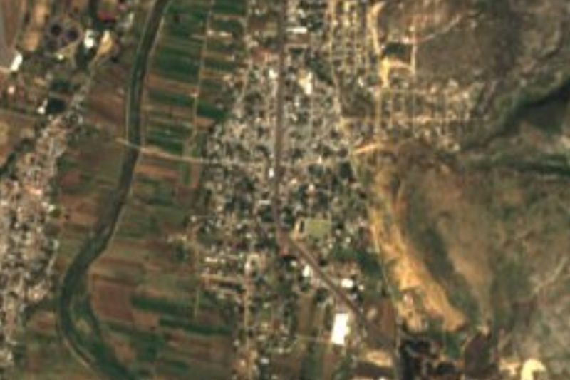
San Bartolo Coyotepec is a Zapotec town about 11 km south of Oaxaca city on Highway 175, the road to Ocotlán and the coast, and today it sits at the southern edge of the metropolitan area. Its Zapotec name, Tzabeche, is usually read as "place of many tigers" (the wild cats were ocelots), while Coyotepec is Nahuatl for "hill of the coyotes". After the conquest the Spanish called it San Bartolomé, and the parish church facing the main square, painted white with red domes, is still dedicated to Saint Bartholomew.
The town is known across Mexico for barro negro, the black pottery of the Central Valleys. Potters here have worked the local grey clay since the Monte Albán era, some 2,500 years ago, and for most of that time the pieces were matte, sturdy jars for carrying and storing water. In the 1950s Doña Rosa Real Mateo de Nieto (1900–1980) began burnishing her pots with a quartz stone before they were fully dry and firing them a little cooler, which gives the clay its metallic black shine. The shiny pieces are more fragile but became a collectors' favourite, and the whole town followed her lead. Several hundred families still make pottery, firing it in wood-fuelled pit or brick kilns.
Visitors come mainly to watch and buy. Doña Rosa's family still runs her workshop in the family home, demonstrating how a pot is shaped, polished and fired and selling from shelves around the courtyard, and many other family workshops line the streets. A crafts market by the church sells candelabras, vases, animal figures and engraved skulls, which are in high demand before the Day of the Dead. On the south side of the square, the Museo Estatal de Arte Popular de Oaxaca (MEAPO), opened by the state in 2004 and directed by barro negro artist Carlomagno Pedro Martínez, has a hall on the history of the town's pottery plus rooms of folk art from across Oaxaca and temporary shows.
How to get to San Bartolo Coyotepec
Drive from Oaxaca: 15 min, 12 km
San Bartolo Coyotepec is about 11 km south of Oaxaca city on Highway 175 toward Ocotlán and Puerto Ángel, a 20 to 30 minute drive past the airport. Shared taxis (colectivos) and buses for San Bartolo and Ocotlán leave from stands around the Central de Abastos market; colectivos go when full and show their destination on the windshield. It makes an easy first stop on a day along the craft villages of the Ocotlán road.
Directions to San Bartolo Coyotepec on Google Maps
Distances are in a straight line; the road is usually longer.
Links open a partner site. We may earn a commission if you book, at no cost to you.
From the nearest cities to San Bartolo Coyotepec
- Oaxaca · 12 km by road, 15 min
- Huajuapan de León · 183 km by road, 2 h 35 min
- Tuxtepec · about 180 km by road, ~2 h 40 min
Drive times by road from OpenStreetMap, without traffic or stops. Times marked ~ are estimated from the straight-line distance.
Before you go to San Bartolo Coyotepec: hours, prices and tips
- Best season
- Engraved black clay skulls and candelabras are most in demand in the weeks before the Day of the Dead (1–2 November). National Geographic (2021) · checked Oct 2026
- Guide or tour
- No guide needed: Doña Rosa's family and other workshops show visitors how pieces are polished and fired. Wikipedia, Doña Rosa · checked Oct 2026
Hours and prices change, especially around holidays. Each fact links to where we checked it.
Visiting San Bartolo Coyotepec: what to see and do
Watch a barro negro demonstration at Doña Rosa's family workshop.
Browse the crafts market beside the parish church.
Visit the Museo Estatal de Arte Popular de Oaxaca on the main square.
Step into the Church of San Bartolomé on the plaza.
Walk the side streets to find smaller family workshops and kilns.
Pick up engraved black clay skulls and candelabras before the Day of the Dead.
Plan your trip
Places to stay in San Bartolo Coyotepec
Compare hotels, posadas, and rentals in and around San Bartolo Coyotepec.
Tours & activities
Day trips around Mitla sometimes stop in San Bartolo Coyotepec; a tour is the easy way to see it without a car.
Rental cars
Pick up a car at OAX (Oaxaca): about 47 min by road to Mitla, then 36 km more to San Bartolo Coyotepec, on your own schedule.
Flights
The nearest airport with scheduled flights is Oaxaca (OAX), about 47 min by road from Mitla, the base for San Bartolo Coyotepec.
Mobile data
Signal can drop away from Mitla: download a map of the way to San Bartolo Coyotepec before you set out, or carry an eSIM with data.
Links open a partner site. We may earn a commission if you book, at no cost to you.
Photos
When to go to San Bartolo Coyotepec mild
San Bartolo Coyotepec shares the climate of Mitla, 36 km away. The best months to visit are January, February, March, and December.
See the month-by-month climate of Mitla
Weather in San Bartolo Coyotepec now and the next 7 days
Live forecast from Open-Meteo. Chance of rain is the day's highest.
The closest Pueblo Mágico: Mitla

Mitla is the Pueblo Mágico closest to San Bartolo Coyotepec, with places to stay, food, and more to see.
Also close to
- Capulálpam de Méndez · Oaxaca · 47 km away
Closest to San Bartolo Coyotepec
-
San Juan Bautista la Raya · Town · 4 km away
-
Ánimas Trujano · Town · 4 km away
-
Villa de Zaachila · Town · 5 km away
-
San Antonio de la Cal · Town · 8 km away
-
Santa Cruz Xoxocotlán · Town · 8 km away
-
Cuilápam de Guerrero · Town · 9 km away
-
San Sebastián Teitipac · Town · 10 km away
-
Mercado 20 de Noviembre · Landmark · 11 km away


Near San Bartolo Coyotepec


Drive times by road from OpenStreetMap, without traffic. Times marked ~ are estimated from the straight-line distance.
Location from OpenStreetMap. Written by Puebloteca.