
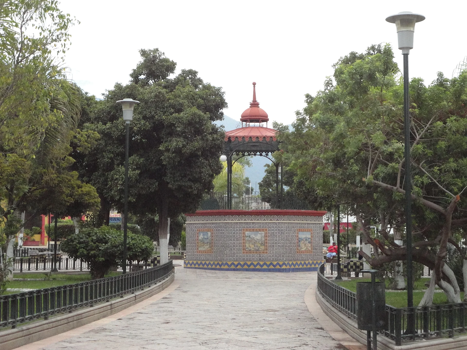
Town Ajalpan, Puebla Municipality of Ajalpan Tehuacán Valley
Town in the Tehuacán valley at the foot of the Sierra Negra, known for its red clay roof tiles and the Señor de Coculco fair in May.
From Tehuacán: 20 min by car (21 km by road) How to get there ↓
Near here
See everything nearby ↓



Plan your visit to Ajalpan
Where to stay near Ajalpan
Compare hotels, posadas and guest houses in Ajalpan.
Tours to Ajalpan
Day trips around Huautla sometimes stop in Ajalpan; a tour is the easy way to see it without a car.
How to get to Ajalpan
- From Tehuacán: about 20 min by road (~21 km)
- Nearest airport: Oaxaca (OAX), 3 h 34 min by car to Huautla
Links open a partner site. We may earn a commission if you book, at no cost to you.
About Ajalpan
Ajalpan is a town in south-eastern Puebla, seat of the municipality of the same name, about 140 km from the state capital. It lies in the desert valley south-east of Tehuacán, between Altepexi and Coxcatlán, where the valley starts climbing toward the Sierra Negra and the Sierra de Zongolica, part of the Sierra Madre Oriental. The Nahuatl name means "on the sand of the water". The municipality, about 395 km², ranges from 1,100 to 2,900 m: cacti and dry tropical forest below, pine and oak forest in the mountains. The Tehuacán or Salado River, one of the rivers that form the Papaloapan, flows through it, along with the Comulco and Zinacastla. The municipality had 60,621 people in 2010.
Ajalpan is known for its red clay roof tiles, so much so that locals joke "Ajalpan da las tejas", Ajalpan makes the tiles. People also weave cotton cloth and reed, and make clay crafts. Prickly pear grows wild all around, and the fruit is eaten or turned into drinks.
The festival calendar is full. On 3 May the Señor de Coculco fair begins, about ten days of dances, rides, sport and charrería. In June the town honours Saint John the Baptist, patron of the main church, and in February the carnival fills the streets with costumed troupes, music and floats. On the Day of the Dead people visit the graves in the morning and in the afternoon walk the streets with baskets of bread, fruit, mole and tamales to take to their compadres.
How to get to Ajalpan
Drive from Tehuacán: 20 min, 21 km
Ajalpan is 22 km by road from Tehuacán, about 20 minutes by car, south-east of the city past Altepexi. Tehuacán in turn is about 2 hours by bus from Puebla's CAPU terminal (ADO and Autobuses Unidos). The state capital is about 140 km away. The nearest Pueblo Mágico is Huautla de Jiménez in Oaxaca, about 51 km away in a straight line, up in the mountains.
Directions to Ajalpan on Google Maps
Distances are in a straight line; the road is usually longer.
Links open a partner site. We may earn a commission if you book, at no cost to you.
From the nearest cities to Ajalpan
- Tehuacán · 21 km by road, 20 min
- Orizaba · 88 km by road, 1 h 25 min
- Huajuapan de León · about 110 km by road, ~1 h 35 min
Drive times by road from OpenStreetMap, without traffic or stops. Times marked ~ are estimated from the straight-line distance.
Before you go to Ajalpan: hours, prices and tips
- Best season
- The Señor de Coculco fair starts on 3 May and lasts about 10 days; carnival is in February and the Saint John the Baptist feast in June. Wikipedia · checked Oct 2026
Hours and prices change, especially around holidays. Each fact links to where we checked it.
Visiting Ajalpan: what to see and do
The main church of Saint John the Baptist and the zócalo.
The Señor de Coculco fair, from 3 May.
The February carnival, with costumed troupes and floats.
The red clay tile workshops and pottery.
The cactus landscape of the valley and the climb toward the Sierra Negra.
Plan your trip
Places to stay in Ajalpan
Compare hotels, posadas, and rentals in and around Ajalpan.
Tours & activities
Day trips around Huautla sometimes stop in Ajalpan; a tour is the easy way to see it without a car.
Rental cars
Pick up a car at OAX (Oaxaca): about 3 h 34 min by road to Huautla, then 51 km more to Ajalpan, on your own schedule.
Flights
The nearest airport with scheduled flights is Oaxaca (OAX), about 3 h 34 min by road from Huautla, the base for Ajalpan.
Mobile data
Signal can drop away from Huautla: download a map of the way to Ajalpan before you set out, or carry an eSIM with data.
Links open a partner site. We may earn a commission if you book, at no cost to you.
When to go to Ajalpan mild
Ajalpan shares the climate of Huautla, 51 km away. The best months to visit are February, March, April, and May.
See the month-by-month climate of Huautla
Weather in Ajalpan now and the next 7 days
Live forecast from Open-Meteo. Chance of rain is the day's highest.
The closest Pueblo Mágico: Huautla

Huautla is the Pueblo Mágico closest to Ajalpan, with places to stay, food, and more to see.
Also close to
- Orizaba · Veracruz · 55 km away
- Córdoba · Veracruz · 67 km away
- Coscomatepec · Veracruz · 80 km away
Closest to Ajalpan
-
Altepexi · Town · 4 km away
-
San Sebastián Zinacatepec · Village · 5 km away
-
San José Miahuatlán · Town · 10 km away
-
San Pablo Tepetzingo · Village · 10 km away
-
San Gabriel Chilac · Town · 11 km away
-
Tehuacán el Viejo (Ndachjian) · Landmark · 12 km away
-
Calipan · Village · 14 km away
-
San Juan Atzingo · Village · 16 km away


Near Ajalpan




Drive times by road from OpenStreetMap, without traffic. Times marked ~ are estimated from the straight-line distance.
Location from OpenStreetMap. Written by Puebloteca.