
Village Tehuacán, Puebla Municipality of Tehuacán Tehuacán Valley
Village in the municipality of Tehuacán, "on the little hill", about 7 km from the city, in the arid valley known as the cradle of maize.
From Tehuacán: 10 min by car (8 km by road) How to get there ↓
Near here
See everything nearby ↓


Plan your visit to San Pablo Tepetzingo
Where to stay near San Pablo Tepetzingo
Compare hotels, posadas and guest houses in San Pablo Tepetzingo.
Tours to San Pablo Tepetzingo
Day trips and guided outings from Orizaba often include San Pablo Tepetzingo; with a local guide you can get there without a car.
How to get to San Pablo Tepetzingo
- From Tehuacán: about 10 min by road (~8 km)
- Nearest airport: Veracruz (VER), 1 h 42 min by car to Orizaba
Links open a partner site. We may earn a commission if you book, at no cost to you.
About San Pablo Tepetzingo
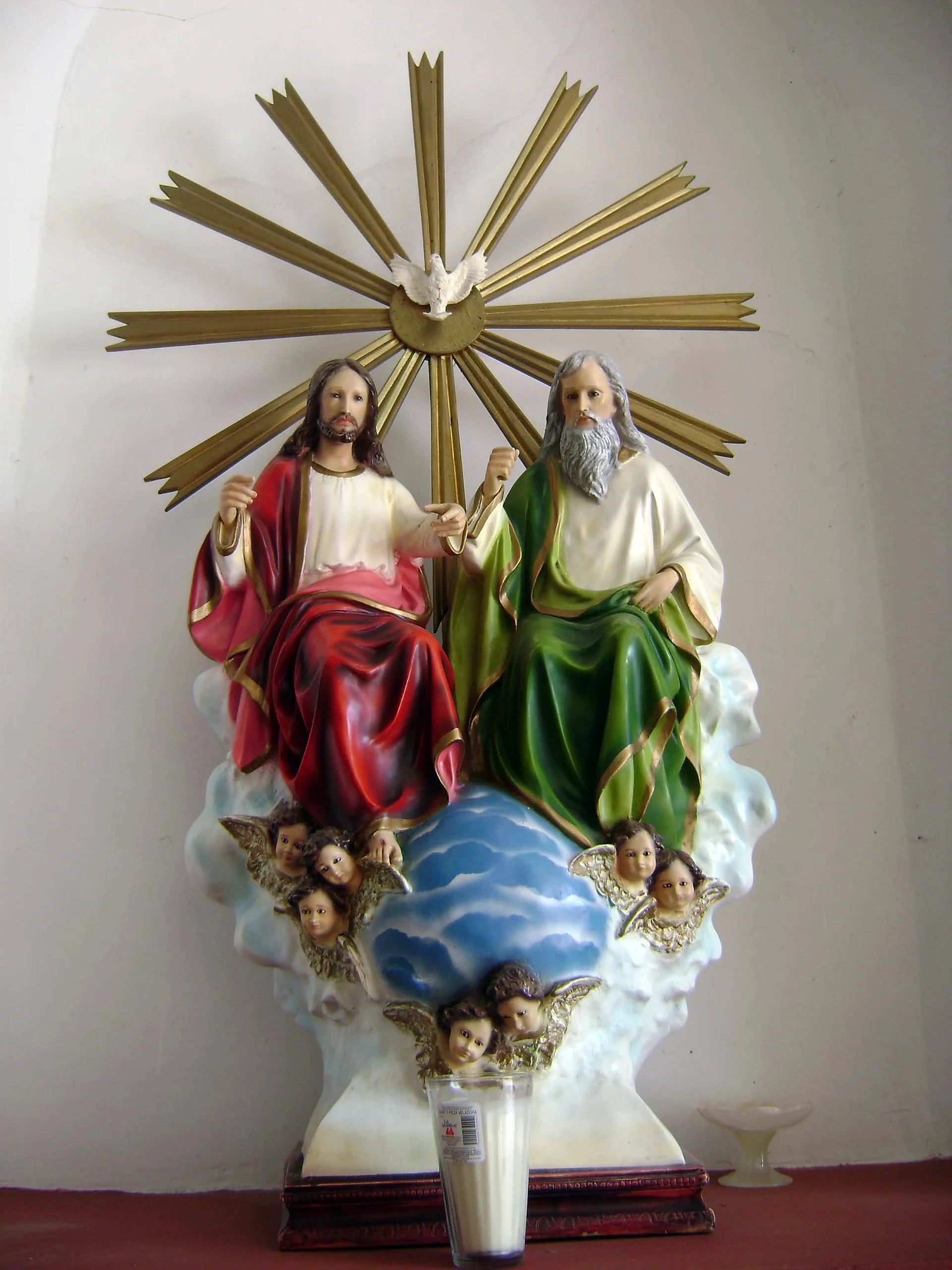
About 7 km from central Tehuacán, San Pablo Tepetzingo is one of the villages ringing Puebla's second city. Its name is Nahuatl: tepetl, hill, tzin, diminutive, and co, place, so "on the little hill"; its patron is Saint Paul. It had 2,785 people in 2020 and stands at about 1,400 m. Its church keeps images such as the small statue of the Holy Trinity in the photo.
The municipality of Tehuacán, with over 327,000 people in 2020, is known as the "cradle of maize" because some of the oldest remains of the crop were found in the Tehuacán-Cuicatlán valley. The landscape is semi-arid: almost 60% of the municipality is scrub, with mesquite and some dry forest, mean temperatures run from 12 to 24 °C, and rain is just 400 to 800 mm a year. Its year-round streams are the Tehuacán, La Huertilla and Zapotitlán rivers, all in the Papaloapan basin, and from underground come the mineral waters that made the city famous.
The region works the pottery of Los Reyes Metzontla, onyx and palm, and in season cooks mole de caderas, the goat stew that marks autumn in Tehuacán.
How to get to San Pablo Tepetzingo
Drive from Tehuacán: 10 min, 8 km
San Pablo Tepetzingo is about 7 km from central Tehuacán. From Puebla's CAPU terminal, ADO and other lines reach Tehuacán in about two hours on highway 150D; local transport and taxis cover the last stretch from the city.
Directions to San Pablo Tepetzingo on Google Maps
Distances are in a straight line; the road is usually longer.
Links open a partner site. We may earn a commission if you book, at no cost to you.
From the nearest cities to San Pablo Tepetzingo
- Tehuacán · 8 km by road, 10 min
- Orizaba · 76 km by road, 1 h 15 min
- Córdoba · 100 km by road, 1 h 30 min
Drive times by road from OpenStreetMap, without traffic or stops. Times marked ~ are estimated from the straight-line distance.
Visiting San Pablo Tepetzingo: what to see and do
The church of San Pablo and its images.
Tehuacán, about 7 km away: the Carmelite convent and the mineral waters.
Mole de caderas, in autumn.
Plan your trip
Places to stay in San Pablo Tepetzingo
Compare hotels, posadas, and rentals in and around San Pablo Tepetzingo.
Tours & activities
Day trips and guided outings from Orizaba often include San Pablo Tepetzingo; with a local guide you can get there without a car.
Rental cars
Pick up a car at VER (Veracruz): about 1 h 42 min by road to Orizaba, then 53 km more to San Pablo Tepetzingo, on your own schedule.
Flights
The nearest airport with scheduled flights is Veracruz (VER), about 1 h 42 min by road from Orizaba, the base for San Pablo Tepetzingo.
Mobile data
Signal can drop away from Orizaba: download a map of the way to San Pablo Tepetzingo before you set out, or carry an eSIM with data.
Links open a partner site. We may earn a commission if you book, at no cost to you.
When to go to San Pablo Tepetzingo mild
San Pablo Tepetzingo shares the climate of Orizaba, 53 km away. The best months to visit are February, March, April, and December.
See the month-by-month climate of Orizaba
Weather in San Pablo Tepetzingo now and the next 7 days
Live forecast from Open-Meteo. Chance of rain is the day's highest.
The closest Pueblo Mágico: Orizaba

Orizaba is the Pueblo Mágico closest to San Pablo Tepetzingo, with places to stay, food, and more to see.
Also close to
- Huautla · Oaxaca · 61 km away
- Córdoba · Veracruz · 67 km away
- Coscomatepec · Veracruz · 78 km away
Closest to San Pablo Tepetzingo
-
Tehuacán el Viejo (Ndachjian) · Landmark · 3 km away
-
Altepexi · Town · 7 km away
-
Museo del Valle de Tehuacán · Landmark · 7 km away
-
Tehuacán · City · 7 km away
-
Ajalpan · Town · 10 km away
-
San Gabriel Chilac · Town · 11 km away
-
San Antonio Texcala · Village · 12 km away
-
San Sebastián Zinacatepec · Village · 14 km away


Near San Pablo Tepetzingo



Drive times by road from OpenStreetMap, without traffic. Times marked ~ are estimated from the straight-line distance.
Location from OpenStreetMap. Written by Puebloteca.