
Town Altepexi, Puebla Tehuacán Valley
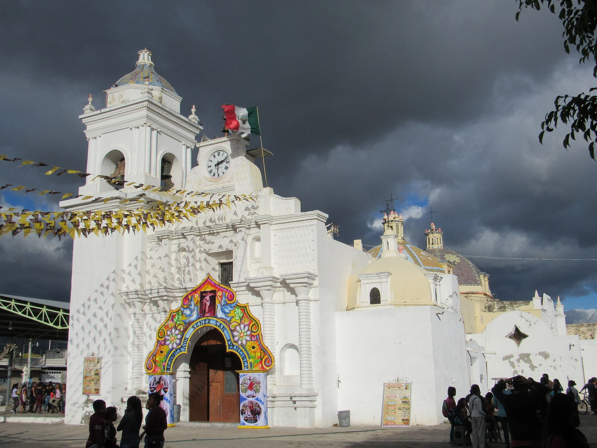
Nahua town in the Tehuacán valley by the Tehuacán River, with a parish church of San Francisco; "water that falls from the hill".
From Tehuacán: 15 min by car (17 km by road) How to get there ↓
Near here
See everything nearby ↓



Plan your visit to Altepexi
Where to stay near Altepexi
Compare hotels, posadas and guest houses in Altepexi.
Tours to Altepexi
Day trips around Huautla sometimes stop in Altepexi; a tour is the easy way to see it without a car.
How to get to Altepexi
- From Tehuacán: about 15 min by road (~17 km)
- Nearest airport: Oaxaca (OAX), 3 h 34 min by car to Huautla
Links open a partner site. We may earn a commission if you book, at no cost to you.
About Altepexi
Altepexi, between Tehuacán and Ajalpan in the heart of the Tehuacán valley, runs its own small municipality in south-eastern Puebla. The Nahuatl name translates as "water that falls from the hill". The 2020 census gave the municipality 22,629 people, and nearly all of them, 21,307, live in the town itself. It borders Tehuacán to the north, Ajalpan to the east, Zinacatepec and San José Miahuatlán to the south and San Gabriel Chilac to the west.
Nahuatl-speaking groups founded the town in the valley; in late colonial times it belonged to the district of Tehuacán, and in 1930 it became a municipality. The parish church is dedicated to Saint Francis of Assisi.
The land is flat, rising slightly to the north-east toward the Sierra Madre Oriental, and the clay soil suits irrigated farming. The Tehuacán River, one of the tributaries of the upper Papaloapan, crosses the north of the municipality, its banks lined with mesquite. To the west rises a mesa crossed by two water channels. The climate is semi-warm and dry, more arid to the south, where desert scrub grows and goats are raised. Plants include the valley's cacti, ponytail palm, prickly pear, reed, mesquite and pitaya; animals include coyotes, rabbits, bats and birds such as the Tehuacán dove.
How to get to Altepexi
Drive from Tehuacán: 15 min, 17 km
Altepexi lies south-east of Tehuacán, about 14 km in a straight line, roughly 15 to 20 minutes by car, on the way from Tehuacán to Ajalpan. ADO and Autobuses Unidos buses from Puebla's CAPU terminal take about two hours to Tehuacán; from there continue by car. The state capital is about 121 km away as the crow flies. The nearest Pueblo Mágico is Huautla de Jiménez in Oaxaca, about 54 km away.
Directions to Altepexi on Google Maps
Distances are in a straight line; the road is usually longer.
Links open a partner site. We may earn a commission if you book, at no cost to you.
From the nearest cities to Altepexi
- Tehuacán · 17 km by road, 15 min
- Orizaba · 84 km by road, 1 h 20 min
- Huajuapan de León · about 105 km by road, ~1 h 30 min
Drive times by road from OpenStreetMap, without traffic or stops. Times marked ~ are estimated from the straight-line distance.
Visiting Altepexi: what to see and do
The parish church of Saint Francis of Assisi.
The banks of the Tehuacán River and their mesquite.
The valley's landscape of cacti and pitaya.
Pair it with neighbouring San Gabriel Chilac and Ajalpan in the same valley.
Plan your trip
Places to stay in Altepexi
Compare hotels, posadas, and rentals in and around Altepexi.
Tours & activities
Day trips around Huautla sometimes stop in Altepexi; a tour is the easy way to see it without a car.
Rental cars
Pick up a car at OAX (Oaxaca): about 3 h 34 min by road to Huautla, then 54 km more to Altepexi, on your own schedule.
Flights
The nearest airport with scheduled flights is Oaxaca (OAX), about 3 h 34 min by road from Huautla, the base for Altepexi.
Mobile data
Signal can drop away from Huautla: download a map of the way to Altepexi before you set out, or carry an eSIM with data.
Links open a partner site. We may earn a commission if you book, at no cost to you.
When to go to Altepexi mild
Altepexi shares the climate of Huautla, 54 km away. The best months to visit are February, March, April, and May.
See the month-by-month climate of Huautla
Weather in Altepexi now and the next 7 days
Live forecast from Open-Meteo. Chance of rain is the day's highest.
The closest Pueblo Mágico: Huautla

Huautla is the Pueblo Mágico closest to Altepexi, with places to stay, food, and more to see.
Also close to
Closest to Altepexi
-
Ajalpan · Town · 4 km away
-
San Gabriel Chilac · Town · 7 km away
-
San Pablo Tepetzingo · Village · 7 km away
-
San Sebastián Zinacatepec · Village · 7 km away
-
San José Miahuatlán · Town · 9 km away
-
Tehuacán el Viejo (Ndachjian) · Landmark · 10 km away
-
San Juan Atzingo · Village · 12 km away
-
Tehuacán · City · 14 km away


Near Altepexi




Drive times by road from OpenStreetMap, without traffic. Times marked ~ are estimated from the straight-line distance.
Location from OpenStreetMap. Written by Puebloteca.