City Othón P. Blanco, Quintana Roo Municipality of Othón P. Blanco Bacalar Lagoon
Town on the Río Hondo, 12 km from Chetumal: Mexico's main land crossing into Belize, facing Santa Elena and Corozal.
From Chetumal: about 10 min by road (~15 km) How to get there ↓
Near here




Plan your visit to Subteniente López
Where to stay near Subteniente López
Compare hotels, posadas and guest houses in Subteniente López.
Tours to Subteniente López
Day trips and guided outings from Bacalar often include Subteniente López; with a local guide you can get there without a car.
 Tours from Bacalar
Sailing Tour through the Laguna de los Siete Colores
★ 5.0 (1,676) · From US$41
How to get to Subteniente López
- From Chetumal: about 10 min by road (~15 km)
- Nearest airport: Chetumal (CTM), 31 min by car to Bacalar
Links open a partner site. We may earn a commission if you book, at no cost to you.
Tours from Bacalar, near Subteniente López


Tours, prices and ratings from Viator, checked weekly. We may earn a commission if you book.
About Subteniente López
Subteniente López is the town where Mexico meets Belize. It lies on the bank of the Río Hondo, about 12 km from Chetumal, with which it has practically merged, and had 2,452 residents at the 2020 census. Its average altitude is only 8 metres, and it belongs to Othón P. Blanco municipality.
It was founded as Santa Elena. In the 1930s, under Governor Rafael E. Melgar, towns with religious names were renamed: Santa Elena became Subteniente López, Santa Lucía became Juan Sarabia and Payo Obispo became Chetumal. Across the river in Belize, the sister town still goes by Santa Elena.
Its reason for existing is the border. It is the main land crossing between Quintana Roo and Belize, facing Santa Elena and the town of Corozal. On the Belizean side a free zone sits before the customs post, and shoppers from south-eastern Mexico go there. The crossing has two bridges over the Río Hondo: the old Subteniente López International Bridge and the Chac-Temal International Bridge, about five blocks to the west, which opened to the public on 15 May 2013. The old bridge was left to pedestrians and light vehicles, with restricted hours.
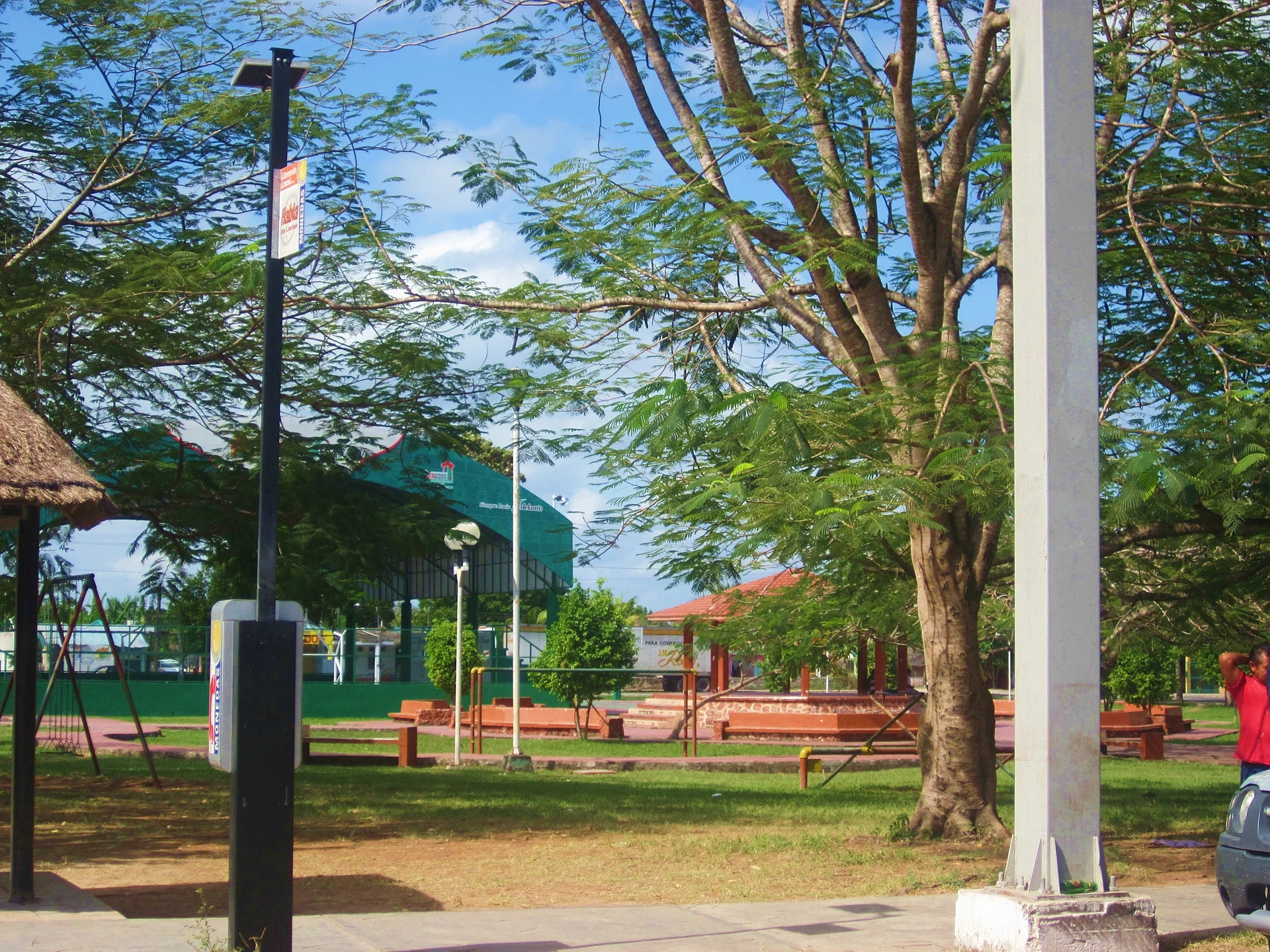
There is little to see in the town for a casual visitor; most people come to cross to Corozal and the rest of Belize, or stop here on the road out of Chetumal.
How to get to Subteniente López
Subteniente López is 12 km from Chetumal by road, about 15 minutes by car; from Bacalar it is 33 km and about 25 minutes. Leave Chetumal on the road that follows the Río Hondo toward the border. Without a car, buses run between Chetumal and Corozal (every 20 to 30 minutes in the daytime, about an hour, around BZ$2.50) and leave from the old ADO station on Salvador Novo street; the BBOC line also covers the route into Belize. A taxi from Chetumal to the bridge is the other option. Schedules and fares change, so confirm them at the terminal.
Directions to Subteniente López on Google Maps
Distances are in a straight line; the road is usually longer.
Links open a partner site. We may earn a commission if you book, at no cost to you.
From the nearest cities to Subteniente López
- Chetumal · about 15 km by road, ~10 min
- Valladolid · about 320 km by road, ~4 h 40 min
- Campeche · about 350 km by road, ~5 h 10 min
Drive times by road from OpenStreetMap, without traffic or stops. Times marked ~ are estimated from the straight-line distance.
What to see in Subteniente López 5
Sights with their own page, closest to the centre first.
Landmarks and museums
-
Centro Histórico de Chetumal · Landmark · 10 km from the centre
Mexico's first Barrio Mágico (November 2022): Payo Obispo's wooden houses, 1930s Art Deco buildings and the old market by the bay. -
Museo de la Cultura Maya · Landmark · 11 km from the centre
Chetumal's big museum of the Maya world, built around a three-level sacred ceiba, with city models and a recreated jungle.
Islands
-
Isla Tamalcab · Island · 24 km from the centre
Uninhabited wooded island in Chetumal Bay, reached by boat from Calderitas, home to spider monkeys, coatis and seabirds.

Lakes
-
Laguna Milagros · Lake · 4 km from the centre
A quiet turquoise lagoon at the village of Huay-Pix, part of the same lake system as Bacalar, with small balnearios for swimming.
Nature reserves
-
Taam Ja' Blue Hole · Nature reserve · 30 km from the centre
A blue hole in Chetumal Bay over 420 m deep with no known bottom, the deepest one measured so far. Not a swim spot.

Map of Subteniente López
Neighbourhoods and villages of Subteniente López
Part of Subteniente López or just outside it, closest first.
-
Xul-Ha · Village · 10 km from the centre
Village at the southern tip of Laguna Bacalar, with a fishermen's pier, stromatolites and a balneario, 15 minutes from Bacalar. -
Calderitas · Village · 16 km from the centre
Fishing village on Chetumal Bay just north of the city, known for seafood restaurants, bay swimming spots and boats to Isla Tamalcab.

Day trips and tours from Subteniente López
The closest Pueblos Mágicos and places to visit, with the drive from Subteniente López and tours that leave from it.


Times marked ~ are estimated from the distance. Links open a partner site. We may earn a commission if you book, at no cost to you.
Before you go: getting to and around Subteniente López
- The nearest airport is Chetumal (CTM).
- The best months to go are January, February, March, and December.
- 7 of the places on this page are more than 3 km from the centre: take a taxi, a ride-hailing app or a local bus.
- Isla Tamalcab: reached by boat or on foot, not by road (each page says from where).
- For day trips a rental car gives the most freedom; the tours above leave from Subteniente López.
Before you go to Subteniente López: hours, prices and tips
- Rules
- Crossing by land, both Mexico and Belize charge exit fees; carry cash and your Mexican entry receipt, and check the current amounts before you go. Wikivoyage (Belize) · checked Oct 2026
Hours and prices change, especially around holidays. Each fact links to where we checked it.
Visiting Subteniente López: what to see and do
The Río Hondo, which marks the border, visible from the international bridge.
The two bridges: the old Subteniente López and the Chac-Temal, opened in 2013.
The free zone on the Belizean side, before Belize customs.
Corozal, the first Belizean town, about an hour by bus from Chetumal.
Plan your trip
Places to stay in Subteniente López
Compare hotels, posadas, and rentals in and around Subteniente López.
Tours & activities
Day trips and guided outings from Bacalar often include Subteniente López; with a local guide you can get there without a car.
Rental cars
Pick up a car at CTM (Chetumal): about 31 min by road to Bacalar, then 20 km more to Subteniente López, on your own schedule.
Flights
The nearest airport with scheduled flights is Chetumal (CTM), about 31 min by road from Bacalar, the base for Subteniente López.
Mobile data
Signal can drop away from Bacalar: download a map of the way to Subteniente López before you set out, or carry an eSIM with data.
Links open a partner site. We may earn a commission if you book, at no cost to you.
When to go to Subteniente López warm
Subteniente López shares the climate of Bacalar, 20 km away. The best months to visit are January, February, March, and December.
See the month-by-month climate of Bacalar
Weather in Subteniente López now and the next 7 days
Live forecast from Open-Meteo. Chance of rain is the day's highest.
The closest Pueblo Mágico: Bacalar

Bacalar is the Pueblo Mágico closest to Subteniente López, with places to stay, food, and more to see.
Near Subteniente López


Drive times by road from OpenStreetMap, without traffic. Times marked ~ are estimated from the straight-line distance.
Location from OpenStreetMap. Written by Puebloteca.