

Landmark Mazatlán, Sinaloa Municipality of Mazatlán Mazatlán and southern Sinaloa
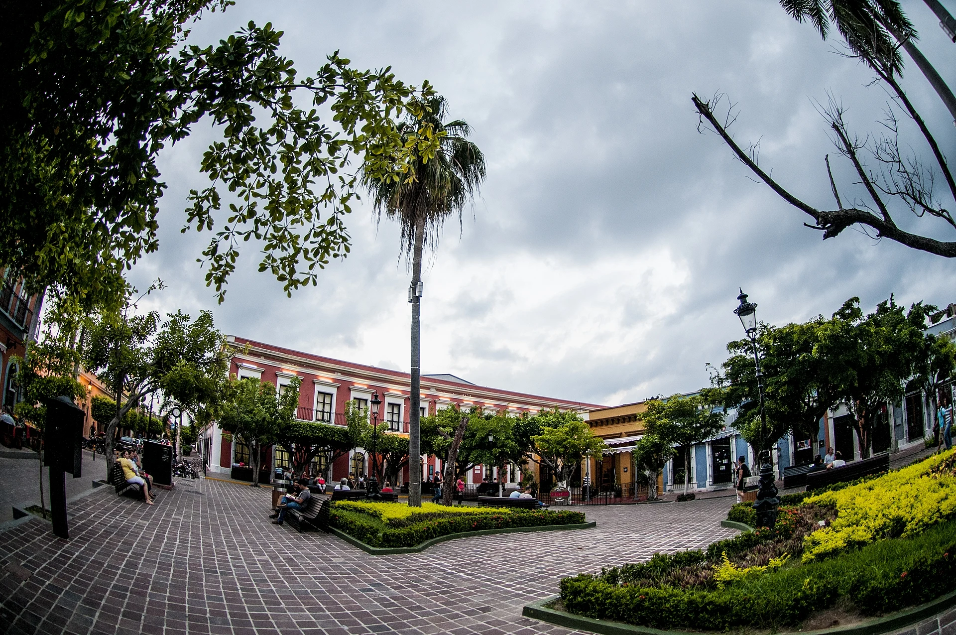
Mazatlán's oldest square, laid out in 1837 by a silver and pearl merchant, with an 1881 iron kiosk and terrace restaurants all around.
From Culiacán: 2 h 55 min by car (220 km by road) How to get there ↓
Near here
See everything nearby ↓


Plan your visit to Plazuela Machado
Where to stay near Plazuela Machado
Compare hotels, posadas and guest houses in Plazuela Machado.
Tours to Plazuela Machado
Look for tours of the area around El Rosario that stop at Plazuela Machado.
 Seafood Secret Tour in Mazatlan
★ 5.0 (21) · From US$88
How to get to Plazuela Machado
- From Culiacán: about 2 h 55 min by road (~220 km)
- Nearest airport: Mazatlán (MZT), 45 min by car to El Rosario
Links open a partner site. We may earn a commission if you book, at no cost to you.
Popular tours to Plazuela Machado


Tours, prices and ratings from Viator, checked weekly. We may earn a commission if you book.
About Plazuela Machado
Plazuela Machado is the square at the heart of Mazatlán's historic centre, a few blocks inland from the Paseo Olas Altas, with its address on Calle Constitución. It is one of the oldest plazas in the city and is often described as its first space designed purely for recreation. It was built in 1837 by Juan Nepomuceno Machado, a merchant who traded in textiles, silver and pearls; the land was his and Antonio Miranda Palacio's, a lagoon had to be filled in to make it, and Doña Tomasa Osuna gave a large sum to the work. Machado later handed it to the city on the condition that it stay a public square.
The first layout had 36 stone benches and orange trees, so people called it the Paseo de los Naranjos. In 1852 the fighting in which some 60 local men turned back the 250 soldiers of Governor Francisco de la Vega took place on and around the square. In 1868 twenty iron benches were ordered from Europe, and a remodel in 1881 added the iron kiosk that still stands in the middle, provided by General Bernardo Reyes; military bands played from it during the US and French occupations. The richest merchants of the port built their trading houses and homes around the plaza, and their doorways, porticos and lintels still frame it.
Today the plazuela is the evening meeting point of the old town. Restaurants, cafés, galleries and bars with live music spill out under the trees, artisans set up stalls on weekends, and the square hosts art shows, book fairs, an annual food fair of local restaurants and part of the Carnaval. A bust of the poet Amado Nervo, who walked these streets and wrote about the plaza, has stood on the corner of Carnaval and Constitución since 2018. The Teatro Ángela Peralta stands right beside the square, and the cathedral is a short walk away.
How to get to Plazuela Machado
Drive from Culiacán: 2 h 55 min, 220 km
The plaza is in the historic centre, between Calle Constitución and Calle Carnaval, a few blocks from Plazuela República and the cathedral and from the sea at Olas Altas. From the Zona Dorada, take a "Sábalo-Centro" bus along the malecón, a pulmonía or an Uber.
Directions to Plazuela Machado on Google Maps
Distances are in a straight line; the road is usually longer.
Links open a partner site. We may earn a commission if you book, at no cost to you.
From the nearest cities to Plazuela Machado
- Culiacán · 220 km by road, 2 h 55 min
- Durango · 250 km by road, 3 h 40 min
- Tepic · 274 km by road, 3 h 40 min
Drive times by road from OpenStreetMap, without traffic or stops. Times marked ~ are estimated from the straight-line distance.
Before you go to Plazuela Machado: hours, prices and tips
- Hours
- A public square, open all year. Wikipedia · checked Oct 2026
- Entry
- Free. Wikipedia · checked Oct 2026
Hours and prices change, especially around holidays. Each fact links to where we checked it.
Visiting Plazuela Machado: what to see and do
Look at the 1881 iron kiosk in the middle of the square.
Have dinner or a drink on one of the terraces around the plaza in the evening.
Browse the artisans' stalls set up on weekends.
Find the bust of poet Amado Nervo at the corner of Carnaval and Constitución.
Catch a show at the Teatro Ángela Peralta next door.
Plan your trip
Places to stay in Plazuela Machado
Compare hotels, posadas, and rentals in and around Plazuela Machado.
Tours & activities
Look for tours of the area around El Rosario that stop at Plazuela Machado.
Rental cars
Pick up a car at MZT (Mazatlán): about 45 min by road to El Rosario, then 62 km more to Plazuela Machado, on your own schedule.
Flights
The nearest airport with scheduled flights is Mazatlán (MZT), about 45 min by road from El Rosario, the base for Plazuela Machado.
Mobile data
Signal can drop away from El Rosario: download a map of the way to Plazuela Machado before you set out, or carry an eSIM with data.
Links open a partner site. We may earn a commission if you book, at no cost to you.
Photos
When to go to Plazuela Machado warm
Plazuela Machado shares the climate of El Rosario, 62 km away. The best months to visit are January, March, November, and December.
See the month-by-month climate of El Rosario
Weather in Plazuela Machado now and the next 7 days
Live forecast from Open-Meteo. Chance of rain is the day's highest.
The closest Pueblo Mágico: El Rosario

El Rosario is the Pueblo Mágico closest to Plazuela Machado, with places to stay, food, and more to see.
Closest to Plazuela Machado
-
Catedral Basílica de la Inmaculada Concepción · Landmark · 0 km away
-
Centro Histórico de Mazatlán · Landmark · 0 km away
-
El Clavadista · Landmark · 0 km away
-
Mercado Pino Suárez · Landmark · 0 km away
-
Playa Olas Altas · Beach · 0 km away
-
Teatro Ángela Peralta · Landmark · 0 km away
-
Museo Nacional de la Ballena · Landmark · 1 km away
-
Observatorio 1873 · Landmark · 1 km away


Near Plazuela Machado
-
Isla de Venados · Island · Sinaloa
25 min: drive to Playa Gaviotas, Zona Dorada (beach by Hotel El Cid Castilla), then 15 min by boat -
Isla de Pájaros · Island · Sinaloa
25 min: drive to Playa Gaviotas, Zona Dorada, then 15 min by boat


Drive times by road from OpenStreetMap, without traffic. Times marked ~ are estimated from the straight-line distance.
Location from OpenStreetMap. Written by Puebloteca.