Beach Mazatlán, Sinaloa Municipality of Mazatlán Mazatlán and southern Sinaloa
A surf beach at Mazatlán's northern tip, by the rocks of Punta Cerritos, with tide pools, low-tide caves, a witch legend and quieter sand than the hotel zone.
From Mazatlán: 25 min by car (17 km by road) How to get there ↓
Near here
See everything nearby ↓


Plan your visit to Playa Brujas
Where to stay near Playa Brujas
Compare hotels, posadas and guest houses in Playa Brujas.
Tours to Playa Brujas
Day trips and guided outings from San Ignacio often include Playa Brujas; with a local guide you can get there without a car.
How to get to Playa Brujas
- From Mazatlán: about 25 min by road (~17 km)
- Nearest airport: Mazatlán (MZT), 2 h 27 min by car to San Ignacio
Links open a partner site. We may earn a commission if you book, at no cost to you.
About Playa Brujas
Playa Brujas, Witches' Beach, also called Playa Las Brujas, is one of the northernmost beaches of Mazatlán, in the Cerritos area, beyond the end of the Zona Dorada and some 30 minutes by road from Olas Altas in the old town. It sits by the rocky headland of Punta Cerritos, where the long sandy shore that runs north from the marina meets a hill and a rocky coast. Less built up and less crowded than the hotel zone, it has kept a looser, bohemian feel, and banda players still work the sand.
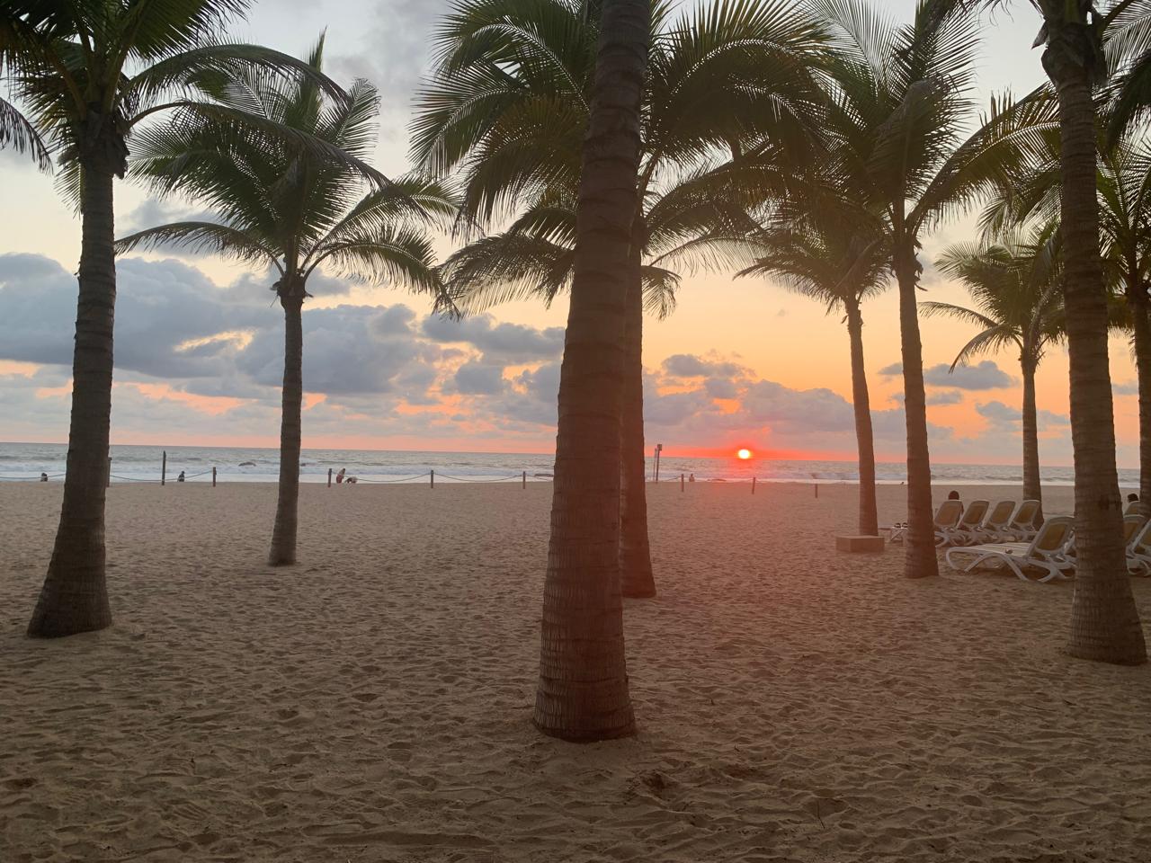
It is above all a surf beach. Big waves roll in here and make it a favorite with surfers and bodyboarders, and surf lessons are offered at this north end of the beach; the same strong sea means it is not always safe for swimming. When the tide goes out, the rocks reveal tide pools, and a cave in the cliffs can be reached by scrambling over the rocks at low tide; at high tide it is cut off. In the afternoon people stay for the sunset over the Pacific.
The name comes from a local legend. A pirate, so the story goes, landed on this coast looking for a place to hide his treasure, met a witch who lived in a cave among the rocks and made a pact with her to guard it forever; on full-moon nights she is said to keep watch, and people tell of lights, figures on the rocks and voices when the tide rises. Services are simple: shade tents and loungers for rent and limited parking that fills on busy days. A few restaurants are near, among them Mr. Lionso and The Last Drop at Punta Cerritos and the Cerritos Resort bar and restaurant, but it is wise to bring food and water.
How to get to Playa Brujas
Drive from Mazatlán: 25 min, 17 km
From the Zona Dorada take Avenida Camarón Sábalo and then Avenida Sábalo-Cerritos north past the marina, about 10 minutes by car; from Olas Altas in the old town allow about 30 minutes. Without a car, take a taxi or the Cerritos bus, which runs along the avenue for a low fare.
Directions to Playa Brujas on Google Maps
Distances are in a straight line; the road is usually longer.
Links open a partner site. We may earn a commission if you book, at no cost to you.
From the nearest cities to Playa Brujas
- Mazatlán · 17 km by road, 25 min
- Culiacán · 208 km by road, 2 h 45 min
- Tepic · 284 km by road, 3 h 40 min
Drive times by road from OpenStreetMap, without traffic or stops. Times marked ~ are estimated from the straight-line distance.
Before you go to Playa Brujas: hours, prices and tips
- What to bring
- Food and drinks of your own, since restaurants nearby are few. Beach Atlas · checked Oct 2026
- Rules
- Swim with care: the surf is strong and the beach is not always safe for swimming. Luz Noticias · checked Oct 2026
Hours and prices change, especially around holidays. Each fact links to where we checked it.
Visiting Playa Brujas: what to see and do
Surf or bodyboard the big waves, or take a lesson at the north end of the beach.
Explore the tide pools on the rocks at low tide.
Scramble over the rocks to the cave, only at low tide.
Stay for the sunset over the Pacific.
Eat at Mr. Lionso or The Last Drop at Punta Cerritos.
Plan your trip
Places to stay in Playa Brujas
Compare hotels, posadas, and rentals in and around Playa Brujas.
Tours & activities
Day trips and guided outings from San Ignacio often include Playa Brujas; with a local guide you can get there without a car.
Rental cars
Pick up a car at MZT (Mazatlán): about 2 h 27 min by road to San Ignacio, then 71 km more to Playa Brujas, on your own schedule.
Flights
The nearest airport with scheduled flights is Mazatlán (MZT), about 2 h 27 min by road from San Ignacio, the base for Playa Brujas.
Travel insurance
If you plan on swimming or surfing at Playa Brujas, check that your policy covers it: some plans leave adventure activities out.
Mobile data
Signal can drop away from San Ignacio: download a map of the way to Playa Brujas before you set out, or carry an eSIM with data.
Links open a partner site. We may earn a commission if you book, at no cost to you.
When to go to Playa Brujas warm
Playa Brujas shares the climate of San Ignacio, 71 km away. The best months to visit are January and February.
Playa Brujas is best for swimming and time on the water in the warmest months (April, May, and June); in the rainiest ones (July, August, and September) expect storms in the afternoon.
See the month-by-month climate of San Ignacio
Weather in Playa Brujas now and the next 7 days
Live forecast from Open-Meteo. Chance of rain is the day's highest.
The closest Pueblo Mágico: San Ignacio

San Ignacio is the Pueblo Mágico closest to Playa Brujas, with places to stay, food, and more to see.
Also close to
- El Rosario · Sinaloa · 73 km away
Closest to Playa Brujas
-
Estero del Yugo · Nature reserve · 1 km away
-
Playa Cerritos · Beach · 4 km away
-
Isla de Pájaros · Island · 5 km away
-
Zona Dorada · Landmark · 7 km away
-
Isla de Venados · Island · 8 km away
-
Gran Acuario Mazatlán · Landmark · 10 km away
-
Malecón de Mazatlán · Landmark · 12 km away
-
Playa Norte · Beach · 12 km away


Near Playa Brujas


Drive times by road from OpenStreetMap, without traffic. Times marked ~ are estimated from the straight-line distance.
Lists with Playa Brujas
Beaches in Sinaloa · 9 Beaches near Mazatlán · 6Location from OpenStreetMap. Written by Puebloteca.