


City Mazatlán, Sinaloa Municipality of Mazatlán Mazatlán and southern Sinaloa
Sinaloa's big Pacific port: a restored 19th-century old town, a seafront promenade of some 20 km, beaches, shrimp and one of Mexico's oldest carnivals.
From Culiacán: 2 h 50 min by car (219 km by road) How to get there ↓
Near here


Plan your visit to Mazatlán
Where to stay near Mazatlán
Compare hotels, posadas and guest houses in Mazatlán.
Tours to Mazatlán
Day trips and guided outings from El Rosario often include Mazatlán; with a local guide you can get there without a car.
 Old Town Mazatlan Segway Tour
★ 5.0 (396) · From US$72
How to get to Mazatlán
- From Culiacán: about 2 h 50 min by road (~219 km)
- Nearest airport: Mazatlán (MZT), 45 min by car to El Rosario
Links open a partner site. We may earn a commission if you book, at no cost to you.
Popular tours to Mazatlán


Tours, prices and ratings from Viator, checked weekly. We may earn a commission if you book.
About Mazatlán
Mazatlán is the second-largest city in Sinaloa after Culiacán, a port on the Pacific facing the southern tip of the Baja California peninsula. The 2020 census counted 441,975 people in the city and about 501,000 in the municipality, which runs some 80 km along the coast. The name is Nahuatl and is usually translated as "place of deer", which is why a deer turns up on monuments around town. Totorames and Xiximes lived in the region before the Spanish arrived; a party sent by Nuño de Guzmán reached the coast on 14 May 1531, the date the city counts as its founding, and the old presidio of 1576 stood where Villa Unión is today. The port was certified as the first deep-water port on Mexico's Pacific coast in 1821, and the customs house moved here from El Rosario in 1828.
The 19th century made Mazatlán. Merchants from Germany, France, Spain, Britain, Italy and the United States settled here, shipping out the silver and gold of the mines in the sierra and building the townhouses that now fill the historic centre. The port was blockaded by US forces in 1847 and fought off a French frigate in 1864, and it was the capital of Sinaloa from 1859 to 1873. German immigrants founded the Pacífico brewery in 1900, and its beer is still brewed in the city. Opera star Ángela Peralta died of yellow fever here in 1883, and the theatre now named after her anchors the old town. The Carnaval, first held in 1898, runs for the six days before Ash Wednesday and is one of the oldest in Mexico.
Today the city lives mainly from tourism and fishing. It has one of the country's biggest fishing fleets, shrimp and tuna lead the catch, and CONAPESCA, the national fisheries agency, has its headquarters here. The waterfront ties everything together: a malecón of roughly 20 km runs from the foot of Cerro del Vigía past Olas Altas and Playa Norte to the hotel strip of the Zona Dorada and on to Sábalo and Cerritos. At the southern end, El Faro stands on Cerro del Crestón, and offshore lie the three islands of Pájaros, Venados and Lobos. Getting around is part of the fun: the open-air "pulmonías", first seen on the streets in December 1965, are the city's own taxis. Cruise ships call regularly, and ferries cross the Gulf of California to La Paz.
How to get to Mazatlán
Drive from Culiacán: 2 h 50 min, 219 km
General Rafael Buelna International Airport (MZT) has domestic flights and service to the US and Canada. By road, Federal Highway 15 and toll road 15D link Mazatlán with Culiacán to the north (about 2 hours by bus) and with Tepic and Guadalajara to the south (about 6 hours by bus). The 230 km Durango–Mazatlán toll road (40D), with 63 tunnels and 115 bridges including the Baluarte Bridge, cuts the trip to Durango to about 3 hours. Baja Ferries sails almost daily to Pichilingue near La Paz (12 hours or more), and the long-distance bus station is in colonia Palos Prietos.
Directions to Mazatlán on Google Maps
Distances are in a straight line; the road is usually longer.
Links open a partner site. We may earn a commission if you book, at no cost to you.
From the nearest cities to Mazatlán
- Culiacán · 219 km by road, 2 h 50 min
- Durango · 248 km by road, 3 h 35 min
- Tepic · 271 km by road, 3 h 35 min
Drive times by road from OpenStreetMap, without traffic or stops. Times marked ~ are estimated from the straight-line distance.
What to see in Mazatlán 20
Sights with their own page, closest to the centre first.
Landmarks and museums
-
Catedral Basílica de la Inmaculada Concepción · Landmark · 2 km from the centre
Mazatlán's twin-towered cathedral, built over four decades and finished in 1899, with a gilded interior and a Cavaillé-Coll organ from Paris. -
Centro Histórico de Mazatlán · Landmark · 2 km from the centre
Mazatlán's old town: 180 blocks of 19th-century merchant houses, plazas, a cathedral, an iron market and a theatre, protected as a heritage zone since 2001. -
Gran Acuario Mazatlán · Landmark · 2 km from the centre
Mazatlán's big aquarium of the Sea of Cortez, opened in 2023 in Parque Central, with sharks, rays, sea lions and penguins in a Tatiana Bilbao building. -
Malecón de Mazatlán · Landmark · 2 km from the centre
Mazatlán's seafront promenade, about 21 km of walkway and bike lane from the old town to the hotel zone, lined with monuments and sunset views. -
Mercado Pino Suárez · Landmark · 2 km from the centre
Mazatlán's iron-and-steel central market of 1899 in the historic center, full of produce, seafood, crafts and cheap breakfast counters. -
El Clavadista · Landmark · 3 km from the centre
The cliff divers' rock on Mazatlán's seafront, where local divers leap about 14 m into shallow surf, timing each jump to an incoming wave. -
Museo Nacional de la Ballena · Landmark · 3 km from the centre
Mexico's national whale museum, opened in 2024 in the Observatorio 1873 park on Cerro del Vigía, with whale skeletons and winter whale-watching trips. -
Plazuela Machado · Landmark · 3 km from the centre
Mazatlán's oldest square, laid out in 1837 by a silver and pearl merchant, with an 1881 iron kiosk and terrace restaurants all around. -
Teatro Ángela Peralta · Landmark · 3 km from the centre
Mazatlán's 19th-century theatre, wrecked by a hurricane in 1975 and reopened in 1992: an 841-seat hall that is the city's main stage today. -
Observatorio 1873 · Landmark · 4 km from the centre
A 19th-century lookout and weather observatory on Cerro del Vigía, now a park with an award-winning funicular, gardens, a museum and sea views. -
Zona Dorada · Landmark · 5 km from the centre
Mazatlán's Golden Zone, the hotel strip along Avenida Camarón Sábalo, with calm Playa Gaviotas, restaurants, bars and boats to Isla de Venados.


Beaches
-
Playa Norte · Beach · 2 km from the centre
Mazatlán's fishermen's beach on the malecón by the old center, where pangas land the catch, families buy fresh fish and the Fishermen's Monument stands. -
Isla de la Piedra · Beach · 3 km from the centre
Mazatlán's long palm-backed beach across the harbor mouth, a few minutes by water taxi, with calm water, palapa seafood restaurants and horse rides. -
Playa Olas Altas · Beach · 3 km from the centre
Mazatlán's historic town beach below the old centre: a 550 m bay of surf, sunsets and old seafront hotels where the city's beach tourism began. -
Playa Cerritos · Beach · 9 km from the centre
Mazatlán's long northern beach from the marina to Punta Cerritos, with firm sand for walking, steady surf, parasailing and nesting sea turtles. -
Playa Brujas · Beach · 13 km from the centre
A surf beach at Mazatlán's northern tip, by the rocks of Punta Cerritos, with tide pools, low-tide caves, a witch legend and quieter sand than the hotel zone.


Islands
-
Isla de Venados · Island · 6 km from the centre
The middle and largest of Mazatlán's three protected islands, a short boat ride off the Zona Dorada, with a calm beach for swimming, snorkeling and kayaking. -
Isla de Pájaros · Island · 8 km from the centre
The northernmost of Mazatlán's three islands, a protected seabird colony with the main brown pelican nesting site in the bay, seen from boats only.


Nature reserves
-
Estero del Yugo · Nature reserve · 12 km from the centre
A small coastal lagoon and dry-forest reserve in Cerritos, north Mazatlán, looked after by the CIAD research center and known as the city's bird sanctuary.

Viewpoints
-
El Faro de Mazatlán · Viewpoint · 5 km from the centre
The lighthouse on top of 157 m Cerro del Crestón: a stepped climb of about 30 minutes to a glass lookout over the port, the city and the islands.

Map of Mazatlán
Day trips and tours from Mazatlán
The closest Pueblos Mágicos and places to visit, with the drive from Mazatlán and tours that leave from it.

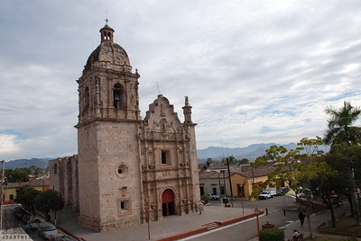



All 3 Pueblos Mágicos within a weekend of Mazatlán →
Times marked ~ are estimated from the distance. Links open a partner site. We may earn a commission if you book, at no cost to you.
Before you go: getting to and around Mazatlán
- The nearest airport is Mazatlán (MZT).
- The best months to go are January, March, November, and December.
- 8 of the places on this page are more than 3 km from the centre: take a taxi, a ride-hailing app or a local bus.
- Isla de Venados and Isla de Pájaros: reached by boat or on foot, not by road (each page says from where).
- For day trips a rental car gives the most freedom; the tours above leave from Mazatlán.
Before you go to Mazatlán: hours, prices and tips
- Best season
- Carnaval fills the city for the six days before Ash Wednesday (February or March); Semana Santa is also very busy. The dry season runs from about November to June. Wikipedia (Carnaval de Mazatlán); Wikivoyage · checked Oct 2026
Hours and prices change, especially around holidays. Each fact links to where we checked it.
Visiting Mazatlán: what to see and do
Walk the restored Centro Histórico from the cathedral to Plazuela Machado and the Teatro Ángela Peralta.
Ride or stroll the malecón from Olas Altas to Playa Norte and the Zona Dorada.
Climb El Faro on Cerro del Crestón for the view over the port and the three islands.
Watch the cliff divers at El Clavadista on the Paseo Olas Altas.
Take the funicular up Cerro del Vigía at the Observatorio 1873.
Come for Carnaval, the six days before Ash Wednesday, held since 1898.
Plan your trip
Places to stay in Mazatlán
Compare hotels, posadas, and rentals in and around Mazatlán.
Tours & activities
Day trips and guided outings from El Rosario often include Mazatlán; with a local guide you can get there without a car.
Rental cars
Pick up a car at MZT (Mazatlán): about 45 min by road to El Rosario, then 61 km more to Mazatlán, on your own schedule.
Flights
The nearest airport with scheduled flights is Mazatlán (MZT), about 45 min by road from El Rosario, the base for Mazatlán.
Mobile data
Signal can drop away from El Rosario: download a map of the way to Mazatlán before you set out, or carry an eSIM with data.
Links open a partner site. We may earn a commission if you book, at no cost to you.
Photos
When to go to Mazatlán warm
Mazatlán shares the climate of El Rosario, 61 km away. The best months to visit are January, March, November, and December.
See the month-by-month climate of El Rosario
Weather in Mazatlán now and the next 7 days
Live forecast from Open-Meteo. Chance of rain is the day's highest.
The closest Pueblo Mágico: El Rosario

El Rosario is the Pueblo Mágico closest to Mazatlán, with places to stay, food, and more to see.
Near Mazatlán





Drive times by road from OpenStreetMap, without traffic. Times marked ~ are estimated from the straight-line distance.
Location from OpenStreetMap. Written by Puebloteca.