Beach Mazatlán, Sinaloa Municipality of Mazatlán Mazatlán and southern Sinaloa
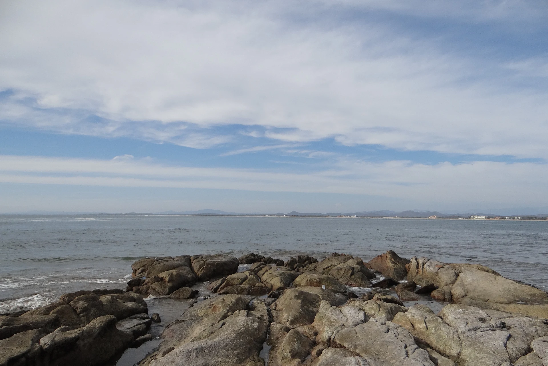
Mazatlán's long northern beach from the marina to Punta Cerritos, with firm sand for walking, steady surf, parasailing and nesting sea turtles.
From Mazatlán: 20 min by car (13 km by road) How to get there ↓
Near here
See everything nearby ↓


Plan your visit to Playa Cerritos
Where to stay near Playa Cerritos
Compare hotels, posadas and guest houses in Playa Cerritos.
Tours to Playa Cerritos
Day trips and guided outings from El Rosario often include Playa Cerritos; with a local guide you can get there without a car.
How to get to Playa Cerritos
- From Mazatlán: about 20 min by road (~13 km)
- Nearest airport: Mazatlán (MZT), 45 min by car to El Rosario
Links open a partner site. We may earn a commission if you book, at no cost to you.
About Playa Cerritos
Playa Cerritos is the long beach on Mazatlán's northern shore, beyond the hotel zone. It begins at the entrance to the newer marina, where the Zona Dorada ends, and runs north to Punta Cerritos, a rocky point just before the Emerald Bay resort, with a hill separating it from Playa Brujas on the other side. Together with Brujas and the stretch some call Playa Pato Blanco, it forms one continuous beach of roughly 5 km, lined with resorts and condominiums along Avenida Sábalo-Cerritos.
This is a beach for long walks. The sand is smooth and packed hard, with a few patches of broken shell, and the tide moves about 1.3 m, uncovering up to 50 m of extra beach at low water, the best time to walk, jog or look for shells. Waves break all year, mild to medium on most days, which suits bodyboards, paddleboards and surfboards, with surfers gathering at the north end and kiteboarders using the open beach; on weekends and holidays parasailing boats tow riders high above the sand in front of the big resorts. Red flags go up on days with strong surf, and the waves are not safe for small children. Sea turtles nest on this beach, and pelicans, shorebirds, sea lions and the odd dolphin are often seen.
Unlike the malecón, Cerritos has few restaurants right on the sand. The Cerritos Resort, about a 15-minute walk along the beach, has a restaurant open to the public, a small grill sets up a bit further on, and at Punta Cerritos there are Mr. Lionso, The Last Drop and Roy's; vendors walk the beach selling hats, jewelry, carvings and fresh fruit drinks, and mariachis play most days. At the point, the rocks shelter tide pools that fill at low tide. The sun sets straight over the Pacific, and the beach stays quieter than the Golden Zone to the south.
How to get to Playa Cerritos
Drive from Mazatlán: 20 min, 13 km
From the Zona Dorada follow Avenida Camarón Sábalo north past the marina entrance onto Avenida Sábalo-Cerritos, which runs behind the beach to Punta Cerritos; it is a short drive or taxi ride, and the Cerritos bus covers the same route. Access to the sand is through public beach entrances between the resorts.
Directions to Playa Cerritos on Google Maps
Distances are in a straight line; the road is usually longer.
Links open a partner site. We may earn a commission if you book, at no cost to you.
From the nearest cities to Playa Cerritos
- Mazatlán · 13 km by road, 20 min
- Culiacán · 211 km by road, 2 h 50 min
- Tepic · 281 km by road, 3 h 35 min
Drive times by road from OpenStreetMap, without traffic or stops. Times marked ~ are estimated from the straight-line distance.
Before you go to Playa Cerritos: hours, prices and tips
- Best time of day
- Low tide for walking and tide pools; late afternoon for the sunset. SunCruiser Media · checked Oct 2026
- Rules
- Respect the red flags on days of strong surf; the waves are not safe for small children. Beach Atlas · checked Oct 2026
Hours and prices change, especially around holidays. Each fact links to where we checked it.
Visiting Playa Cerritos: what to see and do
Walk the hard-packed sand at low tide, when up to 50 m of extra beach appears.
Bodyboard, paddleboard or surf; surfers gather at the north end.
Try parasailing in front of the resorts on a weekend.
Explore the tide pools in the rocks at Punta Cerritos.
Watch the sunset from Mr. Lionso or The Last Drop at the point.
Plan your trip
Places to stay in Playa Cerritos
Compare hotels, posadas, and rentals in and around Playa Cerritos.
Tours & activities
Day trips and guided outings from El Rosario often include Playa Cerritos; with a local guide you can get there without a car.
Rental cars
Pick up a car at MZT (Mazatlán): about 45 min by road to El Rosario, then 69 km more to Playa Cerritos, on your own schedule.
Flights
The nearest airport with scheduled flights is Mazatlán (MZT), about 45 min by road from El Rosario, the base for Playa Cerritos.
Travel insurance
If you plan on swimming or surfing at Playa Cerritos, check that your policy covers it: some plans leave adventure activities out.
Mobile data
Signal can drop away from El Rosario: download a map of the way to Playa Cerritos before you set out, or carry an eSIM with data.
Links open a partner site. We may earn a commission if you book, at no cost to you.
When to go to Playa Cerritos warm
Playa Cerritos shares the climate of El Rosario, 69 km away. The best months to visit are January, March, November, and December.
Playa Cerritos is best for swimming and time on the water in the warmest months (May, June, and July); in the rainiest ones (July, August, and September) expect storms in the afternoon.
See the month-by-month climate of El Rosario
Weather in Playa Cerritos now and the next 7 days
Live forecast from Open-Meteo. Chance of rain is the day's highest.
The closest Pueblo Mágico: El Rosario

El Rosario is the Pueblo Mágico closest to Playa Cerritos, with places to stay, food, and more to see.
Also close to
- San Ignacio · Sinaloa · 74 km away
Closest to Playa Cerritos
-
Isla de Pájaros · Island · 2 km away
-
Estero del Yugo · Nature reserve · 3 km away
-
Zona Dorada · Landmark · 3 km away
-
Isla de Venados · Island · 4 km away
-
Playa Brujas · Beach · 4 km away
-
Gran Acuario Mazatlán · Landmark · 6 km away
-
Malecón de Mazatlán · Landmark · 8 km away
-
Playa Norte · Beach · 8 km away


Near Playa Cerritos


Drive times by road from OpenStreetMap, without traffic. Times marked ~ are estimated from the straight-line distance.
Lists with Playa Cerritos
Beaches in Sinaloa · 9 Beaches near Mazatlán · 6Location from OpenStreetMap. Written by Puebloteca.