Village San Andrés Tuxtla, Veracruz Municipality of San Andrés Tuxtla Los Tuxtlas
Los Tuxtlas village on Highway 180 between San Andrés Tuxtla and Catemaco, joined to Calería and 8 km from the Eyipantla falls.
From San Andrés Tuxtla: 5 min by car (5 km by road) How to get there ↓
Near here
See everything nearby ↓


Plan your visit to Sihuapan
Where to stay near Sihuapan
Compare hotels, posadas and guest houses in Sihuapan.
Tours to Sihuapan
Day trips and guided outings from Veracruz often include Sihuapan; with a local guide you can get there without a car.
How to get to Sihuapan
- From San Andrés Tuxtla: about 5 min by road (~5 km)
Links open a partner site. We may earn a commission if you book, at no cost to you.
About Sihuapan
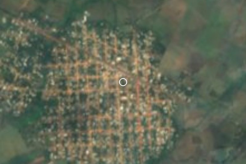
Sihuapan stretches along Federal Highway 180, the Gulf coast road, between San Andrés Tuxtla and Catemaco: central San Andrés is about 5 km away by road and Catemaco about 7. With 3,803 people in 2020 it is the fifth-largest of the municipality's nearly 300 localities, and on its southern side it merges into Calería with no visible boundary; together the two have around 15,000 residents.
The village takes its name from the Sihuapan stream, which runs just east of the city of San Andrés. In Nahuatl the word joins cihuatl (woman) and apan (river). The stream drains into the San Andrés river, which flows on to the San Juan and finally the Papaloapan. Locals are known as sihuapeños.
Sihuapan sits at about 250 metres in the valley between the volcanic cones of the Sierra de Los Tuxtlas, the northernmost tropical rainforest in the Americas. To the north-west rises San Martín Tuxtla volcano, 1,680 metres high, whose 1664 eruption pushed earlier inhabitants down into this valley; its last eruption was in 1793. The climate is hot and wet, averaging 24 °C.
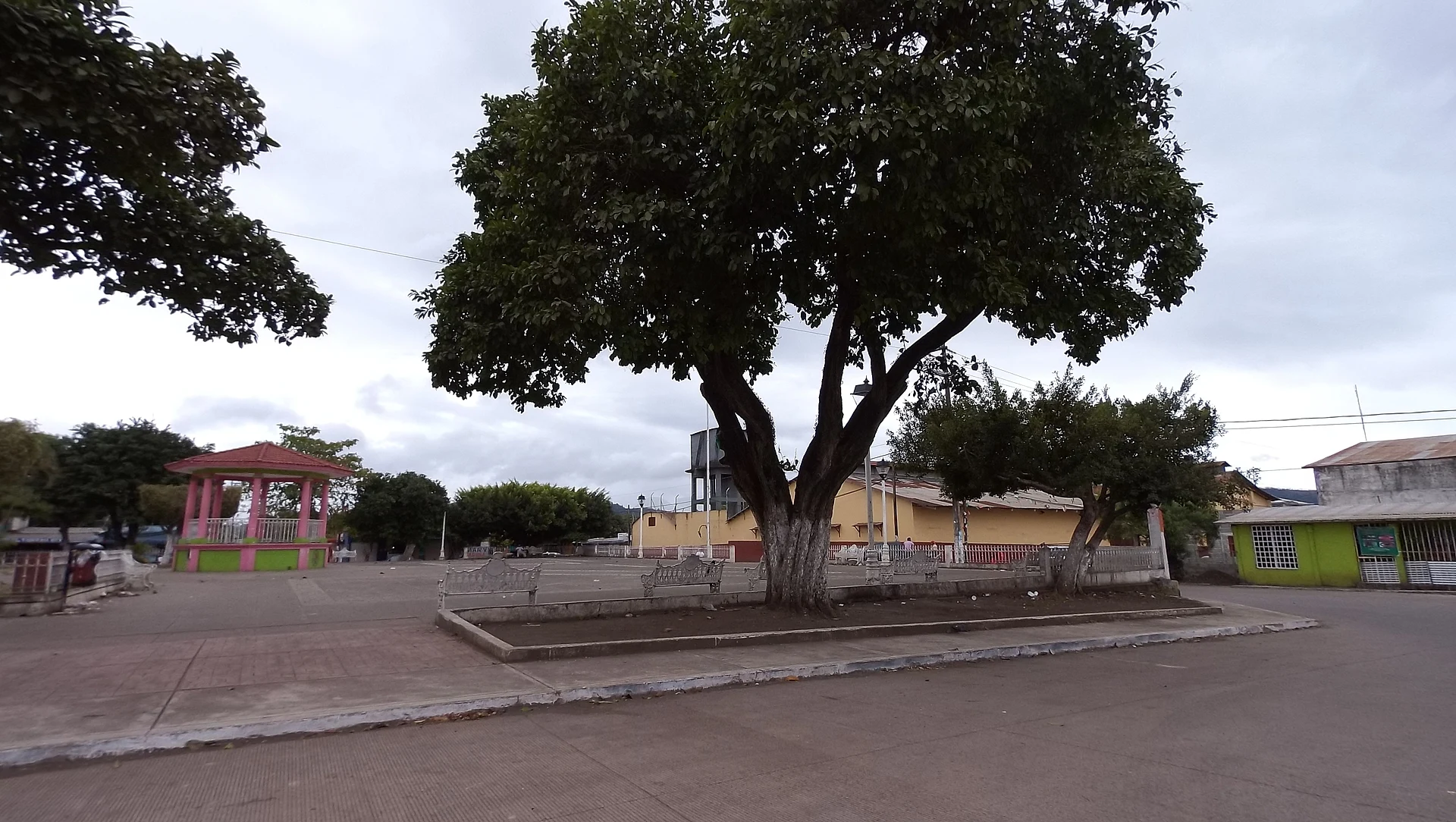
The plaza has a pink bandstand under large shade trees, and the Instituto Tecnológico Superior de San Andrés Tuxtla is close by. For visitors Sihuapan works mainly as a base or stop between San Andrés and Catemaco and a starting point for the Salto de Eyipantla, the waterfall formed where water flowing out of Lake Catemaco joins the Comoapan river.
How to get to Sihuapan
Drive from San Andrés Tuxtla: 5 min, 5 km
Sihuapan lies on Federal Highway 180 (the Gulf coast road). From central San Andrés Tuxtla it is about 5 km towards Catemaco, some 6 minutes; from Catemaco it is about 7.5 km in the other direction, roughly 8 minutes. From Veracruz port it is about 162 km, 2 hours 40 minutes to 3 hours, via the 150D to the junction and then Highway 180 south-east. For the Salto de Eyipantla, head south along Avenida Reforma and Avenida Sihuapan, about 8 km. By bus: San Andrés has an ADO terminal 1 km from its centre, with departures to Veracruz, Catemaco, Coatzacoalcos and Villahermosa; Catemaco has an ADO terminal on Avenida Revolución plus a second-class station. Any bus or taxi travelling on Highway 180 between the two towns passes through the village.
Directions to Sihuapan on Google Maps
Distances are in a straight line; the road is usually longer.
Links open a partner site. We may earn a commission if you book, at no cost to you.
From the nearest cities to Sihuapan
- San Andrés Tuxtla · 5 km by road, 5 min
- Minatitlán · 127 km by road, 2 h
- Tuxtepec · about 140 km by road, ~2 h 5 min
Drive times by road from OpenStreetMap, without traffic or stops. Times marked ~ are estimated from the straight-line distance.
Visiting Sihuapan: what to see and do
Sihuapan's plaza and bandstand.
The Salto de Eyipantla waterfall, about 8 km away along Avenida Sihuapan.
Calería, the adjoining village.
San Martín Tuxtla volcano, 1,680 metres high, to the north-west.
Catemaco and its lake, about 7 km away on Highway 180.
Central San Andrés Tuxtla, about 5 km away.
Plan your trip
Places to stay in Sihuapan
Compare hotels, posadas, and rentals in and around Sihuapan.
Tours & activities
Day trips and guided outings from Veracruz often include Sihuapan; with a local guide you can get there without a car.
Mobile data
Signal can drop away from Veracruz: download a map of the way to Sihuapan before you set out, or carry an eSIM with data.
Links open a partner site. We may earn a commission if you book, at no cost to you.
Closest to Sihuapan
-
Calería · Village · 1 km away
-
San Andrés Tuxtla · City · 4 km away
-
Salto de Eyipantla · Waterfall · 6 km away
-
Catemaco · Town · 7 km away
-
Laguna de Catemaco · Lake · 12 km away
-
Nanciyaga · Nature reserve · 12 km away
-
Santiago Tuxtla · Town · 13 km away
-
Sontecomapan · Village · 17 km away


Near Sihuapan




Drive times by road from OpenStreetMap, without traffic. Times marked ~ are estimated from the straight-line distance.
Location from OpenStreetMap. Written by Puebloteca.