

Village Actopan, Veracruz Municipality of Actopan Veracruz port and the Sotavento
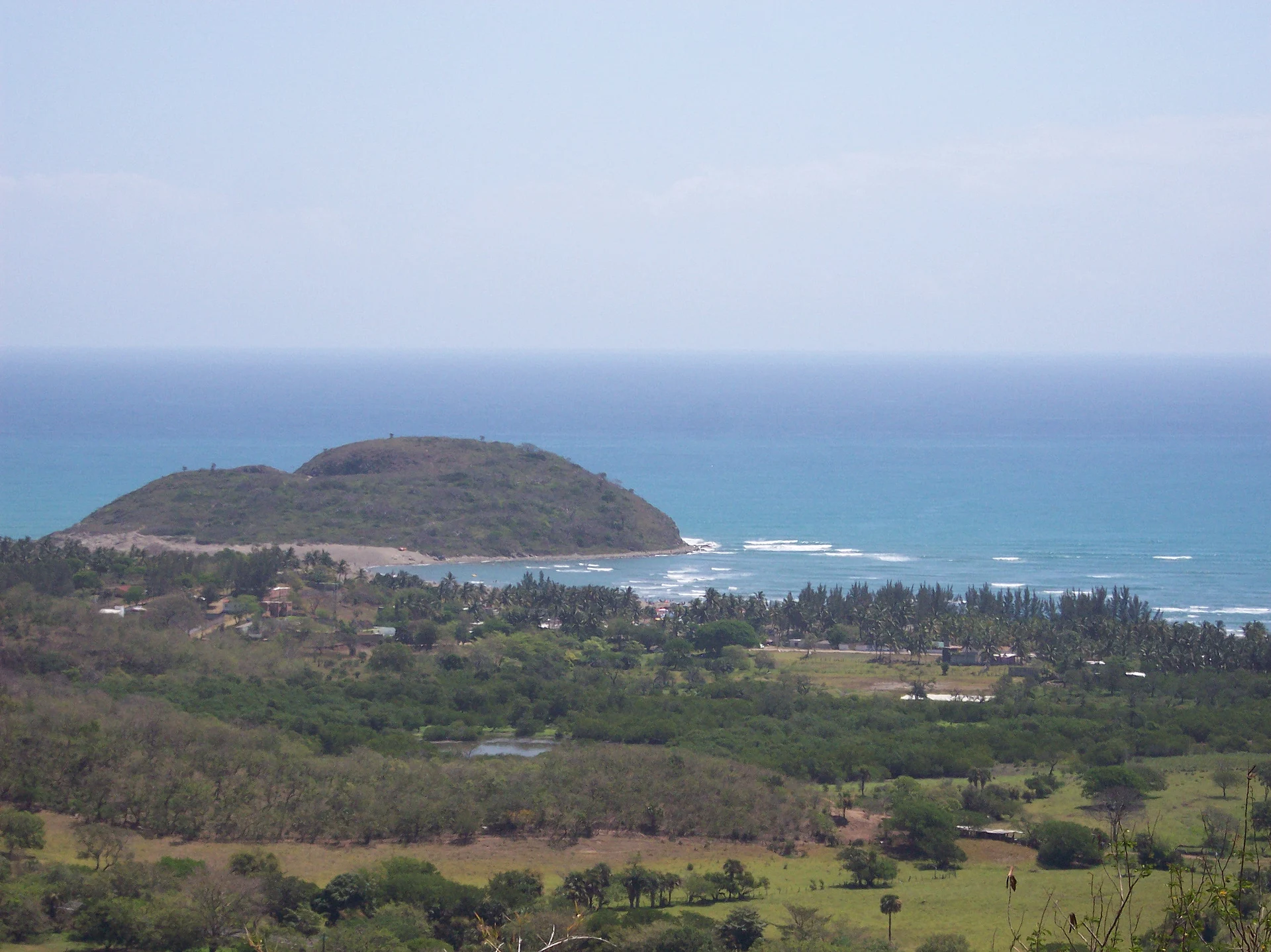
Small fishing village on a calm bay below Quiahuiztlan, where Cortés set up the Villa Rica de la Vera Cruz in 1519; beach, dunes and sea cliffs.
From Veracruz: 1 h by car (74 km by road) How to get there ↓
Near here
See everything nearby ↓


Plan your visit to Villa Rica
Where to stay near Villa Rica
Compare hotels, posadas and guest houses in Villa Rica.
Tours to Villa Rica
Day trips and guided outings from Naolinco often include Villa Rica; with a local guide you can get there without a car.
 Tours from Veracruz
Private Sunrise Taj Mahal Tour from Delhi By Car -All inclusive
★ 5.0 (549) · From US$14
How to get to Villa Rica
- From Veracruz: about 1 h by road (~74 km)
- Nearest airport: Veracruz (VER), 1 h 55 min by car to Naolinco
Links open a partner site. We may earn a commission if you book, at no cost to you.
Tours from Veracruz, near Villa Rica


Tours, prices and ratings from Viator, checked weekly. We may earn a commission if you book.
About Villa Rica
Villa Rica is a small village on a sheltered bay of the central Veracruz coast, in the municipality of Actopan, about 75 km north of the port of Veracruz. INEGI lists it as Villa Rica de la Veracruz, with 180 people at the 2020 census, 19 m above sea level. The bay is closed to the east by a rocky headland called Punta Villa Rica or Punta Bernal, and to the west rises the Cerro de los Metates with the Totonac ruins of Quiahuiztlan on its slopes. Seasonal lagoons such as the Laguna del Llano lie on the plain behind the beach.
This is where the first Spanish town in Mexico took shape. After landing on Good Friday, 22 April 1519, on the beaches facing San Juan de Ulúa, Hernán Cortés sent pilots including Antón de Alaminos up the coast to look for a better site, and they chose this plain in front of Quiahuiztlan, protected by the hills and open to the sea. Here the Villa Rica de la Vera Cruz was laid out with plots for the settlers, a church, a plaza with a pillory, a town hall, a jail, a shipyard and a fortress, built with Totonac labour. By tradition it was also here that Cortés had his ships run aground so his men could not go back to Cuba. The town served as the Spanish base for less than five years before it was moved south to the banks of the Huitzilapan, at today's La Antigua. INAH excavations between 1989 and 1992 uncovered the stone fortress around its central courtyard, Spanish burials laid out in the shape of a cross that may include Juan de Escalante and his soldiers, a lime kiln and a small copper coin from the reign of the Catholic Monarchs. The archaeologist in charge has warned that the remains now cover less than a quarter of a hectare, overgrown and hemmed in by holiday homes.
Today the village is known mostly for its beach. The water in the bay is calm and clear, turquoise to green, and good for swimming, with palapas serving fresh seafood, simple places to eat, cabins facing the sea, toilets and showers. Sand dunes rise beside the beach and can be crossed on foot to a quieter stretch of shore. About 15 minutes' walk along the coast, steps lead down the cliffs known as La Quebrada, where adventure operators run rappels of about 50 m. The local people live from fishing and small farm plots, and the Quiahuiztlan site is a short drive up the hill.
How to get to Villa Rica
Drive from Veracruz: 1 h, 74 km
From the port of Veracruz take Federal Highway 180 north towards Poza Rica, past Cardel, and turn off towards the coast for Villa Rica; it is about 76 km and 1 hour. From José Cardel it is about 39 km, and from Xalapa about 105 km by road.
Directions to Villa Rica on Google Maps
Distances are in a straight line; the road is usually longer.
Links open a partner site. We may earn a commission if you book, at no cost to you.
From the nearest cities to Villa Rica
- Veracruz · 74 km by road, 1 h
- Martínez de la Torre · 103 km by road, 1 h 20 min
- Xalapa · 105 km by road, 1 h 20 min
Drive times by road from OpenStreetMap, without traffic or stops. Times marked ~ are estimated from the straight-line distance.
Before you go to Villa Rica: hours, prices and tips
- Guide or tour
- The 50 m rappel down the cliffs of La Quebrada is done with guides from an adventure operator; the beach and dunes need no guide. Tours: Viator GetYourGuide México Desconocido · checked Oct 2026
Hours and prices change, especially around holidays. Each fact links to where we checked it.
Visiting Villa Rica: what to see and do
Swim in the calm water of Villa Rica bay and eat seafood at the beach palapas.
Walk across the dunes beside the beach to the quieter shore beyond.
Follow the shore about 15 minutes to the cliffs of La Quebrada; rappel down them with a guide.
Look for the overgrown remains of Cortés's 1519 fortress near the beach.
Drive up to the Totonac tombs of Quiahuiztlan for the view over the bay.
Plan your trip
Places to stay in Villa Rica
Compare hotels, posadas, and rentals in and around Villa Rica.
Tours & activities
Day trips and guided outings from Naolinco often include Villa Rica; with a local guide you can get there without a car.
Rental cars
Pick up a car at VER (Veracruz): about 1 h 55 min by road to Naolinco, then 50 km more to Villa Rica, on your own schedule.
Flights
The nearest airport with scheduled flights is Veracruz (VER), about 1 h 55 min by road from Naolinco, the base for Villa Rica.
Mobile data
Signal can drop away from Naolinco: download a map of the way to Villa Rica before you set out, or carry an eSIM with data.
Links open a partner site. We may earn a commission if you book, at no cost to you.
Photos
When to go to Villa Rica mild
Villa Rica shares the climate of Naolinco, 50 km away. The best months to visit are February, March, April, and December.
See the month-by-month climate of Naolinco
Weather in Villa Rica now and the next 7 days
Live forecast from Open-Meteo. Chance of rain is the day's highest.
The closest Pueblo Mágico: Naolinco

Naolinco is the Pueblo Mágico closest to Villa Rica, with places to stay, food, and more to see.
Also close to
Closest to Villa Rica
-
Quiahuiztlan · Archaeological site · 2 km away
-
Palma Sola · Village · 11 km away
-
Cempoala · Archaeological site · 25 km away
-
Actopan · Town · 30 km away
-
Chachalacas · Beach · 30 km away
-
José Cardel · Town · 34 km away
-
Alto Lucero · Town · 36 km away
-
Coyolillo · Village · 38 km away


Near Villa Rica


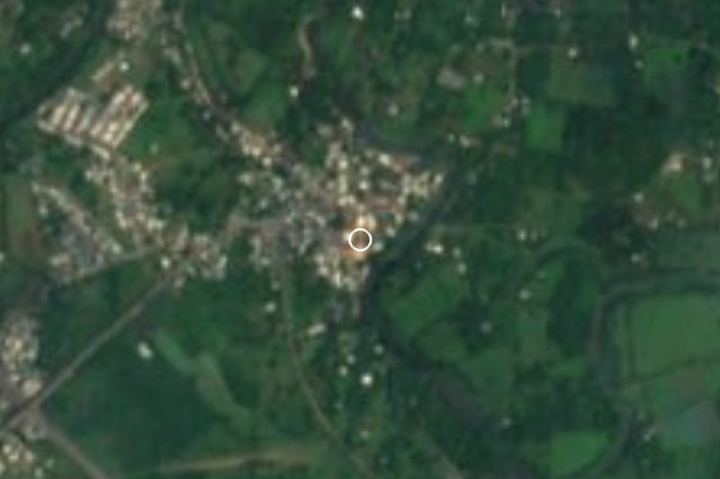
Drive times by road from OpenStreetMap, without traffic. Times marked ~ are estimated from the straight-line distance.
Location from OpenStreetMap. Written by Puebloteca.