Village Alto Lucero de Gutiérrez Barrios, Veracruz
Gulf coast village on Highway 180, the closest community to the Laguna Verde nuclear plant, with a quiet beach and nearby Boca Andrea.
From Veracruz: 1 h 5 min by car (85 km by road) How to get there ↓
Near here
See everything nearby ↓


Plan your visit to Palma Sola
Where to stay near Palma Sola
Compare hotels, posadas and guest houses in Palma Sola.
Tours to Palma Sola
Day trips and guided outings from Naolinco often include Palma Sola; with a local guide you can get there without a car.
How to get to Palma Sola
- From Veracruz: about 1 h 5 min by road (~85 km)
- Nearest airport: Veracruz (VER), 1 h 55 min by car to Naolinco
Links open a partner site. We may earn a commission if you book, at no cost to you.
About Palma Sola
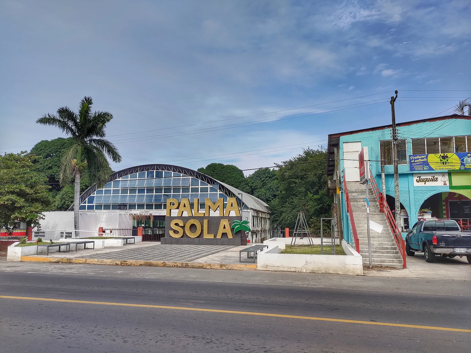
Palma Sola is the main settlement on the coastal strip of Alto Lucero de Gutiérrez Barrios municipality, in central Veracruz. It sits barely above the Gulf, around 7 metres up, and Federal Highway 180, the coast road, runs straight through it as its main street. The 2010 census counted 3,144 people here; by 2020 the figure was about 3,227.
The village is best known for what lies next door. Some five kilometres to the south, at kilometre 42.5 of the Cardel–Nautla stretch, stands the Laguna Verde nuclear power station, the only one in Mexico, and Palma Sola is the community closest to its reactors. That proximity shaped local history: in June 1988, two years after Chernobyl, farmers from Palma Sola blocked the Gulf highway for three days in protest against the plant before federal forces cleared them.
Visitors mostly come for the sea. Palma Sola's own beach has a relaxed, family atmosphere, and Boca Andrea, close by, is an almost undeveloped stretch of sand. There is also a small airfield, the Boca de la Loma aerodrome, with an 800-metre strip restored in 2009. The village makes an easy lunch stop on a drive up the coast between Cardel and Nautla, and a starting point for the winding climb inland to the municipal seat of Alto Lucero, the hometown of the singer Paquita la del Barrio.
How to get to Palma Sola
Drive from Veracruz: 1 h 5 min, 85 km
Palma Sola lies on Federal Highway 180, the Gulf coast road. From Xalapa, take Highway 140 towards Veracruz as far as José Cardel, then Highway 180 north towards Nautla and Poza Rica: about 116 km and 1 h 30 min. From Cardel it is about 50 km (40 min), and from the port of Veracruz, leaving on the Veracruz–Cardel toll road, about 86 km and 1 h 10 min. The Laguna Verde plant, at km 42.5 of the Cardel–Nautla stretch, comes up about 5 km before the village. From Naolinco, the nearest Pueblo Mágico, a very winding two-lane state road drops through Tepetlán and Alto Lucero to Highway 180: about 90 km and 1 h 35 min. Long-distance buses leave from the ADO Central de Autobuses in Veracruz port and from CAXA in Xalapa.
Directions to Palma Sola on Google Maps
Distances are in a straight line; the road is usually longer.
Links open a partner site. We may earn a commission if you book, at no cost to you.
From the nearest cities to Palma Sola
- Veracruz · 85 km by road, 1 h 5 min
- Martínez de la Torre · 97 km by road, 1 h 15 min
- Xalapa · 116 km by road, 1 h 30 min
Drive times by road from OpenStreetMap, without traffic or stops. Times marked ~ are estimated from the straight-line distance.
Visiting Palma Sola: what to see and do
Walk Palma Sola's quiet, family-style beach.
Visit Boca Andrea, a nearby beach with almost no development.
See the Laguna Verde nuclear plant from Highway 180, about 5 km south.
Drive the winding road up to Alto Lucero, the municipal seat.
Plan your trip
Places to stay in Palma Sola
Compare hotels, posadas, and rentals in and around Palma Sola.
Tours & activities
Day trips and guided outings from Naolinco often include Palma Sola; with a local guide you can get there without a car.
Rental cars
Pick up a car at VER (Veracruz): about 1 h 55 min by road to Naolinco, then 48 km more to Palma Sola, on your own schedule.
Flights
The nearest airport with scheduled flights is Veracruz (VER), about 1 h 55 min by road from Naolinco, the base for Palma Sola.
Mobile data
Signal can drop away from Naolinco: download a map of the way to Palma Sola before you set out, or carry an eSIM with data.
Links open a partner site. We may earn a commission if you book, at no cost to you.
When to go to Palma Sola mild
Palma Sola shares the climate of Naolinco, 48 km away. The best months to visit are February, March, April, and December.
See the month-by-month climate of Naolinco
Weather in Palma Sola now and the next 7 days
Live forecast from Open-Meteo. Chance of rain is the day's highest.
The closest Pueblo Mágico: Naolinco

Naolinco is the Pueblo Mágico closest to Palma Sola, with places to stay, food, and more to see.
Also close to
Closest to Palma Sola
-
Quiahuiztlan · Archaeological site · 11 km away
-
Villa Rica · Village · 11 km away
-
Actopan · Town · 36 km away
-
Alto Lucero · Town · 36 km away
-
Cempoala · Archaeological site · 36 km away
-
Coyolillo · Village · 40 km away
-
Chachalacas · Beach · 41 km away
-
Chiconquiaco · Town · 41 km away


Near Palma Sola


Drive times by road from OpenStreetMap, without traffic. Times marked ~ are estimated from the straight-line distance.
Location from OpenStreetMap. Written by Puebloteca.