

Town Chiconquiaco, Veracruz Xalapa and the coffee hills
A misty mountain town in the cloud forests of the Sierra de Chiconquiaco, on the winding scenic road north toward Misantla.
From Xalapa: 55 min by car (45 km by road) How to get there ↓
Near here
See everything nearby ↓


Plan your visit to Chiconquiaco
Where to stay near Chiconquiaco
Naolinco, 11 km away, is the closest town with places to stay.
Hacienda San Fernando Hotel & Spa Hotel · ★★★ · 1.2 km from the center Prices Monte Niebla Hotel Spa Hotel · ★★★ · 9.7 km from the center PricesTours to Chiconquiaco
Day trips around Naolinco sometimes stop in Chiconquiaco; a tour is the easy way to see it without a car.
 Tours from Veracruz
Private Sunrise Taj Mahal Tour from Delhi By Car -All inclusive
★ 5.0 (546) · From US$14
How to get to Chiconquiaco
- From Xalapa: about 55 min by road (~45 km)
- 11 km northeast of Naolinco
- Nearest airport: Veracruz (VER), 1 h 55 min by car to Naolinco
Links open a partner site. We may earn a commission if you book, at no cost to you.
Tours from Veracruz, near Chiconquiaco


Tours, prices and ratings from Viator, checked weekly. We may earn a commission if you book.
About Chiconquiaco
Chiconquiaco is a mountain town north of Naolinco, high in the range that bears its name, the Sierra de Chiconquiaco. At about 2,200 meters it sits well above Naolinco, and the road up climbs through pastures, pine and cloud forest into a landscape that is often wrapped in fog, as moist air from the Gulf of Mexico piles up against the mountains.
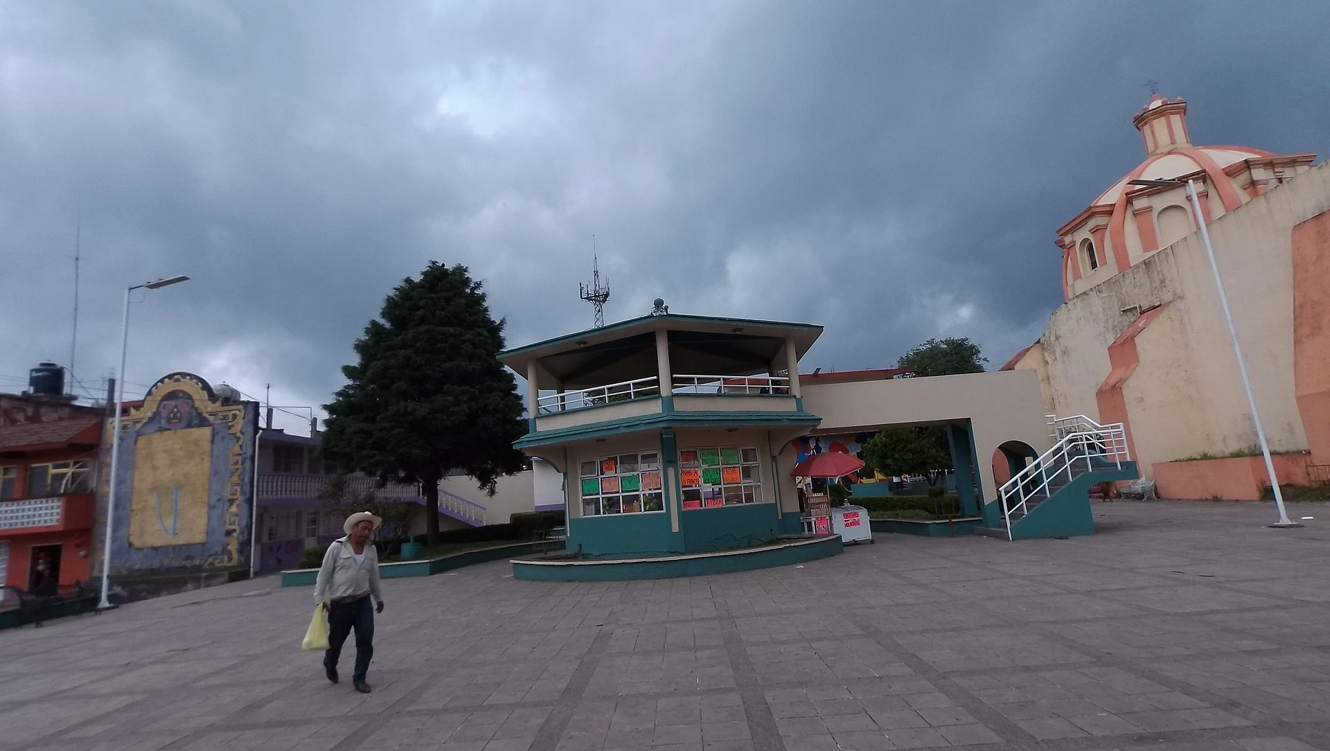
The town is the seat of a rural municipality of some fourteen thousand people spread across dozens of small communities. It is not a tourist town, which is much of its appeal: a quiet main square, a parish church, and wide views over the ridges when the clouds lift.
The best time to come is around June 29, the feast of San Pedro and San Pablo, the town's patron saints. For more than half a century, dance groups of children, young people, and elders have taken to the streets with the Danzas de Conquista, dancing for hours in bright costumes, tall feather headdresses, and hand-carved wooden masks.
How to get to Chiconquiaco
Drive from Xalapa: 55 min, 45 km
Chiconquiaco is roughly 11 km north of Naolinco by straight line; the winding mountain road through Acatlán takes about half an hour by car. Fog is common, especially in the afternoon and in the rainy season, so drive slowly and with lights on.
11 km northeast of Naolinco
Directions from Naolinco on Google Maps
Distances are in a straight line; the road is usually longer.
Links open a partner site. We may earn a commission if you book, at no cost to you.
From the nearest cities to Chiconquiaco
- Xalapa · 45 km by road, 55 min
- Martínez de la Torre · 71 km by road, 1 h 20 min
- Teziutlán · 115 km by road, 1 h 55 min
Drive times by road from OpenStreetMap, without traffic or stops. Times marked ~ are estimated from the straight-line distance.
Before you go to Chiconquiaco: hours, prices and tips
- Best season
- The patron-saint fiesta of San Pedro and San Pablo peaks on June 29, when groups of Conquista dancers in feathered headdresses and carved wooden masks perform in the streets for more than four hours. México Desconocido · checked Oct 2026
Hours and prices change, especially around holidays. Each fact links to where we checked it.
Visiting Chiconquiaco: what to see and do
Drive the mountain road up from Naolinco through cloud forest and fog.
Come on June 29 for the San Pedro and San Pablo fiesta and the Danzas de Conquista.
Walk around the main square and the parish church.
Stop at viewpoints along the way when the clouds clear.
Plan your trip
Places to stay in Chiconquiaco
Compare hotels, posadas, and rentals in and around Chiconquiaco.
Tours & activities
Day trips around Naolinco sometimes stop in Chiconquiaco; a tour is the easy way to see it without a car.
Rental cars
Pick up a car at VER (Veracruz): about 1 h 55 min by road to Naolinco, then 11 km more to Chiconquiaco, on your own schedule.
Flights
The nearest airport with scheduled flights is Veracruz (VER), about 1 h 55 min by road from Naolinco, the base for Chiconquiaco.
Mobile data
Signal can drop away from Naolinco: download a map of the way to Chiconquiaco before you set out, or carry an eSIM with data.
Links open a partner site. We may earn a commission if you book, at no cost to you.
Photos
When to go to Chiconquiaco mild
Chiconquiaco shares the climate of Naolinco, 11 km away. The best months to visit are February, March, April, and December.
See the month-by-month climate of Naolinco
Weather in Chiconquiaco now and the next 7 days
Live forecast from Open-Meteo. Chance of rain is the day's highest.
Make Naolinco your base

Chiconquiaco is an easy trip from Naolinco, a Pueblo Mágico with places to stay, food, and more to see.
Also close to
- Coatepec · Veracruz · 35 km away
- Xico · Veracruz · 41 km away
- Teziutlán · Puebla · 58 km away
- Tlatlauquitepec · Puebla · 72 km away
- Coscomatepec · Veracruz · 78 km away
Closest to Chiconquiaco
-
Landero y Coss · Town · 4 km away · Veracruz
-
Acatlán · Town · 6 km away
-
Miahuatlán · Town · 7 km away · Veracruz
-
Tenochtitlán · Town · 13 km away · Veracruz
-
San Pablo Coapan · Village · 14 km away · Veracruz
-
Alto Lucero · Town · 16 km away · Veracruz
-
Coyolillo · Village · 21 km away · Veracruz
-
El Fresno · Village · 21 km away · Veracruz


Near Chiconquiaco


Drive times by road from OpenStreetMap, without traffic. Times marked ~ are estimated from the straight-line distance.
Something wrong or missing on this page? Suggest a fix or addition
Location from OpenStreetMap. Written by Puebloteca.