Village Actopan, Veracruz Municipality of Actopan Xalapa and the coffee hills
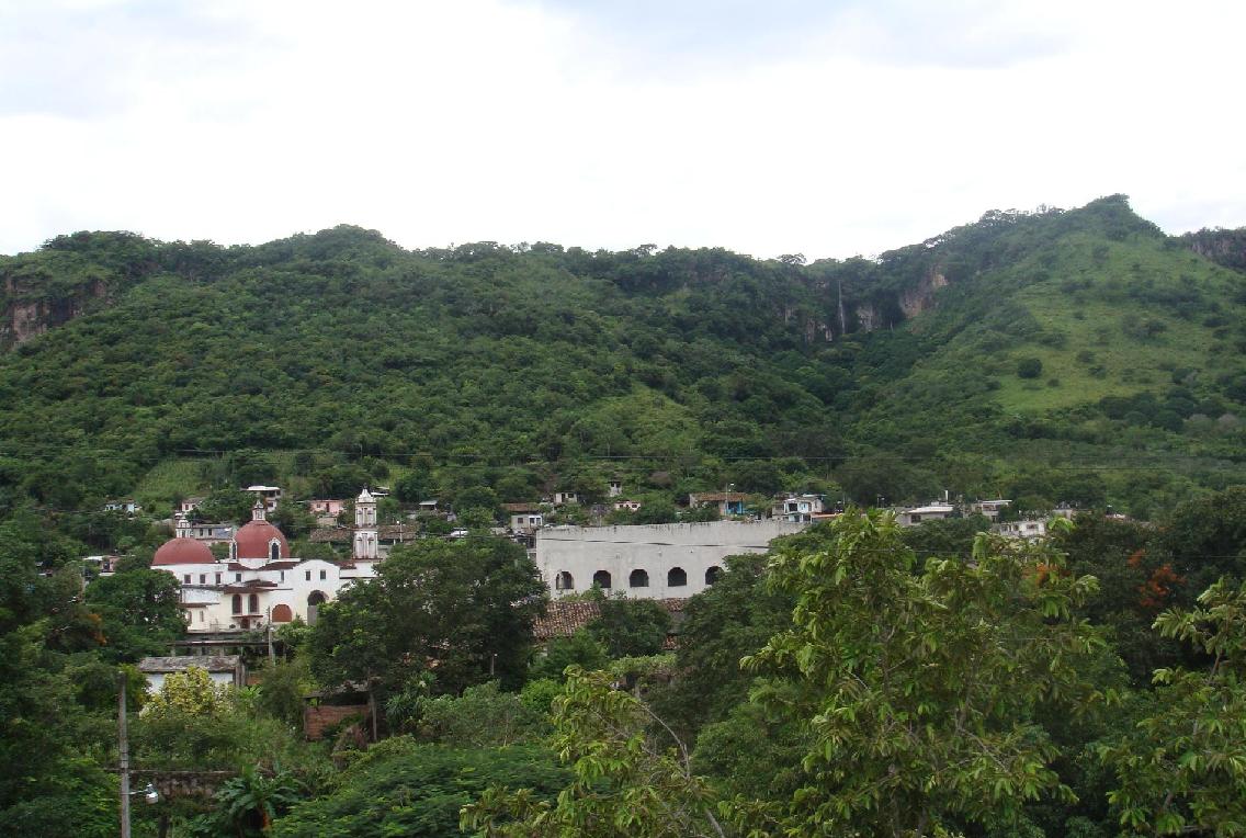
Bread-baking village of Actopan in a warm ravine; on 13 November it hands out bread to visitors. Nearby: Poza Azul and La Capilla ruins.
From Xalapa: 30 min by car (32 km by road) How to get there ↓
Near here
See everything nearby ↓


Plan your visit to Los Otates
Where to stay near Los Otates
Compare hotels, posadas and guest houses in Los Otates.
Tours to Los Otates
Day trips and guided outings from Naolinco often include Los Otates; with a local guide you can get there without a car.
 Tours from Veracruz
Private Sunrise Taj Mahal Tour from Delhi By Car -All inclusive
★ 5.0 (549) · From US$14
How to get to Los Otates
- From Xalapa: about 30 min by road (~32 km)
- Nearest airport: Veracruz (VER), 1 h 55 min by car to Naolinco
Links open a partner site. We may earn a commission if you book, at no cost to you.
Tours from Veracruz, near Los Otates


Tours, prices and ratings from Viator, checked weekly. We may earn a commission if you book.
About Los Otates
In Los Otates, bread is part of who people are. Baking and pastry-making are the village's signature trade, and every 13 November, at the blessing of the bread in honour of San Diego de Alcalá, families bake far more than they need so they can hand out bread and food free to anyone who turns up. It is the village's biggest celebration and one of the best known in the area. The other fiesta is for Saint Rose of Lima, the patron saint, on 30 August.
The village, home to 1,036 people in 2020, lies in a broad ravine between two lines of hills running down from the Sierra Madre Oriental, at about 530 metres, in the western part of Actopan municipality. The climate is warm, with summer rains and a dry winter, averaging close to 25 °C. The name comes from otate, a kind of tall cane that once grew thickly along the stream running through the village, which turns into a strong river in the rainy season.
Its history runs deep. Pottery and obsidian points from a Totonac settlement have been found on Cerro Montoso, also called La Capilla, and the Actopan ravine carried the old indigenous route to Xalapa; some historians hold that Hernán Cortés came through on 17 August 1519. In colonial times the land was a cattle estate, and one heiress, Catarina de la Oliva Domínguez, left a large share to the families who worked it, on condition that they build a bigger chapel to Saint Rose. The church's oldest bell is dated 1766, the tower was added in 1879, and it became a parish in 1973.
On top of Cerro Montoso stand the ruins of La Capilla, a college that Josephite missionaries built between 1901 and 1907, abandoned during the Revolution and gutted by fire in 1945. Close by is Poza Azul, a spring of very clear water that feeds a small stream into the Actopan River, and visitors to the area also go to El Descabezadero, where the Actopan River bursts out of a cliff and people abseil and raft. Farms here grow mostly mangoes and chayote, plus coffee, maize, beans and tomatoes.
How to get to Los Otates
Drive from Xalapa: 30 min, 32 km
From Xalapa it is about 32 to 38 km, 35 to 40 minutes by car: leave along Avenida Antonio Chedraui Caram to the Xalapa–Alto Lucero road, turn right at Paso del Toro onto the road to Actopan, which drops through Coyolillo and Los Frailes, and a final turn-off of about 3 km leads into the village; the road has been paved since the mid-1990s. From Actopan, the municipal seat, it is about 20 minutes on the same road. From Naolinco, the nearest Pueblo Mágico, allow about 32 km and 42 minutes via Xalapa. Without a car, a suburban passenger bus runs from Xalapa (about 1 hour 15 minutes), and shared taxis go to Xalapa and Actopan; long-distance buses arrive at CAXA, Xalapa's main bus station. Mobile signal can drop out among the hills.
Directions to Los Otates on Google Maps
Distances are in a straight line; the road is usually longer.
Links open a partner site. We may earn a commission if you book, at no cost to you.
From the nearest cities to Los Otates
- Xalapa · 32 km by road, 30 min
- Córdoba · about 95 km by road, ~1 h 25 min
- Veracruz · 99 km by road, 1 h 25 min
Drive times by road from OpenStreetMap, without traffic or stops. Times marked ~ are estimated from the straight-line distance.
Visiting Los Otates: what to see and do
The blessing of the bread on 13 November, when visitors are given bread.
The feast of Saint Rose of Lima on 30 August.
The parish church of Santa Rosa de Lima, with a 1766 bell and an 1879 tower.
The ruins of La Capilla, a former Josephite college on Cerro Montoso.
Poza Azul, a clear spring.
El Descabezadero, source of the Actopan River, with abseiling and rafting.
The village bakeries.
Plan your trip
Places to stay in Los Otates
Compare hotels, posadas, and rentals in and around Los Otates.
Tours & activities
Day trips and guided outings from Naolinco often include Los Otates; with a local guide you can get there without a car.
Rental cars
Pick up a car at VER (Veracruz): about 1 h 55 min by road to Naolinco, then 22 km more to Los Otates, on your own schedule.
Flights
The nearest airport with scheduled flights is Veracruz (VER), about 1 h 55 min by road from Naolinco, the base for Los Otates.
Mobile data
Signal can drop away from Naolinco: download a map of the way to Los Otates before you set out, or carry an eSIM with data.
Links open a partner site. We may earn a commission if you book, at no cost to you.
When to go to Los Otates mild
Los Otates shares the climate of Naolinco, 22 km away. The best months to visit are February, March, April, and December.
See the month-by-month climate of Naolinco
Weather in Los Otates now and the next 7 days
Live forecast from Open-Meteo. Chance of rain is the day's highest.
The closest Pueblo Mágico: Naolinco

Naolinco is the Pueblo Mágico closest to Los Otates, with places to stay, food, and more to see.
Also close to
- Coatepec · Veracruz · 26 km away
- Xico · Veracruz · 32 km away
- Coscomatepec · Veracruz · 61 km away
- Córdoba · Veracruz · 73 km away
- Teziutlán · Puebla · 77 km away
Closest to Los Otates
-
Trapiche del Rosario · Village · 3 km away
-
Coyolillo · Village · 6 km away
-
Actopan · Town · 10 km away
-
Ex Hacienda El Lencero · Landmark · 11 km away
-
Alto Lucero · Town · 12 km away
-
Chavarrillo · Village · 13 km away
-
El Castillo · Village · 16 km away
-
Xalapa · City · 21 km away


Near Los Otates


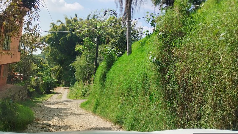

Drive times by road from OpenStreetMap, without traffic. Times marked ~ are estimated from the straight-line distance.
Location from OpenStreetMap. Written by Puebloteca.