Landmark Xalapa, Veracruz Municipality of Xalapa Xalapa and the coffee hills
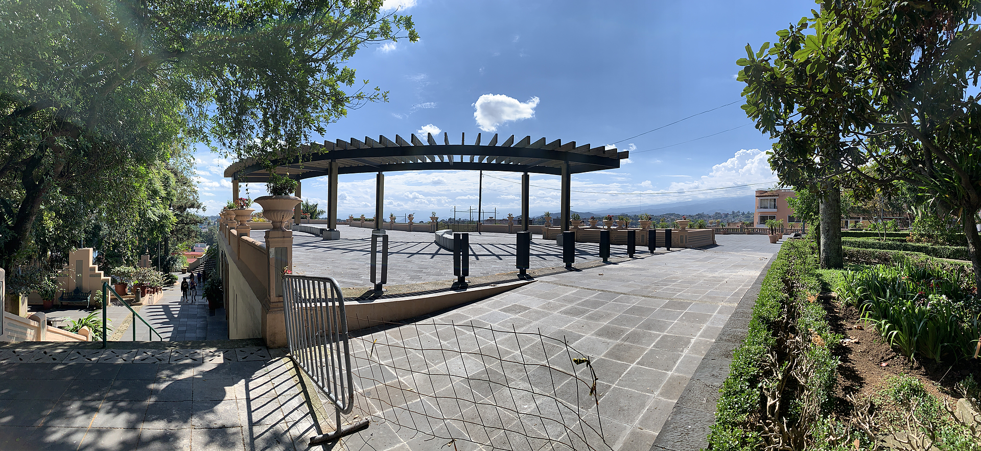
Xalapa's central park, opened in 1892 on a terrace beside the Palacio de Gobierno, with a lookout towards the Cofre de Perote and Pico de Orizaba.
From Teziutlán: 1 h 20 min by car (87 km by road) How to get there ↓
Near here
See everything nearby ↓


Plan your visit to Parque Juárez
Where to stay near Parque Juárez
Compare hotels, posadas and guest houses in Parque Juárez.
Tours to Parque Juárez
Look for tours of the area around Coatepec that stop at Parque Juárez.
 Tours from Veracruz
Private Sunrise Taj Mahal Tour from Delhi By Car -All inclusive
★ 5.0 (549) · From US$14
How to get to Parque Juárez
- From Teziutlán: about 1 h 20 min by road (~87 km)
- Nearest airport: Veracruz (VER), 1 h 37 min by car to Coatepec
Links open a partner site. We may earn a commission if you book, at no cost to you.
Tours from Veracruz, near Parque Juárez


Tours, prices and ratings from Viator, checked weekly. We may earn a commission if you book.
About Parque Juárez
Parque Juárez is the central park of Xalapa, laid out on a terrace at about 1,380 metres on the west side of the Palacio de Gobierno, a few steps from the Palacio Municipal and the cathedral. It is the city's main meeting point and its best-known lookout: from the south side the view takes in the hills of Coatepec and Xico, the Cofre de Perote to the west, the snows of the Pico de Orizaba to the south and, very faintly on clear days, the San Martín Tuxtla volcano more than 200 km away.
The site was once occupied by the Franciscan convent founded in the 1530s, one of the earliest in New Spain; its ruins were demolished in 1889 to make room for the park, which interim governor Leandro Alcolea opened on 16 September 1892 and named after Benito Juárez. It was enlarged under governor Teodoro Dehesa, neighbouring houses were bought up, and the old Teatro Victoria was pulled down to make way for the terrace. In 1921 the chamber of commerce, led by William K. Boone, built the ramp that brought cars up from the railway station. The tall araucaria trees are said to have been a gift from the Chilean ambassador in the Porfirio Díaz years. From the 1920s to the 1940s a band played at weekends while young people circled the park in opposite directions, a courting custom long gone.
The centrepiece is the monument to the four cardinal virtues by Xalapa-born sculptor Gabriel Guerra: Fortitude, Justice and Prudence in Carrara marble were placed in 1931, and a new Temperance in Tatatila marble by Armando Zavaleta León joined them in 1979. There are also monuments to Juárez, Francisco I. Madero and Juan de la Luz Enríquez. Beneath the terrace is the Ágora de la Ciudad, a cultural centre with galleries, an art-house cinema, a bookshop and a café, and the Pinacoteca Diego Rivera is at the edge of the park, along with an open-air forum and a large feathered-serpent play structure.
How to get to Parque Juárez
Drive from Teziutlán: 1 h 20 min, 87 km
The park is in the historic centre of Xalapa on Avenida Enríquez, beside the Palacio de Gobierno and a block from the cathedral. From the CAXA bus station on the east side of the city, take a taxi to the centre.
Directions to Parque Juárez on Google Maps
Distances are in a straight line; the road is usually longer.
Links open a partner site. We may earn a commission if you book, at no cost to you.
From the nearest cities to Parque Juárez
- Teziutlán · 87 km by road, 1 h 20 min
- Córdoba · about 90 km by road, ~1 h 20 min
- Veracruz · 101 km by road, 1 h 20 min
Drive times by road from OpenStreetMap, without traffic or stops. Times marked ~ are estimated from the straight-line distance.
Before you go to Parque Juárez: hours, prices and tips
- Hours
- The Ágora de la Ciudad, in the lower level of the park, opens Tuesday to Sunday from 10 am to 10 pm and is closed on Mondays. Programa Destinos México · checked Oct 2026
- Best time of day
- Come on a clear day to see the Pico de Orizaba and the Cofre de Perote from the south terrace. Wikivoyage · checked Oct 2026
Hours and prices change, especially around holidays. Each fact links to where we checked it.
Visiting Parque Juárez: what to see and do
Look south from the terrace towards the Cofre de Perote and, on a clear day, the Pico de Orizaba.
See Gabriel Guerra's statues of the four cardinal virtues.
Walk under the old araucaria trees planted in the Porfirio Díaz era.
Catch a film or an exhibition at the Ágora de la Ciudad beneath the terrace.
Visit the Pinacoteca Diego Rivera beside the park.
Plan your trip
Places to stay in Parque Juárez
Compare hotels, posadas, and rentals in and around Parque Juárez.
Tours & activities
Look for tours of the area around Coatepec that stop at Parque Juárez.
Rental cars
Pick up a car at VER (Veracruz): about 1 h 37 min by road to Coatepec, then 9 km more to Parque Juárez, on your own schedule.
Flights
The nearest airport with scheduled flights is Veracruz (VER), about 1 h 37 min by road from Coatepec, the base for Parque Juárez.
Mobile data
Signal can drop away from Coatepec: download a map of the way to Parque Juárez before you set out, or carry an eSIM with data.
Links open a partner site. We may earn a commission if you book, at no cost to you.
When to go to Parque Juárez mild
Parque Juárez shares the climate of Coatepec, 9 km away. The best months to visit are February, March, April, and May.
See the month-by-month climate of Coatepec
Weather in Parque Juárez now and the next 7 days
Live forecast from Open-Meteo. Chance of rain is the day's highest.
The closest Pueblo Mágico: Coatepec

Coatepec is the Pueblo Mágico closest to Parque Juárez, with places to stay, food, and more to see.
Also close to
- Naolinco · Veracruz · 15 km away
- Xico · Veracruz · 15 km away
- Coscomatepec · Veracruz · 52 km away
- Teziutlán · Puebla · 58 km away
- Tlatlauquitepec · Puebla · 70 km away
Closest to Parque Juárez
-
Catedral de Xalapa · Landmark · 0 km away
-
Barrio de Xallitic · Landmark · 1 km away
-
Parque Ecológico Los Tecajetes · Nature reserve · 1 km away
-
Cerro de Macuiltépetl · Nature reserve · 2 km away
-
Jardín Botánico Clavijero · Nature reserve · 2 km away
-
Xalapa · City · 2 km away
-
Museo de Antropología de Xalapa · Landmark · 3 km away
-
Cascada Bola de Oro · Waterfall · 7 km away

Near Parque Juárez


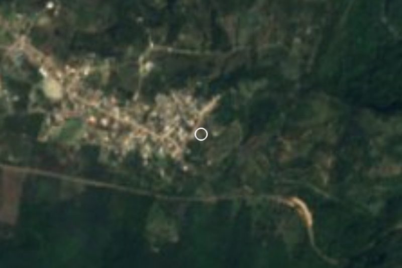


Drive times by road from OpenStreetMap, without traffic. Times marked ~ are estimated from the straight-line distance.
Location from OpenStreetMap. Written by Puebloteca.